Ontario: Rising heat could make Tuesday the last hot day of the year

The building heat and humidity have the potential to topple some temperature records.
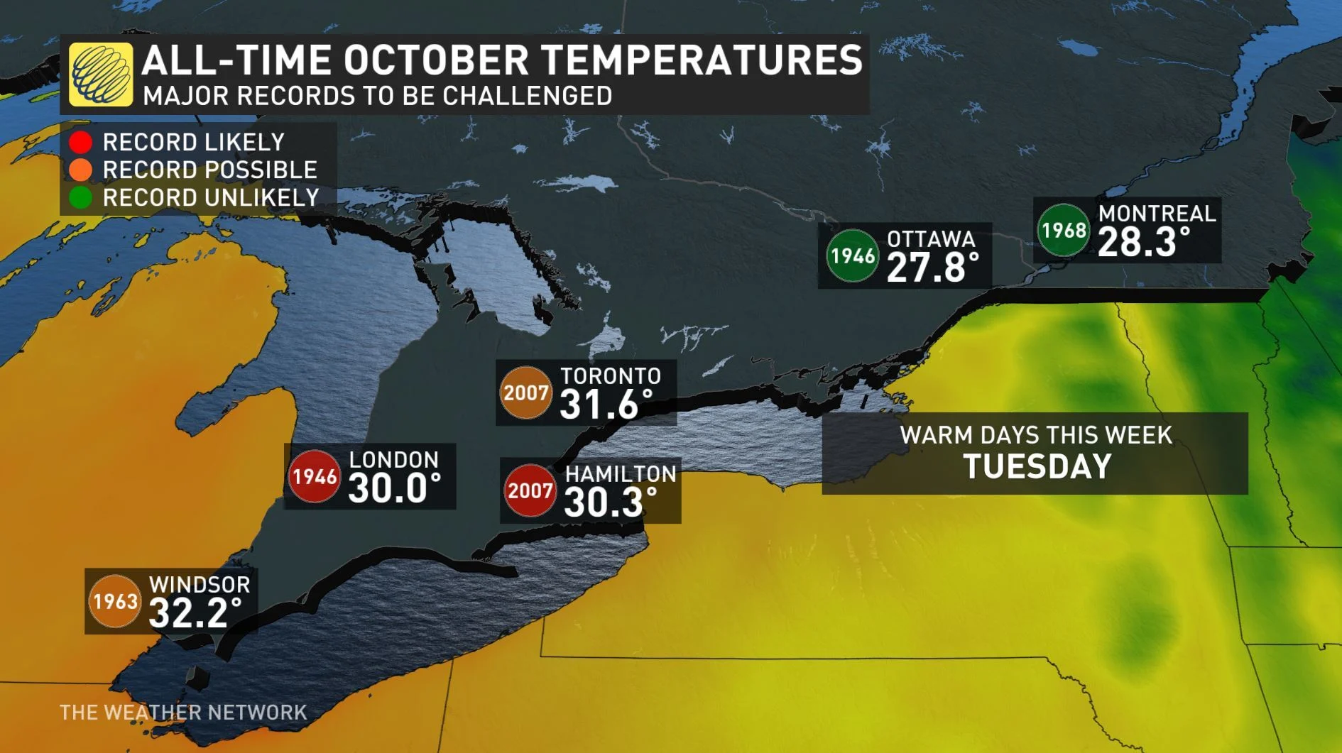
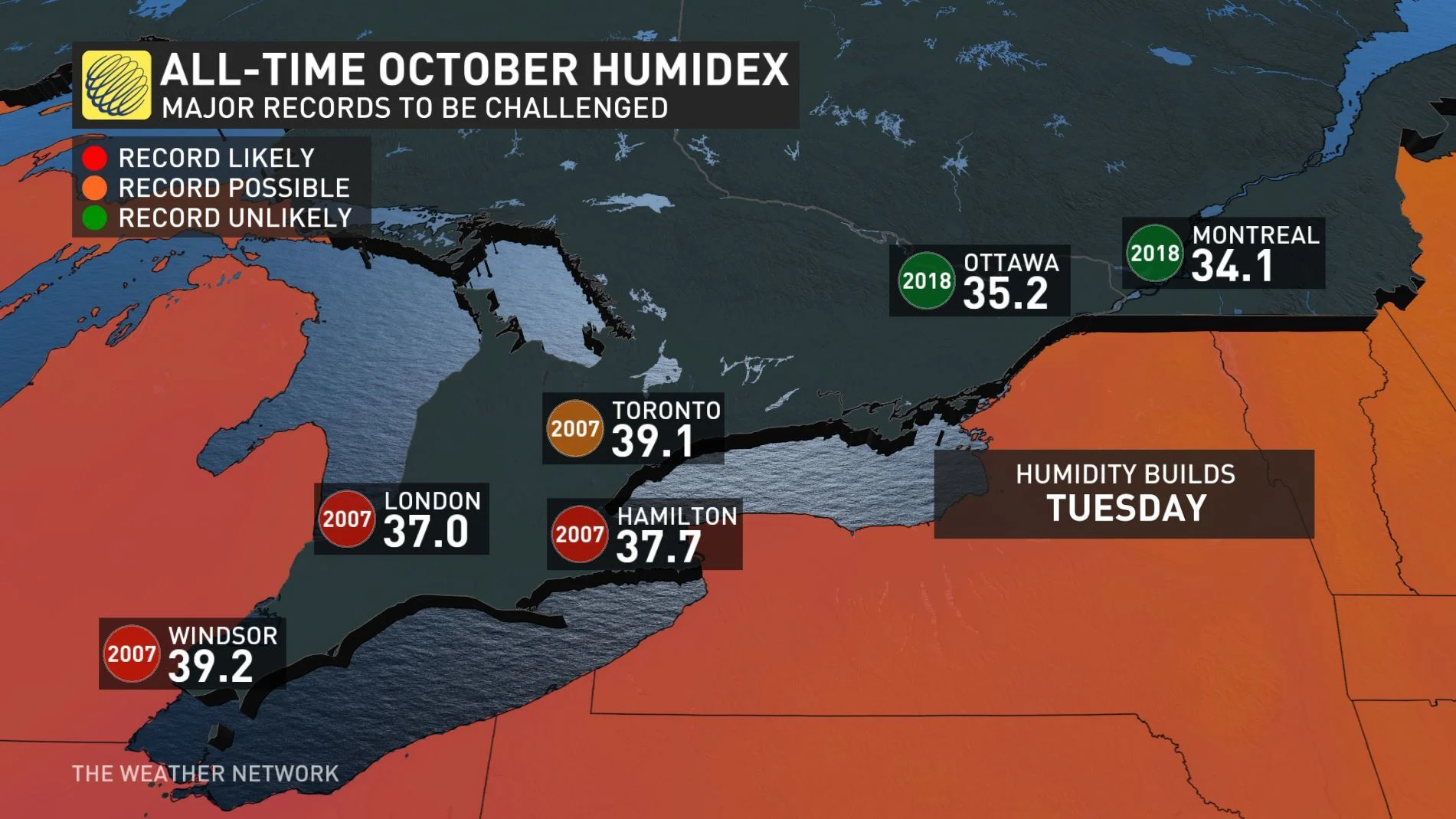
While conditions will be relatively pleasant on Monday, temperatures are set to soar on Tuesday and then plummet by mid-week. The system that will bring the unseasonable warmth could result in all-time heat records for a number of cities, including Windsor and Hamilton, but forecasters are watching the risk for thunderstorms. Details and timing, below.
Visit our Complete Guide to Fall 2019 for an in-depth look at the Fall Forecast, tips to plan for it and a sneak peek at the winter ahead
WEATHER HIGHLIGHTS:
Above seasonal temperatures on Tuesday with soaring humidity
Widespread risk for thunderstorms through Tuesday
Stay aware of ALERTS in your area
WATCH BELOW: RAINFALL TIMING
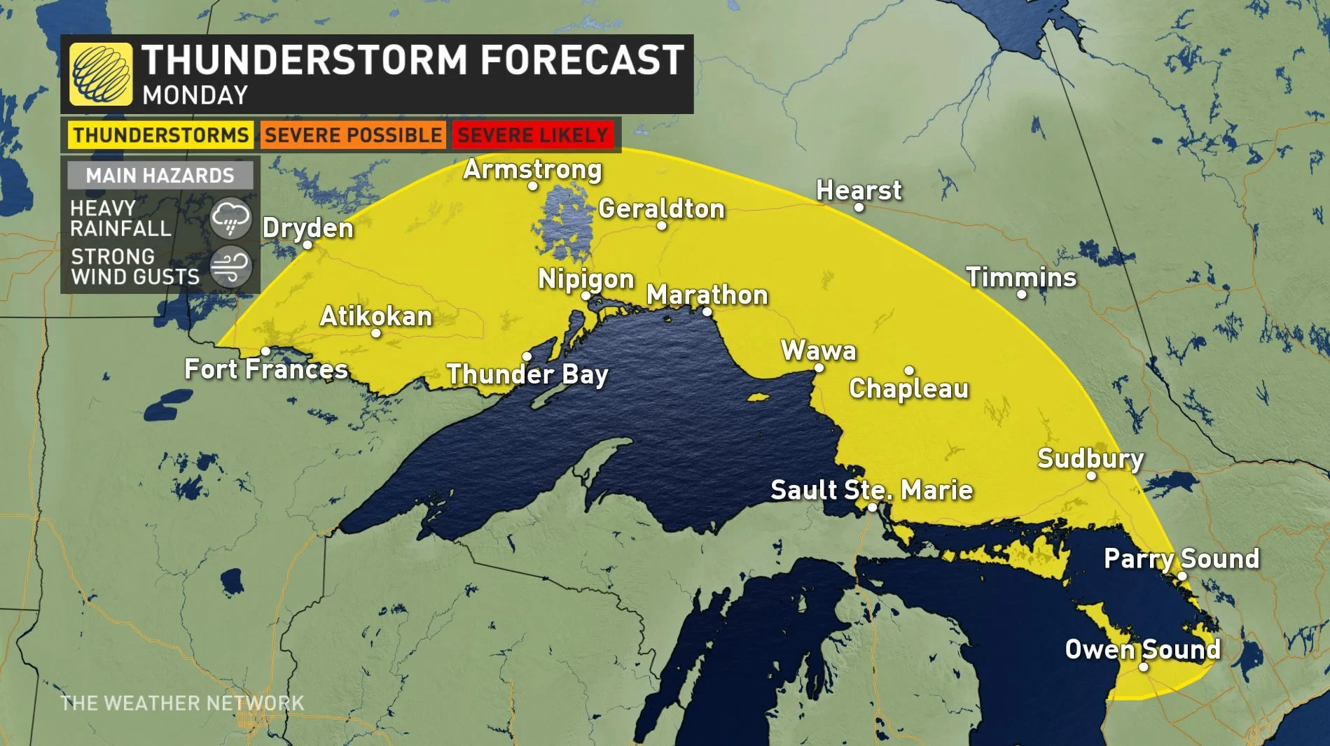
As a warm front slowly lifts north on Monday, a wide range in temperatures will begin to stretch across the region. Monday itself will be mostly cloudy and near seasonal, with a slight risk for showers.
Tuesday will be the real furnace with daytime highs in the upper 20s and close to 30°C, but the humidex making it feel like the upper 30s -- again possibly challenging a few records.
That humidity is something to keep in mind as a new system tracks across the northern parts of Ontaro and Quebec, trailing a cold front as it goes. In practical terms, that will mean a relatively widespread risk of thunderstorms for parts of northern Ontario north of Lake Superior Monday, though the risk doesn't look severe at the moment.
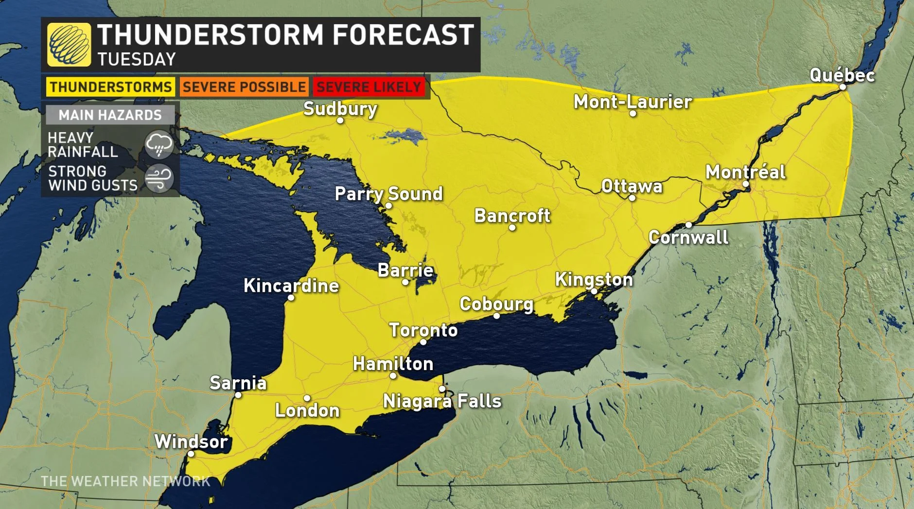
That cold front will dip south, beginning to cross southern Ontario by Tuesday afternoon. As it cuts through the intense humidity, it will spark thunderstorms, leaving showers behind it as it exits the province through Wednesday.
As with the north, Tuesday's storms aren't presently expected to reach severe levels, but it's still something to keep an eye on.
That cold front will usher in a surge of cooler air, such that Weather Network meteorologist Dr. Doug Gillham says Tuesday will likely be the last hot day of the year.
"Much cooler weather is likely late next week with temperatures several degrees cooler than seasonal with highs only in the low to mid teens," Gillham says.


