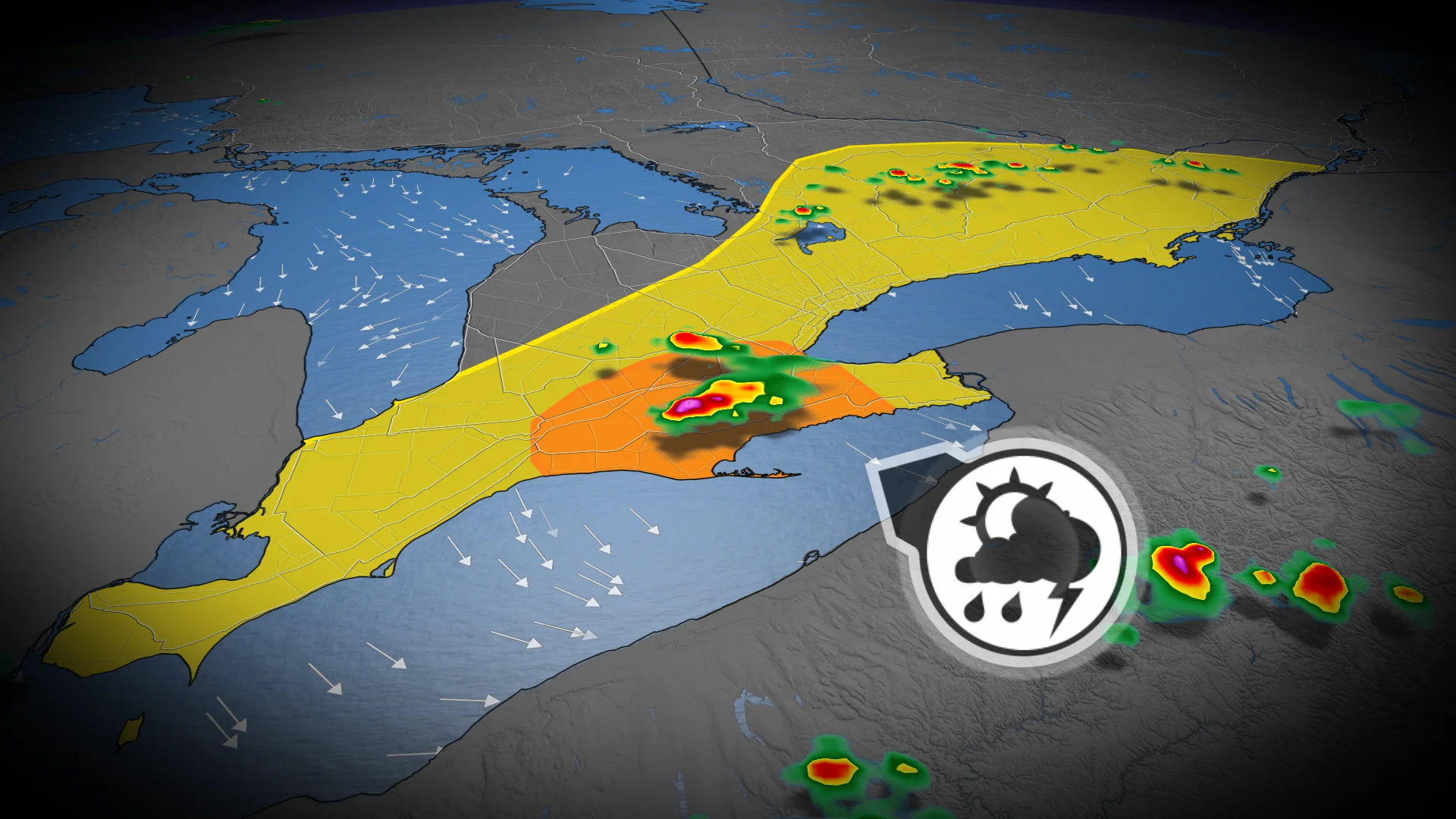
Torrential rain and wind: Isolated severe storm risk in Ontario on Friday

Not everyone will see rain to end the week, but any storms that bubble up could pack a punch
After a stormy Thursday left damage and power outages across southern Ontario, we’re looking ahead to the next round of storms that may pop up across the region to end the week.
A few of Friday’s isolated thunderstorms could turn severe, but not everyone will see one as we go through the day.
DON’T MISS: Rapid El Niño may force the slowest hurricane season in years
Friday storms pop up in southern Ontario
A cold front pushing through the Great Lakes on Friday will eventually bring more comfortable air to the region.
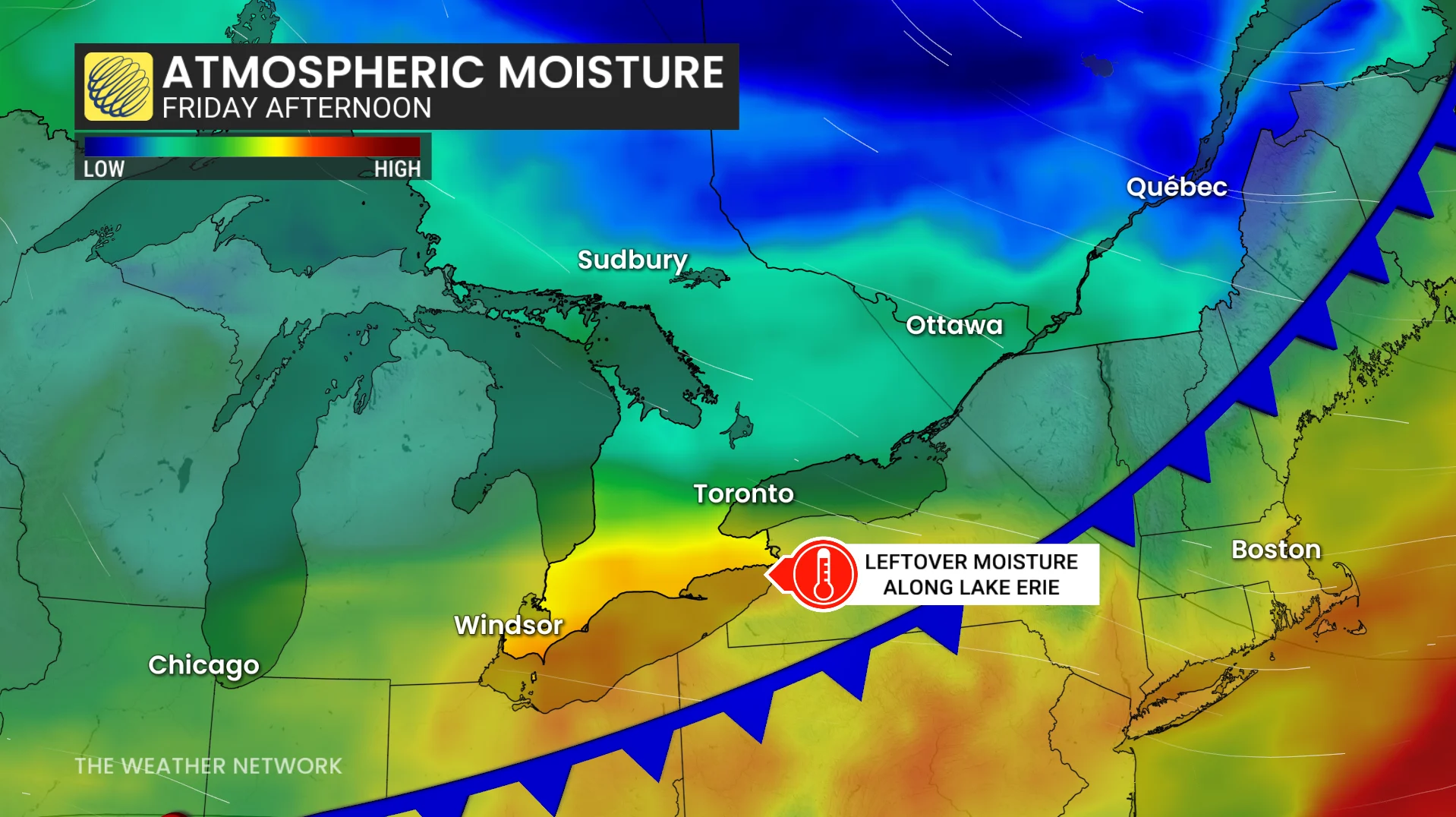
Some muggy, unstable air will linger behind the front, especially around the Lake Erie shorelines. This is the fuel that may trigger some isolated thunderstorms through Friday afternoon.
Forecasters will monitor these pop-up storms for severe potential late in the day, with the chance in place north of Lake Erie around London and Hamilton.
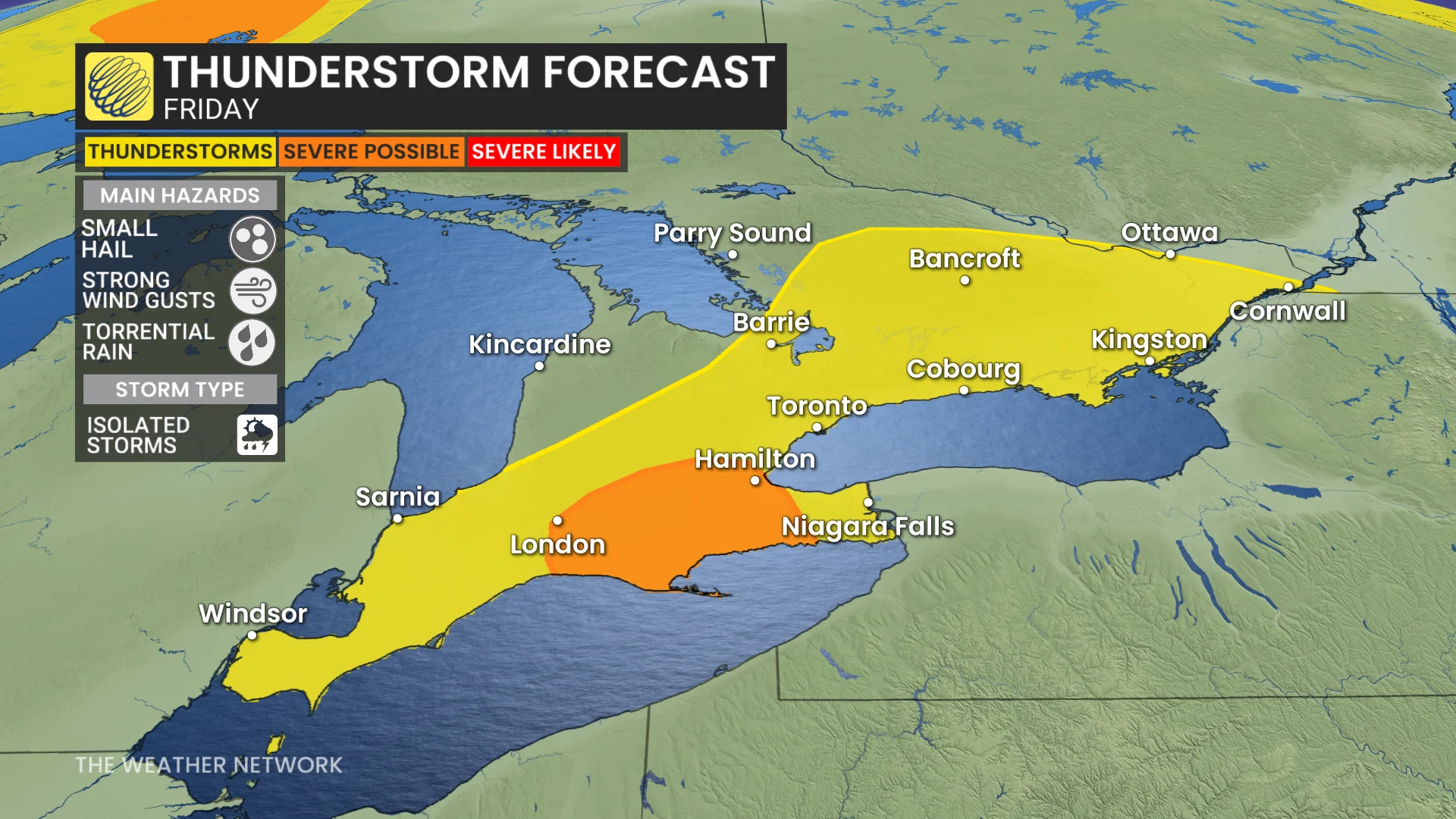
The environment is favourable for any stronger storms that bubble up to produce large hail, wind gusts, and torrential rainfall. Near 30 mm of rain is possible locally, under an isolated thunderstorm.
We can expect a more seasonable and comfortable weekend as the cold front fully clears the region.
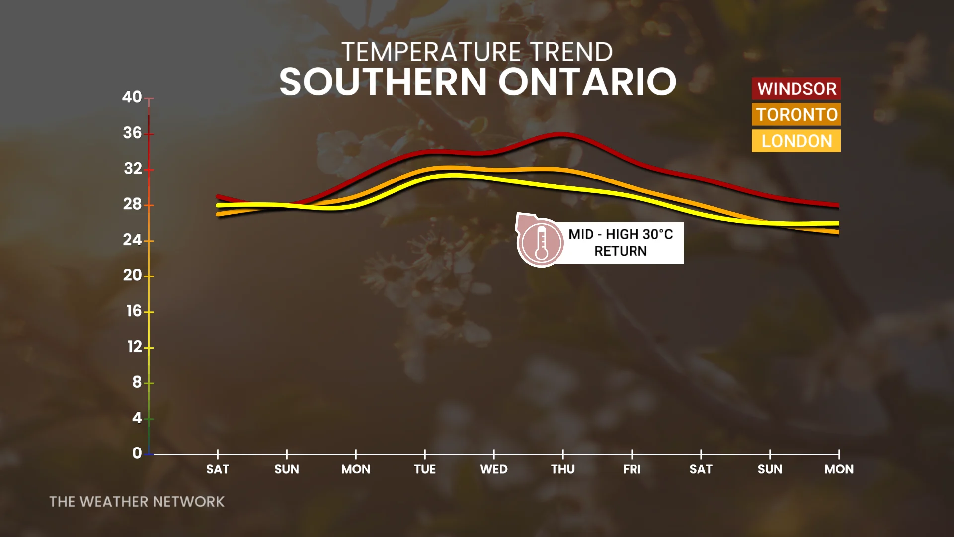
High humidex values will return next week, however.
Stay with The Weather Network for all the latest on conditions across Ontario.