
Beware additional severe storms on the Prairies on Sunday

Strong wind gusts and torrential downpours are possible on the Prairies on Sunday
Our multi-day severe weather threat on the Prairies isn’t over just yet. A fresh round of strong to severe thunderstorms is possible for parts of the region for the final day of the month.
Soaking rains will follow close on the heels of Sunday’s severe storms, with formidable rainfall totals in the forecast for some areas.
DON’T MISS: The pros and cons of an El Niño summer across Canada
Additional severe storms expected on Sunday
A centre of low pressure moving across the Prairies will serve as the focus for yet another round of thunderstorms into the day Sunday.
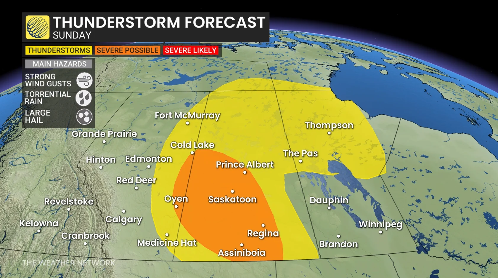
Plenty of muggy air and favourable atmospheric dynamics will allow some of those storms to exceed severe limits.
This risk mainly focuses on the southern half of Saskatchewan while extending into a small portion of Alberta, including Oyen and Cold Lake.
Sunday’s strongest thunderstorms may produce strong wind gusts, torrential rainfall, and large hail.
Heavy rainfall builds into early next week
A trough moving into the western half of the Prairies will allow a wet pattern to develop into early next week.
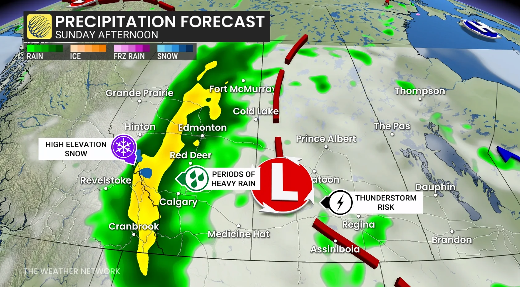
Sunday through Tuesday features the greatest chance for widespread heavy rainfall as a steady reserve of atmospheric moisture streams in from the south.
Forecasters have high confidence in some areas seeing more than 100 mm of rain, which represents more than a month’s worth of rainfall for many communities.