
Prairies: More snow Sunday night, warmth coming soon

Conditions will improve Sunday, but more snow is expected to return by the evening for parts of Alberta
Parts of the Prairies will get a break from the snow Sunday afternoon, but another round of the white stuff is expected tonight for the Foothills and higher elevations in western areas of Alberta.
While there are no warnings in place, an additional 5-10 cm of snow is possible by Monday morning. Temperatures will remain below seasonal and only reach single digits.
However, there is an end in sight to the cold temperatures and snow. Warmer air will hit the Prairies by mid-week.
For the latest on Sunday's snowfall, and when temperatures will bounce back, read below.
Visit our Complete Guide to Spring 2019 for an in depth look at the Spring Forecast, tips to plan for it and much more
WEATHER HIGHLIGHTS
Second round of snow for Alberta Sunday night
Single-digit temperatures across the Prairies
Gradual warmup through the week, from west to east
Stay up-to-date on the ALERTS in your area
TEMPERATURES REMAIN BELOW SEASONAL SUNDAY
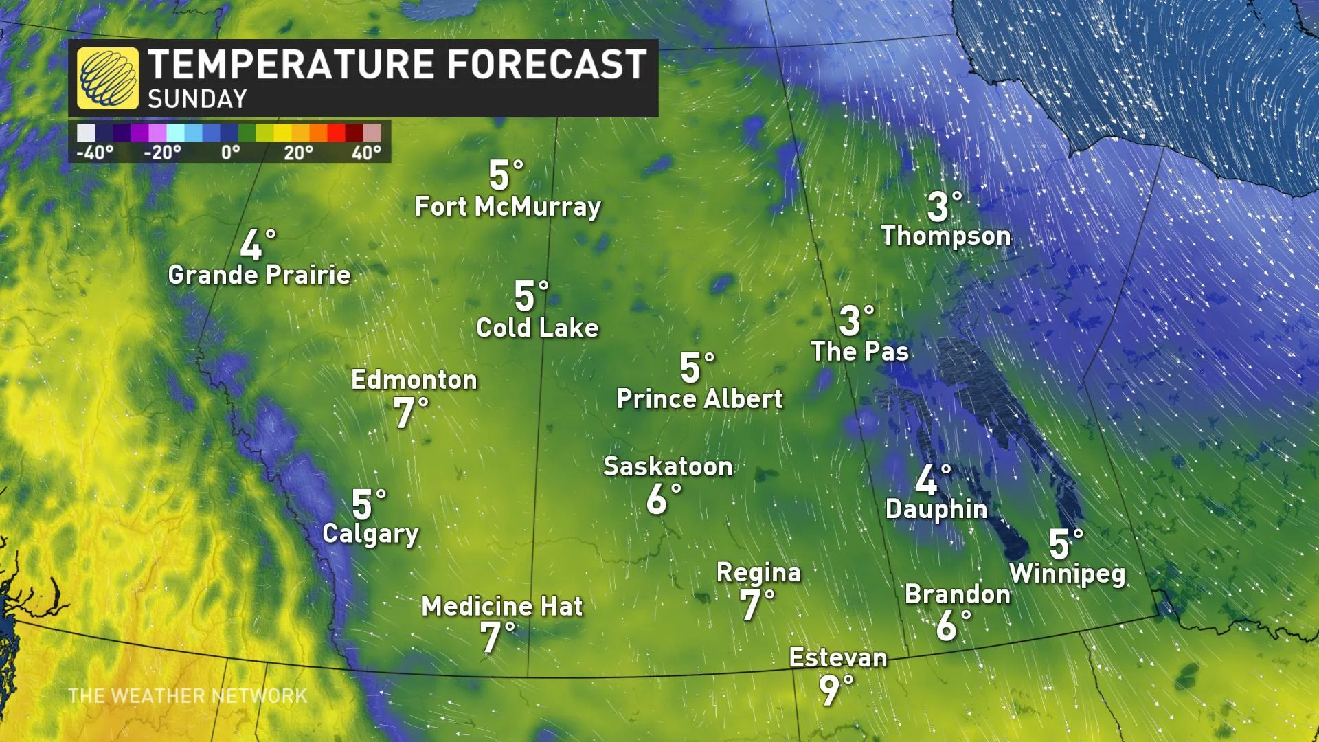
A cold air remains over the Prairies as the weekend comes to a close, with temperatures expected to remain in the single digits across all provinces.
MORE SNOW AHEAD SUNDAY NIGHT
While the first round of snow tapers off in Calgary this morning, another shot is expected in the evening and overnight hours for the Foothills and higher elevations across western portions of Alberta.
A possible 5-10 cm could accumulate by the time it ends by Monday morning.
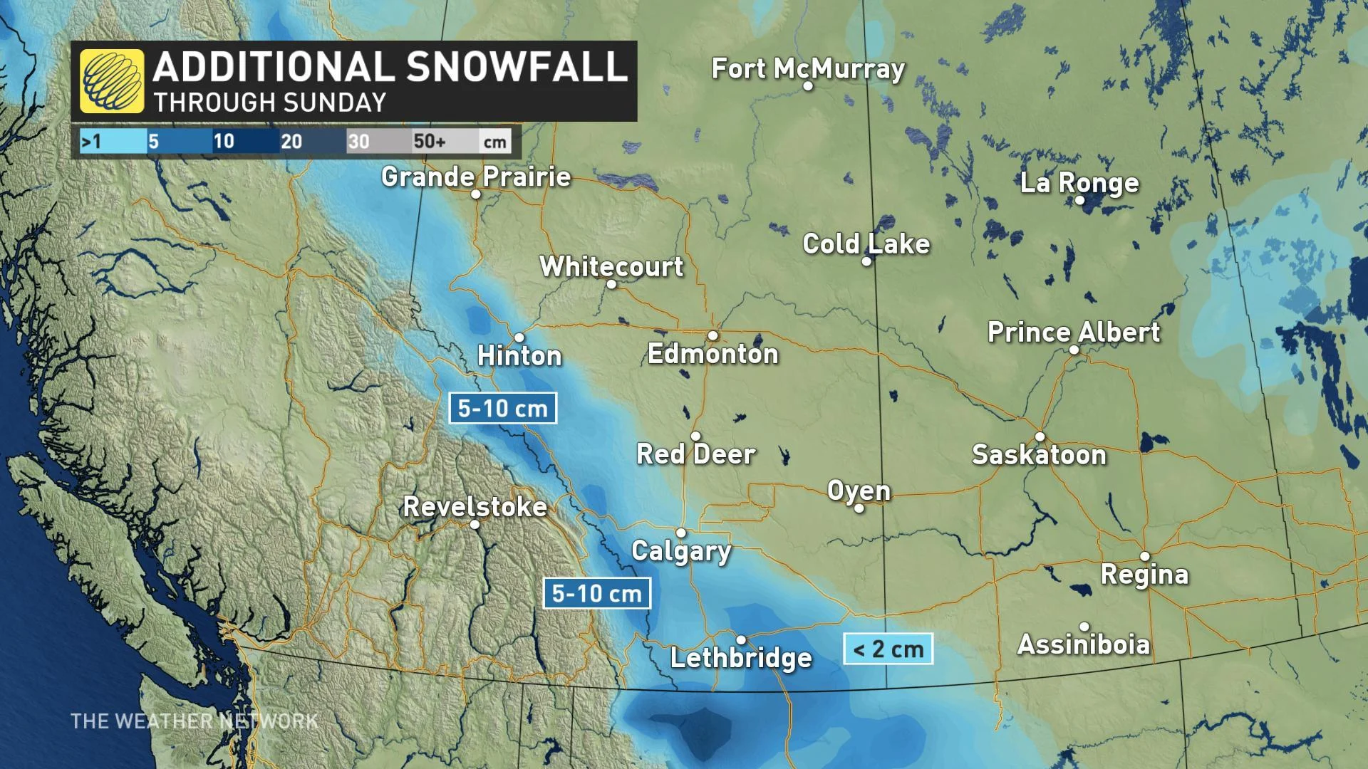
The break in precipitation will be short-lived, however, as another low takes aim at central Alberta with showers and maybe snow or mixing for the Edmonton area, as well as across central Saskatchewan.
DON'T MISS: More flooding, rapid sea level rise in Canada. The Weather Network and Canada's leading experts on climate bring you 2xFaster.
WATCH BELOW: WHEN WARMTH WILL RETURN AND HOW MUCH
Spring warmth is just around the corner for the Prairies, as a pattern shift will end the consistent cold air that has been plaguing the provinces recently. Temperatures are set to hit the mid-teens for much of Alberta by Thursday. Grand Prairie could even hit 20°C.
A ridge of high pressure over British Columbia will be responsible for removing the below-seasonal temperatures and will allow for sunshine to return and a warmup by mid-week.


