B.C. saw its first shot of fall alpine snow. Is there more to come?

This weekend featured the first widespread instance of high-elevation snowfall across B.C. this fall. Is it a sign of things to come?
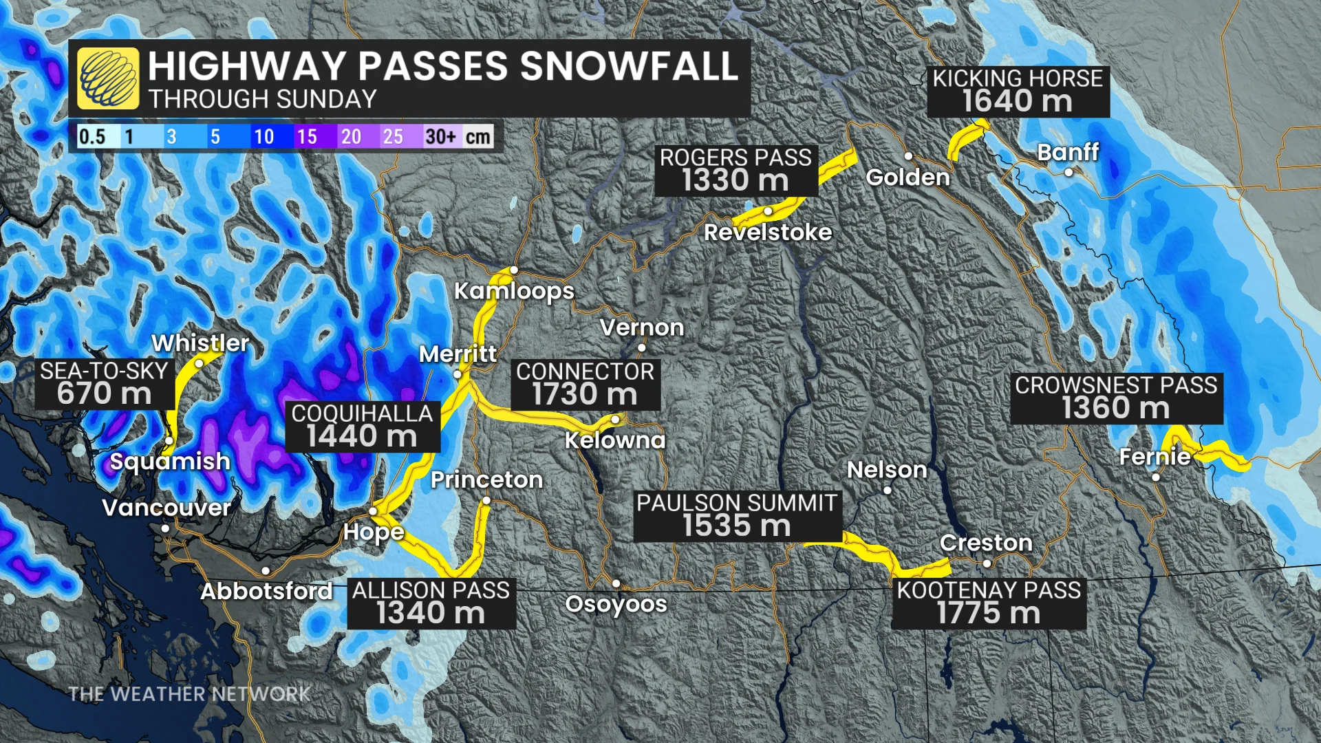
B.C.'s fall storm season kicked off this weekend with a Pacific low off the coast, bringing in rain and the province's first widespread round of alpine snow as freezing levels dropped amid a bout of colder air.
SEE ALSO: Exploring Hornby Island: Inside the "Seaweed School" adventure
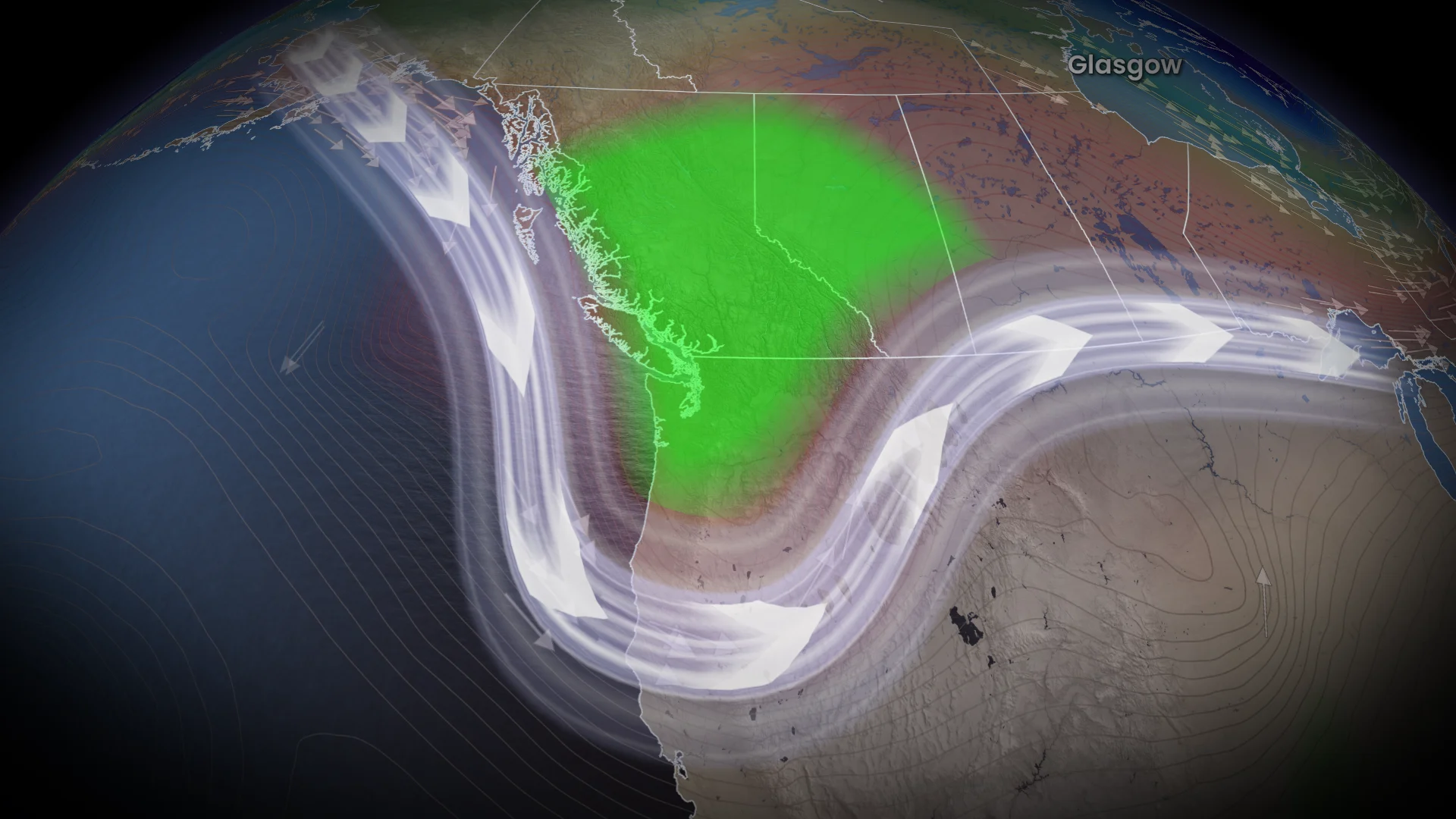
An unusual, late-October pattern has developed across British Columbia this week, pushing temperatures a few degrees below seasonal. If this pattern developed in December or January, snow could be observed close to sea level.
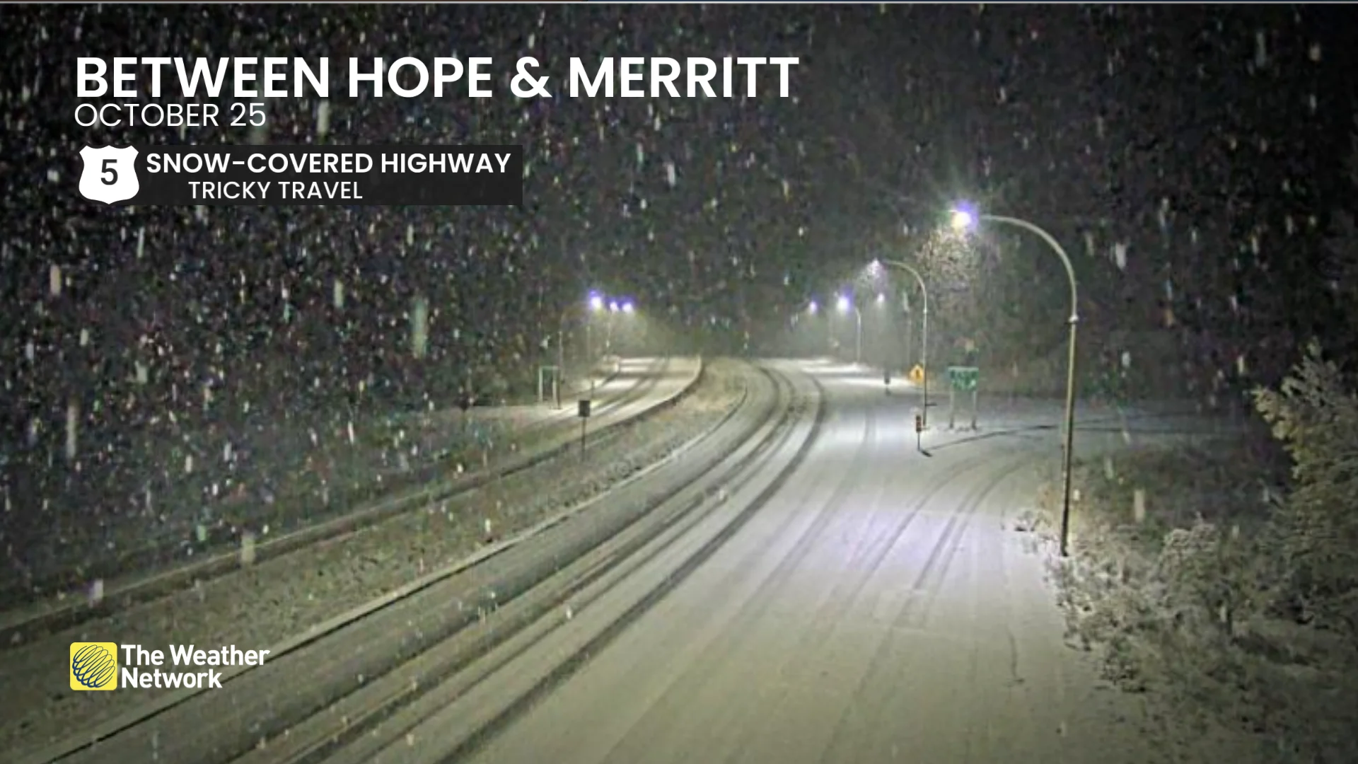
Traffic camera showing snow on Highway 5 between Hope and Merritt, B.C. (DriveBC)
A good reminder that B.C.'s winter tire requirement for some mountain passes came into effect on Oct. 1.
Luckily, the storm stayed far enough offshore to only give the province a glancing blow in terms of impactful weather, which will improve as Sunday progresses.
Chilly temperatures on Saturday
High temperatures on Saturday in B.C. included:
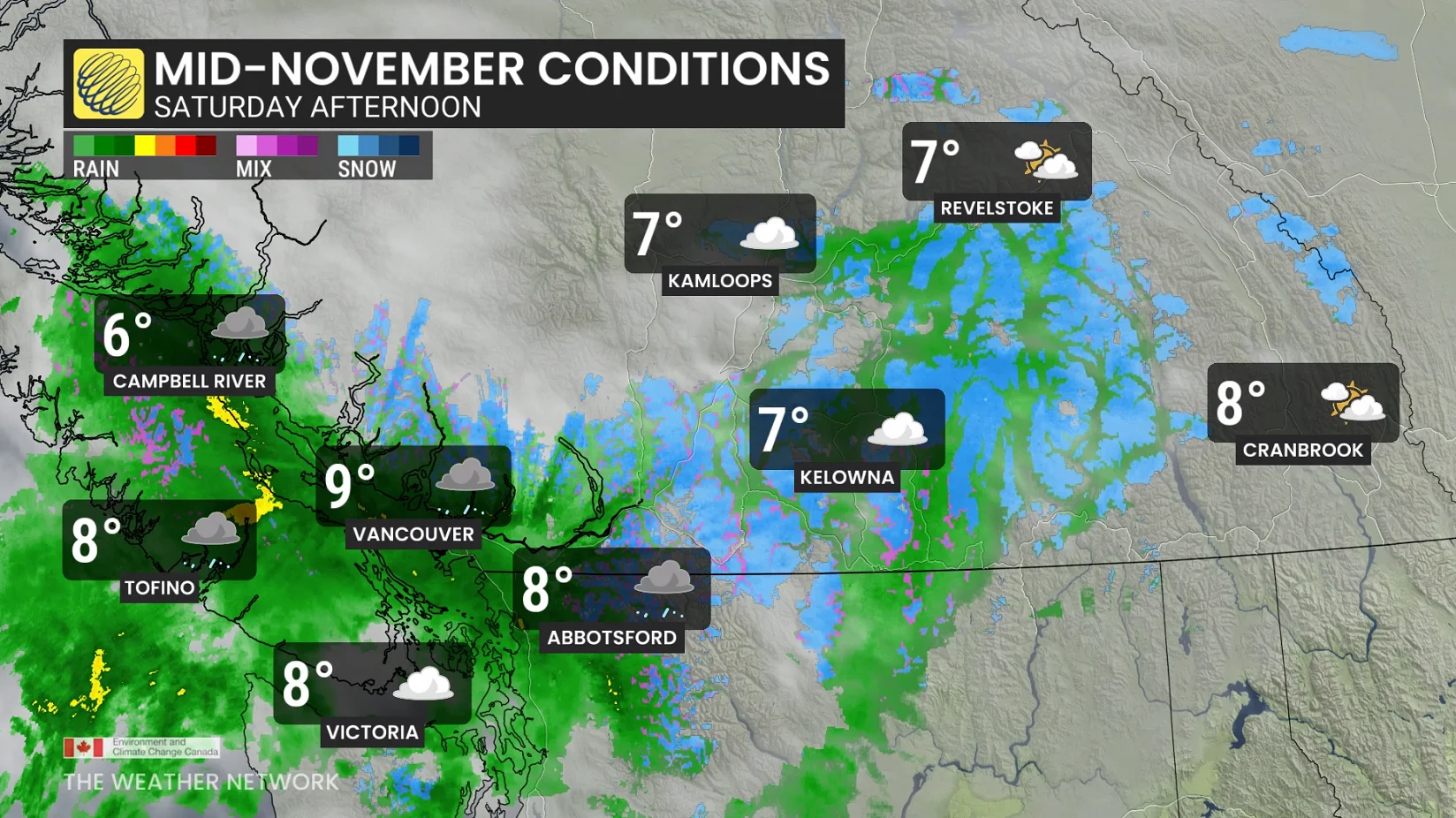
Victoria: 8.7 C
Vancouver: 8.9 C
Comox: 8.4 C
Port Alberni: 6.6 C
Those highs are more reflective of late-November temperatures.
Conditions to improve on Sunday, but a cool trough remains in place
Atmospheric moisture over the South Coast collided with a cold air mass currently sitting over the province. That resulted in a quick decrease in freezing levels and a round of alpine snow along some mountain highway passes this weekend.
Tricky mountain travel continues on Sunday for the southern Coast Mountains through Sunday morning while rain continues for the Lower Mainland.
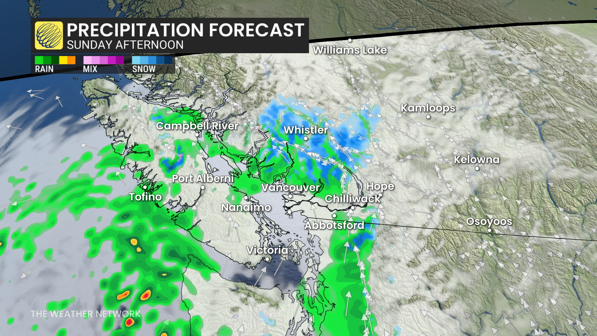
Freezing levels are rising above the mountain passes as the moisture dissipates.
The pattern for the remainder of the month will be a strong, upper-level trough that will keep temperatures cool and unsettled.
DON'T MISS: So long, summer: A final checklist for properly closing your cottage
The cool trough just won’t budge this week across British Columbia as it will feel more like mid-November.
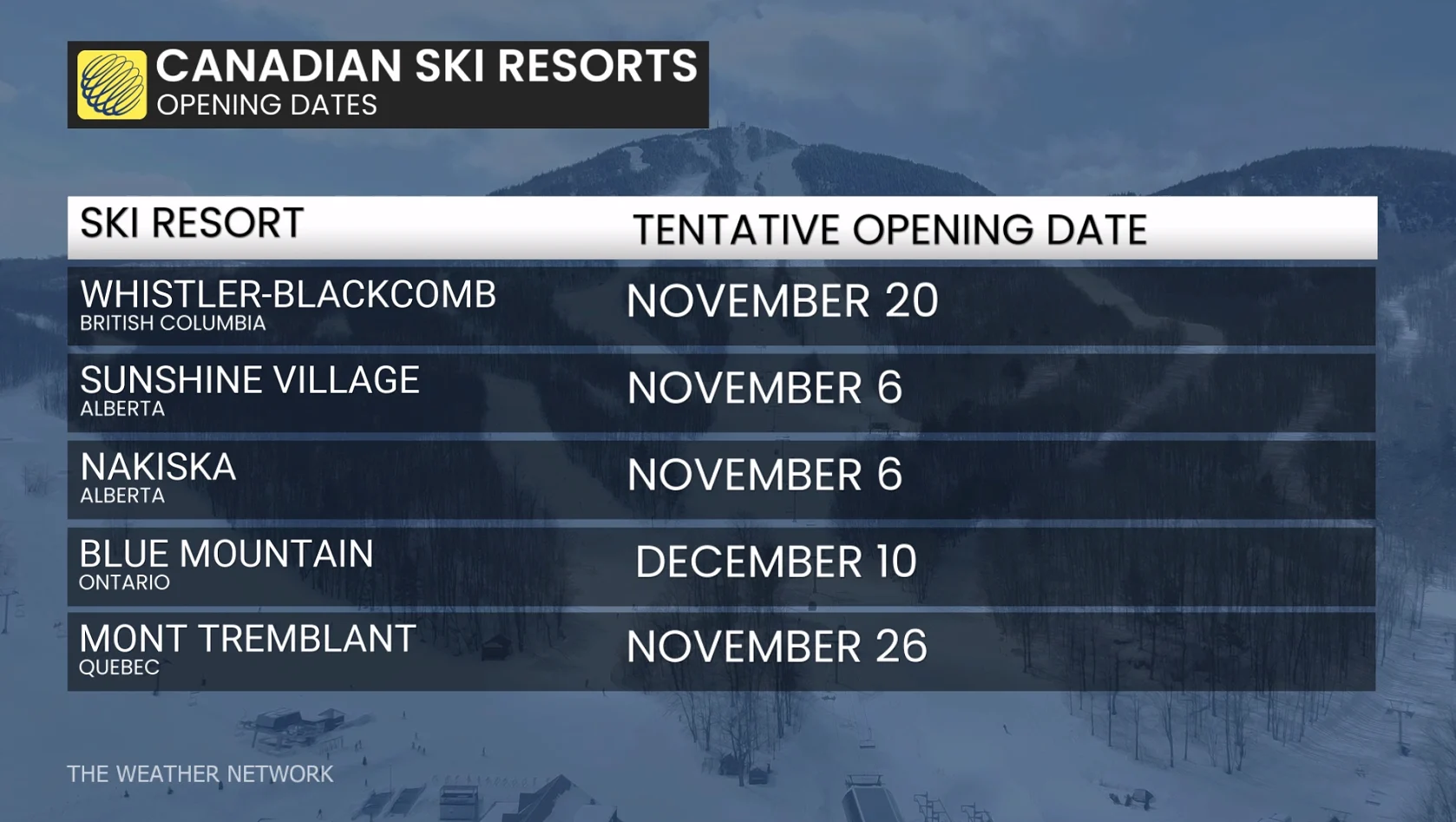
However, that means a favourable pattern to begin to build the permanent snowpack for the winter ski season.
A persistent ridge of high pressure in the Gulf of Alaska will keep an active storm track at bay.
We're slowly chipping away at severe moisture deficits across the South Coast.
It’s officially not the driest October on record for Vancouver, as 23.9 mm of rainfall has been recorded through the month.
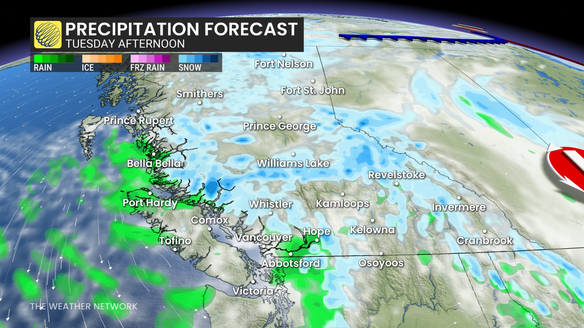
Not looking at any organized lows this week, but moisture will congregate in the trough, resulting in widespread rain and flurries from Tuesday to Wednesday.
A more typical, wet pattern is expected to develop during early November.
Stay with The Weather Network for more information and updates on your weather across B.C.