
Battle of the seasons over Newfoundland this week, and the differences are major
It's a true battle of the seasons across Newfoundland this week with heavy snow and a spring-like flood threat both on the table
A strengthening storm will bring significant rain and snow across Newfoundland on Wednesday. It's a true tale of two seasons, with winter storm watches already in effect for northern parts of the island, while others to the south worry about flooding concerns.
The snow, combined with powerful, northerly winds, could make for some dangerous travel at times through Thursday.
DON'T MISS: Ready for a tease of spring? Thaw to spread across Canada
Meanwhile, heavy rain over the Avalon Peninsula threatens water pooling on roadways, and localized flooding, especially in poor drainage areas. Rainfall rates could reach 10-15 mm an hour at times.
The milder temperatures accompanying the rain could lead to significant snowmelt and run-off, as well. Be sure to plan ahead, and stay up-to-date on the weather warnings in your area as the storm approaches.
Wednesday: Strengthening storm prompts winter storm watches for northwest Newfoundland
The storm will strengthen and track over Newfoundland on Wednesday, bringing winter to the north, and a taste of early spring to the south. Some rain will spill into eastern Nova Scotia on Wednesday, as well.
The snow begins over northwestern sections of the island Wednesday morning, becoming heavier by the afternoon.

At the same time, winds will increase to 40-60+ km/h, leading to blowing snow and periods of blizzard conditions through the evening and overnight. Treacherous winter travel will be likely along Highway 1 from Port aux Basques to Gander.
Snowfall totals could reach between 10-20+ cm through Thursday, with the heaviest falling across the west. Winter storm watches are already in effect.

Heavy rain prompts flooding concerns across the Avalon Peninsula
As heavy snow falls across the north, rain will become widespread across the south through Wednesday afternoon.
At times, rainfall rates could reach 10-15 mm/h. With the ground still frozen, localized flooding will be a factor. Water pooling on roadways will also be a concern.
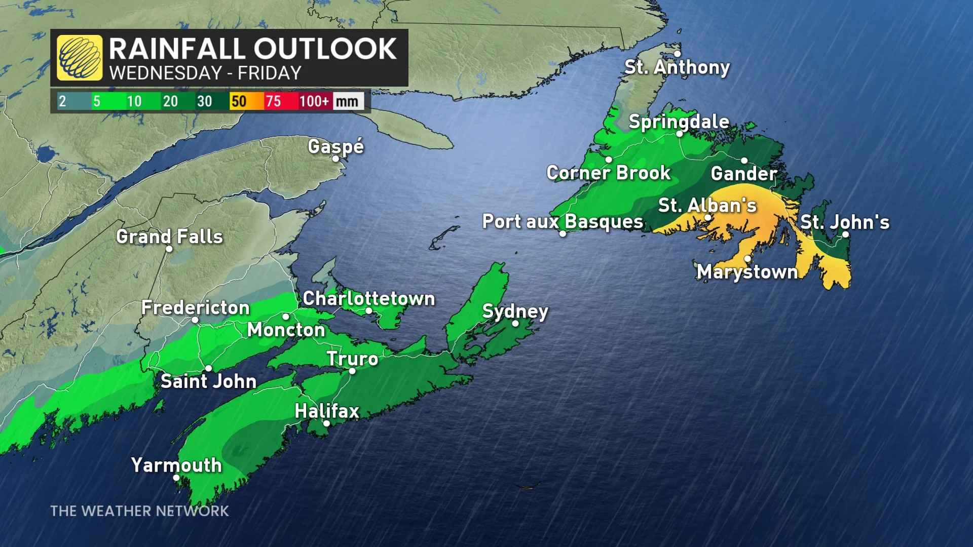
Between 30-50 mm of rain is forecast, with the heaviest likely across the southern coast. Special weather statements cover the region.
Rain eases overnight, but gusty winds will remain through Thursday morning.
Heightened threat for messy winter storms through early March
Stronger storms, which tap into Atlantic moisture are possible during early March.
DON’T MISS: La Niña’s last hurrah? Pattern could disappear by this spring
A colder pattern is also expected during early March, so this will bring a heightened potential for messy winter storms.