Summer heat, thunderstorm risk continues to fuel B.C. wildfire worries

Extreme summer-like heat persists throughout British Columbia, with likely thunderstorms moving through the southernmost parts of the province through mid-week
We're only at the midway point of May, but conditions continue to be summer-like across B.C. This week will see the trend continue for parts of the province, likely to worsen the wildfire situation with a thunderstorm and dry lightning risk Tuesday and Wednesday. Rising freezing levels continues to melt the alpine snowpack, so flooding remains a pretty serious threat.
While the heat conditions has resulted in some daily, and even several all-time monthly temperature records being broken, it must be emphasized that the hot conditions will not approach those reached during the deadly June 2021 heat dome. But, it is on the unprecedented end for mid-May, even pushing the envelope by its standards.
Visit The Weather Network's wildfire hub to keep up with the latest on the active start to wildfire season across Western Canada.

Heat
Extreme heat continues widespread across the province with temperatures in the low- to mid-30s for some across the South Coast and Interior valleys.
Temperatures will slightly relax along the coast through mid-week but still remain well above seasonal, feeling much more summer-like. The Interior will continue to see temperatures soar towards the 30-degree mark for much of this week as an upper-level ridge in the jet stream holds on strong. The heat dome is forecast to diminish but that won’t put an end to the hot temperatures.
DON'T MISS: 9 things you need for the ultimate sun protection
Temperatures won’t see a significant drop until midway through the May long weekend.
A temporary pattern change will allow a trough in the jet stream over the Pacific ocean to slide east into the province, knocking temperatures down at least 10 degrees, maybe more, bringing an end to the false start to summer. But, indications show the end of May will threaten to bring warmer-than-average temperatures once again.

WATCH: Heat, flood, and fire concerns plague British Columbia
Thunderstorm risk
A thunderstorm threat will also nose its way north into the southern communities of the province as an upper-level low spins across the Pacific Northwest. Thunderstorms are possible through Wednesday across the extreme southern regions, expected to remain non-severe, pulse-like storms that develop and diminish quickly.

Impacts
Concerns heighten for flooding as temperatures remain 10-15 degrees above seasonal, contributing to an increase in snowmelt and rising river levels. High streamflow advisories remain in effect for much of the province.
High streamflow advisories are issued when river beds are expected to quickly rise, causing non-major flooding.
While the majority of the province faces non-major flooding, some areas are currently under major flood watches and warnings. Some have even had to evacuate or prepare to evacuate.
MUST WATCH: B.C. fire season is underway, why experts are concerned
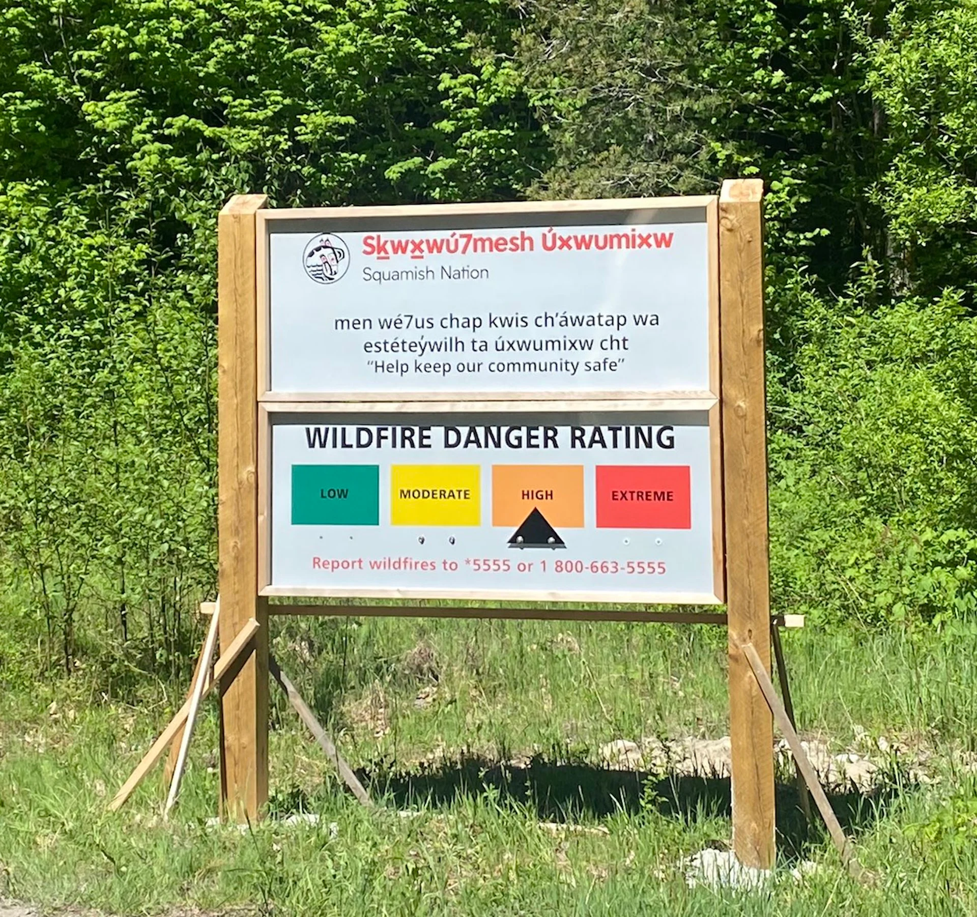
There are also currently 58 active wildfires throughout the province, with four that pose threats to the public. Hot, dry conditions persisting through the week are also fuelling the risk of new fires, especially with the presence of dry lightning. Currently, most of the province is under a moderate to high fire danger rating.
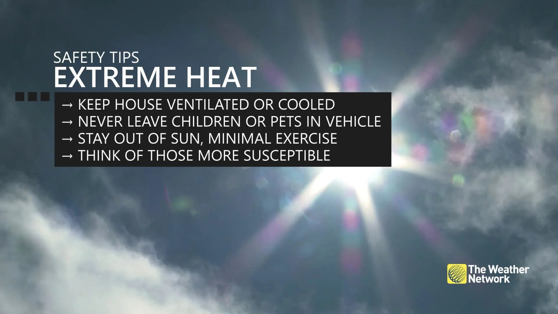
As with any heat event, also be sure to take precautions to protect yourself from heat-related illnesses. Urban centres will feel especially warmer at midday.
Keep checking back to The Weather Network for more forecast information and details in your region.