B.C. coast braces for king tides as stormy weekend looms
The highest tides of the year are expected to arrive this weekend, accompanied by strong winds and low pressure, causing concerns about coastal flooding in parts of B.C.
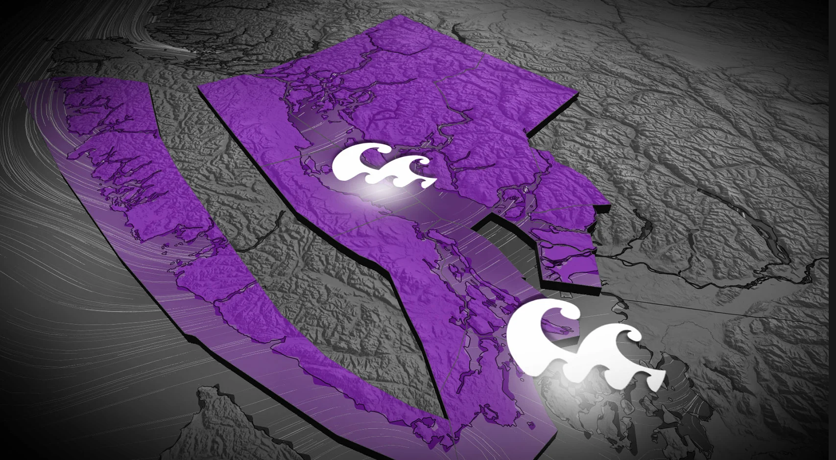
British Columbia's coastline is entering a tense period as the highest tides of the year meet with an approaching storm system, raising the risk of coastal flooding.
Forecasters predict the most hazardous conditions on Sunday, when king tides coincide with strong onshore winds and deep low pressure offshore. The setup allows seawater to accumulate along the coast, raising levels above normal and increasing the risk of flooding in low-lying areas.
While king tides happen every year, experts say this weekend's combination of tides and weather should be closely monitored, particularly along the South Coast and exposed shorelines.
The tides are going to stay elevated into next week, but Sunday is expected to be the most significant overlap of weather and ocean conditions.
DON'T MISS: When is the coldest stretch of the year in your corner of Canada?
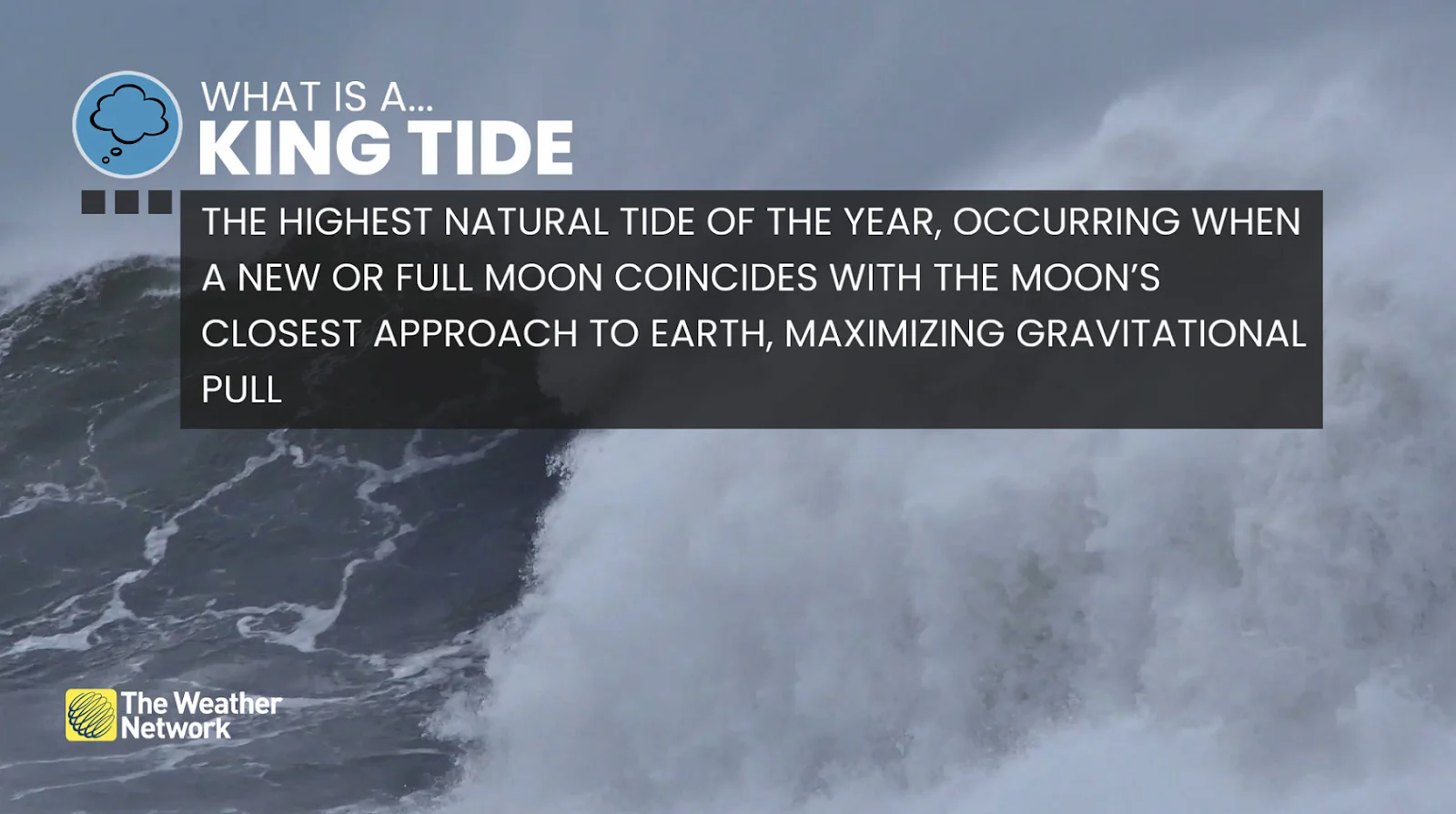
Why king tides matter
King tides are among the most predictable tides of the year, caused by the alignment of the sun, moon and earth. This weekend's tides are amplified by the moon's proximity to Earth, which strengthens its gravitational pull on the oceans.

At the same time, Earth is approaching perihelion, when it is closest to the sun, which slightly increases tidal influence. On their own, king tides rarely cause issues. Stormy weather complicates matters.
Strong winds can push water toward shore, while low atmospheric pressure causes the ocean surface to rise, transforming already high tides into a coastal flooding threat.
Storm conditions raise flood risk
A deep area of low pressure is expected to approach the northwest tip of Vancouver Island early Sunday, with a central pressure of around 985 hectopascals.
Lower pressure causes seawater to expand upward, while moderate to strong southeast winds are anticipated to raise wave heights and push water toward coastal communities.
Some of the most severe marine conditions are expected to coincide with Sunday's peak tides.
B.C.'s distinct coastline, with long inlets, narrow channels and wind-facing shores, may worsen the effects, particularly in areas where water has few escape routes.
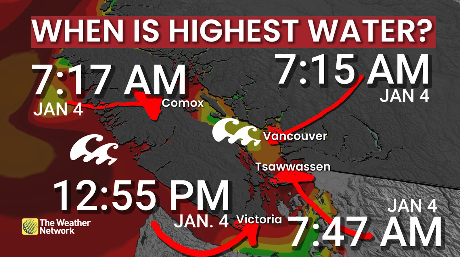
What communities could see
According to model estimates, peak water levels may rise to 5.4 metres above chart datum at Point Atkinson and 5.57 metres in Halfmoon Bay. Campbell River and Victoria are both projected to have higher levels during high tides.

Officials warn that the effects could include seawater overtopping seawalls, debris washing onto roads and walkways, localized coastal erosion and potential closures in low-lying areas.
If conditions worsen, ferry service through the Strait of Georgia and the Juan de Fuca Strait may be disrupted. Those who live in flood-prone coastal areas are urged to monitor forecasts and avoid shorelines during peak tides.
While a strong cold front is expected to move down the coast early Tuesday, bringing another round of gusty southeast winds, forecasters say Sunday is still the most important day to watch as king tides and storm conditions combine.
Stay with The Weather Network for the latest updates across British Columbia