Avalanche risk increases as a weekend atmospheric river targets B.C.
British Columbia's full sunshine will soon be replaced with heavy rain and snow -- all welcomed moisture that's needed for much of the province, but it will also raise the province's avalanche danger
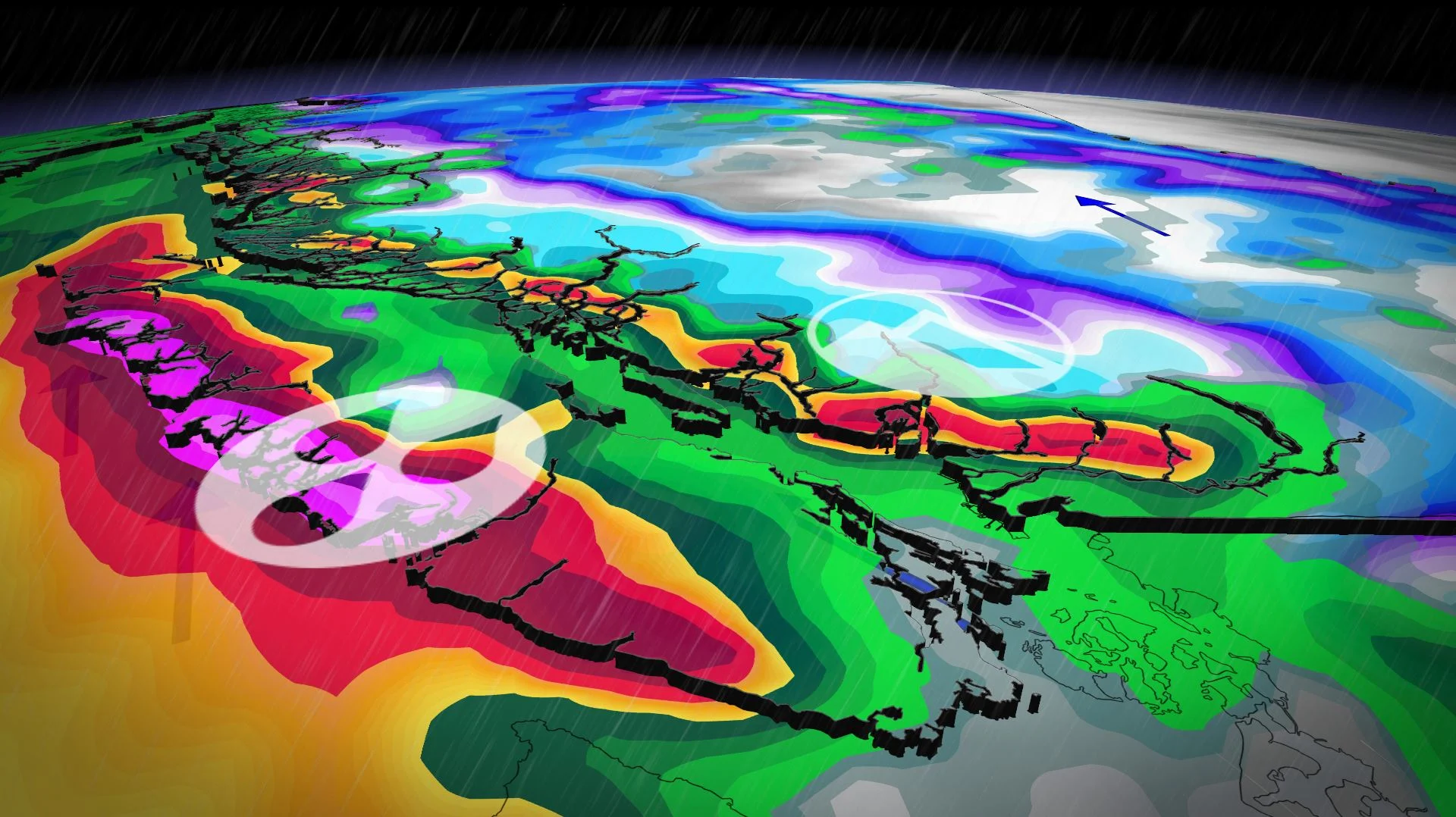
A more active pattern will return to British Columbia's South Coast region, with an atmospheric river event setting up for this weekend.
MARCH 2025 OUTLOOK: Canada to see March madness as winter transitions to spring
Heavy rain and alpine snow are forecast -- all beneficial moisture for the entire province. So far this winter, the majority of B.C. has seen less than 60 per cent of normal precipitation.

The wetter-than-normal conditions are expected to continue well into the second half of March, as well, and temperatures will be cold enough to bring some very impressive snow totals for the alpine regions. That means an abundance of snow for ski areas as we head closer to spring.
Friday through Sunday: Atmospheric river dumps heavy rain over the South Coast
A low pressure system hitting the North Coast will drag a cold front down the coast, stalling over Vancouver Island, and providing the path for an atmospheric river this weekend.

Freezing levels will rise above 1500 m to start the weekend.
Heavy rain will be persistent on both Saturday and Sunday, with significant rainfall totals replacing the recent abundant sunshine.

Between 40-50 mm of rain is forecast for the Lower Mainland, with as much as 70 mm possible for Metro Vancouver. Victoria will see closer to 20-30 mm fall.
RELATED: Atmospheric Rivers: Expert explains the good and bad of these extreme storms
Meanwhile, alpine snow totals for the coastal mountains could reach as much as 100 cm, with between 30-50 cm forecast for the Rockies.

Beware: Increasing avalanche risk this weekend
The avalanche risk isn’t a major concern leading into the weekend on Friday, but a crunchy and icy top layer will likely result in an increasing threat as the weekend progresses. A high avalanche danger rating has been issued for Saturday along Vancouver Island's mountains and the Sea to Sky region.

In addition to the rain and snow, wind gusts of 40-60 km/h will sweep up the Georgia Strait Friday and Saturday. While the wind strength won't be anything overly impressive, the persistency could result in higher than expected waves.
DON'T MISS: Why avalanche risks heighten in March
Forecasters are also keeping an eye on a rather strong storm that could bring powerful winds through the middle of next week.
Be sure to check back for all of the weather updates across British Columbia.