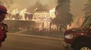
Australia's wildfires are now generating their own weather

The massive fires are generating pyrocumulonimbus clouds, which can start more wildfires on their own.
Australia's enormous and widespread bushfires have now reached the point where they are generating their own weather, creating a feedback loop that will make the already dire situation worse.
That's according to the Bureau of Meteorology office for the state of Victoria, which says it's observed pyrocumulonimbus clouds above eastern parts of the state.
The mechanism by which these clouds form isn't completely understood, but to observers, the clouds will appear very similar to the kind of clouds known to produce thunderstorms.
However, they're bad news for areas hit by wildfires. Unlike regular thunderstorms, they are 'dry' -- meaning they don't produce rain, only lightning, which, given how parched and hot much of Australia has been for the last few weeks, so not only do they not provide downpours to curb some of the flames, their lightning may actually spark more wildfires, and they can generate strong winds that stoke existing wildfires. They also can carry burning embers far and wide, starting new fires elsewhere.
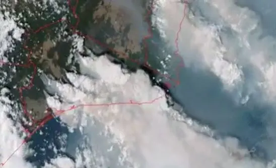
Another problem: They draw up a great deal of smoke and ash high into the atmosphere, affecting air quality and visibility over a very wide area. In 2017, traces of chemicals believed to have originated from wildfires in B.C. and Washington State were found as far away as Greenland and Ellesmere Island.
Though it's still early days, there is some evidence that these kinds of clouds are becoming more common, particularly in a world with more wildfires. Canada is not immune, with several pyrocumulonimbus clouds being observed during the 2016 Fort McMurray wildfire.