Freezing rain, flooding risk continues across Atlantic Canada

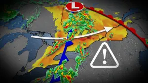
An impactful storm is battering Atlantic Canada, bringing prolonged freezing rain, ice pellet accumulations and localized, flooding rains.
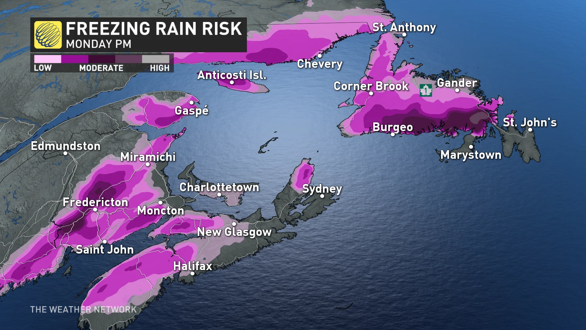
Atlantic Canada is facing prolonged rounds of freezing rain, snow, and rain, which will continue into the early part of this week.
Widespread rainfall and freezing rain warnings cover the Atlantic region. This ample moisture raises concerns for abundant rainfall accumulations, especially along the southern coastal regions. There are already reports of water covering some roadways in the region as a result of rain and snowmelt.
There is a risk of significant ice accretion in some areas before this changeover.
Travel will be dangerous across areas that experience even minor ice accretion from freezing rain. It only takes a thin glaze of ice to make roads, sidewalks, stairs, and driveways exceptionally slippery.
Wind gusts of 40-60 km/h are also expected during the storm. Ice adds extra weight to surfaces so power outages can be expected.
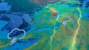
Timing of the freezing rain, ice and rain
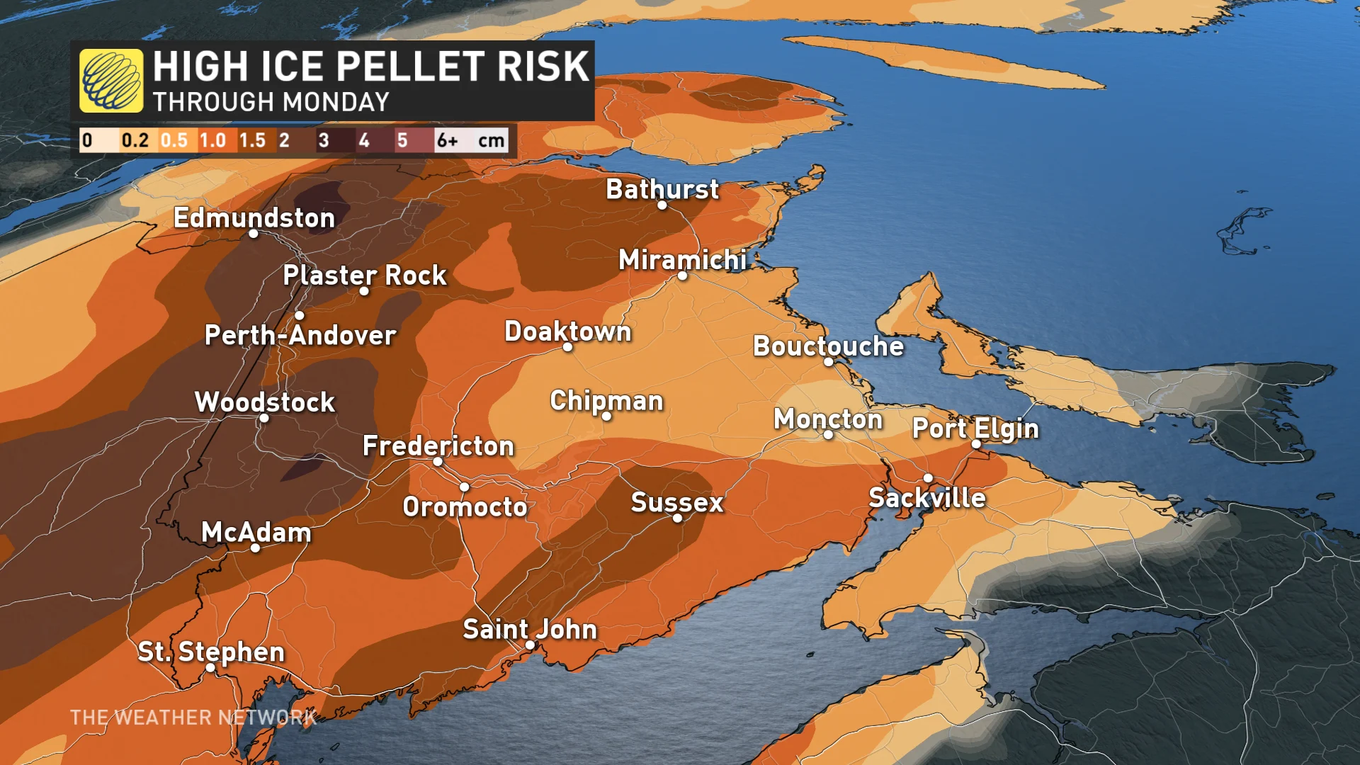
Freezing rain and ice pellets will continue into Monday morning for New Brunswick before warmer air finally changes the precipitation to showers.
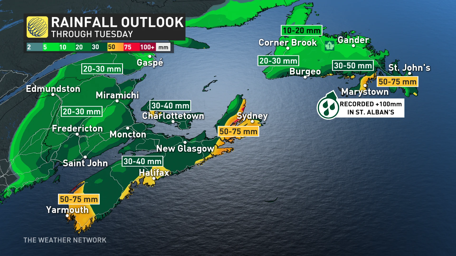
Rainfall, that could be heavy at times, will persist across Nova Scotia into Monday morning.
“Localized flooding in low-lying areas is possible. If visibility is reduced while driving, turn on your lights and maintain a safe following distance,” Environment and Climate Change Canada (ECCC) stated in their rainfall warning for Halifax.
MUST SEE: Here's what you need, indoors and out, to get through winter
Across the Gulf, a third round of freezing rain and ice pellets is expected late overnight Sunday and Monday morning. However, at this time it is expected to be mostly light and should not yield any significant icing.
In Newfoundland, the majority of the rain should fall by Monday morning. Showers are expected to persist from Monday to Wednesday, but at this time amounts are not forecast to be significant.
Much of the southern coastlines of both Nova Scotia and Newfoundland will bear the brunt of the rain. Expect to see between 30-75 mm for Nova Scotia and southern Newfoundland, with potentially up to 100 mm for extreme southern areas of the latter.
Above-seasonal temperatures will dominate through the week with an active pattern expected through the end of January.
Stay tuned to The Weather Network for the latest forecasts across Atlantic Canada.