Atmospheric river or atmospheric treadmill? Why B.C.'s rain is going nowhere
A series of storms are expected to drench parts of the Pacific Northwest and the South Coast of B.C. with over 100+ mm of rain later this week.
As California experiences the bulk of the atmospheric river activity, B.C. will soon get a taste.
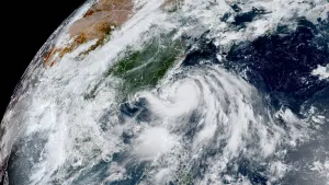
A strong low is churning in the eastern Pacific, but even more remarkable is the sheer size. At over 3,000 kilometres wide, it's on the upper end of what the atmosphere is capable of generating.

SEE ALSO: Hurricanes and floods bring $120 billion in insurance losses in 2022
Over the next few days, the low will only shift about 1,000 km. It is in the perfect position to steer the moisture approaching California and splay it farther north.
The incoming system will not technically meet the definition of an atmospheric river for Metro Vancouver. However, it is the duration of the rain that is more concerning.
With such a pronounced southeast flow, the Olympic Mountains will create a pronounced rain shadow, limiting Victoria to just a handful of millimetres.

As the system moves north of the Fraser River and along the Sea to Sky, the precipitation will jump to over 100 mm of rainfall.
Local ski hills around Metro Vancouver will be faced with rain by late Thursday. Pockets of cooler air near Whistler should keep the bulk of the precipitation as snow, especially above 1800 metres.
Some cities will face up to 60 hours of rainfall that will taper to showers on Saturday.
This system comes as California continues to be hounded with torrential rainfall and damaging winds, which have caused major flooding and power outages for many parts of the state. Many residents in Southern California were forced to evacuate from their homes due to increased risk of flooding and the potential for mudslides.

Meanwhile, heavy snow is expected for the alpine regions, so travellers can expect to see difficult road conditions.
Colder temperatures are expected the following week, which should mean that ski areas will see heavy snowfall. The Lower Mainland and coastal areas will continue to see rain.
Beyond, the South Coast should expect a reprieve from the wet weather for the last week of January, though the North Coast will still experience some wetness.
WATCH: Major avalanche concerns for B.C. right now, here's what you should know
Check back in to The Weather Network for the latest forecast updates for B.C.


