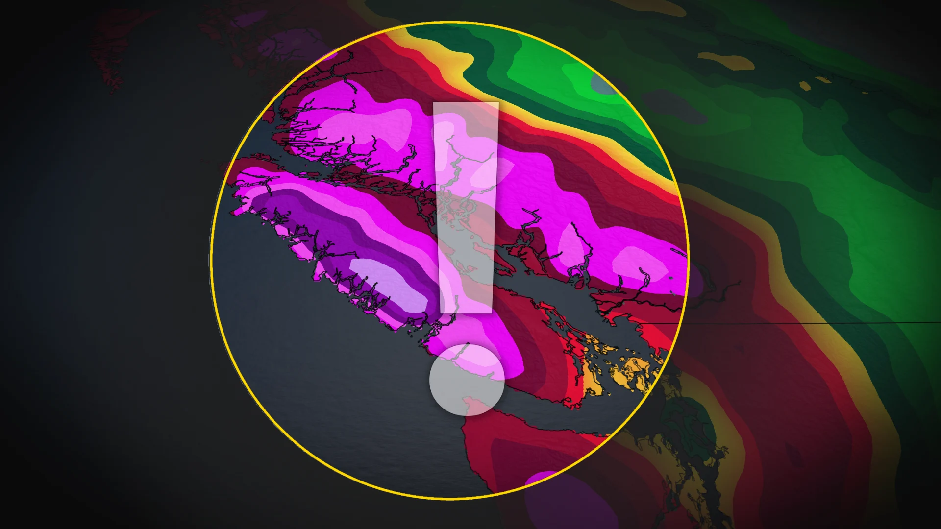
B.C. to become wettest place on Earth as stormy pattern settles in

A series of atmoshperic rivers are forecast to impact British Columbia's South Coast, where we will see Vancouver Island become the wettest place on Earth by next week.
It's November, which means British Columbia is in its rainiest month of the year. The month is forecast to start off strong across the South Coast as widespread rains and alpine snow fall over the region this week, lingering into the weekend.
The Vancouver airport recorded only 38.8 mm of rainfall throughout October--just 32 per cent of the monthly average. That's about to change, though, as a series of atmospheric rivers take aim at the South Coast over the coming days.
SEE ALSO: Two historic events point a question mark over Canada's November
Parts of Vancouvers Island could see 300-400 mm of rainfall through the weekend and into early next week. Nowhere else on Earth is forecast to receive this much rain over that timespan.
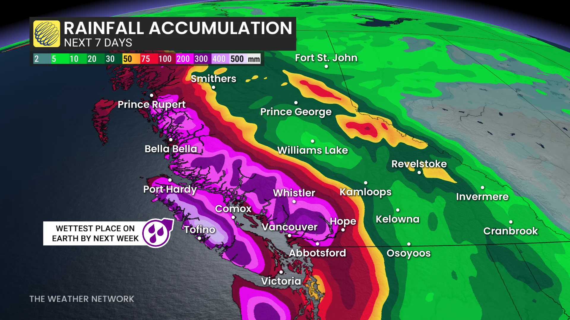
Forecasters are looking at an AR3-4 for Vancouver Island and AR2 for the Central Coast over the next seven days.
Since October was so dry, we could see localized flooding from the sudden deluge, as the ground may be too dry to absorb the rain right away. Strong winds will also raise the risk of local power outages, high surf, and ferry delays.
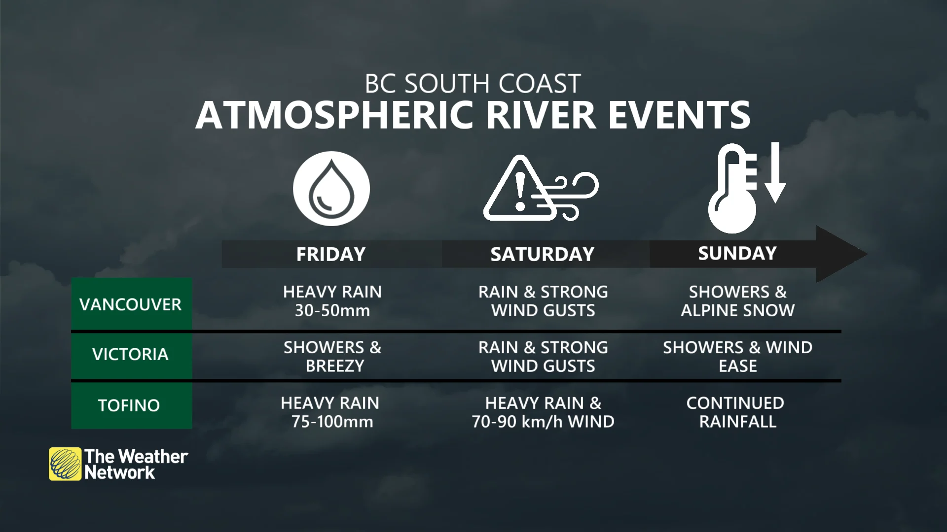
Heavy rains continue Friday
The first round of rain came to B.C. on Wednesday as a sharp cold front moved in. The rain is forecast to push southward from the Central Coast to northern Vancouver Island by late Thursday.
By Friday, we'll see that rainfall impact southern Vancouver Island as well as the Lower Mainland, including Metro Vancouver, becoming heavy through the day.
The Central Coast and western Vancouver Island could see 75-100 mm of rain through Friday, while the Lower Mainland could see 20-50 mm.
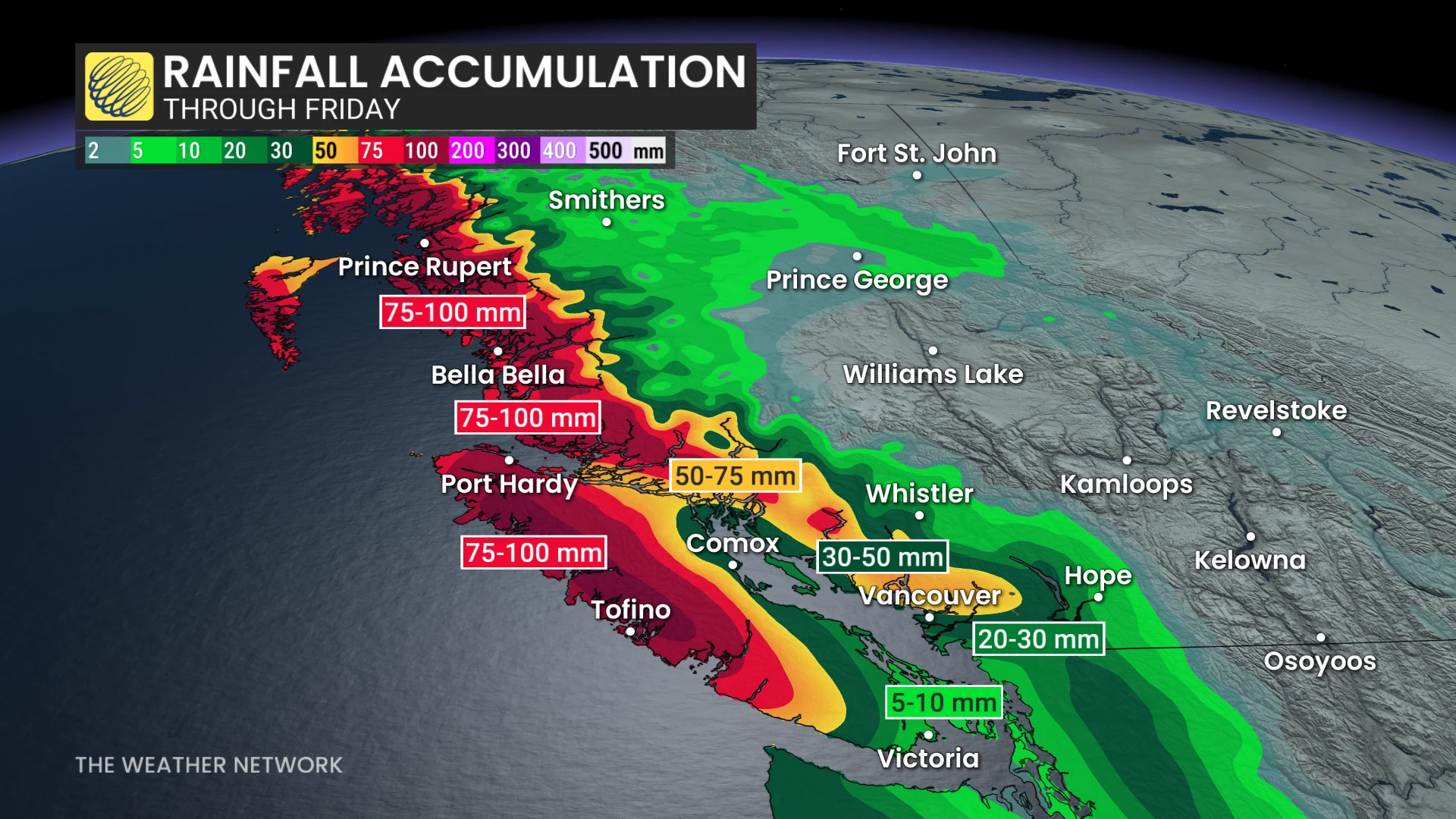
Winds gusting between 60-80 km/h into the straits may also lead to ferry delays throughout the day.
Folks will get a brief break in the rainy weather late Friday, but a deepening system with sharp fronts moving in Saturday will bring even more impactful weather to the coast over the weekend.
DON'T MISS: How did this ski hill make its snow last all year?
More rain, heavy alpine snow moves in over the weekend
Enjoy what you can of the weather on Saturday before heavy rains begin once more in the evening and persist through Sunday. The Lower Mainland could see another 20-30+ mm of rainfall by the end of the weekend, while parts of Vancouver Island could see another 30-50+ mm.
Late Saturday through Sunday is also when we'll see the strongest winds pick up, gusting between 60-90 km/h for parts of Vancouver Island, 50-60 km/h in Metro Vancouver, and 70-80 km/h in the Strait of Georgia.
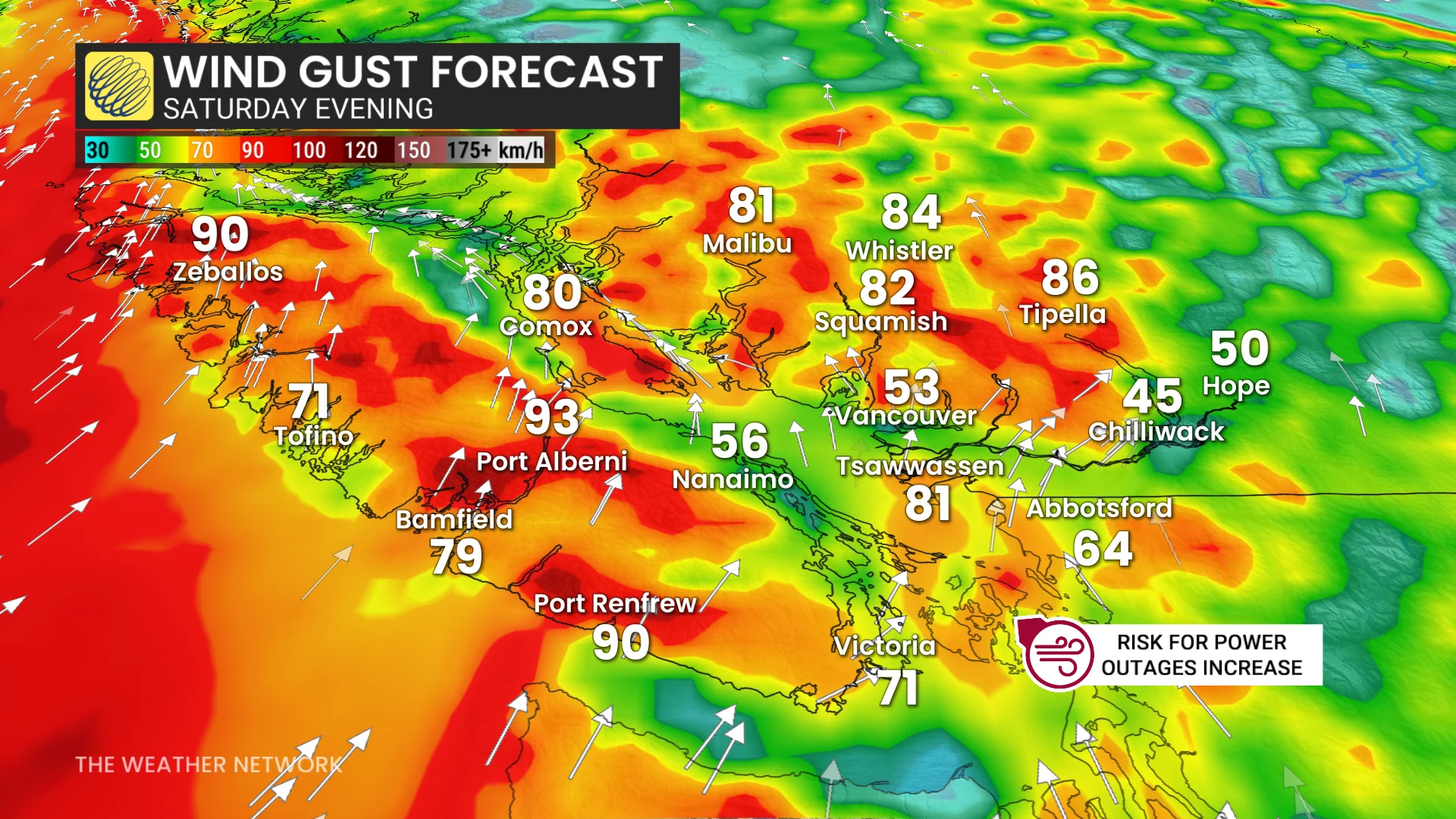
The strong winds are expected to persist inland and across the North Coast mountains as well.
Freezing levels are forecast to rise to 2,600 metres into Saturday, but will fall back to around 1,500-1,600 metres on Sunday behind the system's cold front.
Folks can expect to see heavy alpine snow through the weekend, which is great news for ski resorts, but less favourable for those travelling through the mountains.
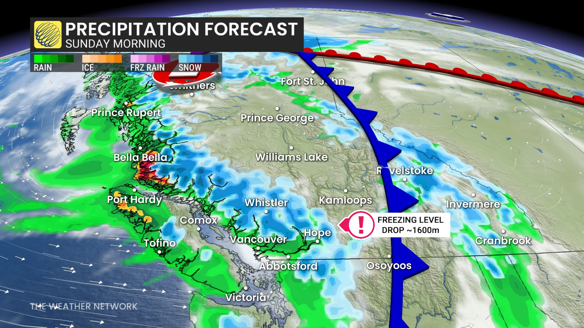
Another atmospheric river takes aim early next week
Forecasters are closely watching another strong system and atmospheric river event that is building into the work week.
Since the ground will already be very saturated from the weekend, we could see even greater impacts, such as localized flooding, through the early week.
While exact totals haven't been determined yet this far out, forecasters are expecting strong winds, as well as significant rain and snow to be in play.
Stay with The Weather Network for more information and updates on your weather across B.C.