Atlantic: Heavy rain, light snow for some on Tuesday

Parts of Newfoundland will see heavy rain while some in the Maritimes are seeing the potential for accumulating snow.
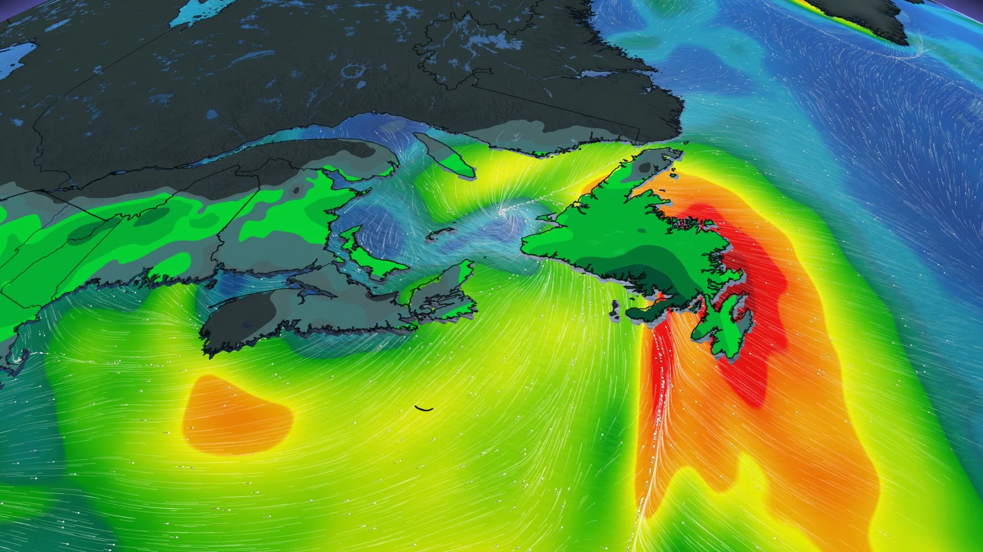
A strong low-pressure system will bring heavy rain for some parts of the Atlantic region, along with a few rounds of light snow here and there, with Fredericton likely to see some minor accumulations late Tuesday, with wet snow showers possible for parts of Nova Scotia and Newfoundland Wednesday morning. Details and timing, below.
WEATHER HIGHLIGHTS:
Widespread showers, heaviest in southern Newfoundland and Cape Breton
Flurries, wet snow showers possible in New Brunswick
Winds will be gusty, 50-70 km/h in the Avalon
Keep on top of weather ALERTS in your area
TUESDAY AND WEDNESDAY: WIDESPREAD RAIN
The Maritimes will see 5-15 mm of rain as showers track through the region on Tuesday.
The rain will become heavier in Newfoundland throughout the day, beginning over the southern coast and reaching the Avalon by late evening. Amounts will generally be heavier on the island than in the Maritimes, with as much as 40 mm possible for southern areas.

Strong winds are forecast for Tuesday afternoon in Newfoundland, moving to the Gulf of St. Lawrence by the evening hours, though not as strong as over the weekend. Gusts of 50-70 km/h are expected for the Avalon and 40-50 km/h in the Maritimes.
Flurries are possible in northern New Brunswick throughout Tuesday and again in southern and central regions of the province Wednesday as the system departs. Wet snow showers are possible for Nova Scotia Wednesday.
BEYOND: ACTIVE PATTERN CONTINUES
Thursday features fairer conditions, but the next system is already in sight, tracking into the Maritimes later Friday. Mostly rain is expected from this system, though a wet snow/rain mix is not out of the question for northern New Brunswick.
The rain ends Saturday, and the system moves far enough south to stay clear of Newfoundland, but the active pattern continues next week, with a system eyeing the region Monday.
Stay tuned to The Weather Network as we continue to monitor the forecast.