
Arctic air on the loose: Who’s next in line for the freeze?

The cold air is coming, Canada, and someone will experience a 20-degree temperature drop in the coming days. We track the movement of a polar vortex, detailing a significant drop in temperatures across the country
A lobe of the polar vortex is currently parked over Hudson Bay, and Arctic air continues to ooze south out of Northern Canada, setting its sights on millions of Canadians in the days ahead.
Here’s the scoop.
By Wednesday, the coldest temperatures relative to normal across North America will focus on the eastern Prairies and northern Ontario. In these regions, temperatures will plunge well into the -20°C range, creating an anomalous and unusually deep cold air mass for early December.

SEE ALSO: Canada’s December outlook holds a strong, cold start to winter
A steep temperature drop
Regions east of Lake Superior are staring at a 20°C or greater temperature drop in just 24 hours.
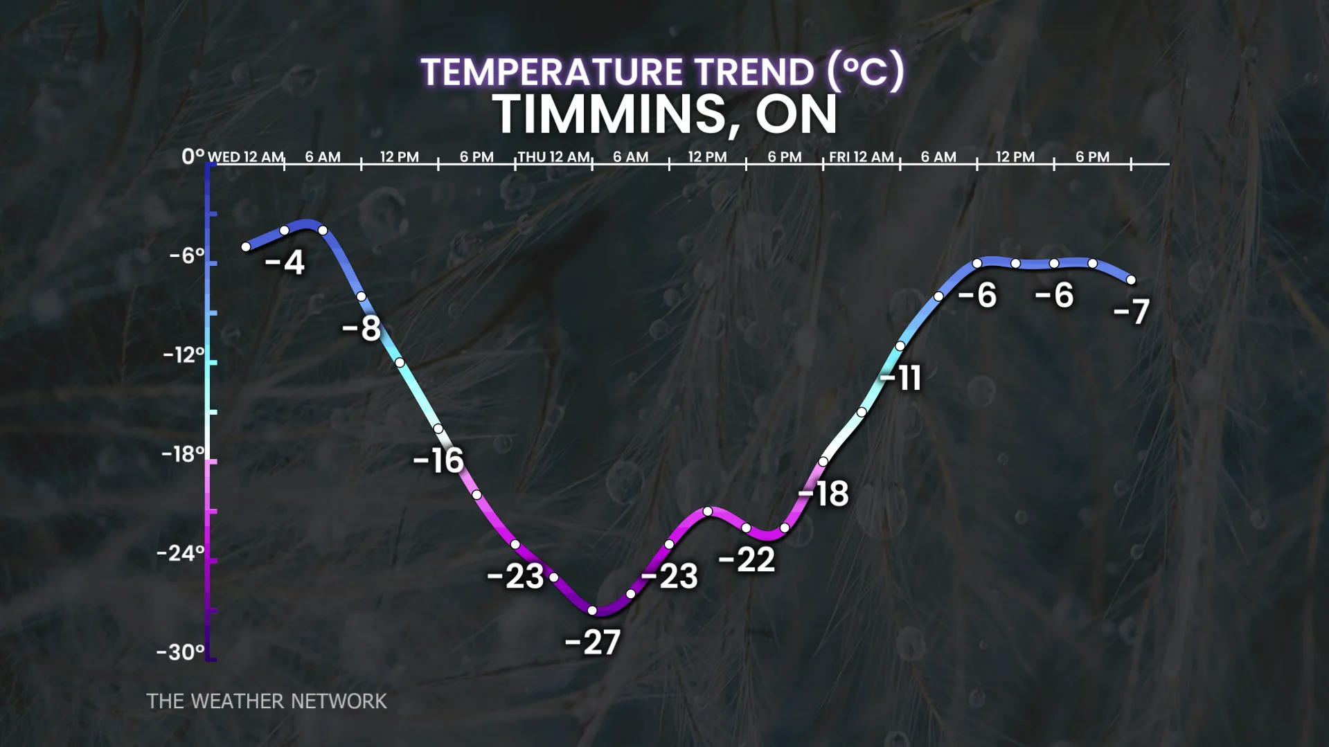
Eastern Ontario and Quebec will see drops of 15°C or more.

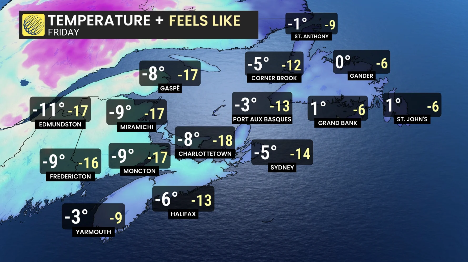
Even Atlantic Canada is expected to record a 15°C plunge by Friday
The Greater Toronto Area (GTA) and southern Ontario, buffered by the Great Lakes, should avoid the worst of the crash, but 10–12°C drops are still likely for communities downwind of Lake Huron and Georgian Bay.

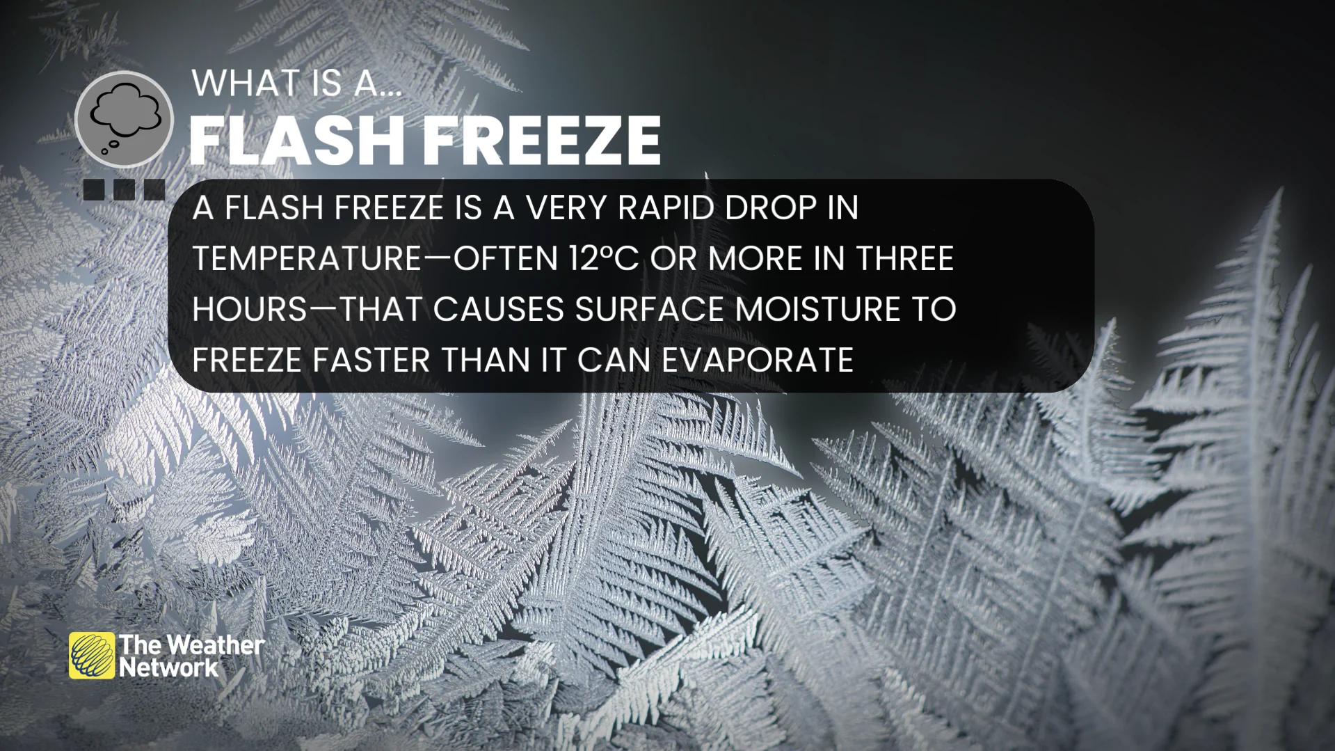
Is this a flash freeze?
Not in a strict meteorological sense. For a true flash freeze, the temperature must start above the freezing mark and crash rapidly.
A flash freeze occurs when the temperature drops extremely rapidly, often by 12°C or more within three hours, starting from above 0°C. When this happens, wet surfaces can freeze almost instantly, as rain, slush, or meltwater freezes before road crews have time to respond.
In the current setup, most areas will already be below freezing, which lowers the risk. But that doesn’t eliminate the icy hazards.
Why flash freezes can be finicky
Wet roads don’t always freeze; they often dry out first
If conditions behind a cold front (low humidity, dry air), water on roads can evaporate before it freezes, even with a sharp drop in temperatures
Pooling water is the biggest red flag
Flash freezing is much more likely where rainwater has pooled, rather than in thin films of moisture
Snow on the roads makes freezing more efficient
Snow crystals can be the seed for ice formation. If it’s snowing as temperatures crash through zero, water is more likely to freeze than evaporate
The faster the drop, the higher the risk.
The highest impact flash freeze needs a serious temperature drop. If cooling slows, the risk drops, unless snow directly overlaps the temperature plunge.
It’s not just the temperature, it’s how it feels
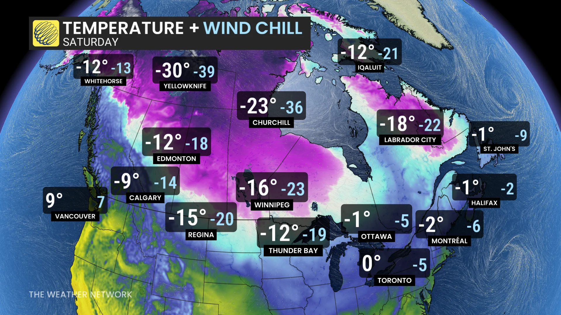
As Arctic air floods south, wind chill becomes a serious factor, especially overnight. Wind chill represents how cold the air feels on your skin as wind strips away the body’s natural bubble of warmth.
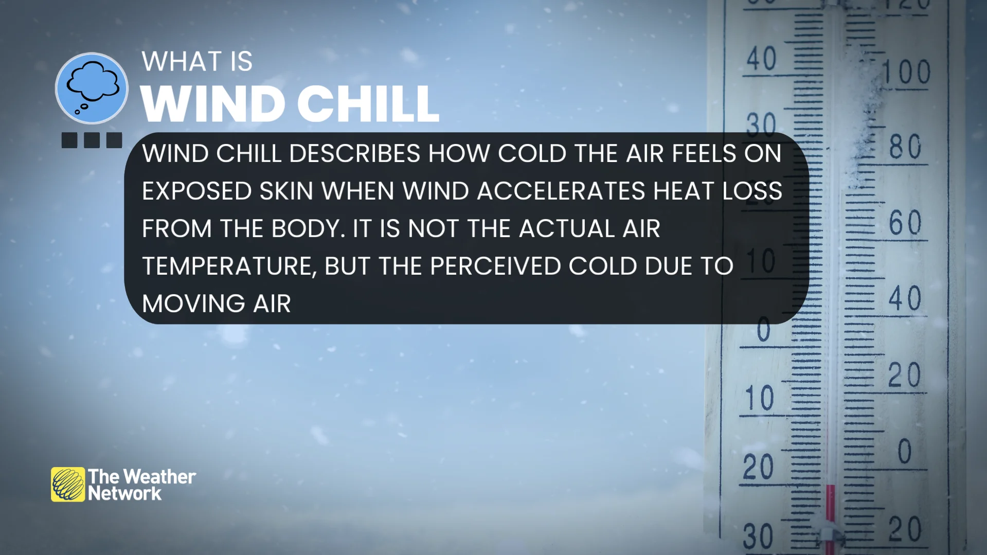
This accelerates heat loss, increases frostbite risk, particularly for anyone caught outside ill-prepared.
RELATED: When is the cold too cold? How extreme cold warnings are issued

Arctic air reloads
Just as one Arctic blast leaves, another reload of Arctic air is already lining up.
A late-week chill is unleashed across the Prairies, and by Friday and Saturday, temperatures are forecast to tumble with the next wave of Arctic air.
If you’ve read our December outlook, you already know this pattern looks primed to stay active.