April kicks off with a heavy snow threat, travel troubles in parts of Quebec
A spring storm with accumulating snow could result in some travel troubles across Quebec this week. Plan ahead, and be prepared for the deteriorating conditions
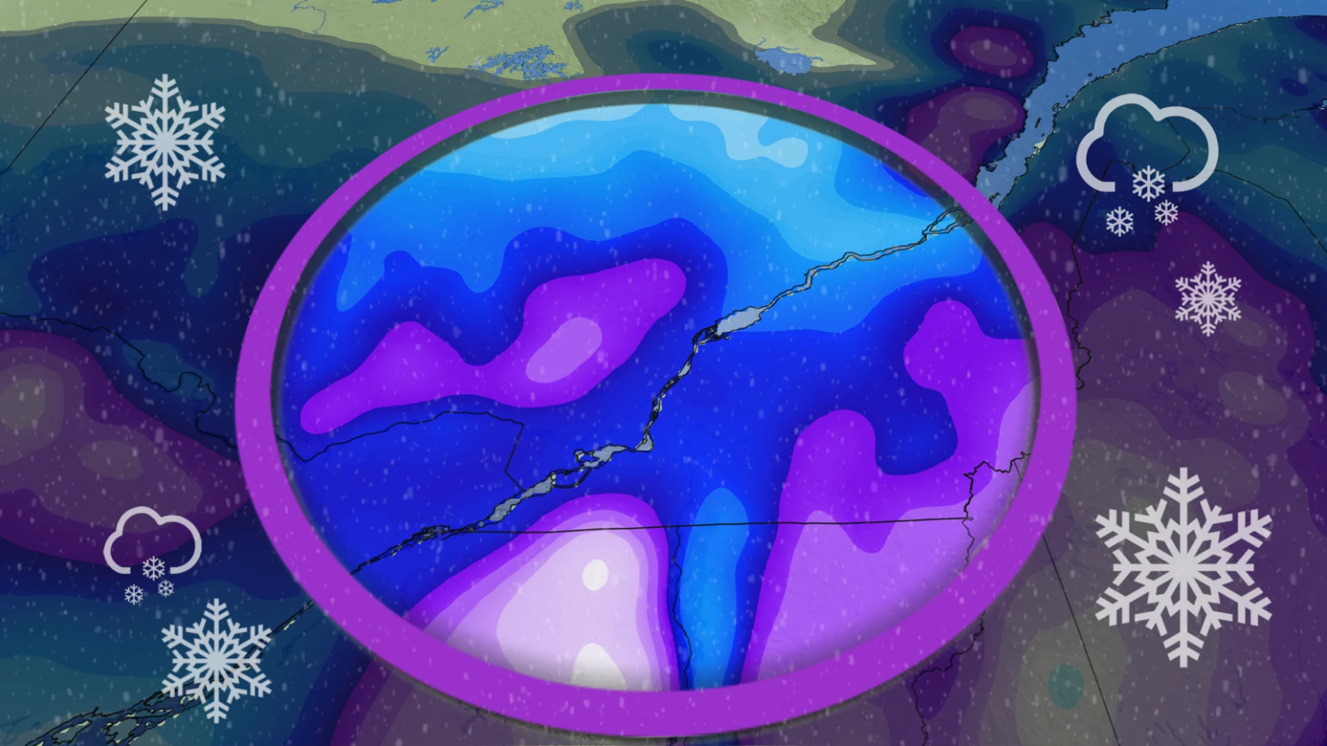
This may not be the start to April you were hoping for, as periods of heavy snow threaten parts of Quebec this week. Special weather statements and snowfall warnings are in place, warning of the potential for some difficult travel.
The first round of rocky weather is set to track towards the region with wind and rain mid-week, with a secondary low will developing in the U.S. Northeast, threatening the heavier snow over southern Quebec through Thursday.
DON'T MISS: Canada faces a fickle April as winter wanes and summer teases
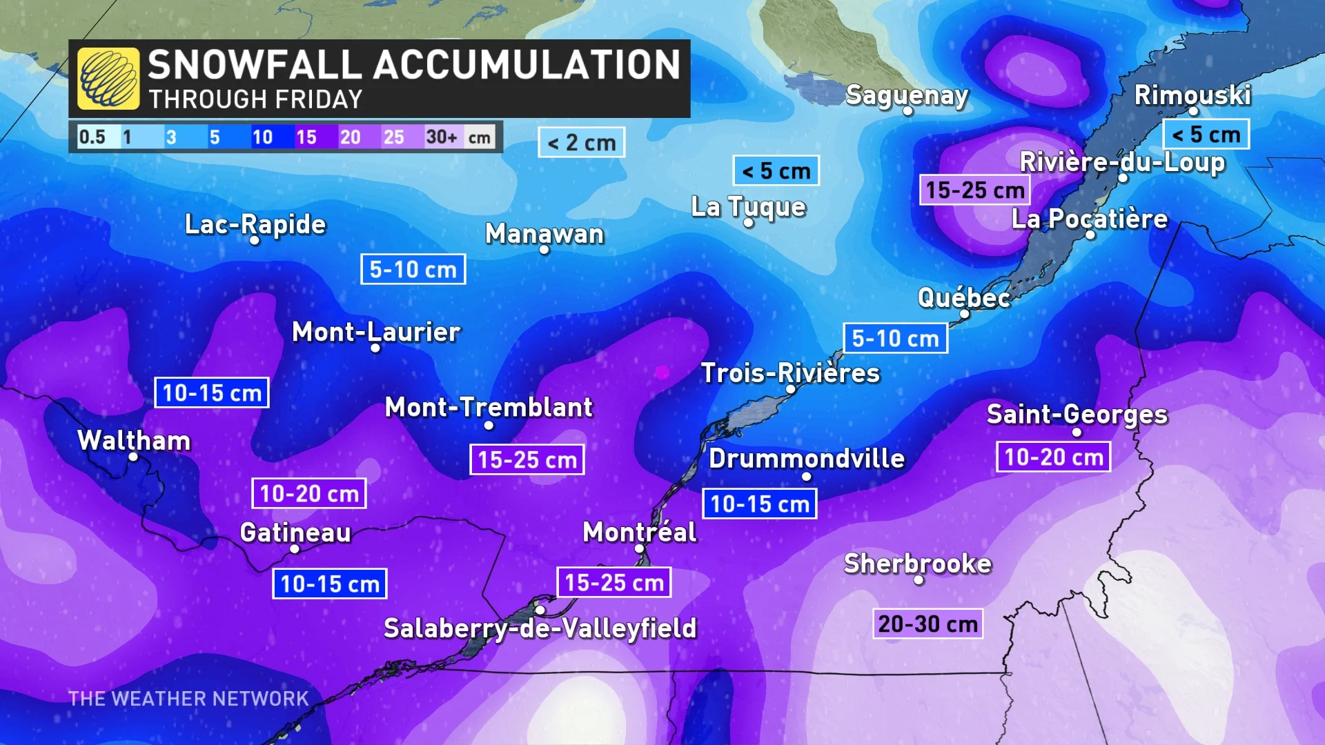
While there is uncertainty with exact totals, anywhere from 10-30 cm of snowfall could fall, depending on locale.
Drivers should be prepared for deteriorating and slippery road conditions for the latter half of this week. With northeasterly winds gusting up to 60 km/h, there's the chance for scattered power outages, as well.
Wednesday into Thursday: Rain, wind and snow spread across the province
After starting the week on a rather calm note, northeasterly winds will pick up across Quebec on Wednesday, keeping temperatures close to the freezing mark.
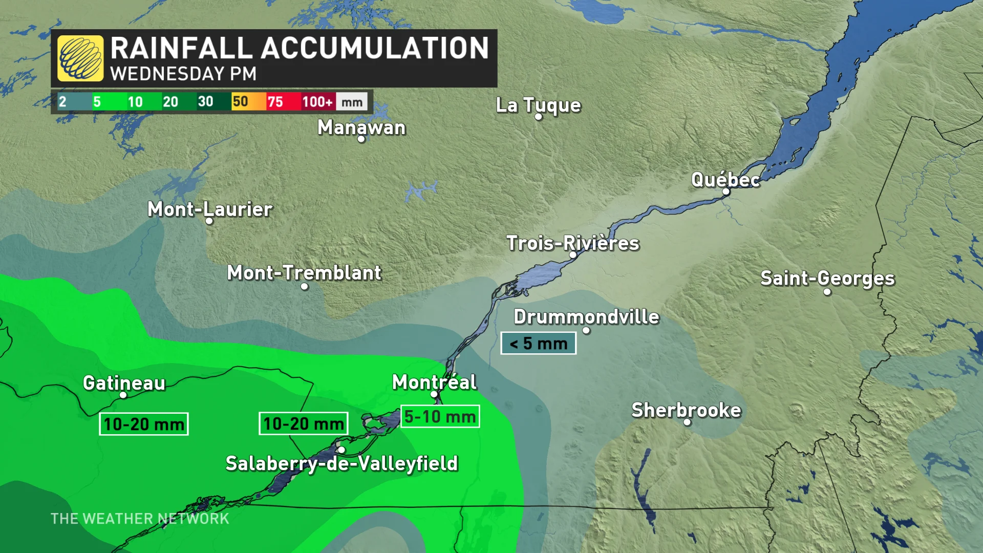
Chances for rain will move into the Gatineau region through the evening hours, possibly reaching as far north as Montreal. Rainfall totals won't be anything overly excessive, with between 5-20 mm forecast.
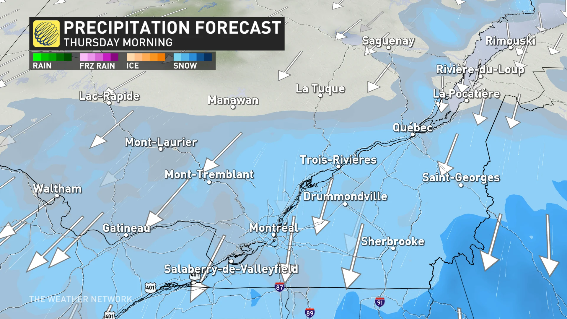
As temperatures cool further through the overnight hours, however, the risk for wet snow will move in. That's as a secondary low develops in the U.S. Northeast.
The snow is set to intensify through the afternoon hours on Thursday, and will be at its heaviest across southern sections, including Montreal.
Due to the dynamic setup of this system, there is still some uncertainty in how much snow will fall. Temperatures will remain very close to the freezing mark for a good part of the system, greatly influencing the amount of snow that accumulates on the ground, as opposed to melting.
Regardless, drivers should be prepared for the deteriorating conditions, and the threat for slick roads through Friday. There's also the chance for some areas to overachieve with snowfall totals, so this will be a forecast you'll want to continue to check back on.
Snow flurries will continue into Friday morning, though with a bump in temperatures bringing mixed precipitation and scattered rain.
ECLIPSE FORECAST: Here's an early look at how weather may affect eclipse viewing
A warming trend is forecast into the weekend, with temperatures climbing well above seasonal. Forecasters will continue to monitor conditions ahead of the total solar eclipse that’ll traverse the region on Monday, April 8.
Check back frequently for the latest on this evolving forecast over Quebec.