Tornado warning issued in southern Ontario amid severe storms
Get ready to head indoors if thunder roars as we end the week across southern Ontario
7:29 p.m. EDT - Severe thunderstorms prompted a tornado warning in southern Ontario on Friday evening.
Environment and Climate Change Canada issued a tornado warning for the following areas in southern Ontario:
Chatham-Kent - Rondeau Park
"This is a dangerous and potentially life-threatening situation. Take cover immediately, if threatening weather approaches," ECCC said in its warning.
The agency added: "Go indoors to a room on the lowest floor, away from outside walls and windows, such as a basement, bathroom, stairwell or interior closet. Leave mobile homes, vehicles, tents, trailers and other temporary or free-standing shelter, and move to a strong building if you can. As a last resort, lie in a low spot and protect your head from flying debris.”
CURRENT TORNADO WARNINGS (ONTARIO):
Chatham-Kent - Rondeau Park
The original article with the full forecast for the region continues below.
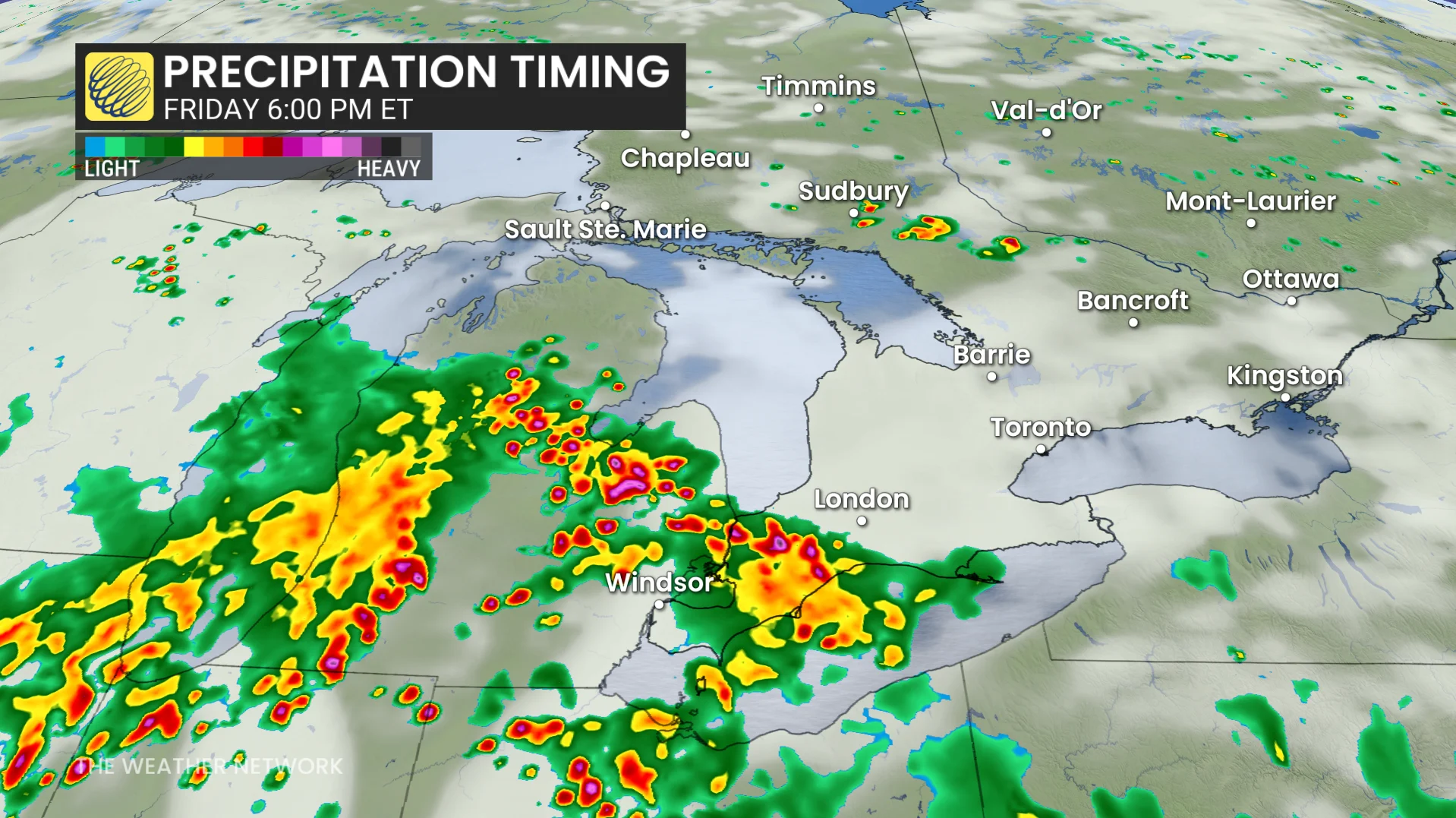
A persistently stormy pattern draped across southern Ontario continues into Friday as storm energy rebuilds with another hot and humid day.
Cleanup continues from the severe Canada Day storms that downed trees and power lines, as well as the drenchers that covered parts of the Golden Horseshoe.
Be ready to alter any outdoor plans in case threatening weather approaches your location. Remember, if you can hear thunder, you’re close enough to be struck by lightning.
DON’T MISS: Canada’s July outlook holds a major flip-flop across the country

Friday risk builds throughout southern Ontario
Extreme heat and humidity parked over the Great Lakes region will result in another round of afternoon thunderstorms fuelled by lake breezes. Humidex values will once again reach near 40 around the Greater Toronto Area, and up to 44 in the Windsor area.
This will be very similar to Thursday’s setup, in which more areas stayed dry than saw a storm.
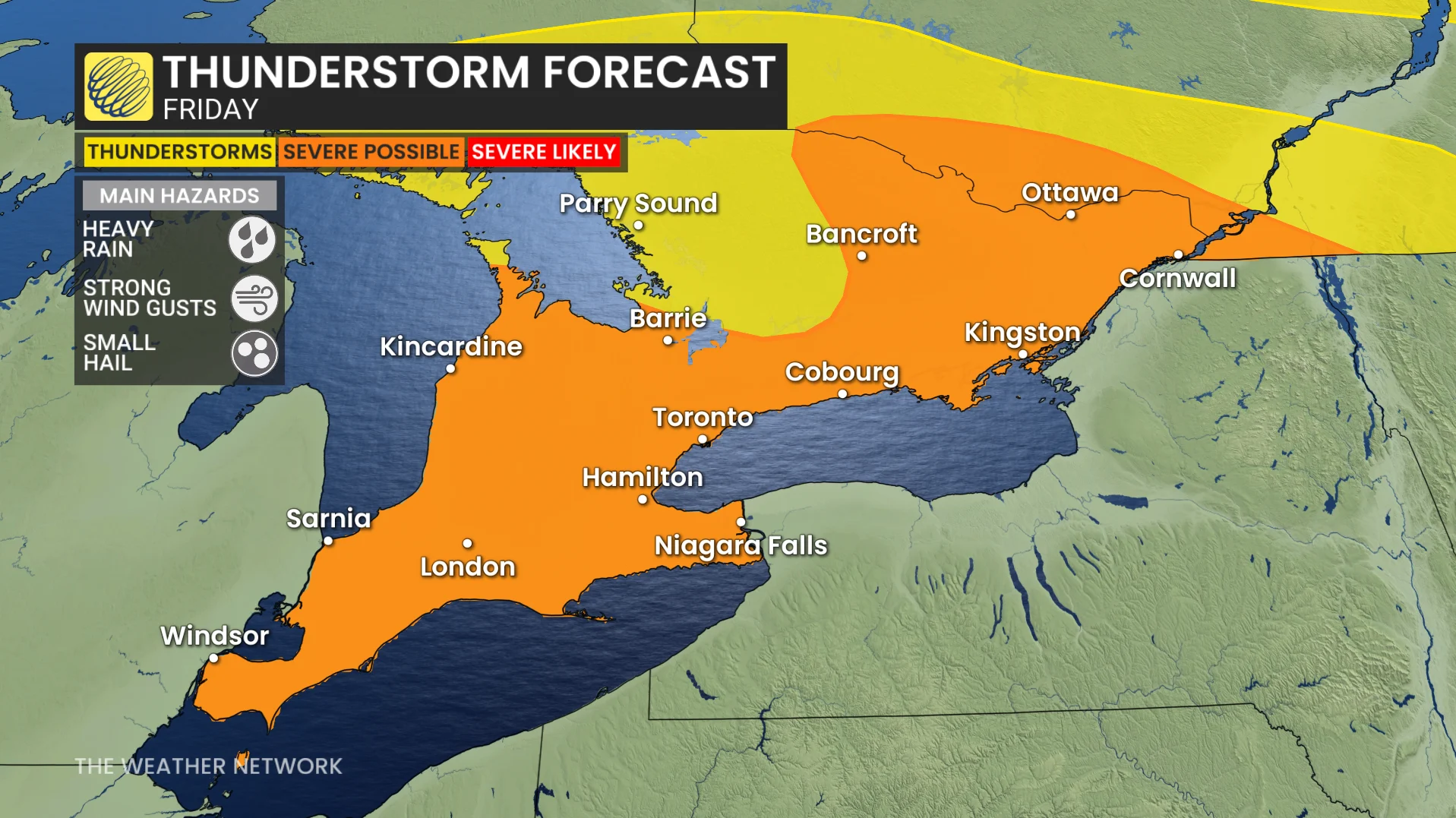
Slow-moving thunderstorms will be capable of wringing out the ample moisture in the atmosphere, resulting in downpours that could rack up hefty rainfall totals in short order. Strong wind gusts are also possible in the strongest storms.
Some of the stronger storms could also drop up to 2 cm diameter hail, raising the risk of tree and property damage.
A weak cold front approaching the region will also trigger a second round of storms in the evening. Even though this front won’t be able to completely clear out the humidity, it will make the weekend much more comfortable.