Another messy storm to sweep Ontario on Friday, heavy snow east of GTA
A rain-to-snow transition is coming once more, this time from southwest to northeast, with eastern and central Ontario receiving up to 20 cm of snow through Saturday
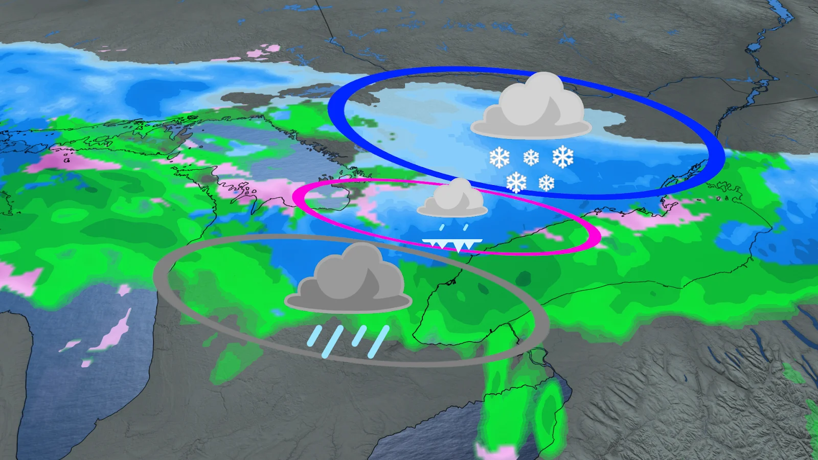
A storm identical to Wednesday's system is expected to move across southern and eastern Ontario on Friday, bringing another round of unpredictable precipitation to end the week.
This system, like the one from the middle of the week, will be moving from southwest to northeast, with precipitation types shifting along the way. Many areas are going to see rain turn to freezing rain before snow falls, but not everyone will get the full experience.
DON'T MISS: Ontario's wild wintry Wednesday ended with...thunderstorms?
The transition zone will once again form near the Greater Toronto Area (GTA), making conditions difficult throughout the day.

CHECK OUT: Moving pile of fishing net leads to record-breaking rescue
Rain in Toronto, heavier snow farther east
In comparison to Wednesday's storm, this system will bring consistent snow to eastern parts of the province, including Ottawa, where snowfall totals are expected to increase.
The heaviest snowfall, between 15 and 20 cm, is expected in eastern and central Ontario, where colder air will be more stable.
RELATED: 160 collisions in the GTHA since winter storm took hold, OPP says
In Toronto, however, temperatures are expected to remain mild enough for mostly rain. Instead of cycling through multiple precipitation types, the city will most likely experience a simple rain-to-snow transition.
In addition, there are fewer concerns about significant ice pellet accumulation than on Wednesday.

A winter that just won’t quit
Wednesday's storm dumped 6 cm at Toronto Pearson International Airport, bringing the city's total seasonal snowfall to 173 cm.
This is well above the seasonal average of 115 cm and marks the snowiest winter since 2007-08.
SEE ALSO: Toronto's record winter highlights snow removal challenges in North America
With another system upon the horizon, winter isn't over just yet, especially in communities east of the GTA, where plows will be working overtime.
Residents are encouraged to closely monitor forecasts, especially in areas where precipitation types are expected to change, as even minor temperature changes can have a significant impact on local conditions.

Stay with The Weather Network for the latest updates across Ontario