Alberta: Snow continues Wednesday as temperatures dip

The heaviest snow will be along the mountains and foothills, and beyond is a gradual temperature recovery.
A low-pressure system diving south across Alberta will bring mostly snow or rain/snow mix to part of southern Alberta Wednesday. Beyond, a long period of below-seasonal temperatures gradually comes to an end, with a flood of double-digit warmth by Friday. For a closer look, see below.
WEATHER HIGHLIGHTS
Heaviest snow along the Rockies and southern foothills
Temperatures recover to seasonal late-week
Keep on top of weather ALERTS in your area
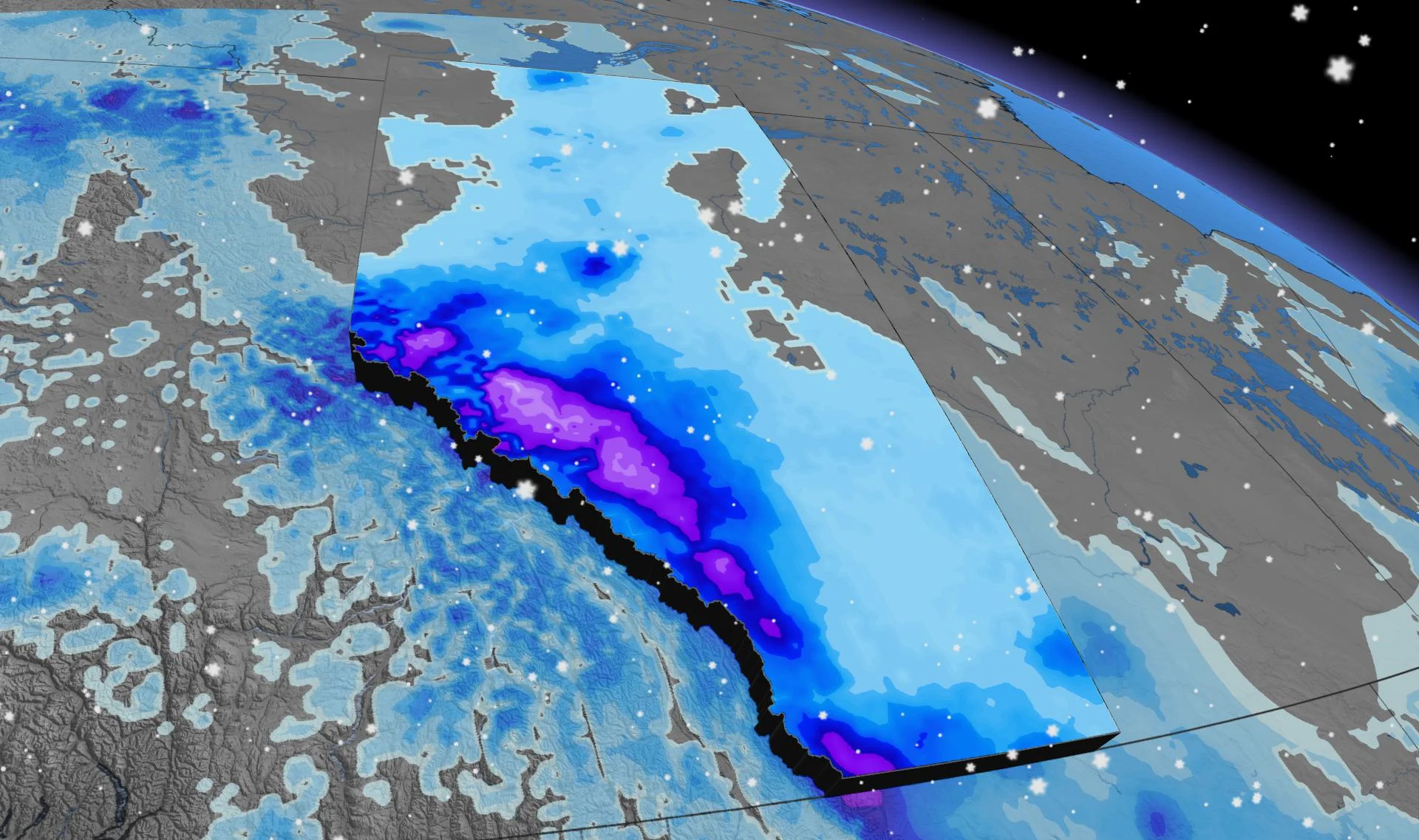
WEDNESDAY: SNOW CONTINUES, HEAVIEST IN THE MOUNTAINS AND FOOTHILLS
Rain began transitioning to snow late Tuesday and overnight into Wednesday as temperatures continue to fall.
Cooler air will move in for Wednesday, so the bulk of the precipitation looks set to remain as snow or a rain/snow mix.
Presently, it seems the heaviest snow will be confined to the Rockies and foothills, with some 10-20 cm through Kananaskis, Banff and Clearwater counties from this event. Totals drop off considerably the further east one goes, and will likely remain below 5 cm for areas along the QEII.

Upslope enhancement will continue through Wednesday as temperatures remain below seasonal.
Winds will also pick up during the overnight hours through Wednesday morning — particularly along the QEII from Edmonton to the stateside border, with gusts between 50-60 km/h expected.
LATE WEEK: GRADUAL WARM-UP
You haven't been imagining it: The first half of April has indeed been cooler than normal, for most of Alberta and even into parts of Saskatchewan. In fact, the region has been 5-10 degrees colder than normal:

Relief is ahead, though. As a ridge pushes inland from the Pacific, temperatures will trend closer to normal by Thursday and Friday, with daytime highs in the double digits for southern parts of Alberta by the end of the week.
