Northern Ontario dives into winter freeze, up to 40 cm snow over major highway
Spring and winter battle it out across northern Ontario on Wednesday, with a hefty helping of snow blasting parts of the region. Brace for quickly deteriorating roadway conditions
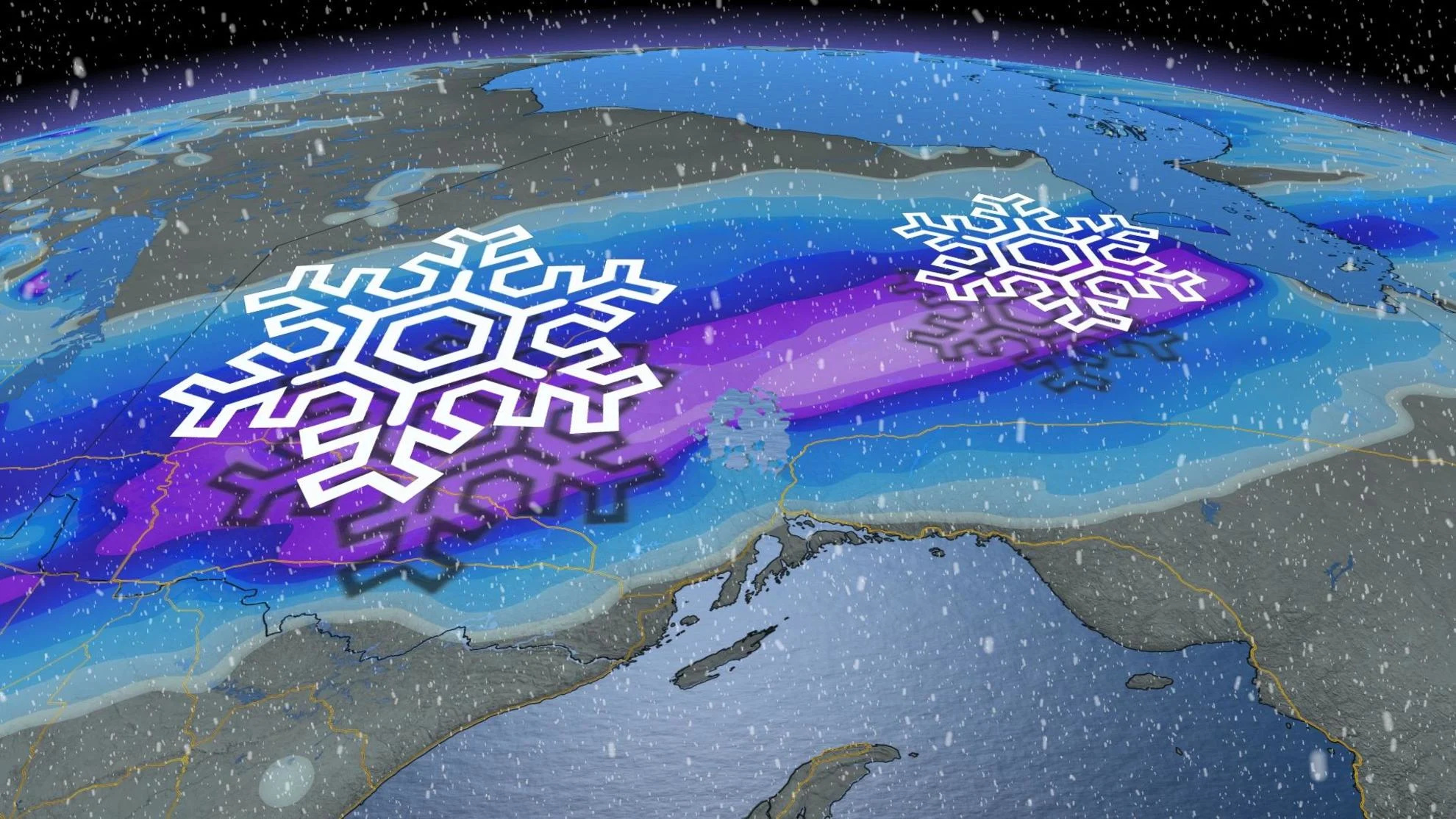
Winter driving will be put to the test across parts of northern Ontario this week, as a potent late season storm system threatens up to 40 cm of snow in some of the hardest hit areas through Wednesday. Icy precipitation and a flash freeze are also a major threat, with drivers being urged to brace for quickly changing and deteriorating conditions.
SEE ALSO: Dramatic temperature drop after spring-like warmth, thunderstorm risk in Ontario
Parts of northwestern Ontario began to see the snow Tuesday morning and has continued to track northeast throughout the day. Between 10-20 cm of snow is expected in its wake in the northwest, and upwards to 40 cm in the northeast, towards James Bay.

For areas near Timmins and south, milder temperatures caused rain to fall at first on Tuesday, but will freeze and create icy conditions overnight before snow moves in Wednesday morning.
Between the cold and warm boundary, there's the potential of a wintry mix of freezing rain and ice pellets through areas like Sault Ste. Marie, Timmins and New Liskeard.

There is also a risk for a dangerous flash freeze for areas between Timmins and Sudbury. Hazardous driving conditions are expected as roads may become icy from the freezing rain, ice, and sudden frost.
The heaviest snow will fall north of the Trans-Canada Highway from Kapuskasing to Moosonee, with 20-40 cm expected there. A winter storm warning is in effect for the region, with drivers being urged to evaluate the possibility of delaying any non-essential travel until conditions improve.

Looking ahead, there is some good news on the horizon. The quick blast of arctic air will be followed by much milder weather during the weekend and early next week. However, a spring storm is expected for early next week, associated with another strong Arctic front.
Stay tuned to The Weather Network for the latest forecast updates for northern Ontario.