A well timed warm-up could bring Ontario's first 30°C day this long weekend
Summer-like temperatures could bring Ontario's first 30°C day of the year this long weekend
Friday began with more frosty conditions in rural areas north and west of the Greater Toronto Area (GTA), but the rest of the day will warm up, with partly sunny skies and highs reaching the mid-to-upper teens.
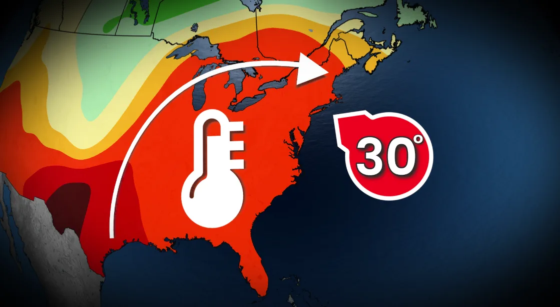
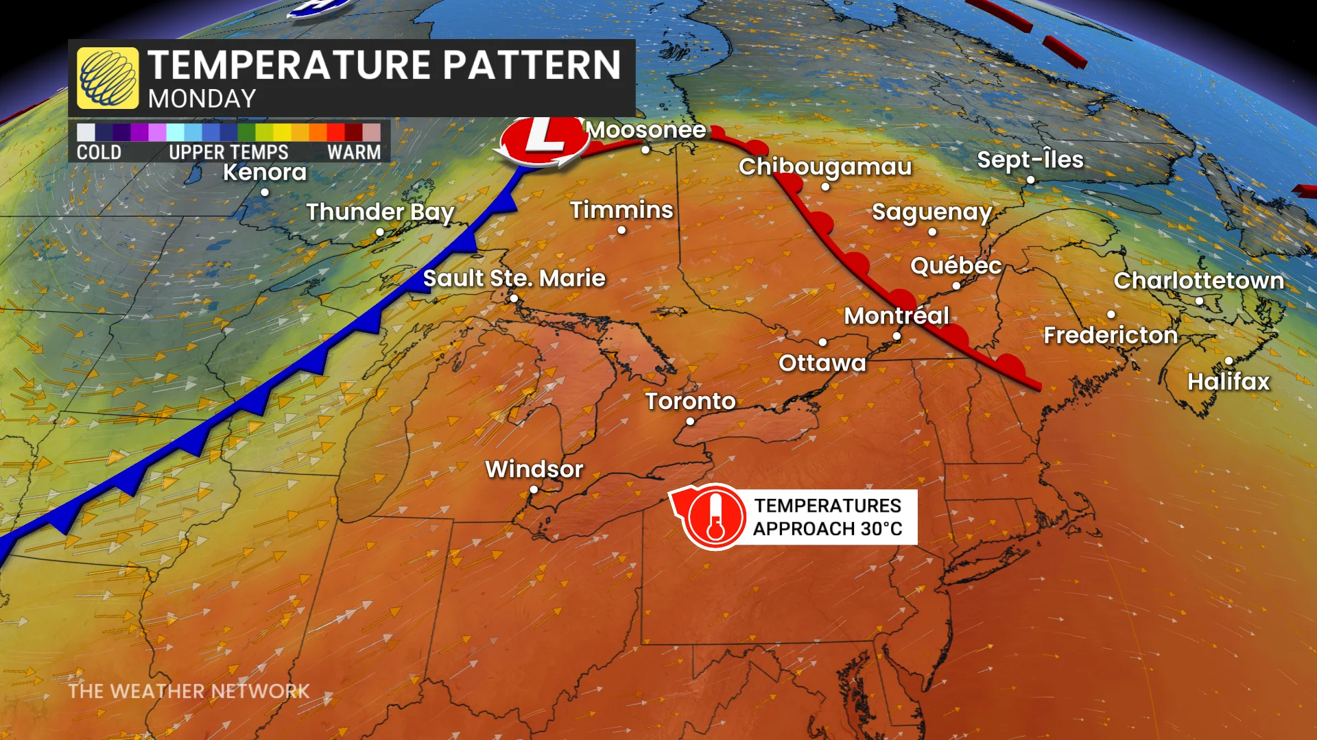
A ridge of high pressure is developing over the Great Lakes, creating the setup for May warmth across southern and eastern Ontario. The upcoming May long weekend will bring a stretch of well timed warmer weather, with the potential to hit 30°C for the first time this year.
DON'T MISS: Canada's weather shakeup for the long weekend: What to expect
Temperatures climb through the May long weekend in southern Ontario
By Monday, southern and eastern Ontario will find themselves under the influence of a warm front linked to an approaching storm system. Southerly winds and elevated moisture from the Gulf of Mexico will bring unseasonably warm temperatures, with highs climbing into the high 20s across London, Niagara, the GTA, and Ottawa — feeling closer to the low 30s with the humidex.
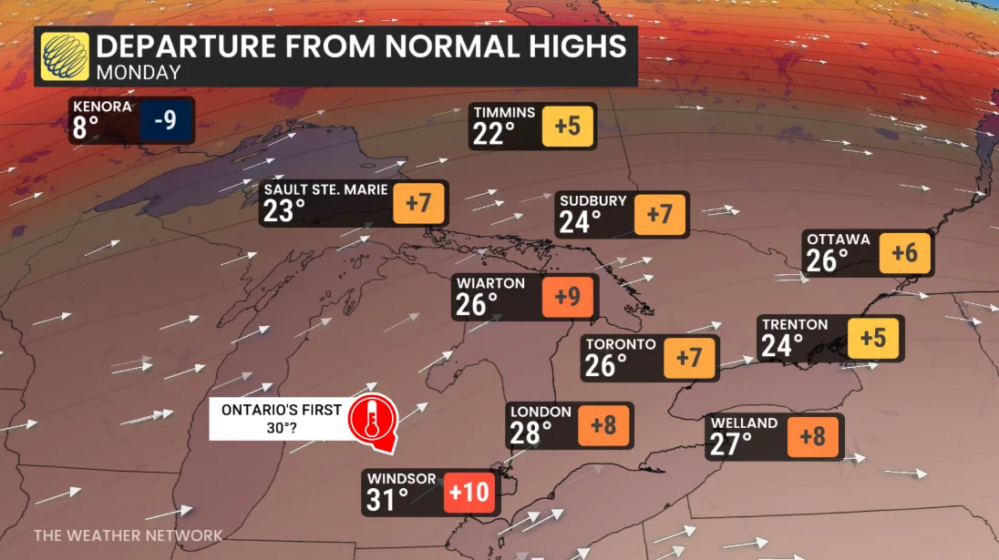
Meanwhile, the Windsor-Sarnia region is forecast to reach 31°C on Monday, likely marking Ontario’s first 30°C day of the year.
SEE ALSO: 130 years later, this Muskoka resort still knows how summer should feel
On Tuesday, humidity levels will peak, pushing humidex values above 30 across a vast stretch from Windsor to Ottawa, including Toronto.
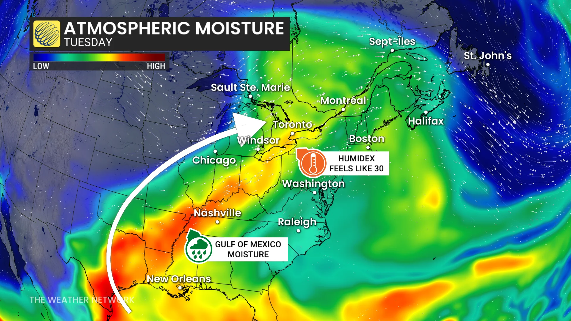
A cold front associated with the system will bring an end to the heat late Tuesday, ushering in rain and thunderstorms across the region.
The timing, rainfall amounts, and intensity of Tuesday's thunderstorms remain uncertain. However, there is high confidence in the trend of warm temperatures, with several regions expected to approach 30°C.
RELATED: Severe season: Canada's first tornado and microburst of 2026 confirmed
Be sure to check the UV index
Despite the cool start to spring and fewer sunny days overall, UV exposure can still be underestimated during the season. In contrast to summer, where warm temperatures often prompt the use of sunscreen and protective clothing, the cooler spring air may lead to a false sense of security.
With temperatures forecast to climb into the high 20s or even approach 30°C for the first time this season in some areas, it is crucial to stay mindful of sun protection. Pay close attention to the UV index and take appropriate precautions, including wearing sunscreen, protective clothing, and sunglasses.

Remember, UV exposure isn’t dependent on the temperature—it can remain high on clear days regardless of how it feels outside. Being prepared will ensure outdoor enjoyment while minimizing the risk of sunburn.
A cooler weather pattern is forecast to develop around the start of June and persist into the month.