New atmospheric river to hit B.C. with hefty rain, raises flood, avalanche risk
A new bout of Pacific moisture will infiltrate B.C. with soaking rains that will elevate the flood risk and avalanche concerns for some areas.
Prepare for several days of unsettled conditions across British Columbia as a renewed surge of moisture streams into the West Coast.
The renewed atmospheric river expected to move into the West Coast this weekend is a pineapple express, a potent type of atmospheric river that transports moisture straight from the region around Hawaii.
DON’T MISS: What’s a Pineapple Express? Diving into this robust atmospheric river
Dangerous avalanche conditions are anticipated as heavy rain and fluctuating freezing levels could destabilize the snowpack. An elevated flood risk will also exist in steep terrain and regions with poor drainage.
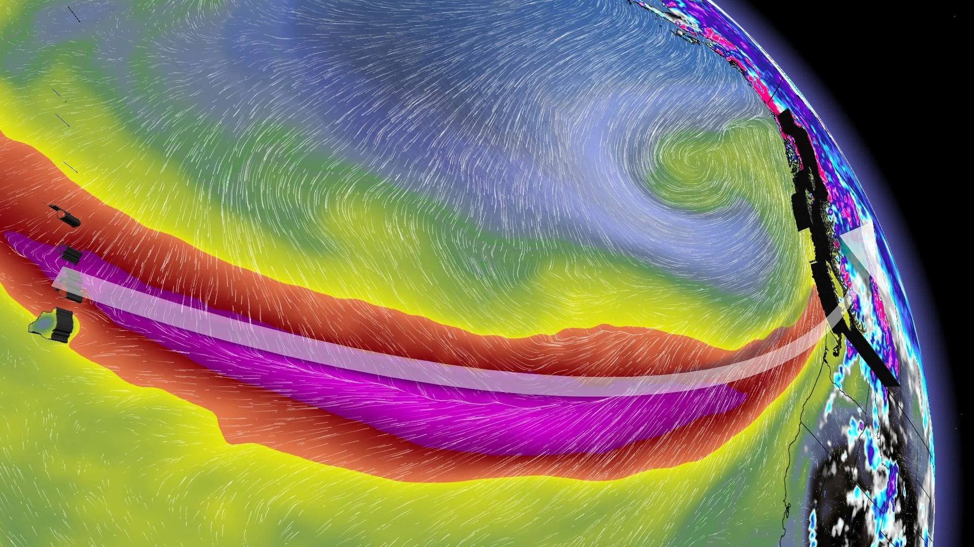
Atmospheric river aims for the West Coast
The atmospheric river model guidance indicates this event will be a AR-2 to AR-3, with a moderate to high impact.

We’ll see multiple waves of moisture linger along the coast this weekend as frontal systems target the South Coast. By Sunday night, the most potent moisture is expected to move ashore.
Heavy rainfall is expected across Vancouver Island, the South Coast, and Coast Mountains.
Rainfall forecast (Through Tuesday morning)
Tofino: 150-200 mm
Port Alberni: 100-150 mm
Nanaimo: Approximately 40 mm
Victoria: 20-40 mm
Downtown Vancouver: 50-75 mm
Abbotsford: 75-100 mm
North Vancouver: 100+ mm
Squamish: 125-150 mm

Slower-than-normal Monday morning commute across the Lower Mainland as frequent ponding, pooling, and localized flooding will occur as the heaviest rain moves in.
Freezing levels are expected to rise rapidly to 2,000 metres or higher by Sunday, followed by a peak later Tuesday at values locally near 3,000 metres above sea level near the North Shore Mountains.
The warm-up will allow rain to reach well into the alpine regions and accelerate snowmelt throughout the mountains.
Dangerous avalanche conditions are expected as heavy rain and fluctuating freezing levels could destabilize the snowpack. An elevated flood risk will also exist in steep terrain and regions with poor drainage.
Stay with The Weather Network for all the latest on conditions across British Columbia.