80-hour snowfall event leads into major, frigid pattern with Arctic blast

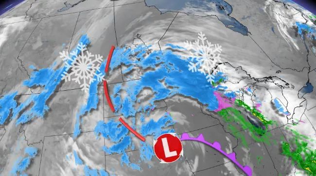
A Colorado low marching across North America will bring far-reaching impacts including an extended period of heavy snowfall that may last for more than 80 hours and stretch more than 1,000 km from Saskatchewan to northwestern Ontario.
Those in the southern section of the eastern Prairies will soon be bracing for a significant winter storm. The slow-moving Colorado low will lead to more than 80 hours of snowfall for parts of the eastern Prairies and northwestern Ontario this week.
DON’T MISS: A looming December chill could boost Canada’s odds of a white Christmas
Special weather statements are in place.
The Colorado low had already begun to spread snow over southwestern Manitoba as of late Tuesday afternoon. The area of snow will expand in coverage with most areas seeing some accumulation through Wednesday.
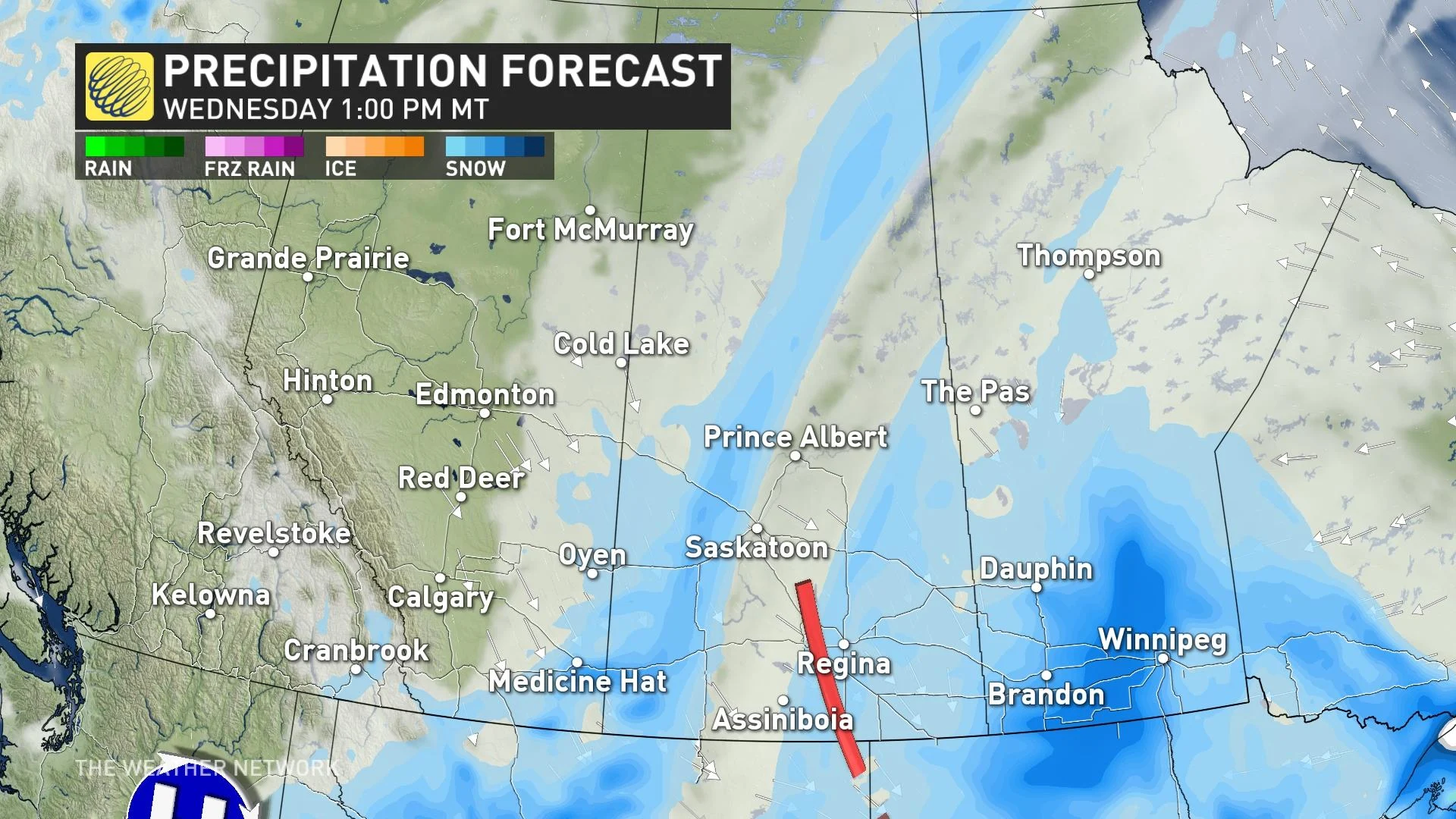
The storm will stall and stretch, delivering southeastern Saskatchewan, southern Manitoba and parts of northwestern Ontario a general 15-25 cm of snow, but localized areas, especially into northwestern Ontario near Thunder Bay, could see totals tip near 50 cm.
Travellers using the Trans Canada-Highway should exercise caution as the roads will get hit by varying amounts of snowfall.
So, what is causing this almost never-ending snowfall? A combination of a highly amplified jet stream and blocking pattern in the atmosphere is what is causing the low to move slowly, but there is also a front diving southeast from Alberta and Saskatchewan that will interact with the low, providing some more moisture and snow to the system.

Snowfall rates should remain somewhat low, but brief bursts of heavier amounts is possible during the duration of the event. In combination with some gusty winds at times, the snow could create reduced visibility on the roads and difficult travel.
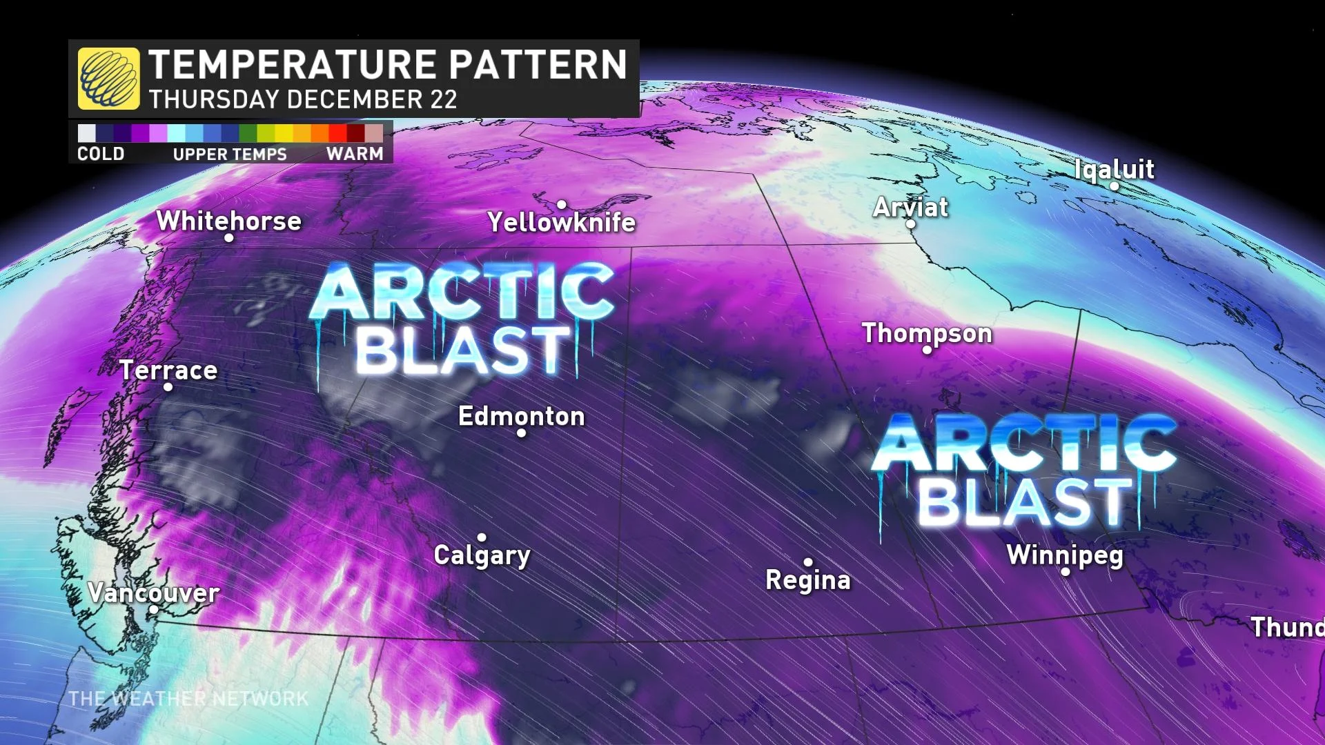
Extremely frigid temperatures will seep into Western Canada beginning this weekend and spread east through the days leading up to Christmas. Temperatures and wind chills will be dangerously cold, with daytime highs in the -20s and feels-like values into the -30s and -40s.
The one upside to the prolonged snow and extreme cold? The snow will be sticking around for the morning on Dec. 25, assuring much of the region a white Christmas.
Stay tuned to The Weather Network for the latest forecast updates on the Prairies.