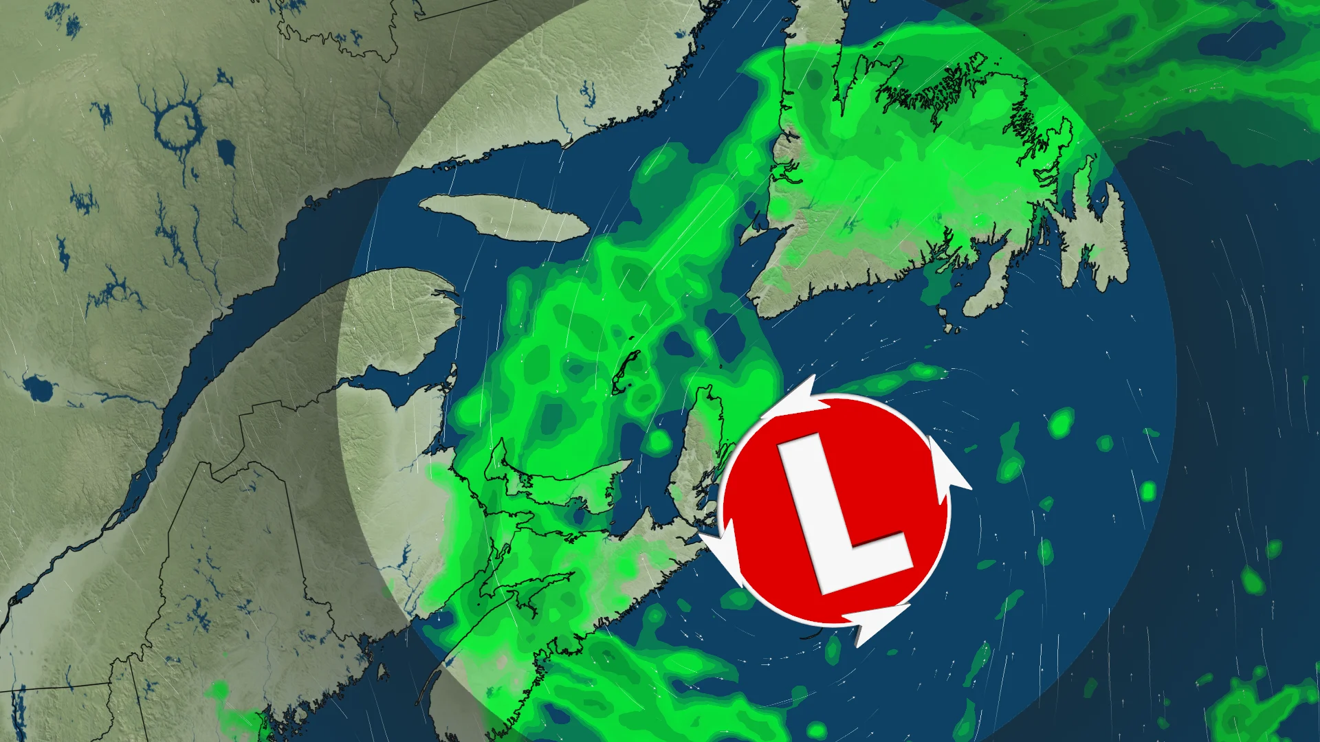
50-80+ mm: Soggy weekend ahead for Atlantic Canada with bouts of rainfall

Grab the umbrella, Atlantic Canada, because this weekend is going to be wet. Some areas are potentially in line to see as much as 75-80 mm of rainfall, or more.
A stretch of very wet weather is headed to Atlantic Canada for this weekend, lingering into early next week.
Multiple, developing low-pressure systems will track into the region, bringing periods of widespread rain through the weekend--and beyond. Potential for thunderstorms could enhance rainfall totals, increasing threat of localized flooding.
DON'T MISS: Canada's Winter Sneak Peek: El Niño puts record warmth in play
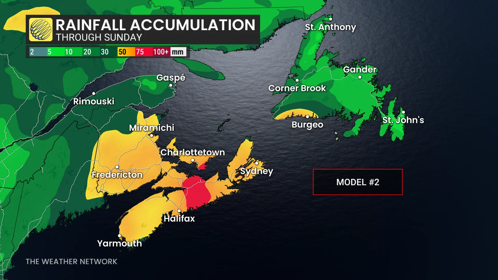
Some areas in the Maritimes and Newfoundland could see 50-80+ mm of rainfall by the time it concludes, with localized totals reaching or exceeding 100 mm. However, there remains uncertainty in the totals because of the track and timing. The threat of rain will spill into early next week, as well.
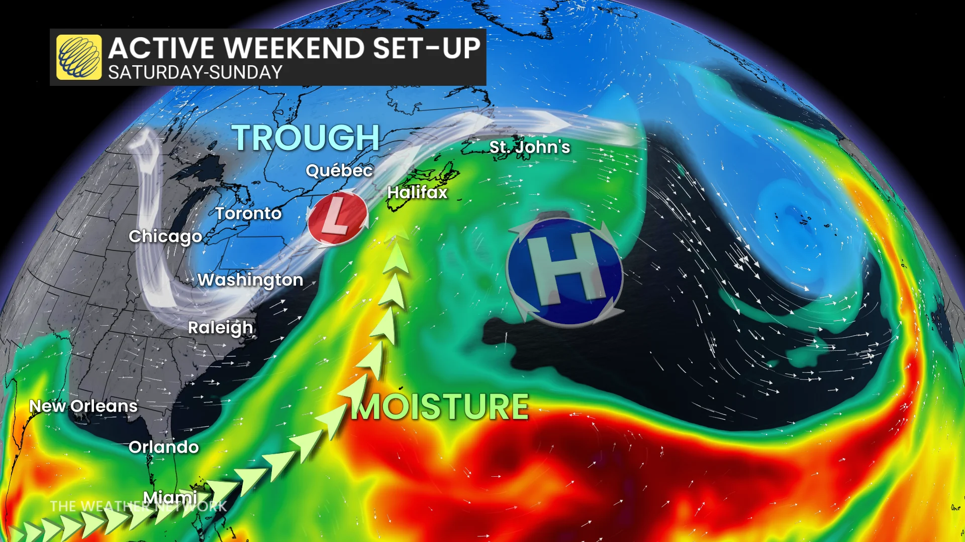
Weekend: Soaking rains coming for Atlantic Canada
A trough over Ontario and Quebec, and a high-pressure ridge over the Atlantic Ocean is creating a narrow pathway for moisture to travel along, creating an atmospheric river as a result.
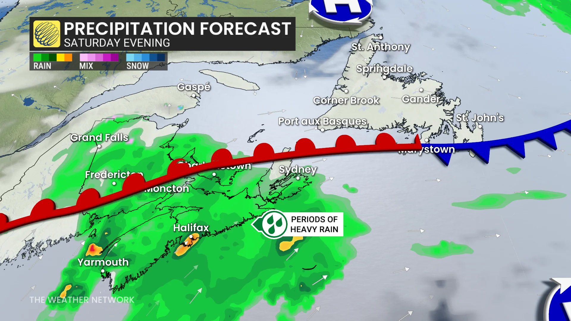
Heavy rainfall across Nova Scotia will start on Friday evening. Embedded thunderstorms are expected through the evening, as well, potentially increasing the rainfall amounts.
DON'T MISS: Winter has a few tricks up its sleeve for Eastern Canada this year
By Saturday, all of the Maritimes will be encompassed in the rainfall. Nova Scotia will see the heaviest plume of rainfall through Saturday afternoon.
Current models are indicating rainfall amounts could reach up to 5-10 mm an hour along the coasts. Localized flooding will be a big concern.
Nova Scotia could see more than 50 mm of rainfall, with some places potentially exceeding 75 mm.
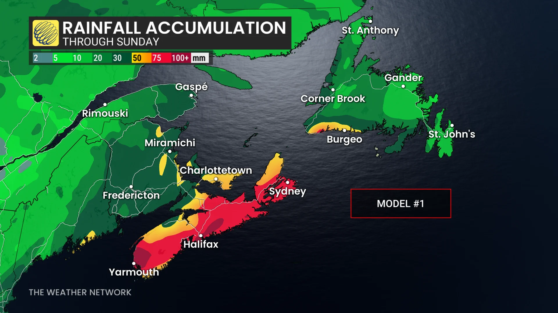
By Sunday, the heaviest rainfall will move into Newfoundland.
Rain totals will be quite substantial across much of the Maritimes, and into western and southwestern Newfoundland. Amounts of 50-80+mm are expected, with localized totals of 100+mm possible.
However, there is still uncertainty to the amount of rainfall accumulation. The amount of rainfall shifting is dependent on the timing of the trough. If it slows while pushing farther east, it leaves a greater area for the moisture to spread across the region, lowering amounts.
But, if the trough movement is faster, it creates a narrower area and increases the concentration of moisture into Mova Scotia.
The threat for showers will continue into early next week with an upper-level low and the potential for a clipper.
Another system from the Atlantic is possible on Tuesday or Wednesday, but then drier weather should return for the second half of next week and into the following week.
Stay with The Weather Network for the latest updates and information on your forecast across Atlantic Canada.