50-100 mm of rain heading to B.C. through early next week
A brief reprieve from the rainy weather ends this weekend as the next waves of precipitation roll ashore
Folks across British Columbia got to enjoy several days of sunshine after Vancouver recorded measurable rain each and every day for more than two weeks.
That calm break in conditions will be in the rearview mirror by Sunday as an active pattern returns to the West Coast.
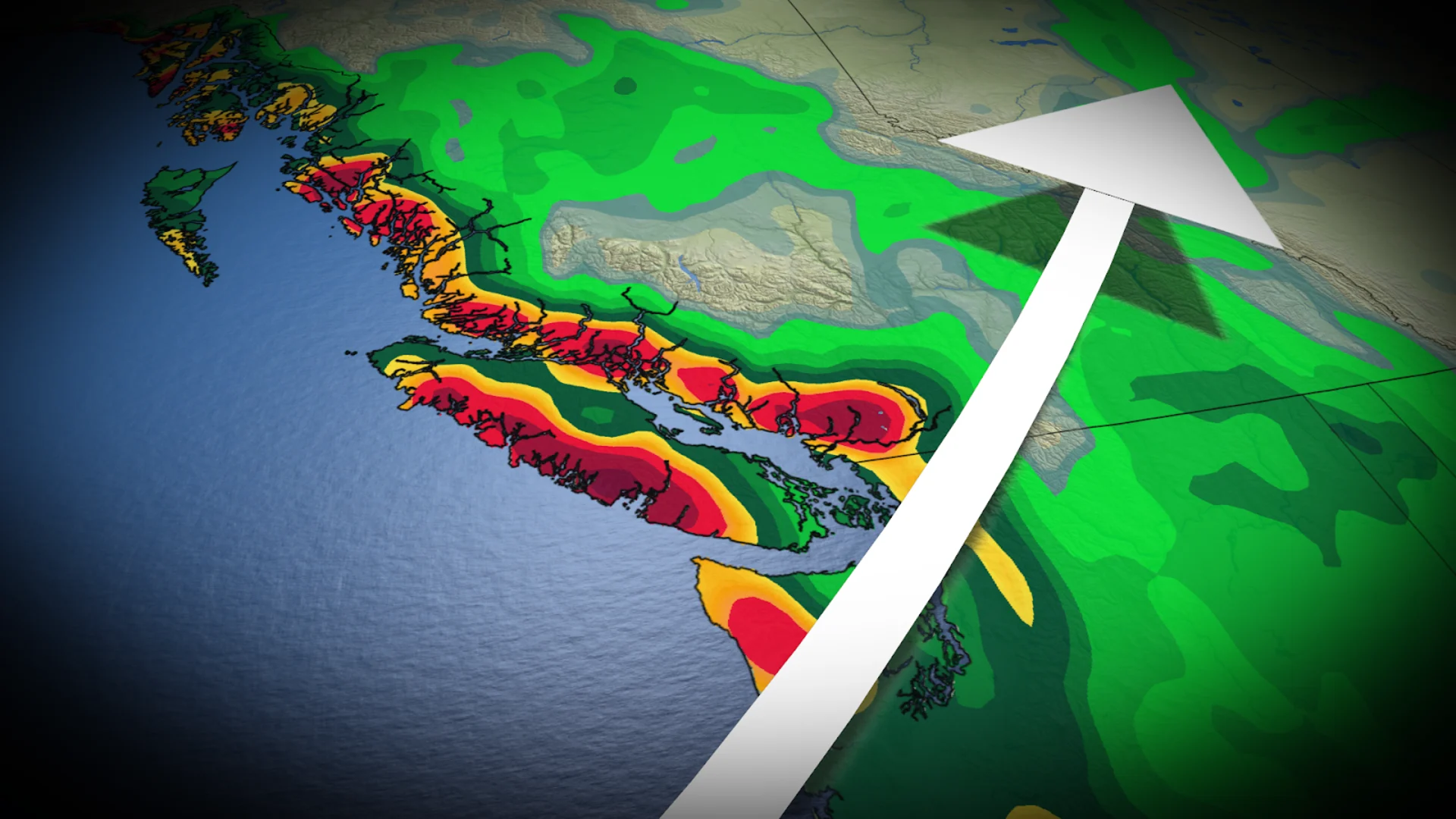
Several waves of precipitation will bring widespread totals of 50-100+ mm of rain across southwestern portions of the province.
DON’T MISS: The threat of earthquakes is very real in Canada: Are you prepared?
Front arrives Sunday morning
The centres of high pressure that kept the storm track at bay will wane through the weekend, allowing the activity to build back into B.C. by Sunday.

We’ll see a rainy front drape across the coast by Sunday morning, with the active pattern holding on for several days into next week.
Expect a parade of storms with persistent rains across Vancouver Island and the Lower Mainland. Each individual wave of rain won’t be noteworthy on its own, but the cumulative rain from each event will add up by next week.

Rainfall totals on the order of 50-100 mm are possible for Tofino and the North Shore Mountains. Falling temperatures will push freezing levels from 1500m to 1000m between Sunday and Tuesday, which could allow 30-50 cm of snow to fall throughout the alpines. Beware the risk for an unstable snowpack throughout the region.
All the rain of late isn’t necessarily a bad thing. Rain in the spring is usually good news heading into the upcoming wildfire season.