300+ mm rain: Impactful atmospheric rivers threaten B.C. coast

Some areas will see excessive rainfall totals and strong winds in the coming days
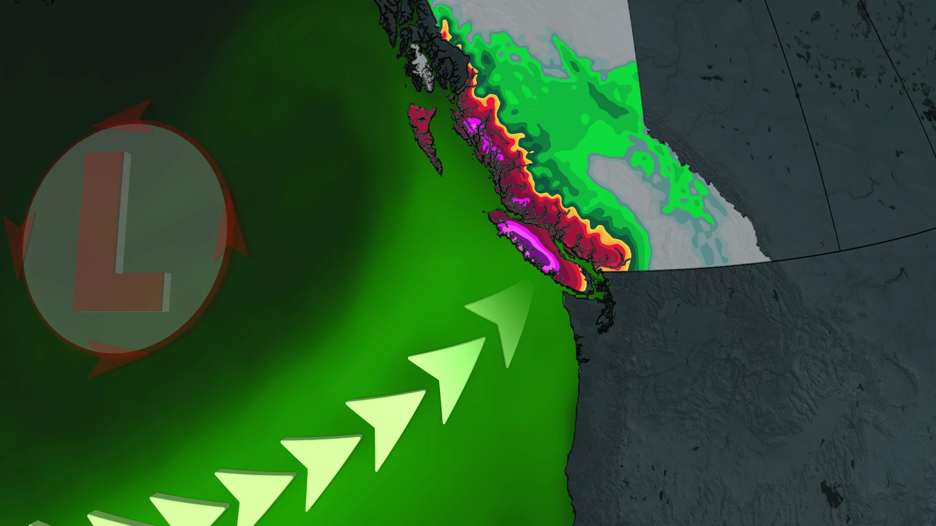
A series of atmospheric rivers will push into the West Coast in the coming days, threatening hefty rainfall totals for some areas.
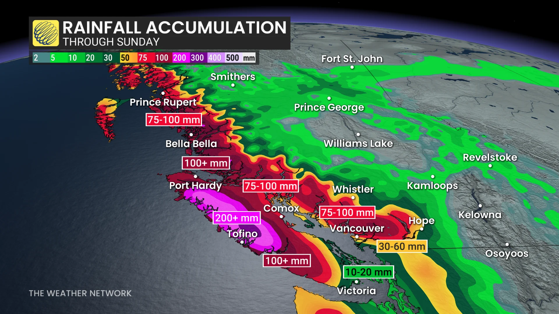
Portions of Vancouver Island could see more than 300 mm of rain through early next week, making this the wettest place on Earth in the near future.
SEE ALSO: Two historic events point a question mark over Canada's November
Watch the potential for localized flooding in the hardest-hit areas. Gusty winds could lead to ferry delays, power outages, and high surf along the coast.
Many ferries have already been cancelled early Friday due to the high winds.
A soggy Friday on tap for coastal B.C.
Several waves of rich moisture will sweep into coastal British Columbia into this weekend and early next week.
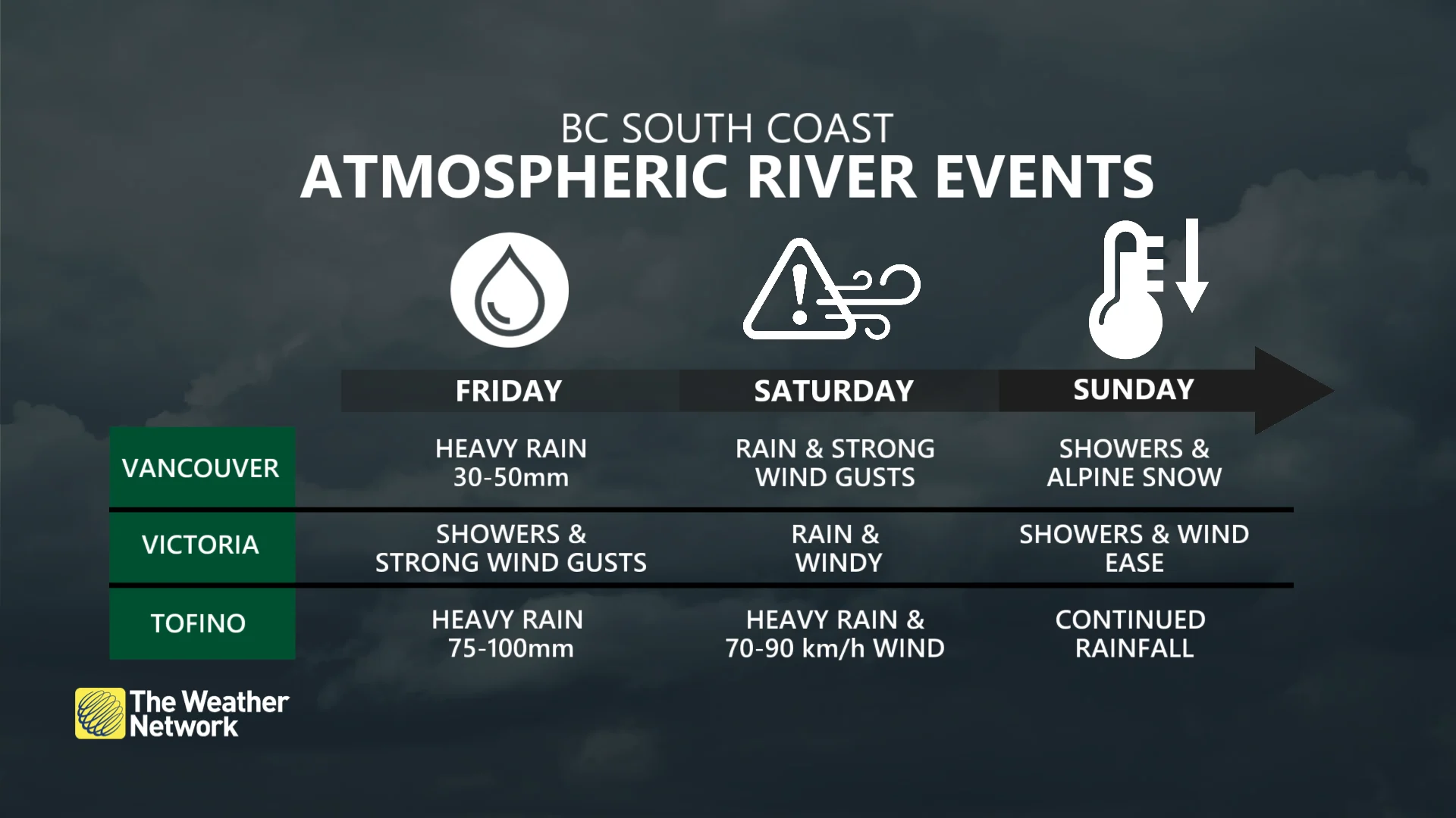
Heavy rain moved into the South Coast through the overnight Thursday, and will continue Friday.
Portions of the Central Coast and western Vancouver Island will see 75-100 mm of rain from this first batch of moisture.
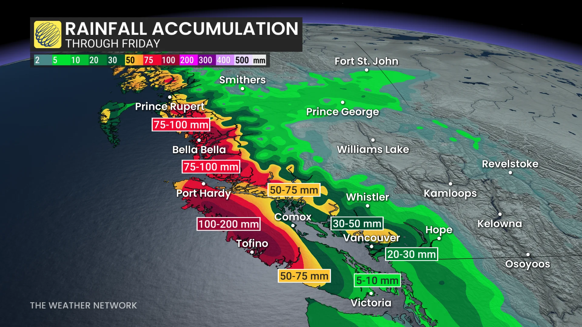
Meanwhile, 50-80 mm of rain is forecast for the North Shore region, including West Vancouver and North Vancouver, as well as Coquitlam and Howe Sound to the northeast. The rest of the Lower Mainland could see 20-30 mm.
Environment and Climate Change Canada has already issued widespread rainfall and wind warnings for much of the South Coast Friday.
Strong winds with gusts up to 70-90 km/h in the straits Friday will reach their peak in the afternoon and may lead to ferry delays, as well as localized power outages.
Stronger wave arrives this weekend
We’ll see a deepening system move in and bring foul weather to the region on Saturday and Sunday. The system may even reach "weather bomb" criteria as its pressure rapidly drops on its approach.
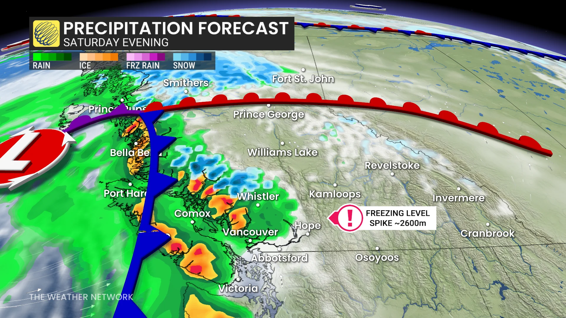
Heavy rainfall and the strongest wind gusts are forecast on Saturday evening.
The Lower Mainland will see another 20-30+ mm of rain, with an additional 50-100 mm expected on western Vancouver Island and the Central Coast. The North Shore region could also once again see another 50-80 mm of rainfall.
The Strait of Georgia, including the Sunshine Coast, will see the risk for 70-80 km/h gusts, while winds should gust around 50-60 km/h in Vancouver and Victoria.
This system will also bring heavy alpine snow to the region. Freezing levels will surge to around 2600 m on Saturday, falling to around 1500 m behind the cold front on Sunday.
Looking ahead, forecasters are closely watching another strong atmospheric river expected to affect the region into next workweek.
Higher impacts are possible since the ground will be saturated from this weekend’s coming rainfall. Strong winds and significant precipitation, both rain and snow, are expected with this upcoming event.
Stay with The Weather Network for all the latest on conditions across British Columbia.