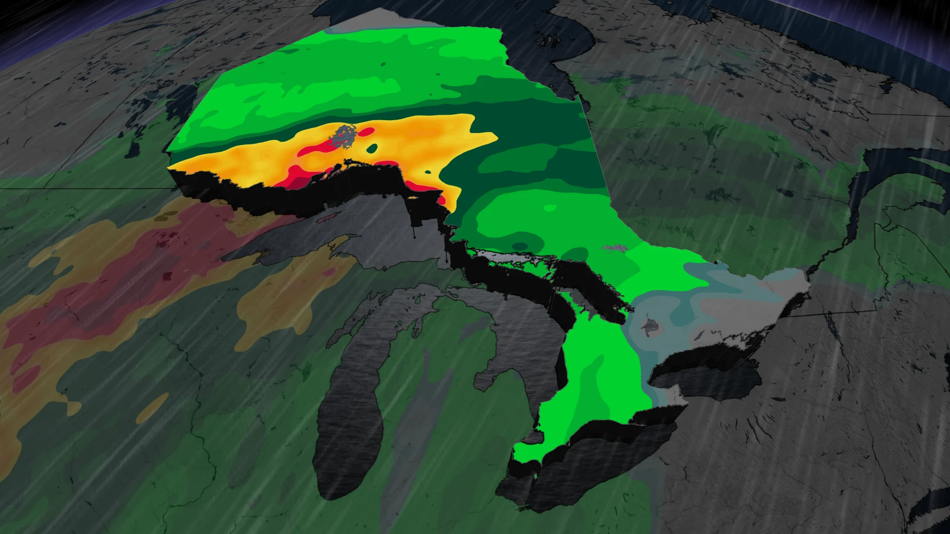
20 degrees and 75+ mm rain: Ontario's November off to record start

Parts of Ontario could see the warmest start to November in history, but it may come at a soggy cost for some.
November has arrived, but this forecast will have you double-checking the calendar.
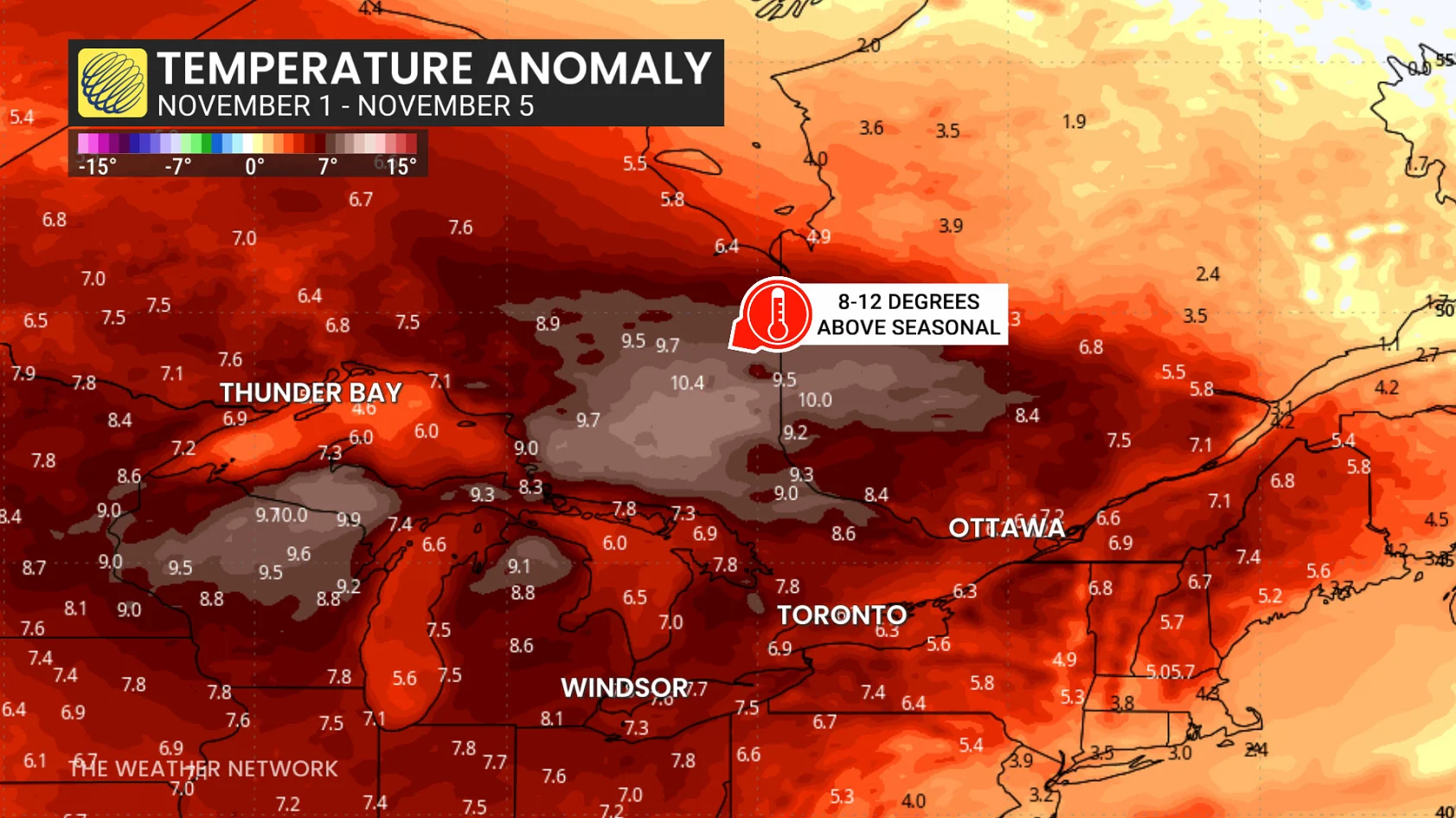
An exceptional stretch of warmth will bring daytime highs around 6-10 degrees above seasonal. Parts of southern Ontario could even see the thermometer creep back into the 20s!
DON'T MISS: The Weather Network’s November Forecast 2026
However, this exceptional warmth will come at a soggy cost for folks across northwestern Ontario and parts of the northeast, with multiple rounds of heavy rainfall forecast throughout the first week of November.
Up to 75+ mm rainfall possible across northwestern Ontario this week
A large low-pressure system is forecast to track into the Great Lakes this week, pulling both Pacific and Gulf moisture into northern Ontario. A high-pressure system to the northeast will slow its progession, however, resulting in multiple rounds of heavy rainfall across the region.
The first round of rain is forecast to begin Monday afternoon. We'll see the rain continue off and on in rounds all the way into Thursday morning.
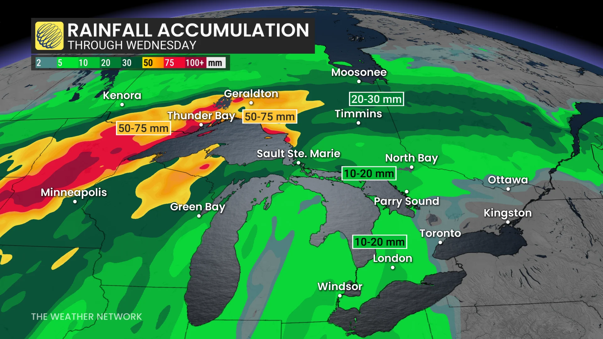
50-75+ mm of rainfall is expected across northwestern Ontario, including Fort Frances, Dryden, Thunder Bay, and Nipigon. The swath of heavy rain may also reach Geraldton and Wawa.
Expect impacts to parts of Highways 11 and 17 through the region during the heavier bouts of rain, when visibility may be impacted.
The rest of the province could see showers move in Tuesday morning, but won't see steadier rainfall until Wednesday evening. A widespread 5-15 mm is forecast across parts of southern and eastern Ontario.
SEE ALSO: Weather could cast a vote in Tuesday's U.S. midterm elections
Record-breaking start to November in southern Ontario
While November occasionally features brief spells of warmth, setups in 1956 and 2022 stand out in particular.
Toronto-Pearson Airport set its monthly temperature record on Nov. 5, 2002, when they hit 25.1°C for a daytime high. Looking deeper into the history books, multiple cities in southern Ontario started Nov. 1956 by notching their warmest-ever first five days of the month.
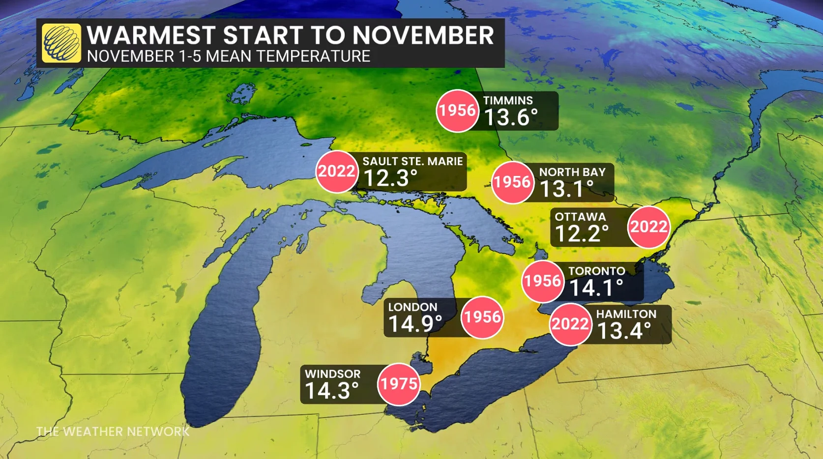
Given the warmer-than-normal nights in the forecast, some all-time mean temperature records are in jeopardy as this new month kicks off.
An even more remarkable feat is that the average low here is just 1-2°C above the freezing mark to start November. Some overnight lows are forecast to remain in the lower teens over the coming days.
Stay with The Weather Network for the latest updates and information on your weather across Ontario.