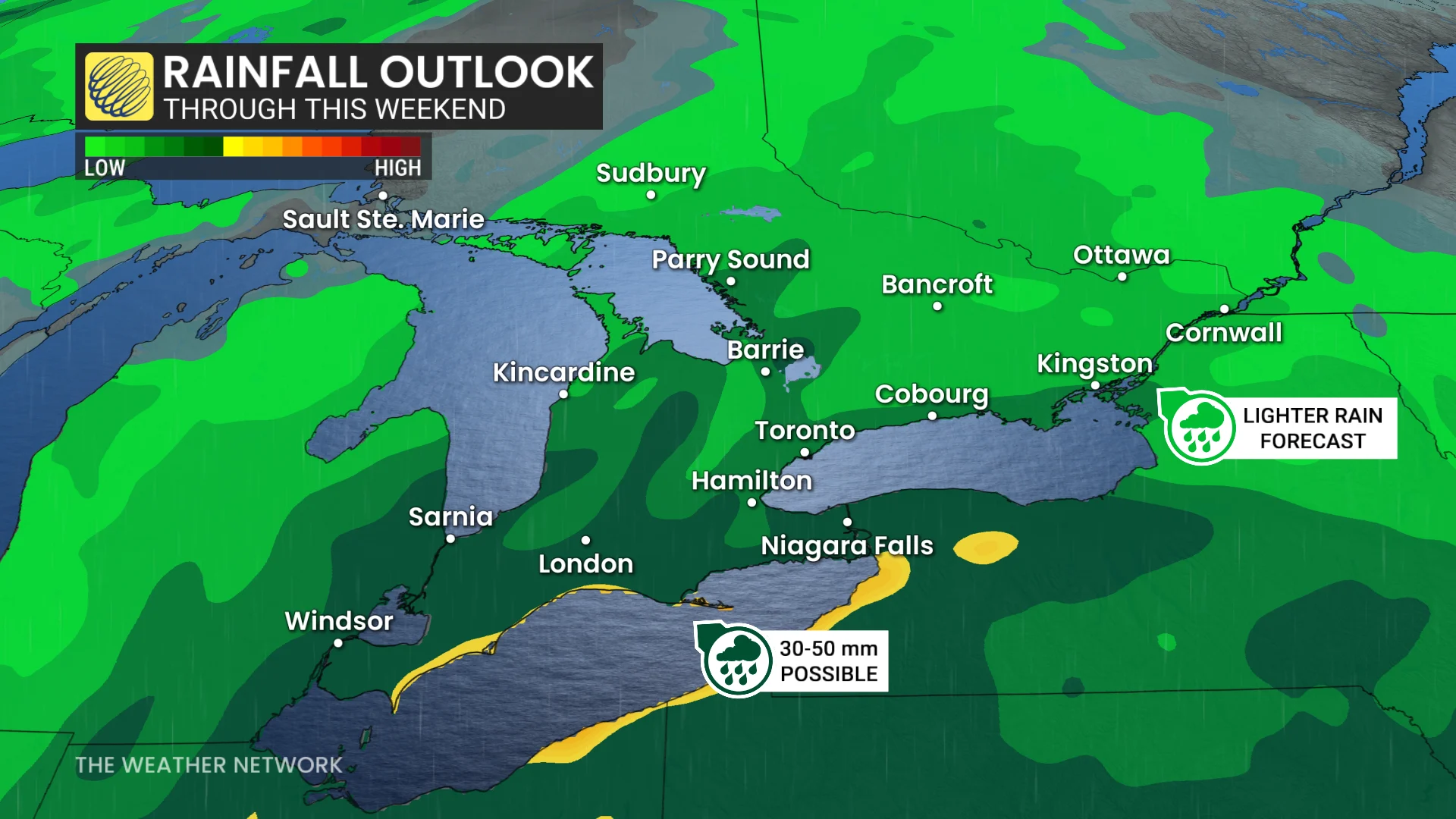
20-50 mm: Half of Ontario's weekend likely a washout
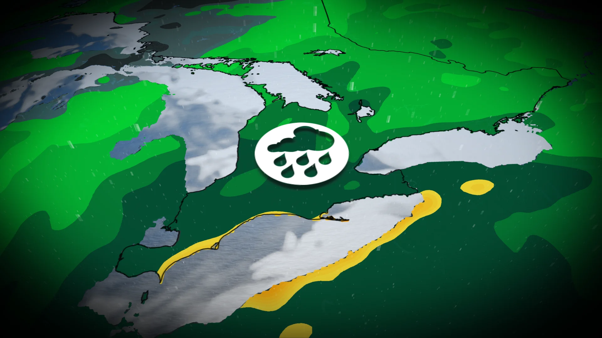
Rainy Saturday ahead for southern Ontario with heavy downpours forecast in some areas
Southern Ontario is in for a wet weekend as a rain-filled system moves into the region on Saturday.
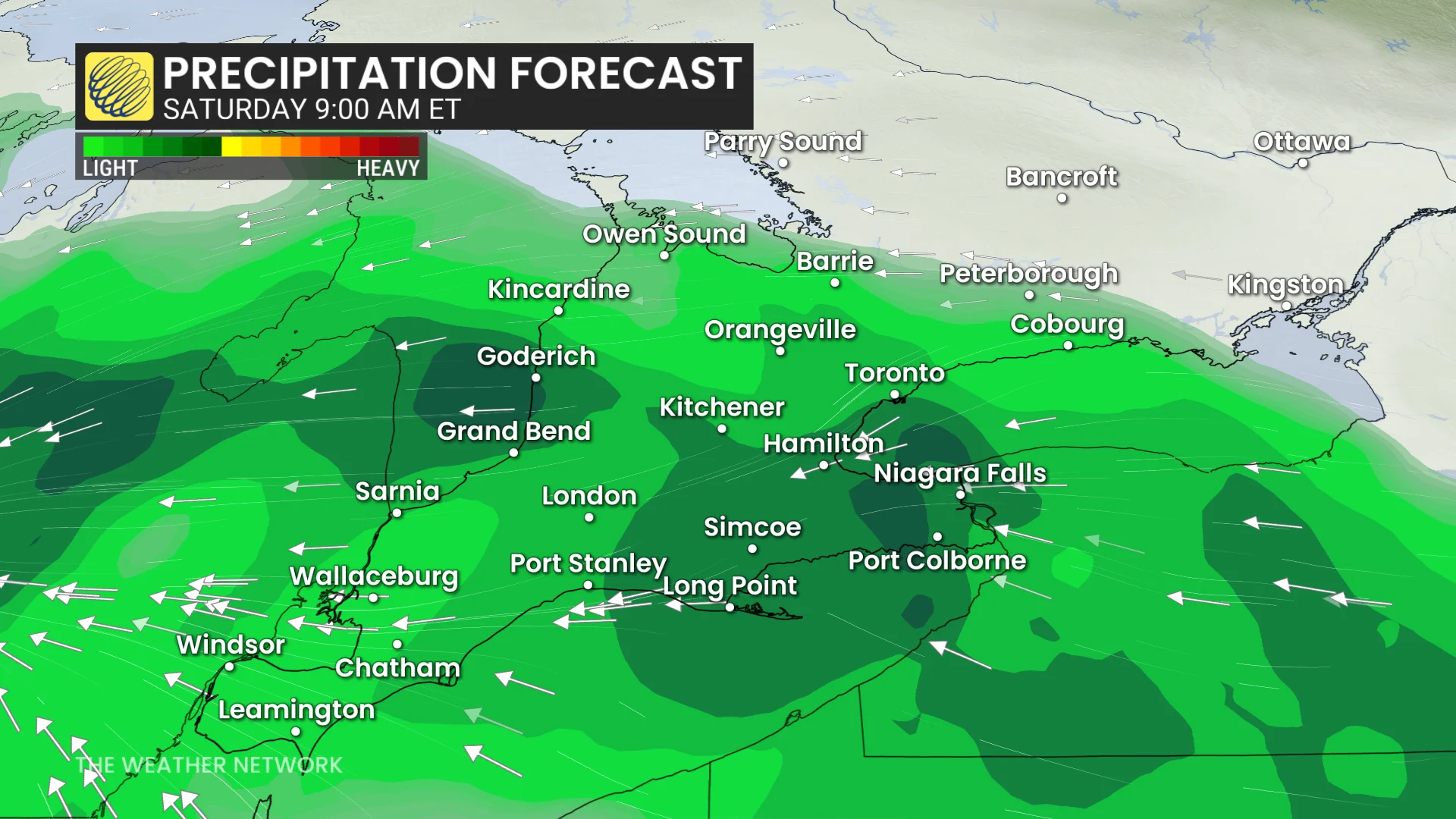
Following a dry end to the workweek, rainfall is expected to spread across the southwest and Greater Toronto Area (GTA) in the morning, continuing through the afternoon and evening with periods of heavy rain.
RELATED: One dead as severe storms sweep Ontario, tornado confirmed near London
Saturday washout: 20-50 mm of rain is forecast in parts of Ontario
The system’s movement will be slowed by a high pressure area over Quebec, leading to prolonged showers and the potential for a washout in parts of southern Ontario. By late Saturday afternoon, rain will spread into eastern Ontario, lingering into Sunday.
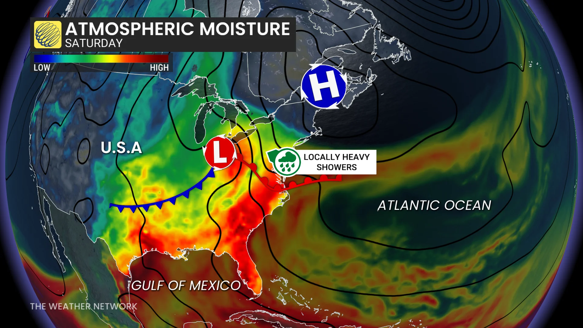
The heaviest rainfall totals are expected in southwestern Ontario, where atmospheric moisture could boost accumulations to 30-50 mm, particularly from Windsor to the Lake Erie shoreline and possibly Niagara.
RELATED: PHOTO: Powerful, tornado-warned thunderstorms charge through Ontario
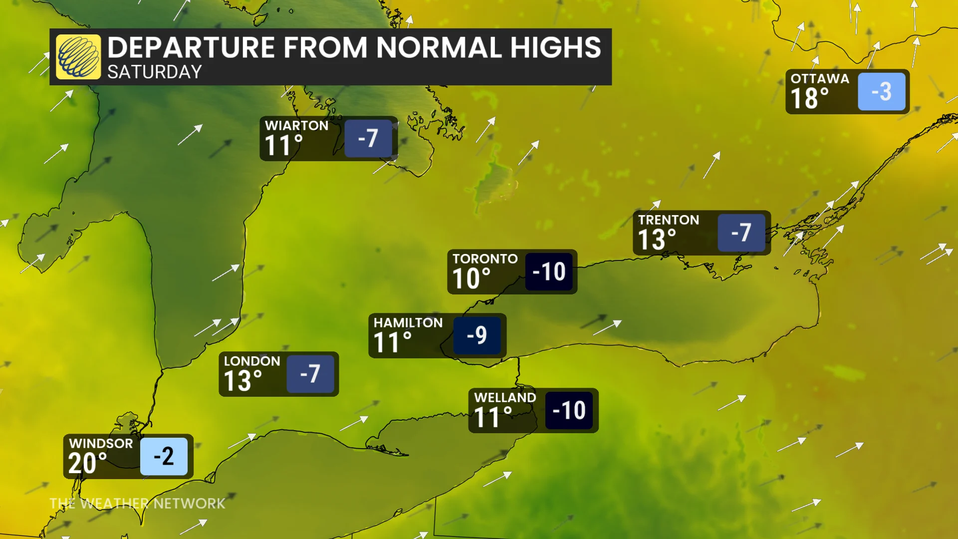
Lighter totals of 10-20 mm are forecast for Toronto, Ottawa, and Barrie. There is a low risk of isolated thunderstorms.
Cooler daytime highs are also anticipated under dense cloud cover and rainfall: 10-12°C for Toronto, mid-to-high teens in Ottawa, and up to 20°C in Windsor.
Showers on Saturday may also impact preparations for Montreal’s Formula 1 Grand Prix on Sunday, although lower rainfall totals are expected in the city, with clearing likely later in the day.
Some scattered showers may develop Monday, but much of the coming week is expected to remain mostly dry.
DON'T MISS: Canada's end to May: Who will get the head start on summer?
Temperatures will stay near seasonal, with some areas, particularly in the west, seeing conditions a few degrees above seasonal. This weather pattern is likely to persist into the early days of June.
Stay with The Weather Network for the latest across Ontario