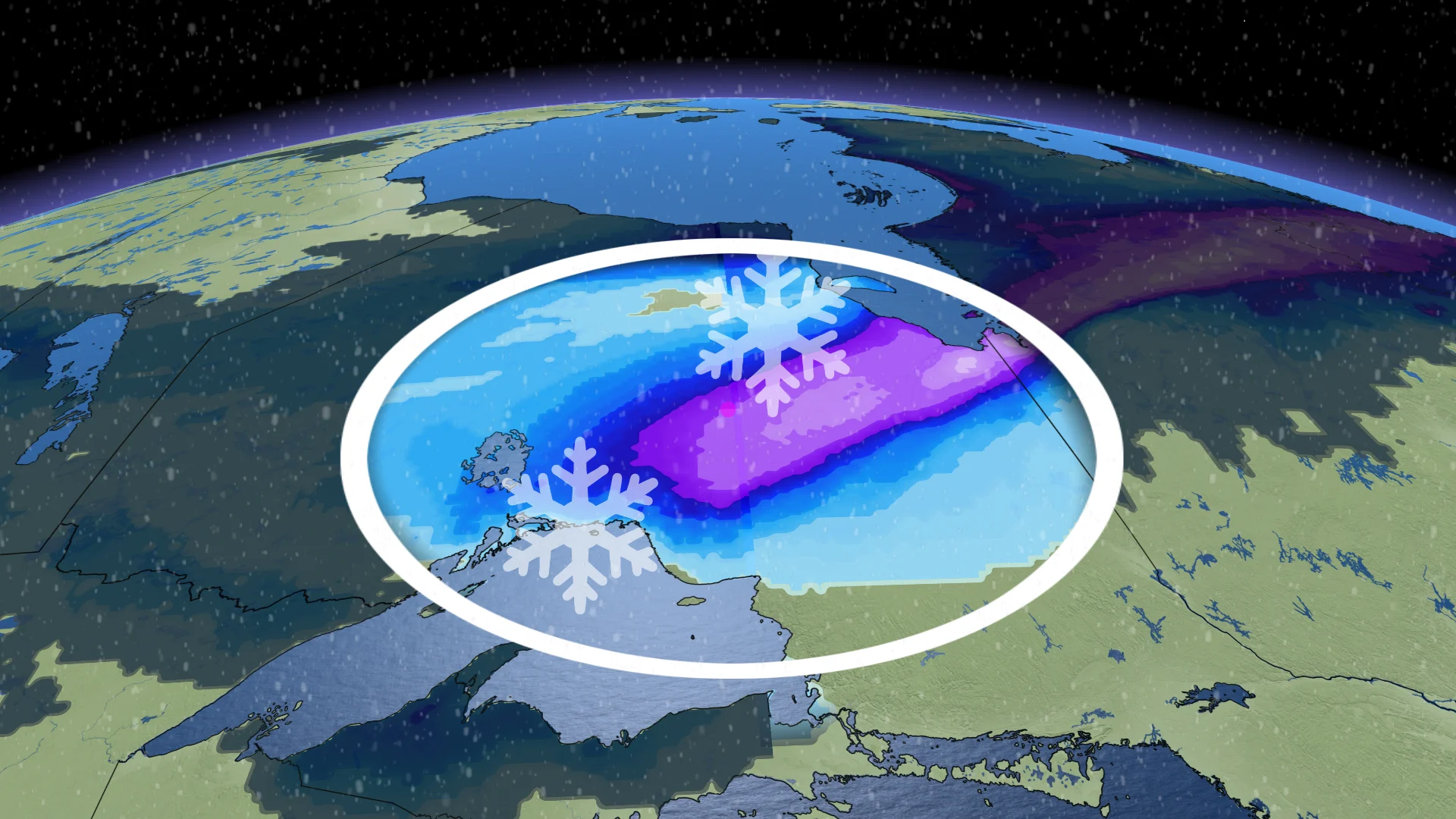
20-30 cm: Temperature dive in northern Ontario comes with heavy snow

After a very mild stretch of temperatures in northern Ontario, the region will get a harsh reality check on Sunday as a significant cooldown will come with heavy snow--with some areas possibly seeing up to 30 cm by Monday.
Northern Ontario will get quite the cool, snowy shock back into reality on Sunday.
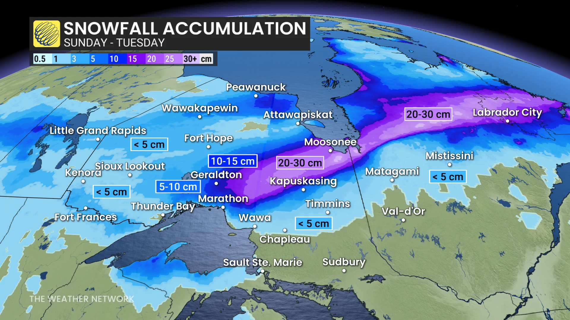
Areas to the west of the storm track will see the rain change to snow, with 10-30 cm possible for a stretch of the Trans-Canada Highway, including Kapuskasing and Hearst.
Allow extra time for travel. Prepare for possible disruptions to transportation, services and utilities.
Cooldown and heavy snow coming; difficult travel anticipated
Special weather statements have been issued by Environment and Climate Change Canada (ECCC) for parts of the region for the forthcoming 10-20 cm of snowfall this weekend.
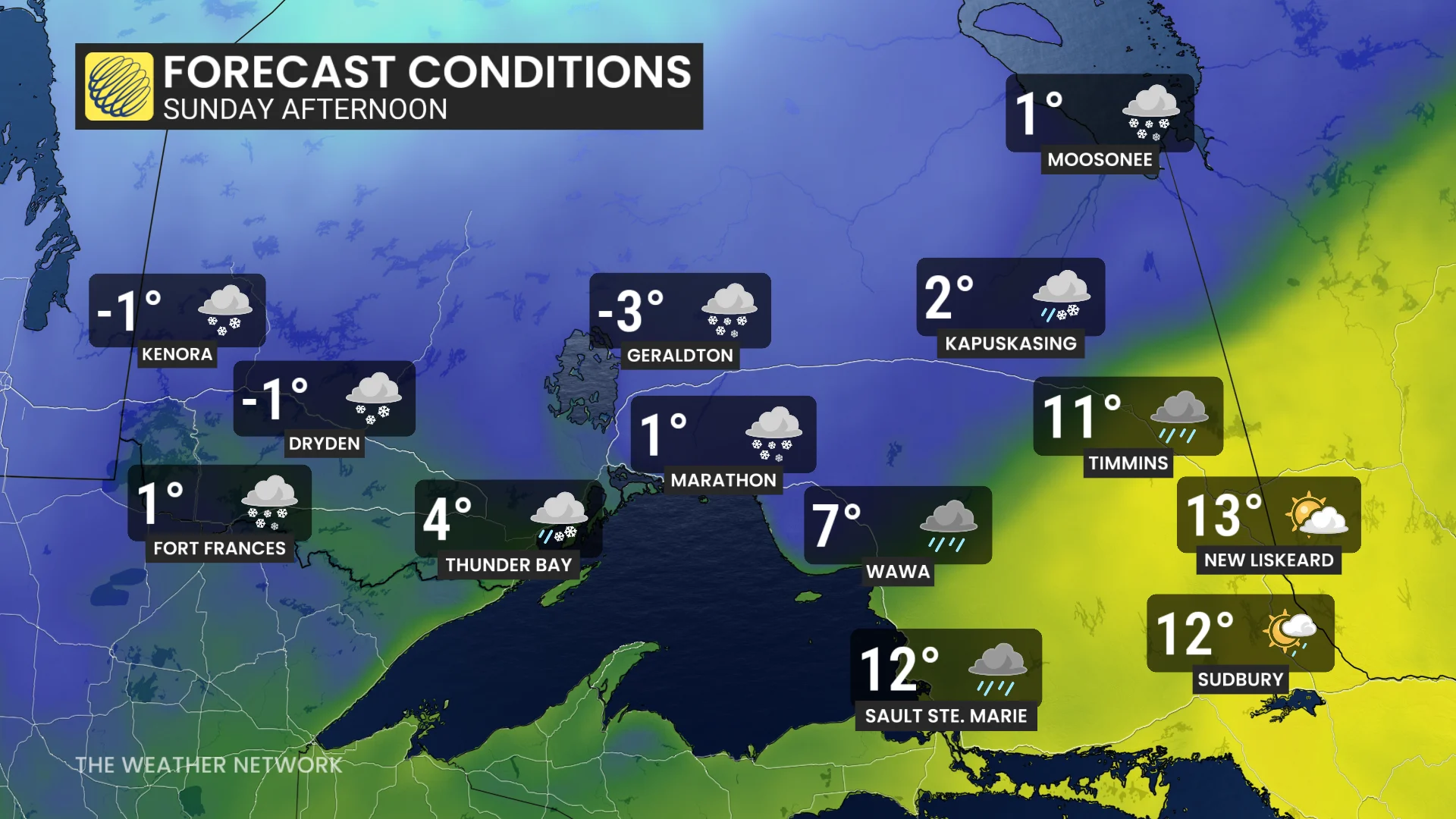
A high pressure centred off to the East Coast and an approaching, low-pressure system has dragged very mild air all the way across northern Ontario, reaching the shores of James Bay.
DON'T MISS: Freezing rain is the 'worst' type of precipitation. Here's why
Temperatures have been in the double digits and even teens for the past week. That is all about to come crashing down.
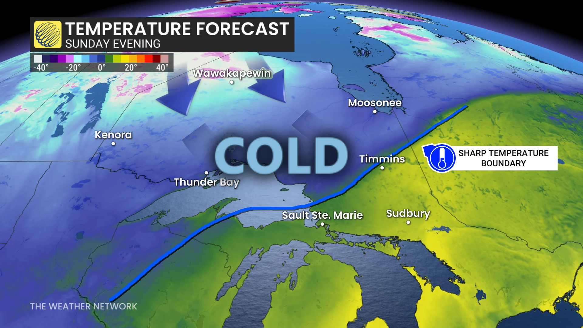
By Sunday morning, much colder air sweeps and snow spreads from west to east through the day. Northeastern Ontario starts as rain Sunday morning, but by end of day, that will transition to snow.
Across the northwest, and areas closer to the Quebec border, around 5 cm is expected.
5-10 cm for areas north of Thunder Bay, toward Marathon and Geraldton. Travel along the Trans-Canada Highway from Geraldton to Kapuskasing will be treacherous as this region could get up to 20 or more cm.
RELATED: How Colorado lows and Texas lows affect our weather in Canada
Snow wraps up across the far northeast near James Bay and the Quebec border by early Monday.
Hazardous travel is expected to begin Sunday morning across the northwest, affecting highways 11, 17, 102 and 61. Gusty winds of 30-40 km/h will lead to worsening travel conditions.
No significant storms are expected next week, but a more active pattern could develop during the following week as we head into the start of December.