
Parts of Manitoba to face severe storm risk through Wednesday overnight

Parts of Manitoba will face more severe weather as thunderstorms continue Wednesday overnight. Stay alert and have a plan in place.
After tornado warnings were issued Wednesday evening in northern Manitoba, the risk for severe weather in parts of the province will linger through the overnight.
Severe storms will still be possible for some through the hours to come, so be sure to keep up with the latest watches and warnings in your area.
DON'T MISS: Benefits of forest bathing and why you should try it
On Thursday, will see the storm potential shift farther east into northwestern Ontario as the Prairies deal with an uptick in the heat.
More severe weather possible in Manitoba through Wednesday night
The potential for severe weather will linger through the overnight hours in parts of Manitoba.
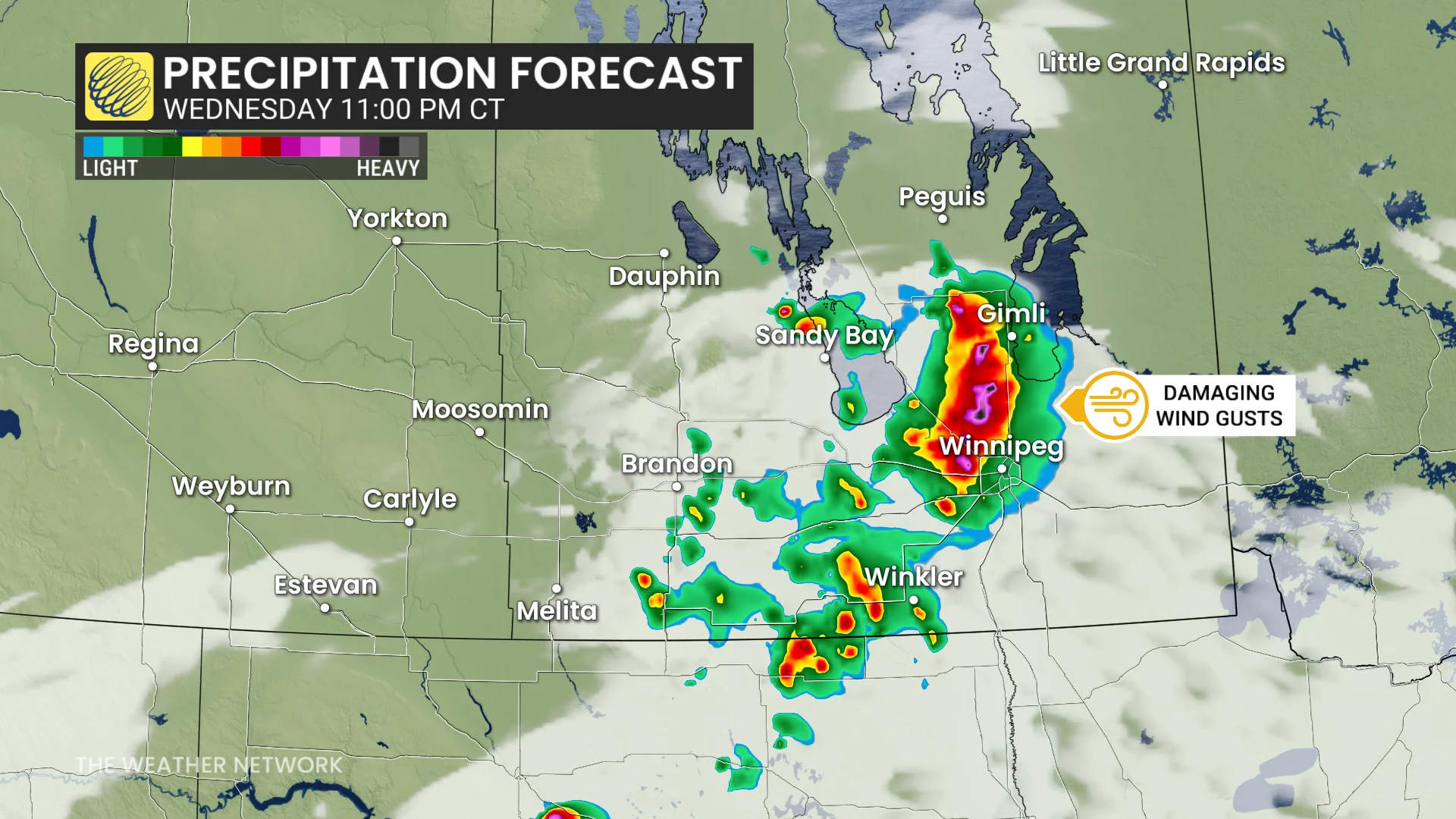
That will come courtesy of high thunderstorm energy and a highly moist environment, along with a strong cold front as the trigger.
Models show a cluster of storms will form stateside near sundown and mature as it quickly tracks northeast across southern Manitoba. The main hazard will be a damaging wind threat as storms line out near Winnipeg.
A mesoscale convective system (MCS) will likely continue east of Winnipeg, stretching into northwestern Ontario in the early Thursday morning hours.
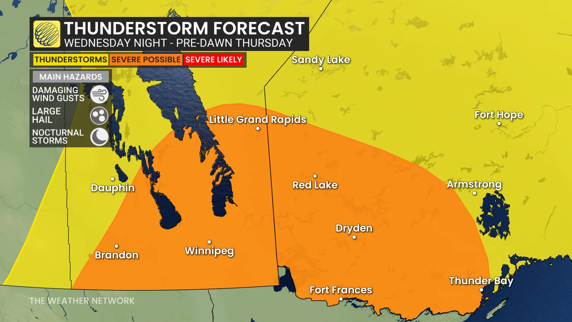
Later on Thursday, a similar area could see a repeat of storms develop in the afternoon, bringing a heightened risk for significant rainfall.
Meanwhile, the intense heat will ramp up across the Prairies on Thursday.
Stay with The Weather Network for the latest across the Prairies.