Tornado warning issued in northern Manitoba as severe storms move in

A severe thunderstorm capable of producing a tornado has been detected in northern Manitoba. Residents in the affected region should be in their shelters.
5:18 p.m. CDT: Tornado warnings are issued when a thunderstorm is producing or is likely to produce a tornado.
Current tornado warnings
South Indian Lake and Amisk Prov. Park
Nelson House
Leaf Rapids
A severe thunderstorm capable of producing a tornado was east of Leaf Rapids, moving east at 30 km/h.
Hazards:
Tornado.
90 km/h wind gusts.
Quarter-sized hail.
Heavy rainfall.
This is a very dangerous and potentially life-threatening situation.
Current tornado watches
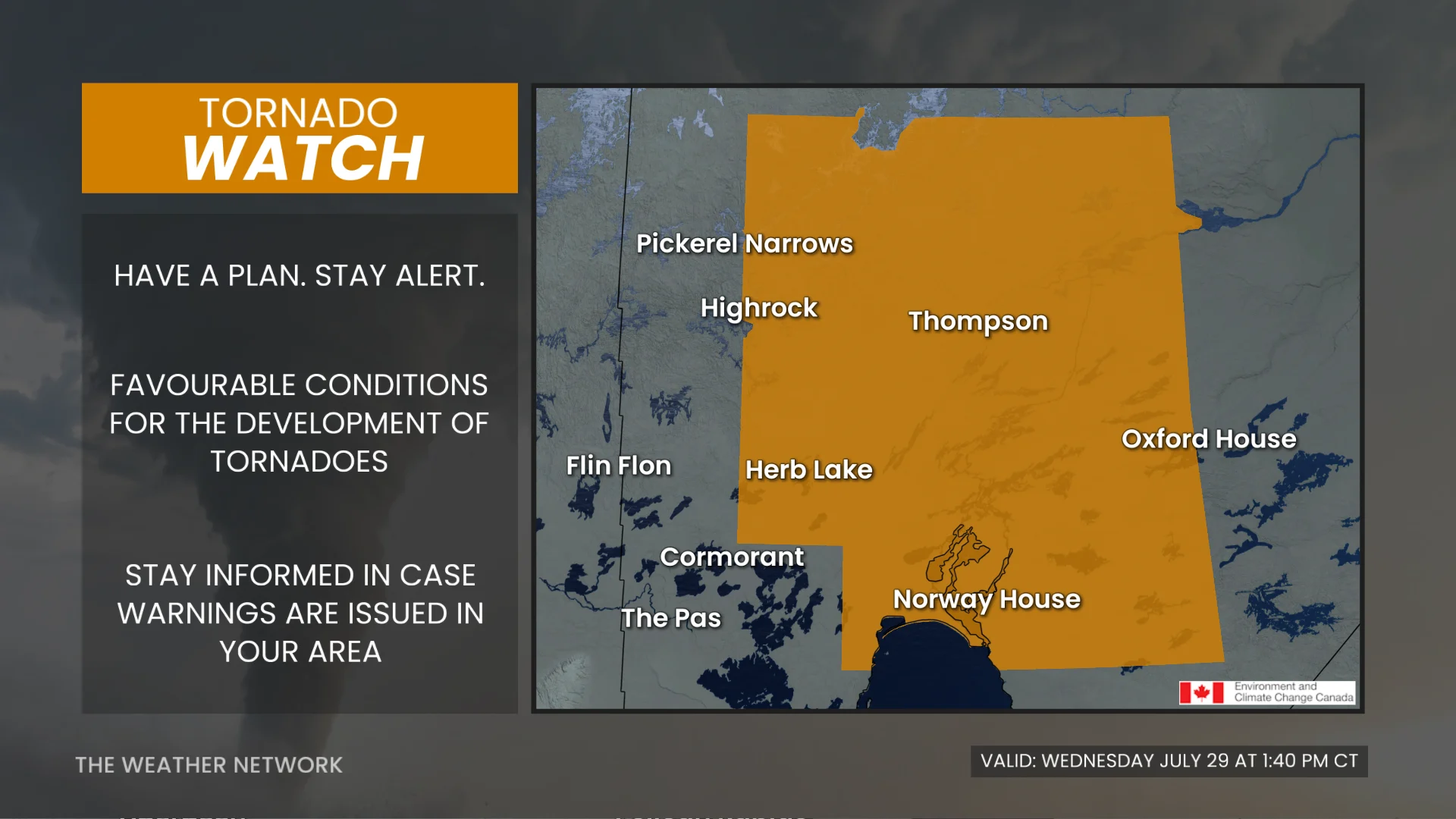
1 p.m. CDT: Tornado watches are issued when conditions are favourable for the development of severe thunderstorms capable of producing tornadoes.
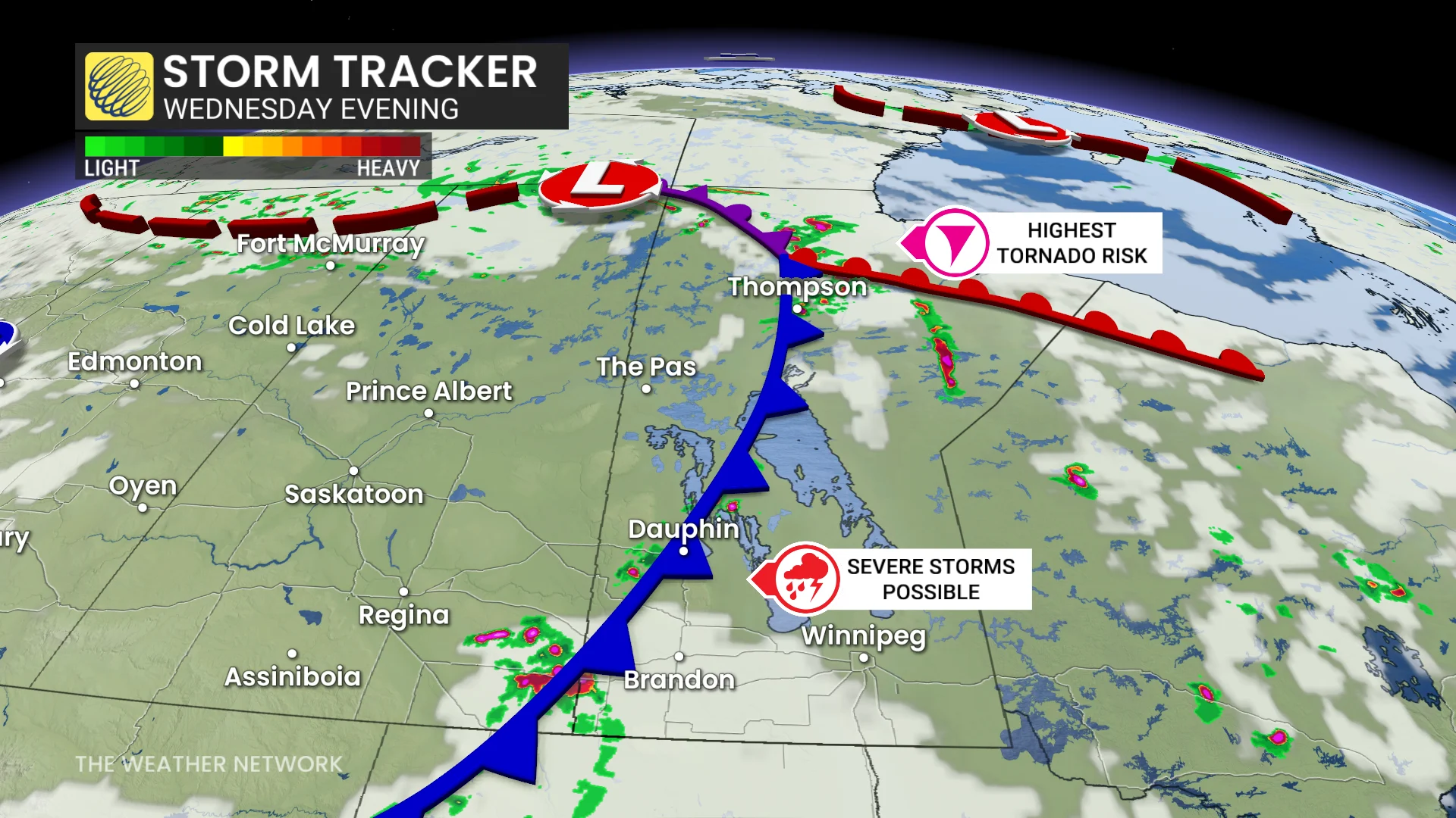
Severe thunderstorms are expected to develop this afternoon near the Saskatchewan border and move east, where storms will pose a risk for tornadoes. The threat for tornadoes will diminish later this evening.
Locations: Portions of north-central Manitoba, including the city of Thompson.
Timing: This afternoon and evening.
Hazards: Tornadoes, large hail and strong, gusty winds.
For the full, current alerts, click here.
Read on to get the full forecast details.
After a stormy Tuesday night in Alberta, the risk for severe weather will expand into Saskatchewan and Manitoba on Wednesday, although the severity of the threat will be reduced.
Although the jet stream over the southern Prairies will help to intensify storms across southern Saskatchewan and Manitoba, an area of high pressure south of the border is expected to curb some of the storm intensity.
The risk for severe weather in Manitoba will linger through Wednesday overnight. On Thursday, will see the storm potential shift into northwestern Ontario as the Prairies deal with an uptick in the heat.
Severe storms will still be possible for some, so be sure to keep up with the latest watches and warnings in your area.
DON'T MISS: Benefits of forest bathing and why you should try it
Potential for severe weather shifts into Saskatchewan, Manitoba on Wednesday
On Wednesday, a renewed threat for severe storms will ignite on the Prairies, also shifting into parts of Saskatchewan and Manitoba.
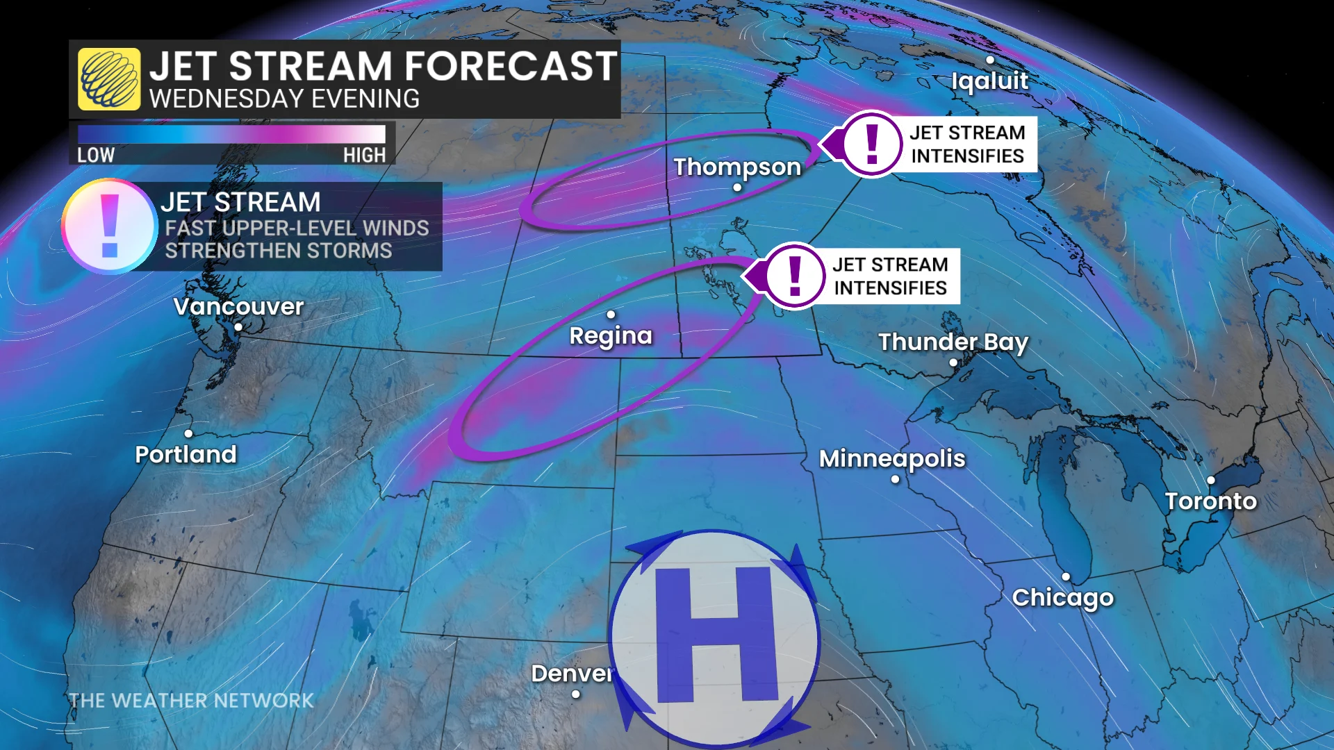
As well, a new region to watch for severe weather will be in southern Saskatchewan and Manitoba. A cold front will extend south across Manitoba, also pushing into the northern U.S. Plains.
The centre of a low station itself over northern Alberta and Saskatchewan. That will be where the warm and cold fronts collide, spilling into northern Manitoba.
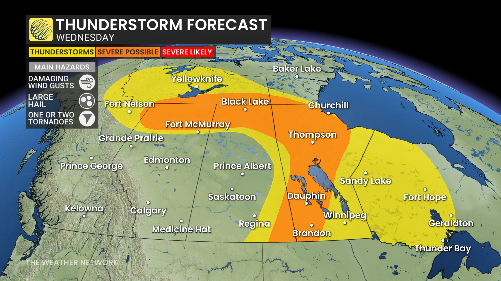
The result is an increased, atmospheric spin and convergence, leading to a risk of an isolated tornado in the region.
Severe storms with large hail, damaging wind gusts up to 100 km/h and heavy downpours are expected by the afternoon through the evening hours.
On Thursday, the thunderstorm risk moves into northwestern Ontario while the heat ramps up across the Prairies.
Stay with The Weather Network for the latest across Alberta.