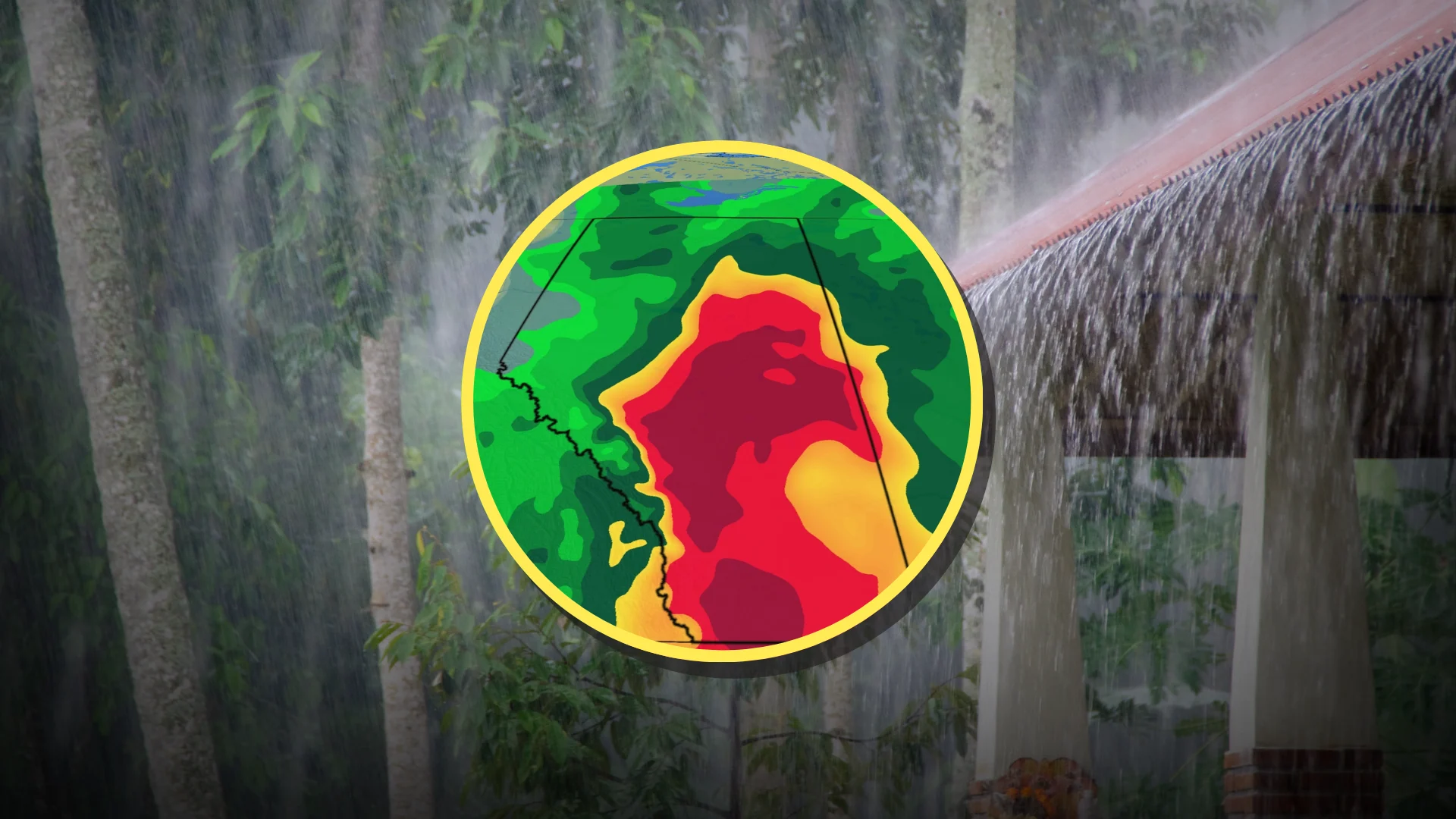
100+ mm of rain on tap in Alberta as flood potential increases

Beware the risk for flooding as significant and widespread heavy rainfall targets Alberta over the next several days
A steady stream of moisture will fuel widespread heavy rainfall across Alberta over the next several days, potentially leading to flooding issues in some areas.
Parts of the province may see more than 100 mm of rain through the middle of the workweek, which represents more than a month’s worth of rain in many spots.
Residents are encouraged to monitor forecasts and alerts as conditions evolve.
Alberta's 2026 Summer Forecast: Strong start, but with some concerns
Excessive rainfall on tap across much of Alberta
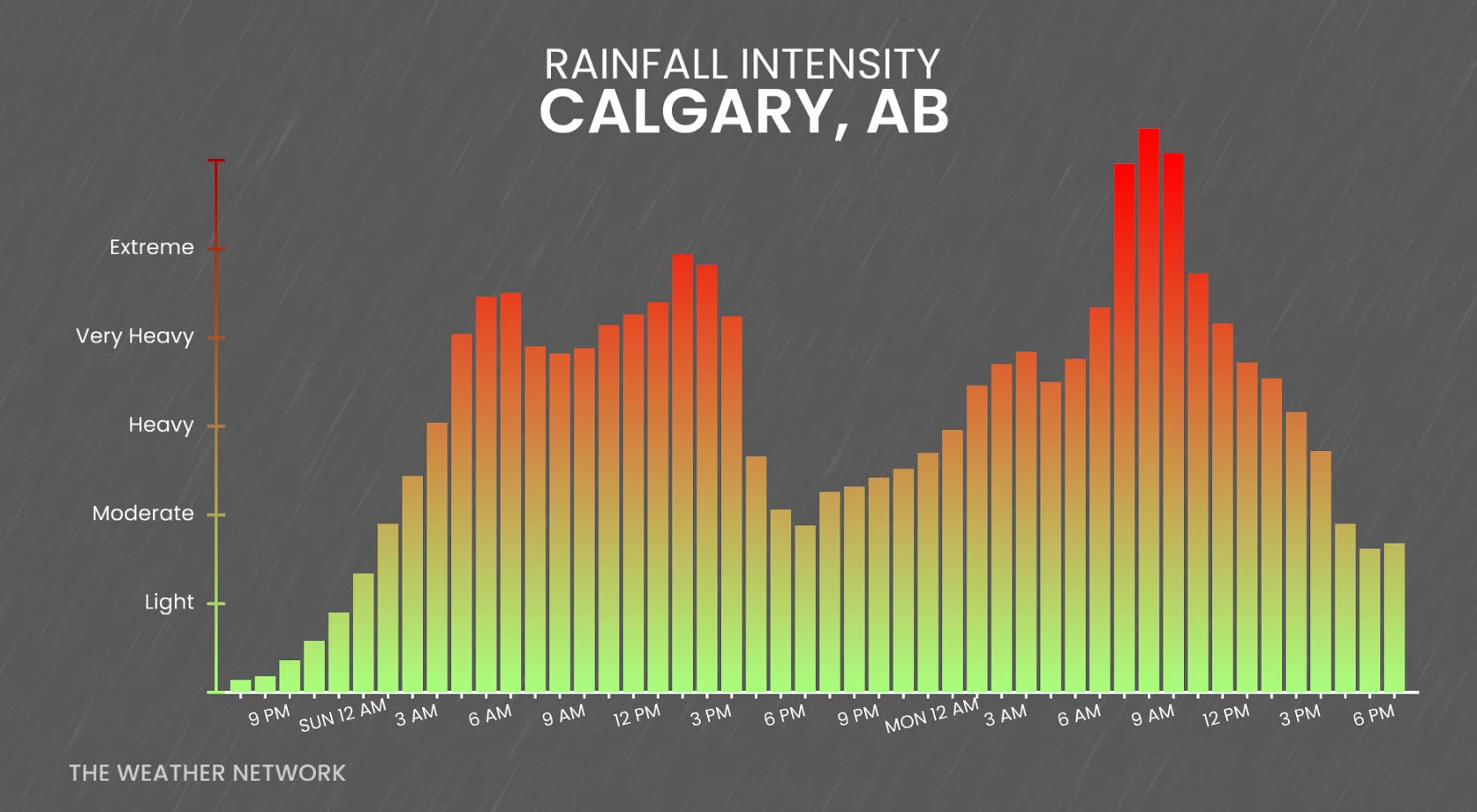
An active storm track taking hold on Sunday will deliver repeated rounds of heavy rainfall across Alberta into the upcoming workweek.
A rich reserve of moisture straight from the Gulf of Mexico will fuel the incoming precipitation, allowing for excessive totals in many locations.
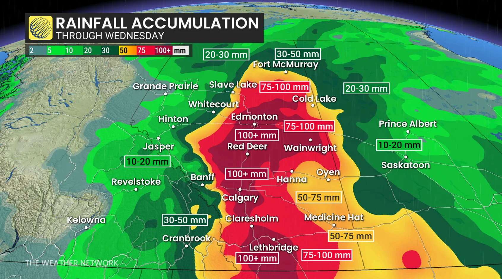
Accumulations of 50-100+ mm will be a common sight as this long-duration event unfolds through the middle of the week. Localized totals of 100-150+ mm are possible.
For reference, Calgary averages 112 mm of rain in a typical June, while Edmonton and Medicine Hat normally pick up around 75 mm of precipitation through the month.
Snowpack remains greater than normal for a majority of regional mountain sites. A combination of high snowpack, heavy rain, and warm temperatures will increase the concern for avalanches.
Rising river levels have led to localized flooding. Areas such as Beachwood and the Mercer lands have been closed to the public. Some low-elevation areas and trails in Lake Louise are also closed due to flooding from rising water levels.
Stay with The Weather Network for all the latest on conditions across Alberta