
100+mm and 80+km/h: Alberta being hit by wicked winds and extreme rainfall

A long duration of significant rainfall is forecast in Alberta, with some areas on the hook for seeing 100+ mm, raising the flood risk through the middle of this week. Parts of the province will also experience blustery wind gusts through Monday
A multi-day, heavy rain event is ongoing for a good portion of Alberta into early this week, bringing a high risk for flooding.
Parts of the province may see more than 100 mm of rain through the middle of this week, representing more than a month’s worth of rain in many spots.
Residents are encouraged to monitor forecasts and alerts as conditions evolve.
In addition to the rainfall, parts of the province are facing a wind threat with the potential for 80-100 km/h gusts in some areas.
Excessive rainfall on tap across much of Alberta
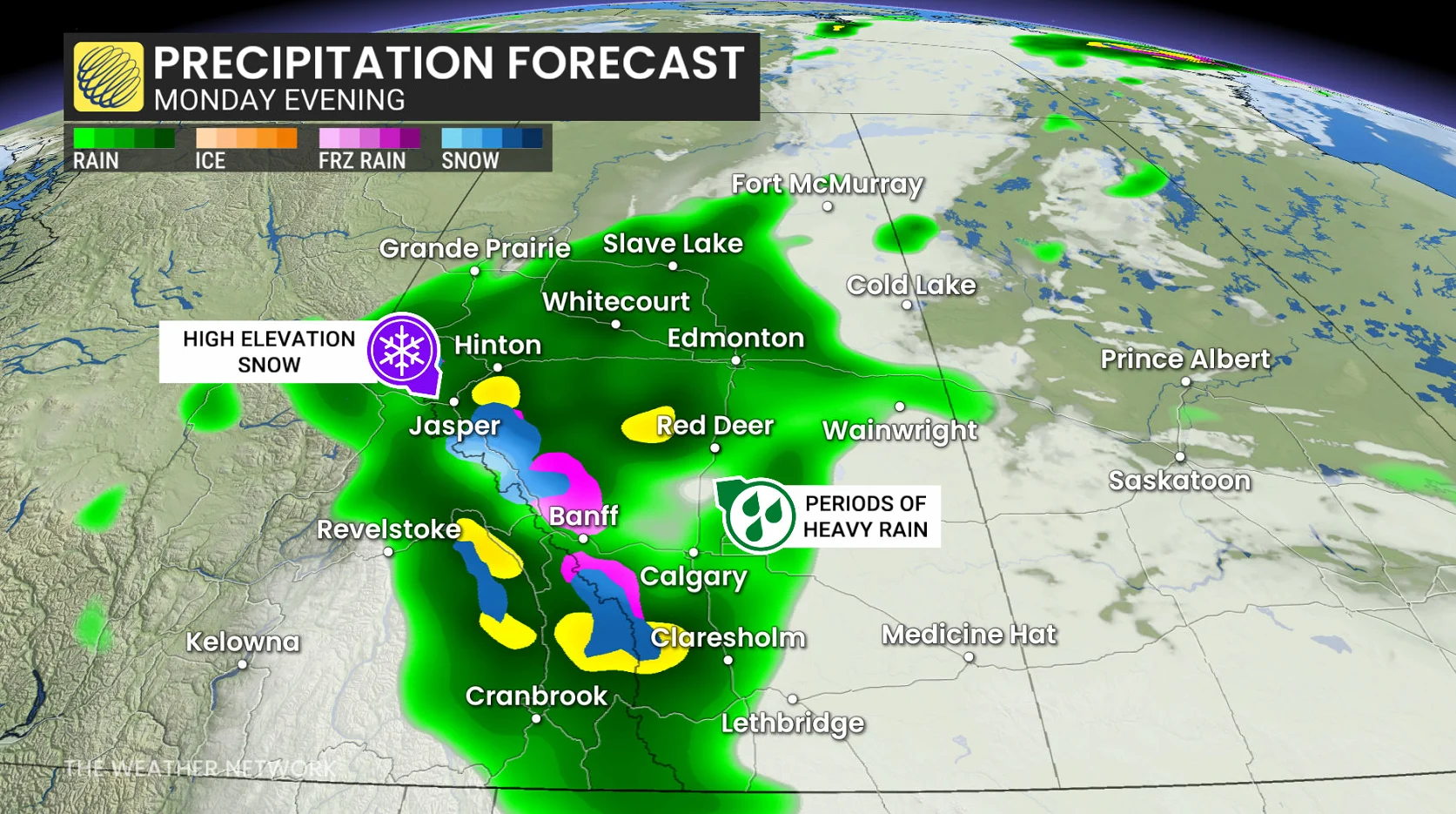
An active storm track taking hold on Sunday will deliver repeated rounds of heavy rainfall across Alberta into this week.
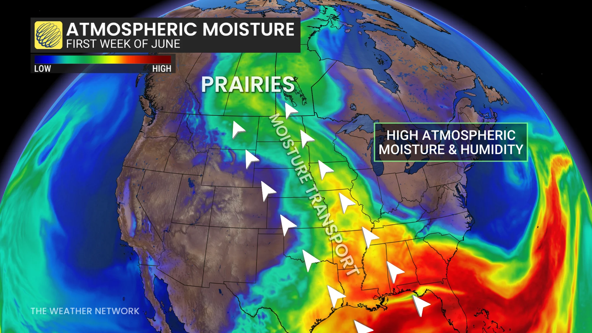
A rich reserve of moisture straight from the Gulf of Mexico will fuel the incoming precipitation, allowing for excessive totals in many locations.
Accumulations of 50-100+ mm will be a common sight as this long-duration event unfolds through the middle of the week. Localized totals of 100-150+ mm are possible.
Alberta's 2026 Summer Forecast: Strong start, but with some concerns
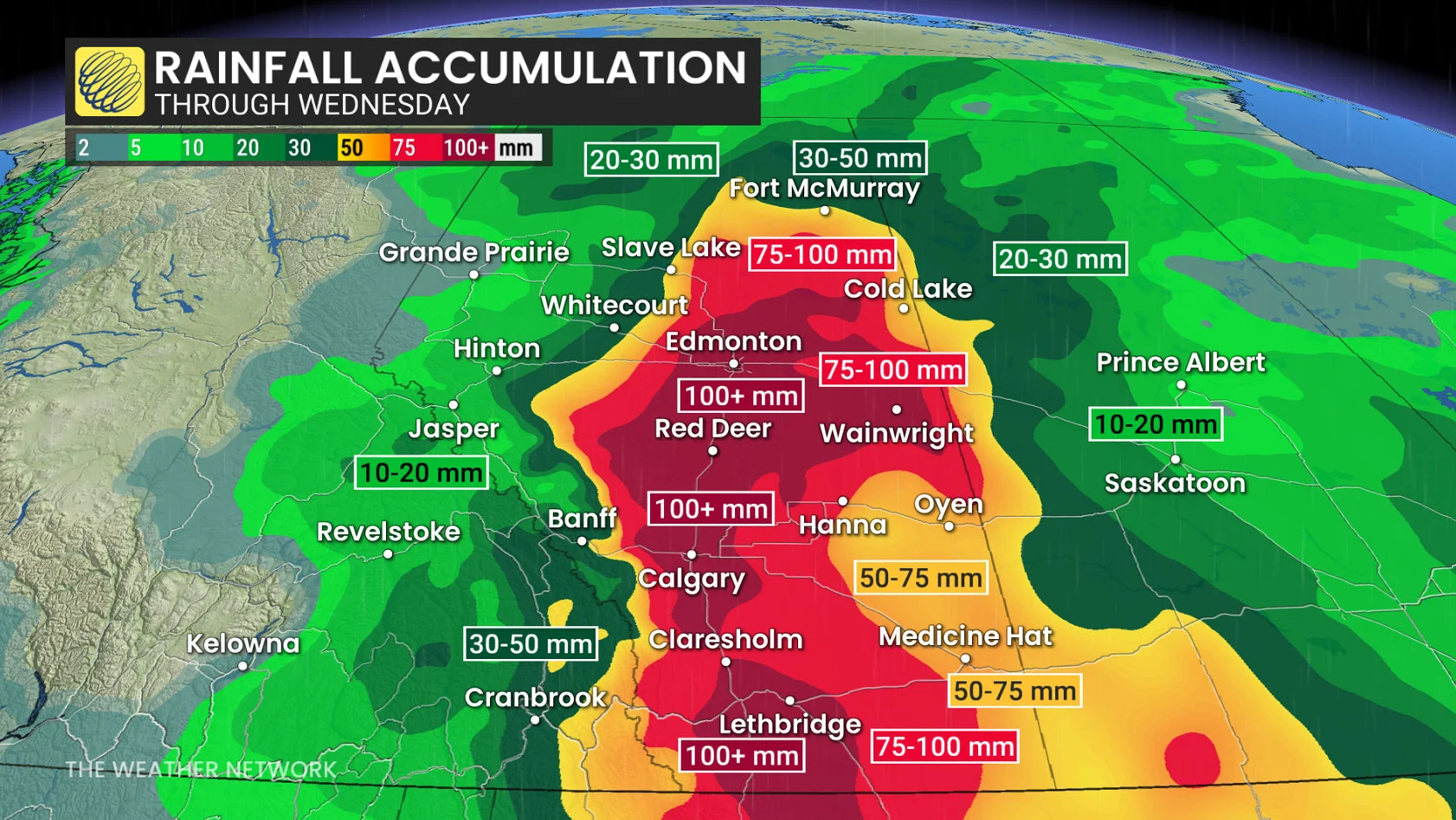
For reference, Calgary averages 112 mm of rain in a typical June, while Edmonton and Medicine Hat normally pick up around 75 mm of precipitation through the month.
Snowpack remains greater than normal for a majority of regional mountain sites. A combination of high snowpack, heavy rain, and warm temperatures will increase the concern for avalanches.
Rising river levels have led to localized flooding. Areas such as Beachwood and the Mercer lands have been closed to the public. Some low-elevation areas and trails in Lake Louise are also closed due to flooding from rising water levels.
WATCH: Rain on the Prairies set to bring relief, but totals could reach 100 mm+
Blustery wind threat
As the low stalls near the Alberta-Saskatchewan border on Sunday, it will drive strong, northwesterly winds across central and southern Alberta. Gusts up to 80 km/h are possible.
Wind warnings are in place for gusts up to 100 km/h, easing Monday evening.
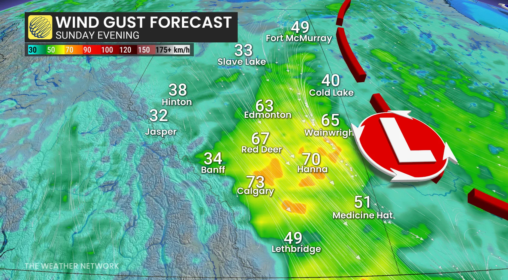
Sustained winds will likely reach 50 km/h through Sunday afternoon.
That will likely cause scattered outages and impacts to drivers.
Although the area of low pressure isn’t remarkably deep, there’s a stronger pressure gradient courtesy of a 1040 hPa high that is situated across northern B.C.
Stay with The Weather Network for all the latest on conditions across Alberta
Thumbnail courtesy of Getty Images/BrianAJackson/iStock / Getty Images Plus. Creative #: 1757967583