100+ km/h winds cause a dust storm on the Prairies, ice and snow are next
Expect blustery conditions to persist across parts of the region into Friday
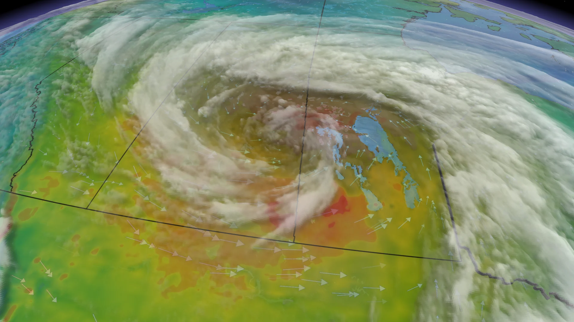
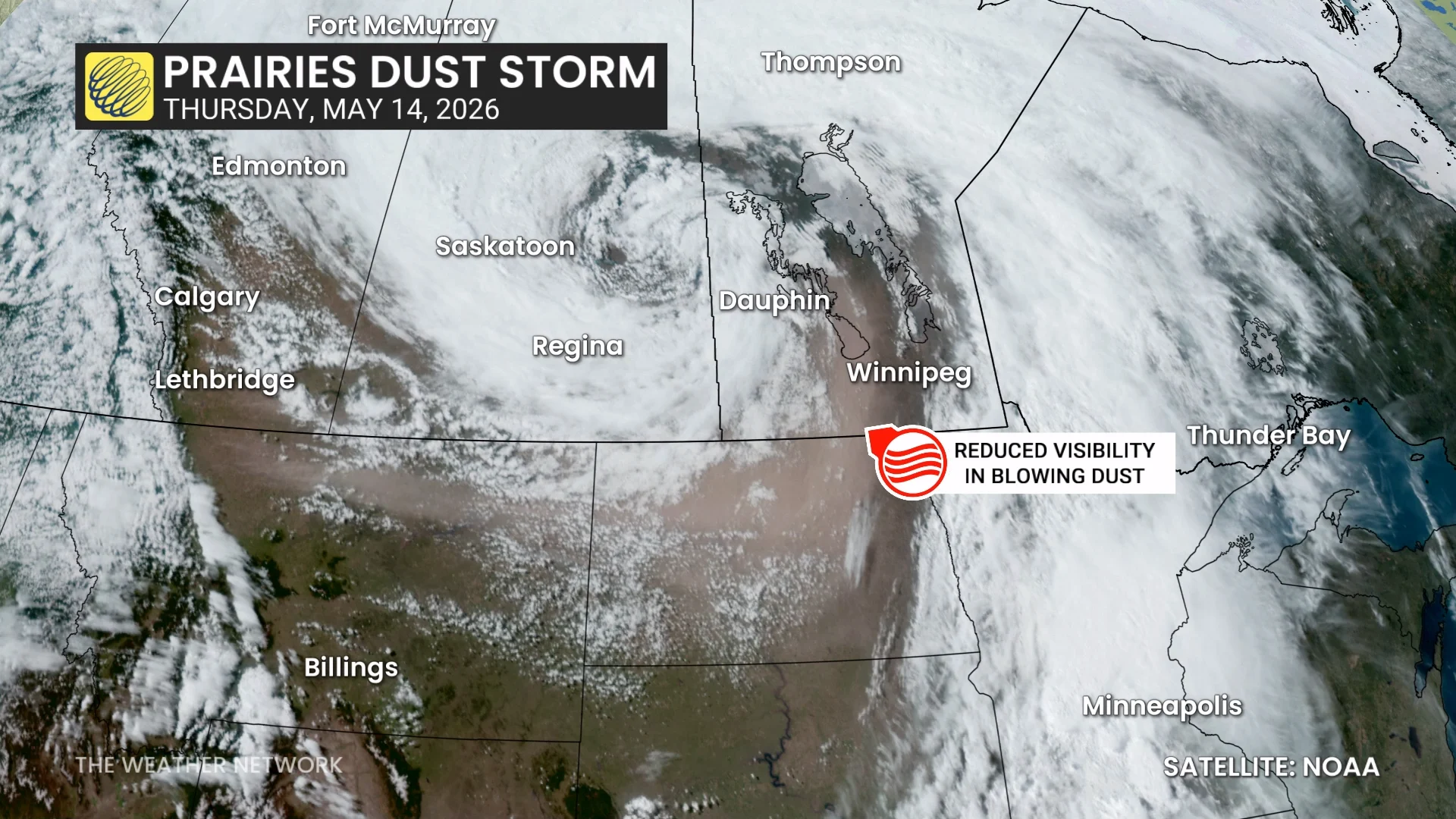
A strong low-pressure system sweeping across the Prairies has whipped up high winds throughout the region, with gusts of 100+ km/h reported in some locations on Thursday.
Intense wind gusts kicked up enough dust to cause lower visibility, prompting forecasters to issue rare dust storm warnings on Thursday evening in southern portions of Saskatchewan and Manitoba.
Expect gusty winds to continue into Friday, along with the potential for accumulating snow in some areas.
DON’T MISS: Canada's weather shakeup for the long weekend: What to expect
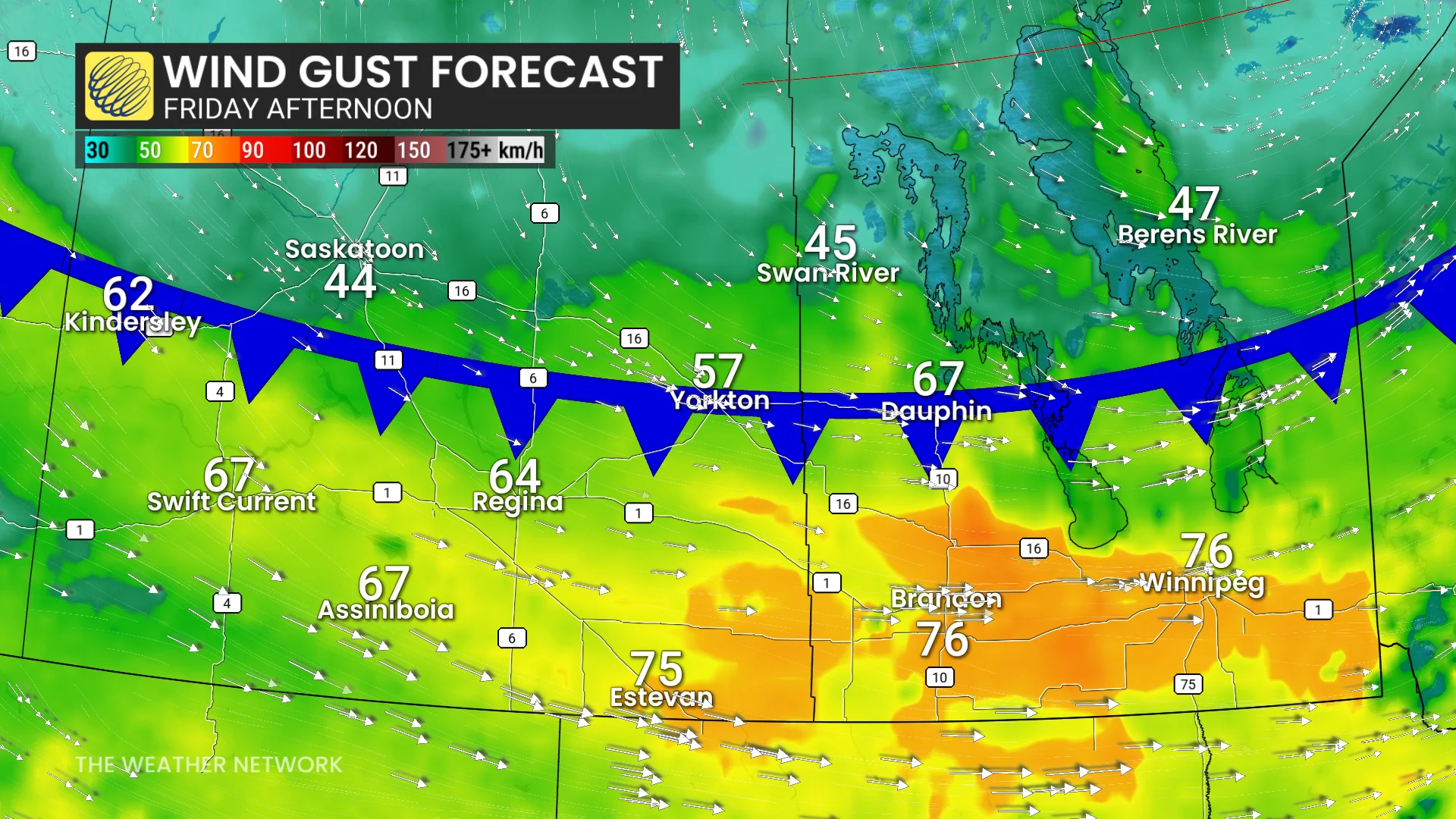
Blustery conditions continue into Friday
The centre of low pressure responsible for the foul weather will continue moving east to end the week.
Strong wind gusts of 50-70+ km/h will persist through the day Friday for southern Saskatchewan and much of Manitoba, with local gusts up to 90 km/h possible.
Cold air will force rain to transition to snow and ice across far northern sections of Saskatchewan and Manitoba, with some snow also possible in northeastern Alberta.
We could see 2-5+ cm of accumulation in areas that see snowfall, with localized totals up to 10 cm possible.
An impressive temperature gradient will continue on the Prairies as 20-degree warmth hangs on across southern sections of the region, while communities in the far north deal with temperatures below the freezing mark.
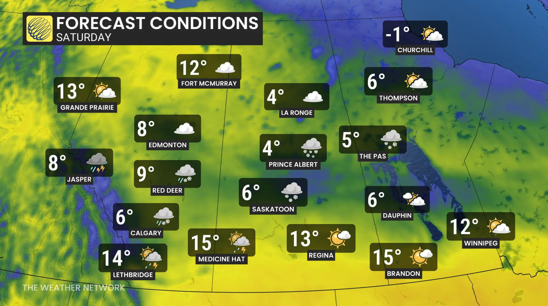
Looking ahead, below-seasonal temperatures will stick around through the long weekend across the Prairies, with single-digit daytime highs possible for some areas.
Snowfall is likely in the Rockies, with the opportunity for on-and-off showers throughout the weekend as the generally unsettled pattern continues for the region.