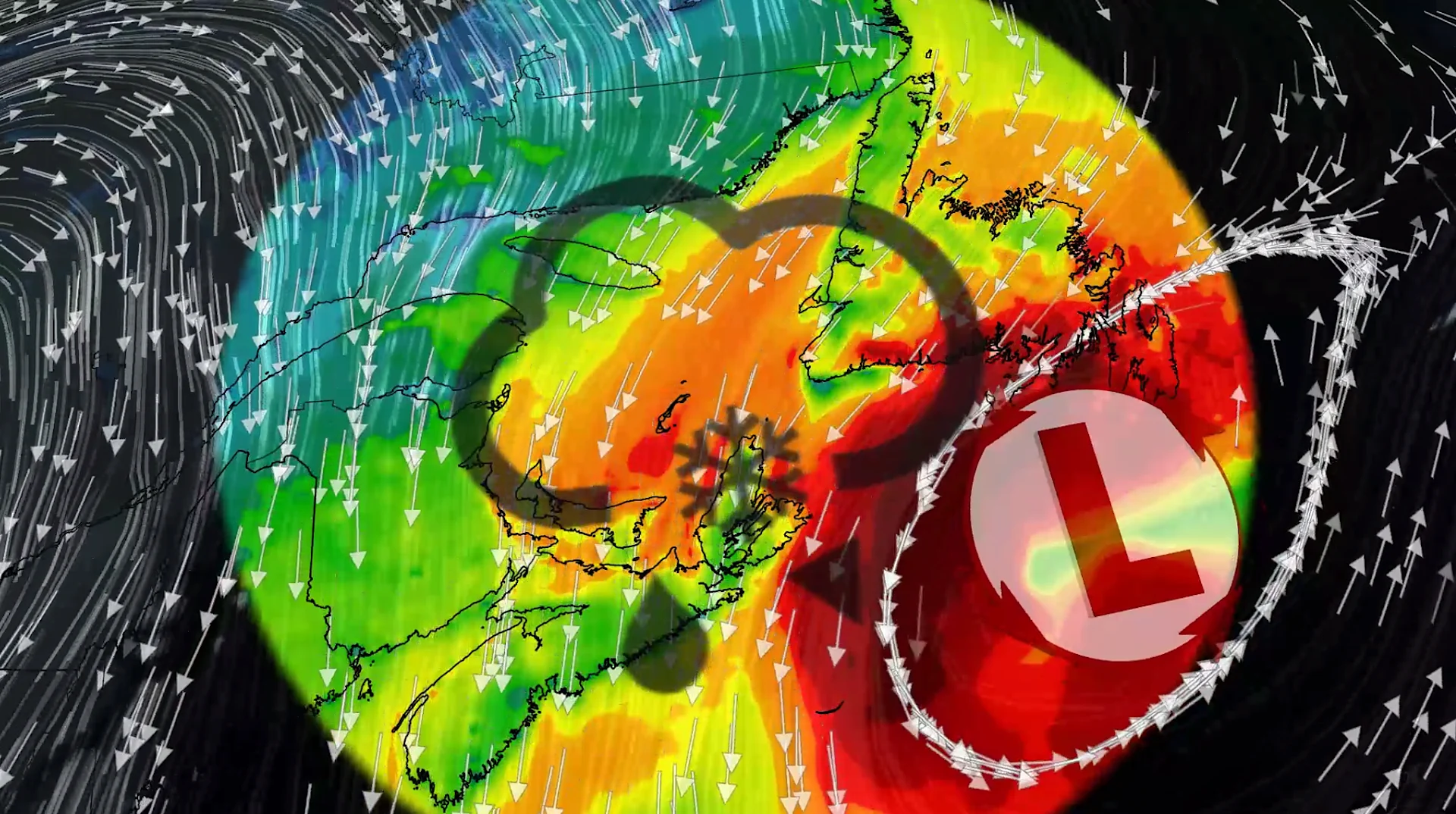
100+ km/h winds and snow: Nor'easter to clip Atlantic Canada this week

A comprehensive look at the developing nor'easter this week, including its potential for significant wind, rainfall, and possibly some snow for parts of Atlantic Canada
Atlantic Canada may be in for a rough middle of the or late week, with forecasters keeping a close eye on the formation of a nor'easter.
A non-tropical, low-pressure system between the U.S. East Coast and Bermuda has been meandering up the coast and has eveolved into a hybrid system with some subtropical characteristics.
Royal Caribbean's Oasis of the Seas is docked in Halifax after originally being scheduled for a warm-weather Bahamas and Florida trip. The ship had to be rerouted north due to the nor'easter off the U.S. East Coast. It's expected to depart from Canadian waters Thursday evening.
DON'T MISS: Canada's Winter Sneak Peek: El Niño puts record warmth in play
This system is expected to intensify, track northeast, and may become a nor’easter for Atlantic Canada late week. Widespread winds and rainy conditions, particularly for parts of Nova Scotia and Newfoundland, are possible Thursday through Friday.
Impacts to Atlantic Canada by end of week
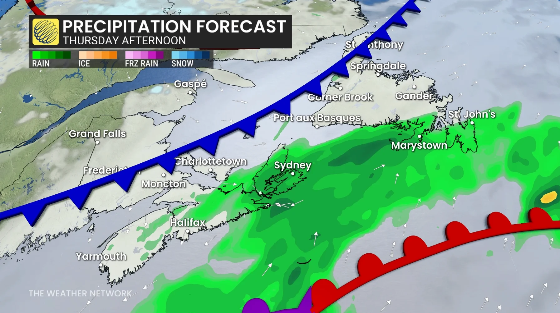
Rain is forecast to begin across Nova Scotia on Thursday morning, reaching Newfoundland's coast by the afternoon. While the rain is expected to remain east of Prince Edward Island, in Newfoundland, the Burin and Avalon Peninsulas will be in line for a direct hit.
SEE ALSO: Fight flu season with nature: Four immune-boosting foods to try this fall
Friday morning will feature the heaviest round of showers across Cape Breton.
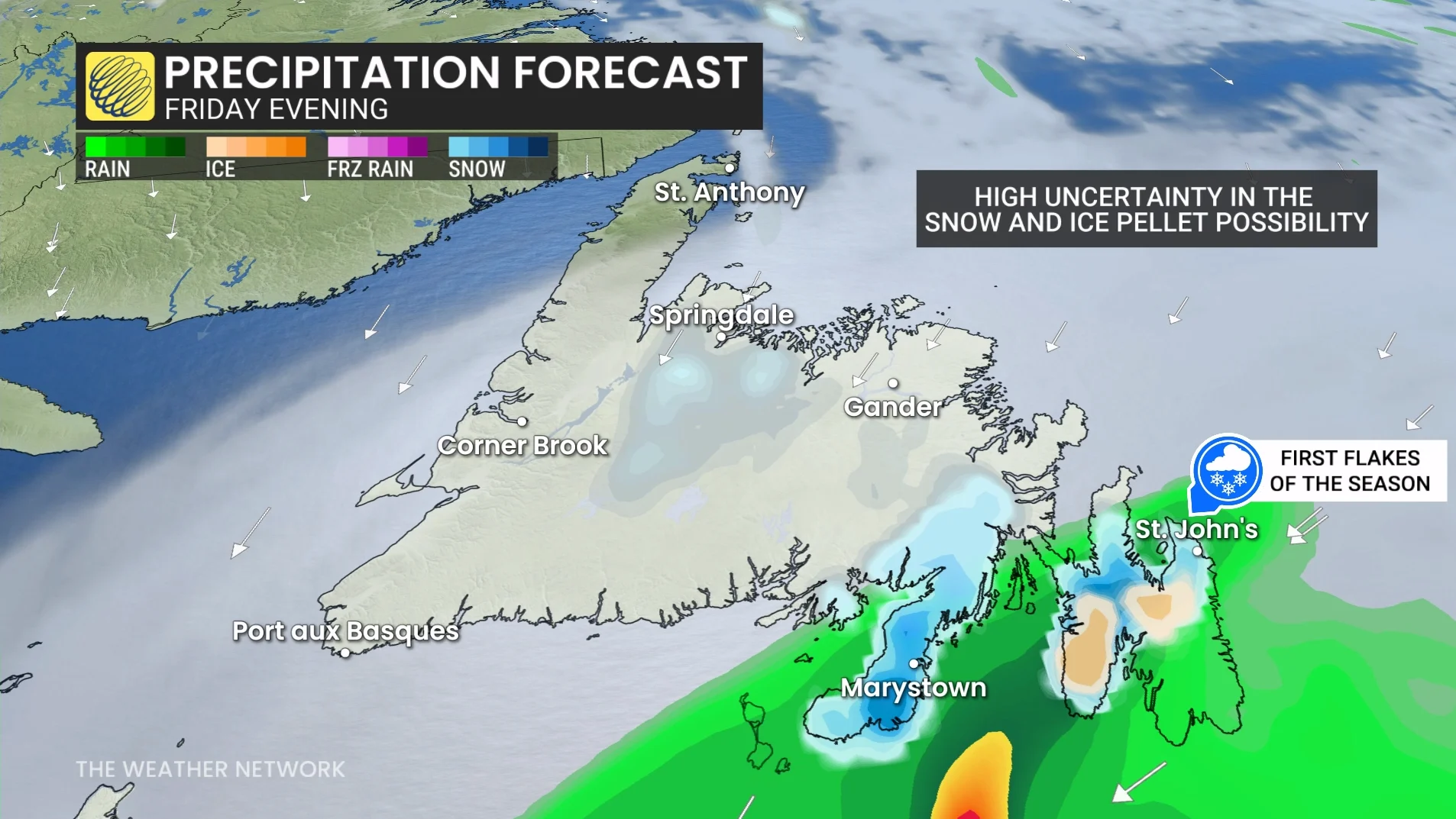
Cold, northern air will wrap around the low as it continues to meander north on Friday, bringing the risk of some snow and ice pellets to parts of Newfoundland later in the day, including for the Avalon.
How much snow will depend on how much of the cold air can get to the surface. It's entirely possible that the warmer, southern airmass will keep the cold air from pushing to the surface, resulting in more rain instead of snow.
Aside from the rain and possible snow, the other impact with this system forecasters are watching for is the wind, especially across Newfoundland.
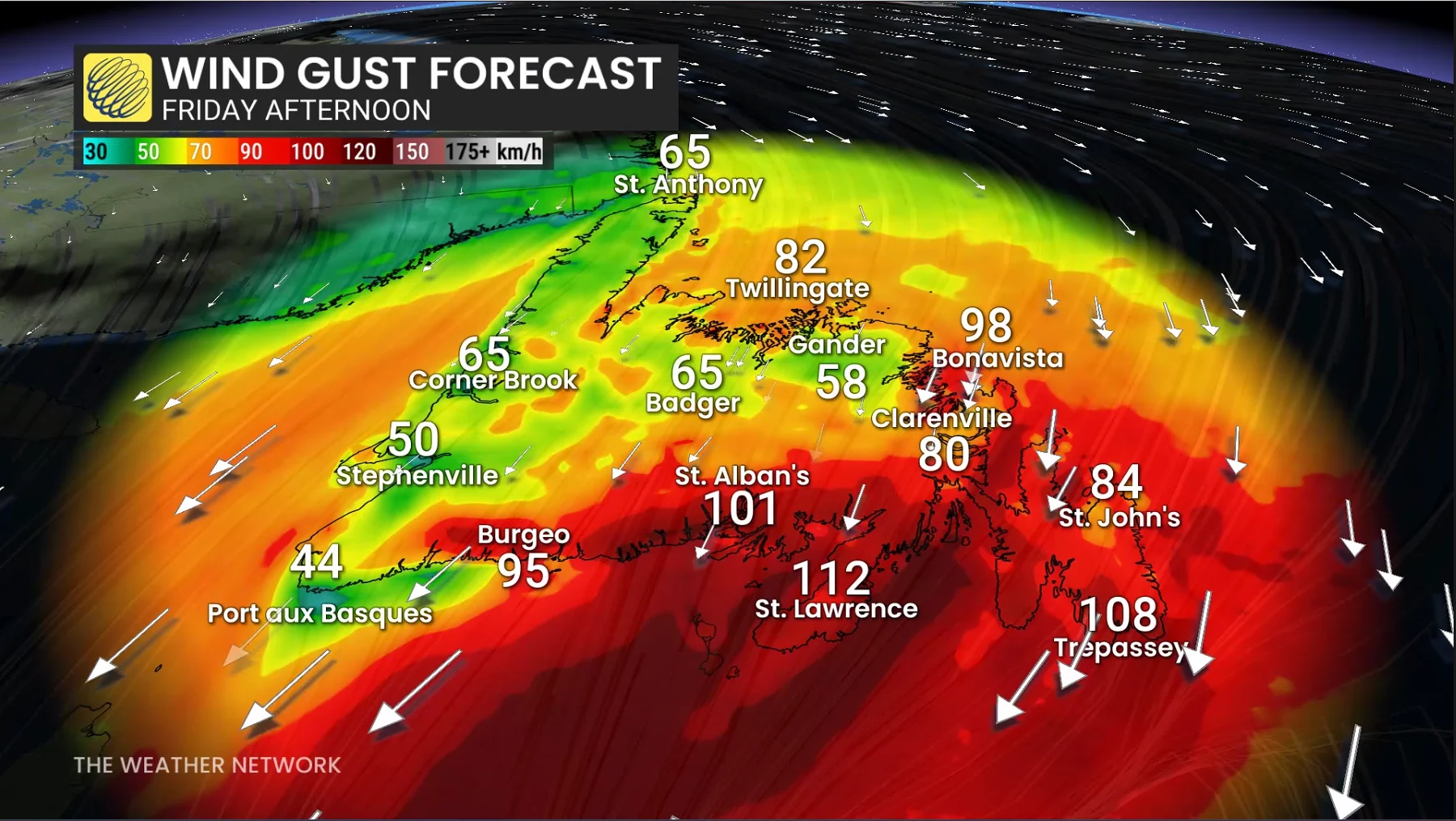
Wind gusts up to and over 100 km/h are possible on Friday along Newfoundland's southeastern coastline.
With the strong winds will also come a risk of coastal flooding, as wave heights and swells could reach 3-5 metres. Widespread power outages and tree damage are also possible.
Stay with The Weather Network for the latest updates and information on your forecast across Atlantic Canada.