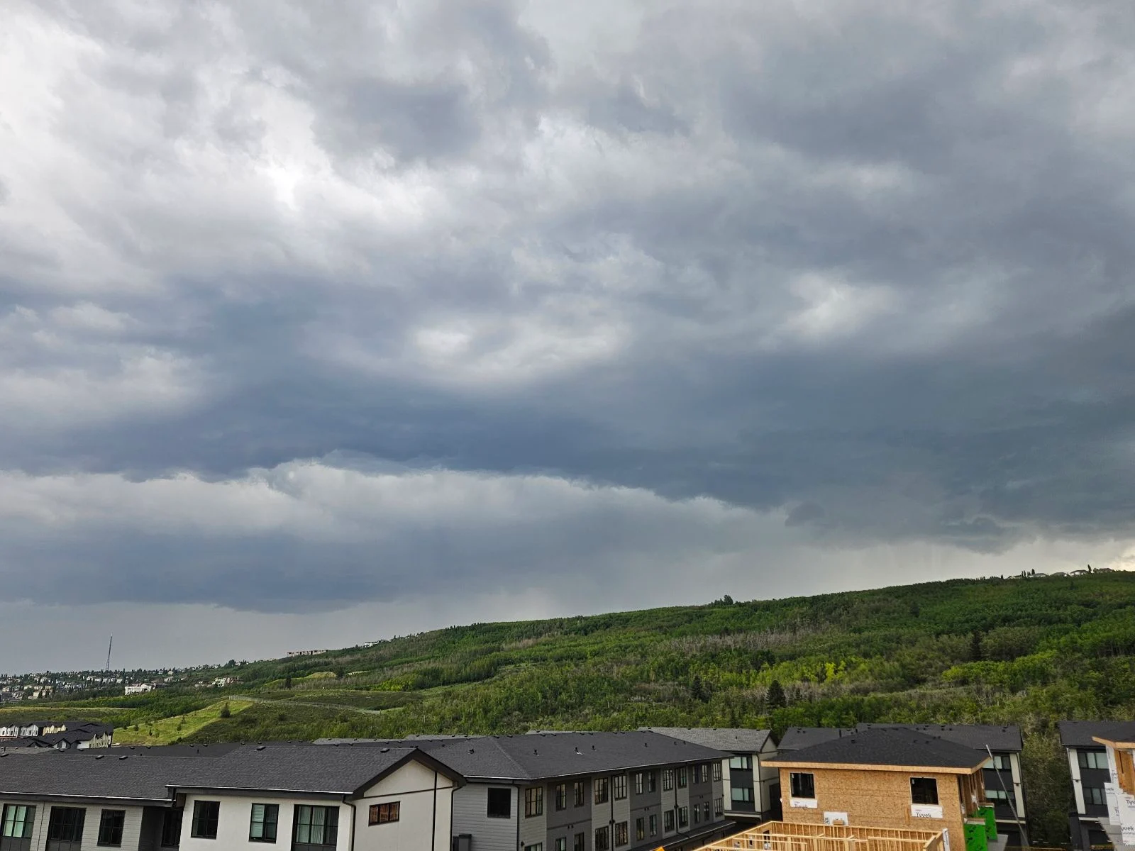
100 km/h winds and large hail: Strong storm risk lingers over Alberta

The multi-day severe thunderstorm risk continues over Alberta on Thursday and Friday, with strong winds, large hail, and a tornado or two possible
Severe weather continues to be a concern in Alberta, with the threat of thunderstorms persisting through Thursday.
DON'T MISS: Tornado warning safety: Here’s what you should do
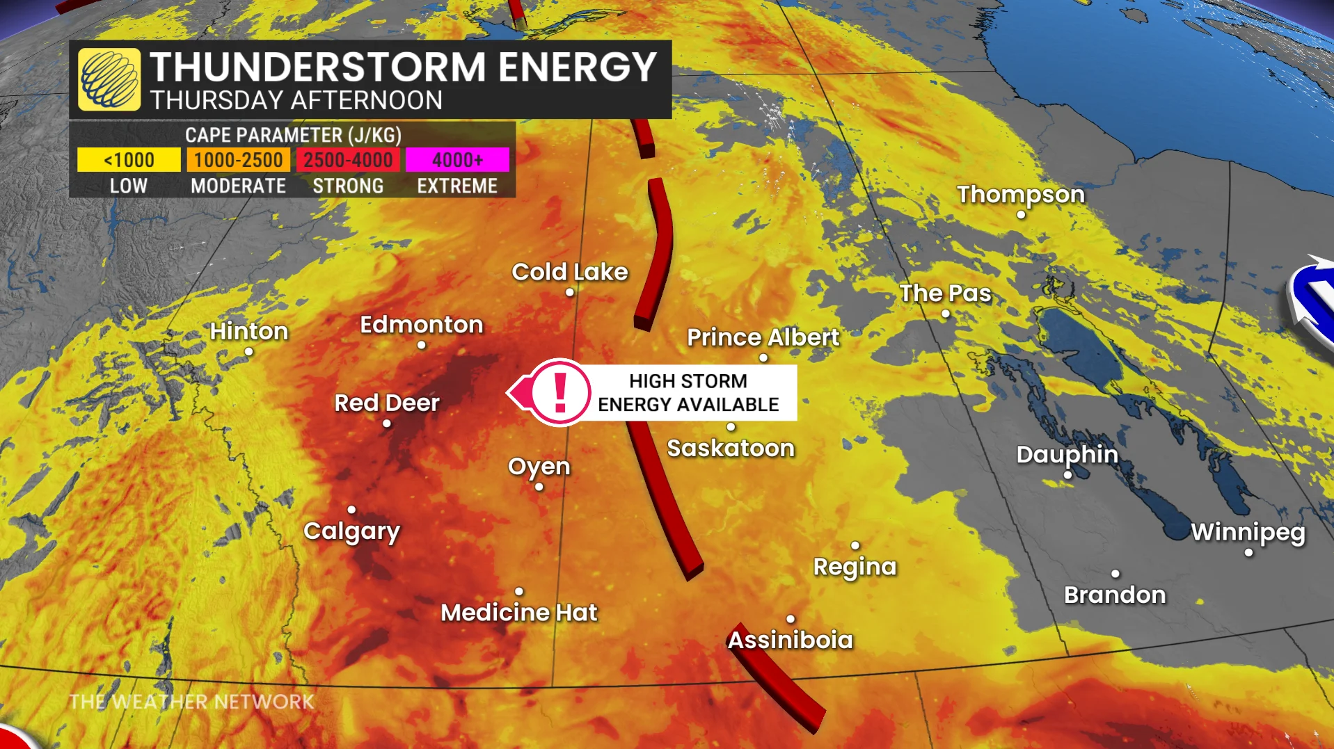
Following several days of tornado watches and warnings, storm activity is expected to become widespread. Elevated thunderstorm potential on Thursday is linked to high CAPE values, increasing the likelihood of intense storms in the region.
Stay weather aware and monitor updates and alerts.
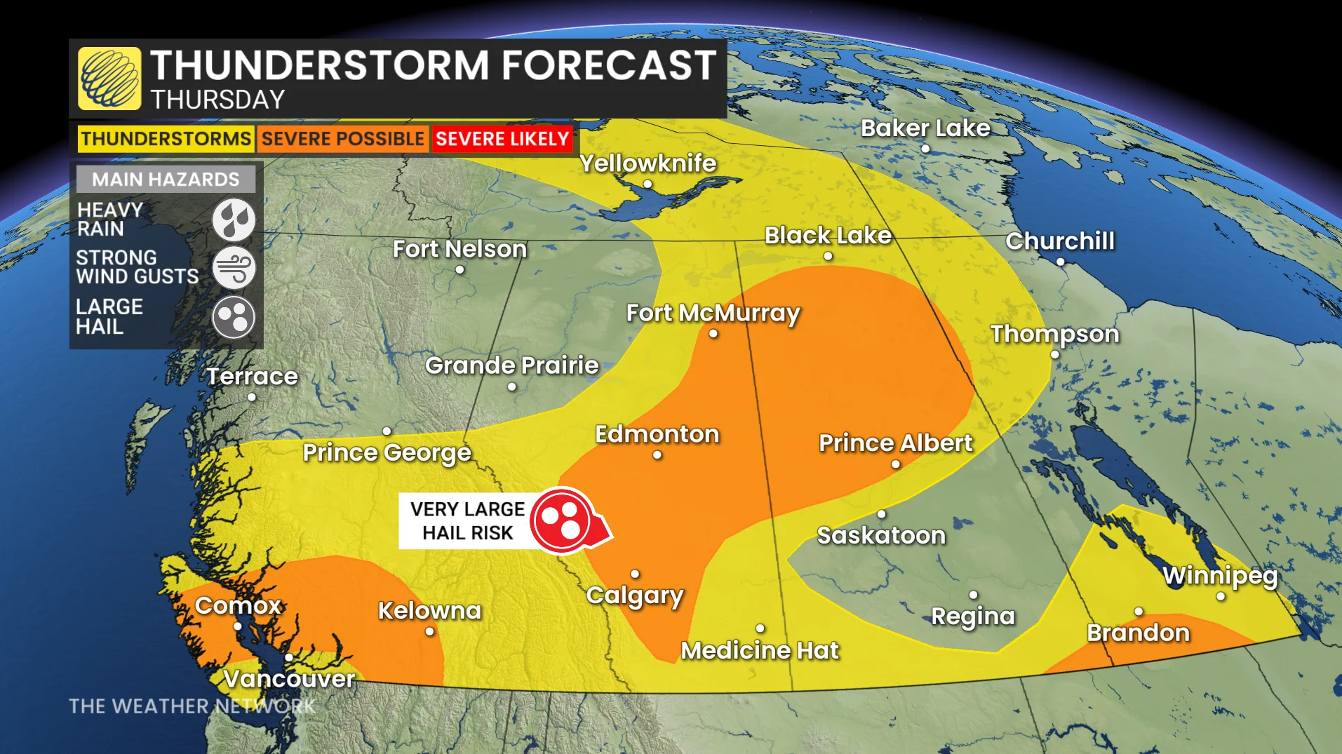
Thursday: Risk for strong winds, hail, and a tornado or two
A low pressure system is positioned over northern Alberta and Saskatchewan, while a surface trough remains along the Rockies. Severe thunderstorms are anticipated Thursday afternoon and evening, stretching from the foothills to northern Saskatchewan.
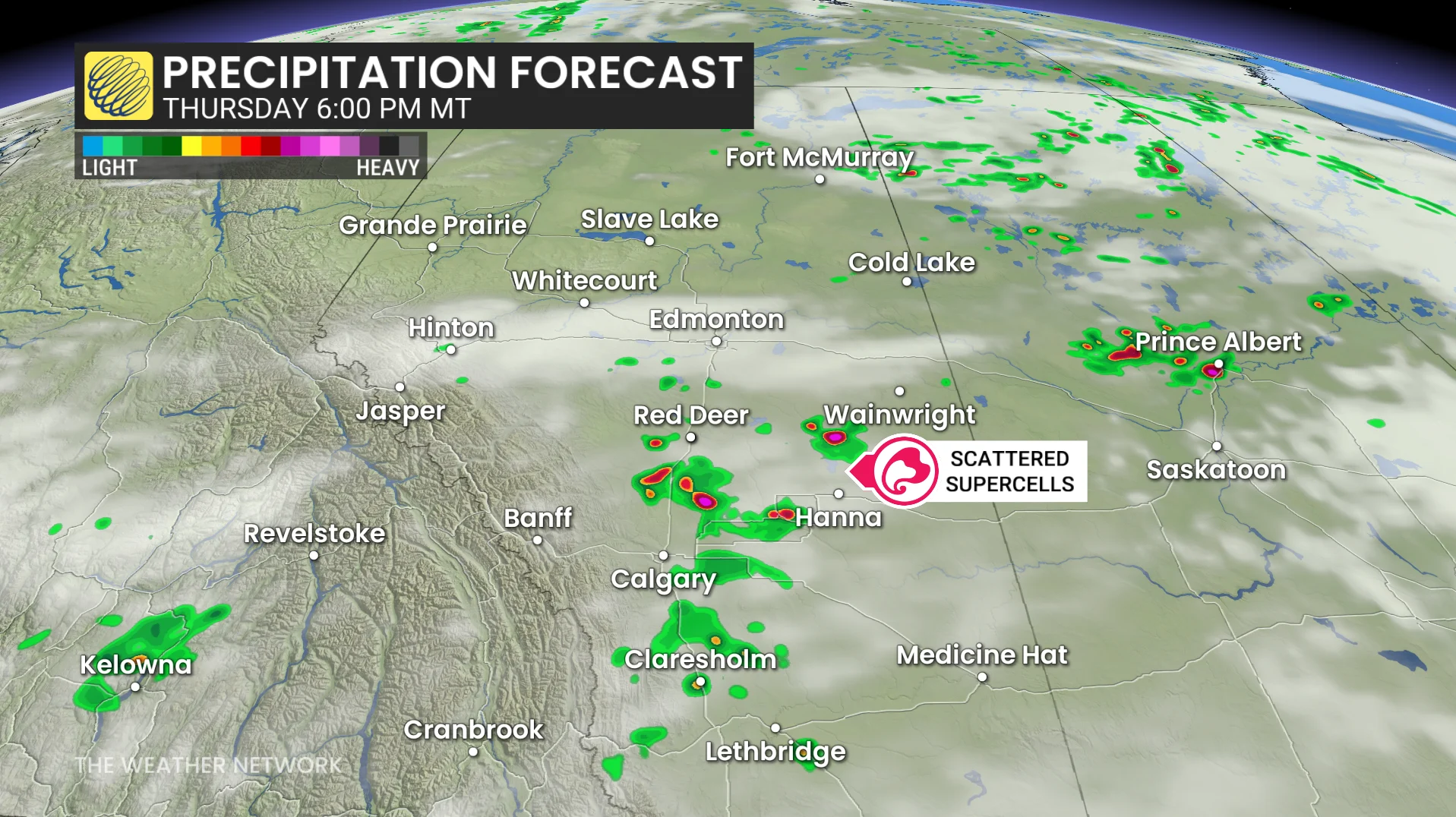
These storms are expected to be scattered, making their exact location difficult to predict.
Key risks include strong wind gusts that could surpass 100 km/h in the most intense storms. Large hail, potentially reaching golf ball size, is also a concern.
Funnel clouds remain possible in northern Alberta and Saskatchewan. Additionally, conditions in southern and central Alberta could lead to the development of one or two tornadoes.
Severe thunderstorm and tornado risk rises on Friday
Severe thunderstorms and a potential tornadic threat are expected to intensify across Alberta on Friday. Strong storms are forecast to develop near the foothills northwest of Calgary before tracking eastward.
The critical time frame for storm development is between 4 p.m. and 10 p.m. MT.
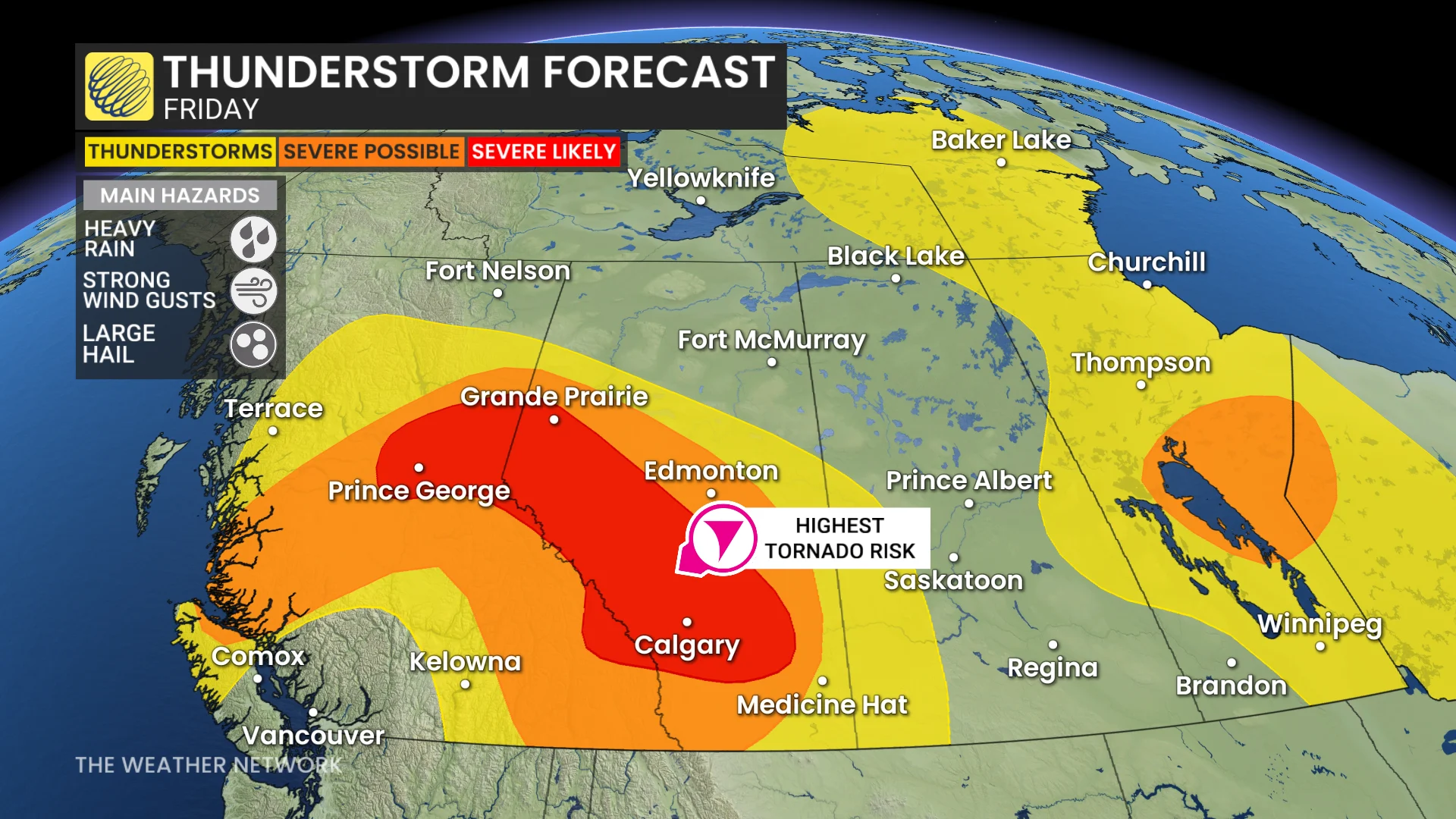
Areas at risk include regions northwest of Calgary, stretching eastward across the QE2 corridor to Red Deer, Stettler, Drumheller, and Brooks. Calgary itself may see storms pass very close during the early evening hours and should be closely monitored.
Stay weather alert and prepared for possible warnings during this heightened storm period.