Severe thunderstorm threat shifts east on the Prairies ahead of weekend heat

Parts of Saskatchewan will continue to see the risk for severe weather Wednesday overnight, so make sure to stay alert
Severe thunderstorms are forecast over the next few days across the Prairies, with risks of very large hail and damaging winds.
DON'T MISS: Say it isn't snow! Burst of July snow on tap for some Canadians this week
Stay weather-aware if travelling in areas under severe storm risk, and keep informed of local alerts.
Thursday: Risk for supercells and large hail
A threat for severe storms on the southern Prairies popped up Wednesday afternoon, prompting a tornado watch in Saskatchewan.
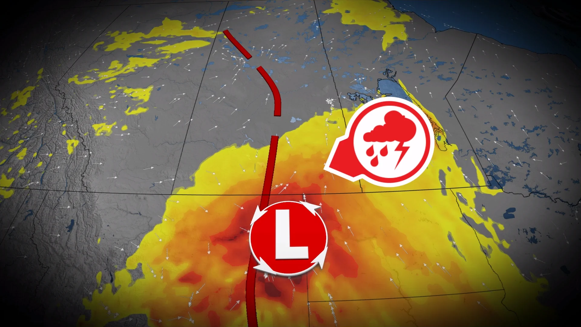
On Thursday, the surface low is expected to deepen as it moves into Manitoba’s Interlake region, bringing the potential for severe thunderstorms.
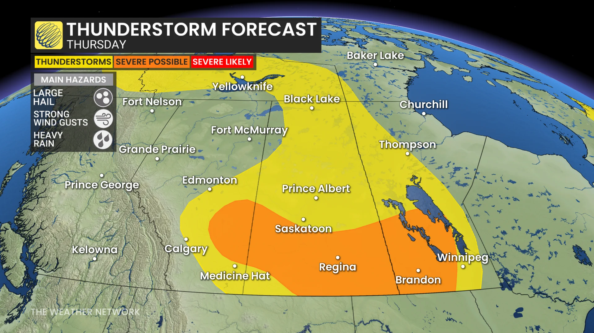
Very similar hazards as the Wednesday storms--large hail, severe to damaging winds.
In addition, a few supercells could develop east of Calgary and track into southern Saskatchewan during the late afternoon and evening.
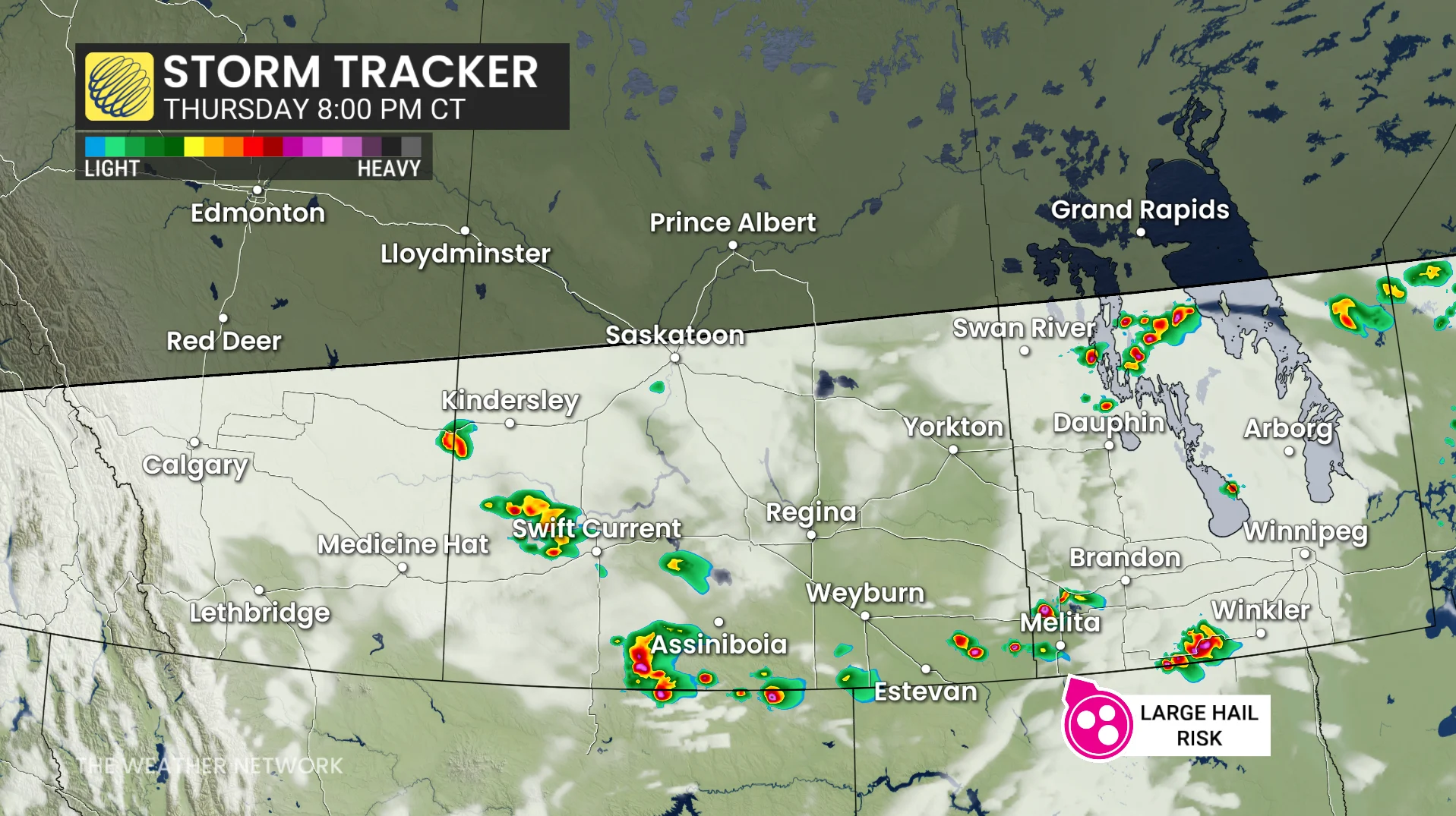
At this time, the primary threat from these storms is large hail. However, uncertainty remains regarding the exact severity and timing of these storms.
DON'T MISS: A normal July brings Canada drought, downpours, and dizzying heat
Forecast updates and possible upgrades could follow as details become clearer.
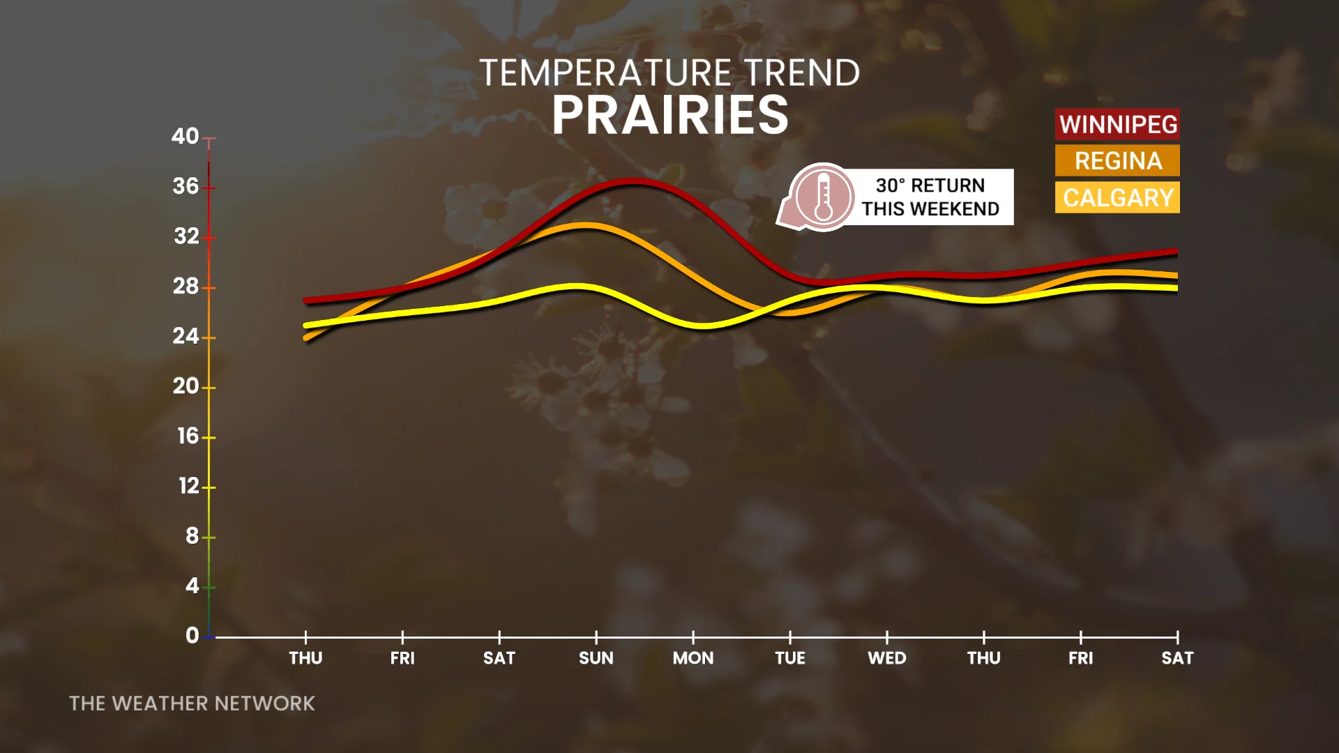
Hot and drier weather is expected to set in this weekend into next week.
Stay with The Weather Network for all the latest on conditions across the region.