
Tornado watch issued in Saskatchewan amid severe storm threat

Residents across parts of Saskatchewan are advised to monitor the forecast closely as severe weather, including the potential for a tornado, is expected to continue until Wednesday evening. Check back regularly for updates.
A threat for severe storms on the southern Prairies popped up Wednesday afternoon, prompting a tornado watch in Saskatchewan. Storms capable of producing heavy rain, strong winds and large hail target parts of southern Saskatchewan. The threat for tornadoes will persist into the evening hours on Wednesday.
2:36 PM CST: Conditions are favourable for the development of severe thunderstorms, which may produce tornadoes. Strong winds, large hail and heavy rain are also possible.
Severe thunderstorms are expected to develop this afternoon along a warm front in Alberta, and will track east into Saskatchewan late this afternoon. The potential for tornadoes will decrease this evening.
This is a dangerous and potentially life-threatening situation.
Be prepared for severe weather. Take cover immediately, if threatening weather approaches.
Tornado watches are issued when atmospheric conditions are favourable for the development of thunderstorms that could produce tornadoes.
Read below for the full forecast details.
Wednesday evening: Strong to damaging wind threat spans Alberta, Saskatchewan
In southern Alberta near the Alberta-Saskatchewan border, isolated severe storms may develop. Elevated, atmospheric hailers could produce hail as large as golf balls due to high thunderstorm energy and raised cloud bases.
DON'T MISS: A normal July brings Canada drought, downpours, and dizzying heat
As storms push into Saskatchewan during the evening, a developing surface low could introduce slight, atmospheric spin, creating a low, though not null, tornado risk.
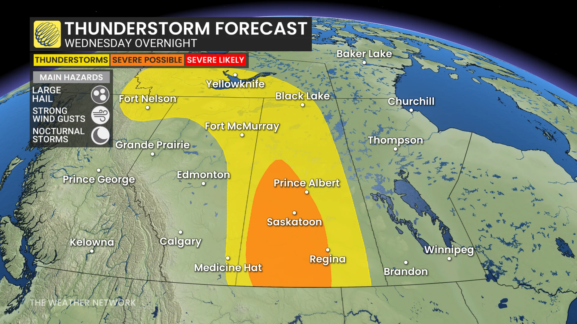
Overnight, storms may organize into a linear mesoscale convective system (MCS), with damaging winds up to 110 km/h, affecting areas near Regina and Saskatoon.
Stay updated as storms are expected to remain severe after sunset.
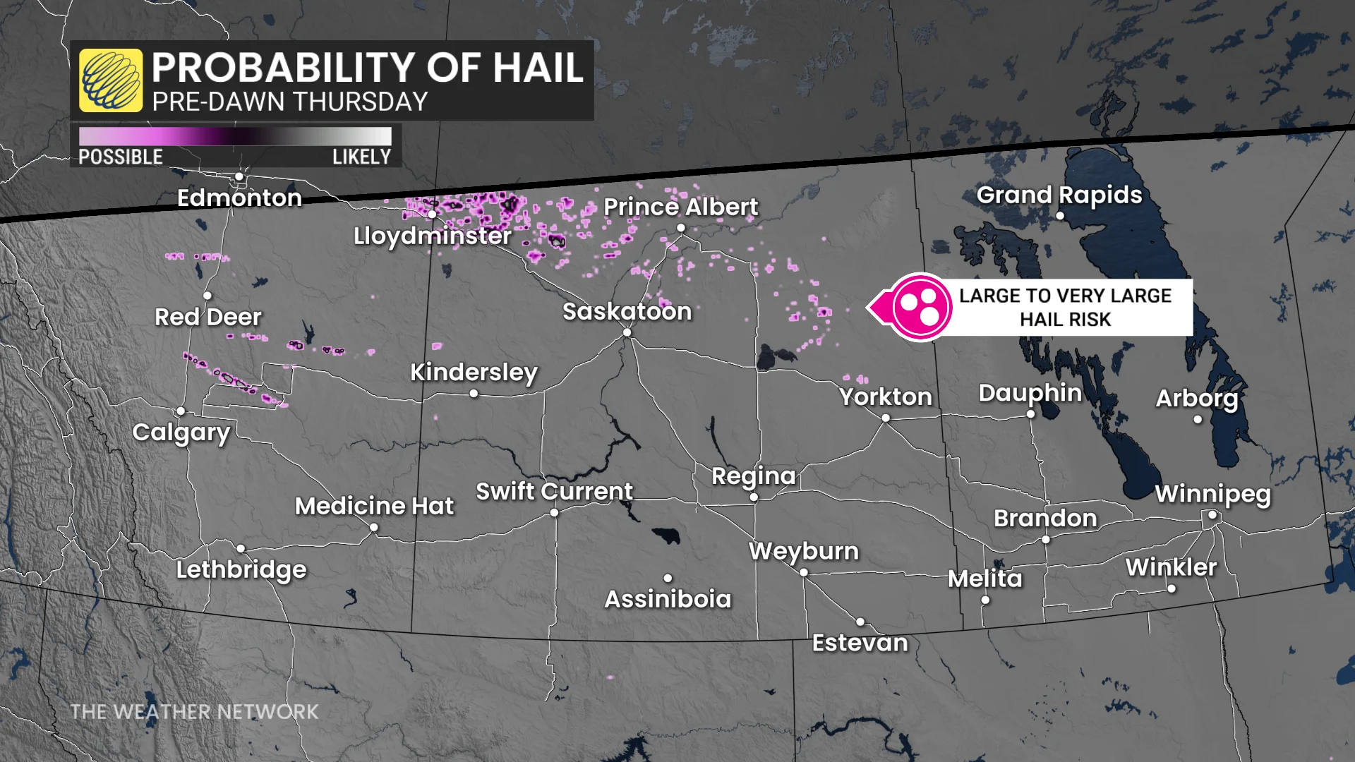
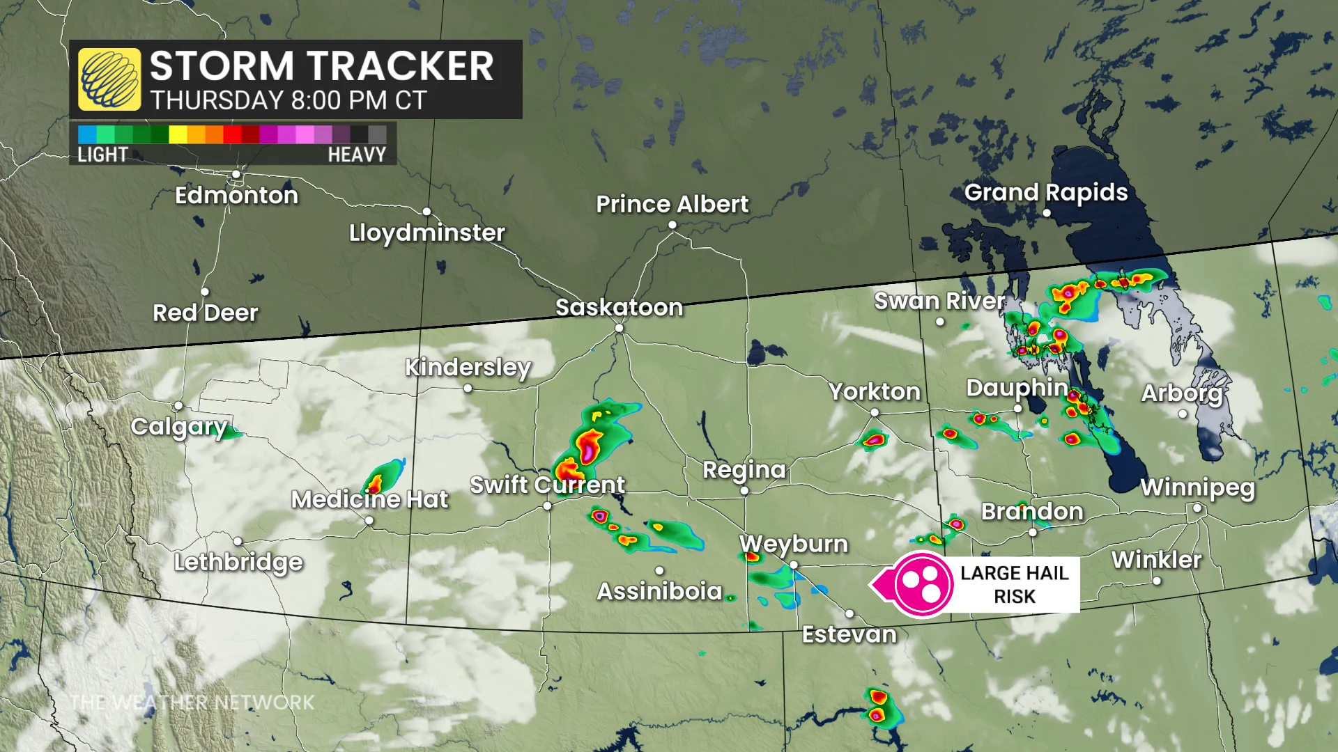
Thursday: Risk for supercells and large hail
On Thursday, the surface low is expected to deepen as it moves into Manitoba’s Interlake region, bringing the potential for severe thunderstorms.
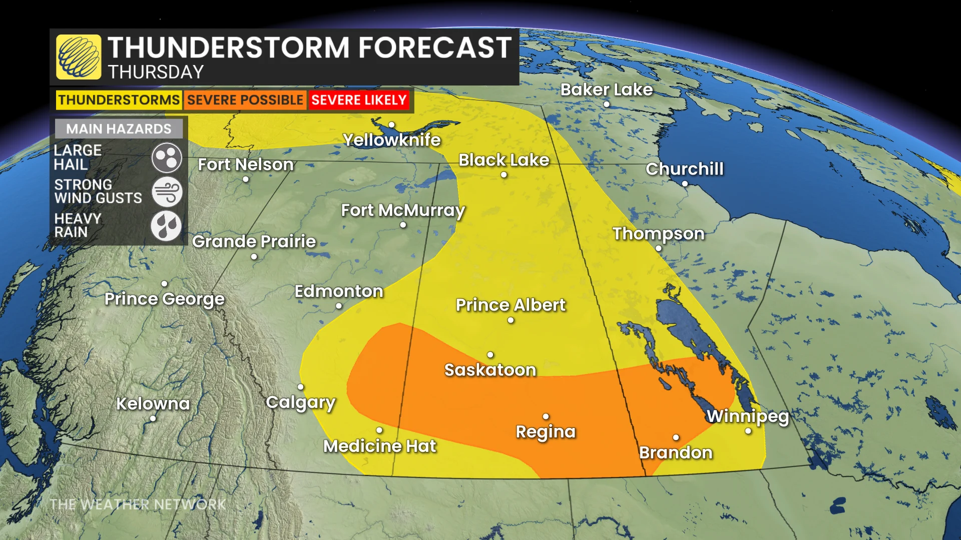
In addition, a few supercells could develop east of Calgary and track into southern Saskatchewan during the late afternoon and evening.
At this time, the primary threat from these storms is large hail. However, uncertainty remains regarding the exact severity and timing of these storms.
Forecast updates and possible upgrades could follow as details become clearer.
Stay with The Weather Network for all the latest on conditions across the region.