100+ km/h: Strongest winds in months set to hit Newfoundland this weekend

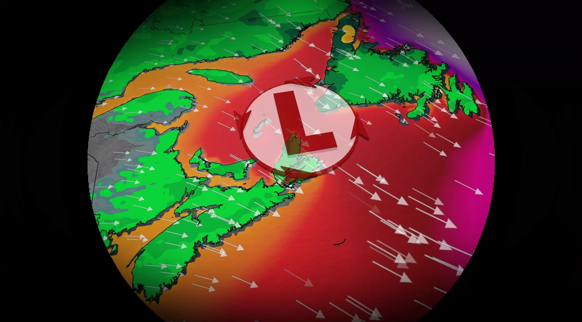
A powerful low pressure system is expected to strengthen as it tracks into Newfoundland. Northern areas and St. John’s could experience significant wind gusts, potentially reaching up to 100 km/h on Saturday
A developing low pressure system over the northeastern United States will track into Atlantic Canada on Friday, strengthening as it moves across Newfoundland.
This system will bring significant weather impacts, including heavy rainfall, strong winds, and high swells, beginning late this week. Special weather statements are in effect, with the risk for power outages and disruptions to ferry services.
Visit our Complete Guide to Fall 2026 for an in depth look at the Fall Forecast, tips to plan for it and much more!
Stay updated with the latest information on this developing system, and any weather warnings in your area.
Rain picks up through Friday, damaging wind threat Saturday
Rain will begin overnight Thursday across the Maritimes, with the heaviest amounts expected in Nova Scotia Friday morning. By Friday afternoon, the rain will push into Newfoundland and continue into the evening.
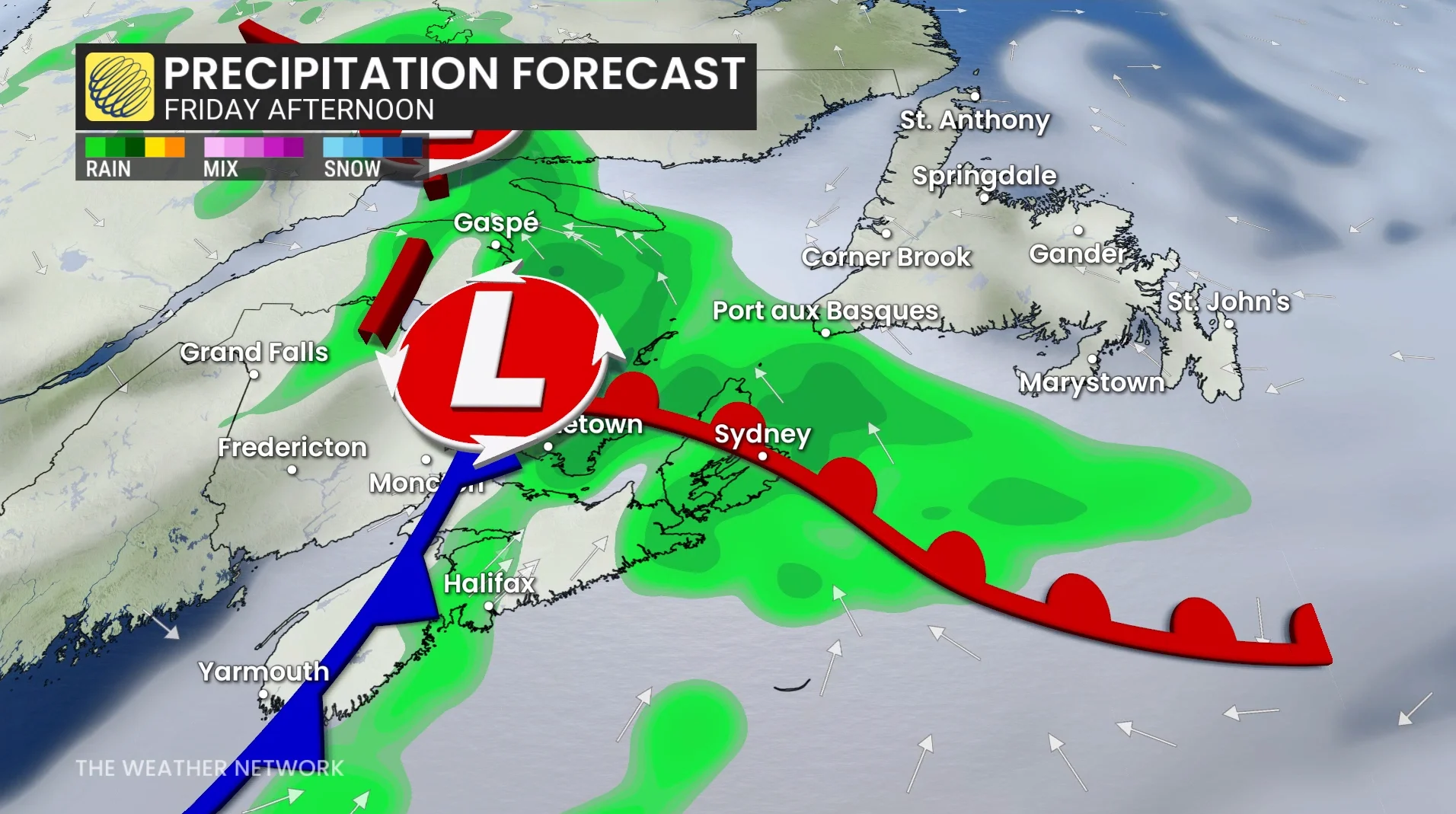
Forecast rainfall amounts are 10-20 mm for much of the Maritimes and Newfoundland, while the west coast and north coast of Newfoundland could see higher totals due to wraparound showers extending into Saturday.
The primary concern will be strong winds, particularly for Newfoundland’s northern coast, where wind gusts between 80-110 km/h are forecast.
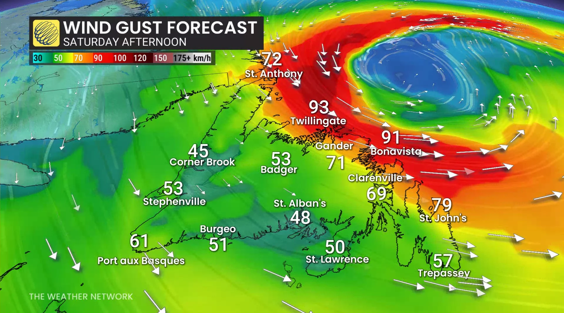
Special weather statements are in effect for Saturday in the region, with St. John’s set to experience its windiest day since May 13.
Offshore, wave heights are expected to reach 4-6 metres, increasing the risk of storm surge during high tides.
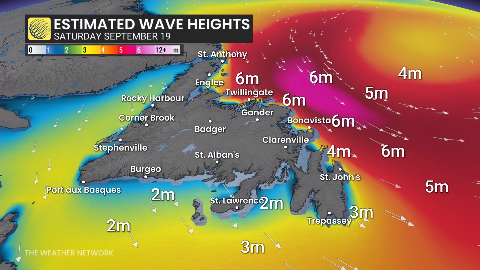
Power outages and disruptions to ferry services are possible.
St. John’s experienced a maximum wind speed of 74 km/h between June and August, marking the lowest peak wind speed recorded during the summer months since 2007. This made it the calmest summer in nearly two decades for the region.