100 km/h winds: Threat for outages with Friday's storms in Ontario, Quebec
A stormy week is set to conclude on Friday with another risk of severe storms targeting northern and eastern Ontario, along with sections of Quebec. Residents in these areas should stay alert for potential weather warnings and advisories
Following a week of active weather across much of Canada, a low pressure system moving north from the U.S. Midwest is expected to bring a severe storm risk to eastern Ontario and Quebec on Friday.
This round of storms will also usher in a notable shift, as heat and humidity are forecast to ease heading into the weekend, bringing some relief to the affected regions.
RELATED: Drastic temperature flip in store across Canada
Make sure to monitor the radar if you're heading out and to have notifications turned on to receive any active weather alerts for your area.
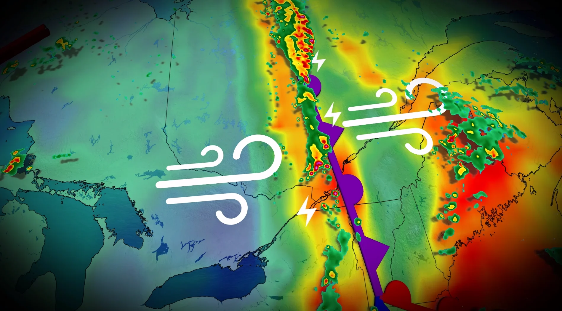
Power outage risk with 100 km/h winds on Friday
Daytime heating combined with high humidity will create a prime environment for active weather to bubble up once the system's sharp cold front sweeps in during the afternoon hours. The front will help to lift the warm, humid air aloft and trigger a line of thunderstorms.
Montreal is expected to see stormy conditions around the evening rush hour on Friday.

The greatest threats from this setup will be heavy downpours, large hail, and damaging winds up to 100 km/h.
This will also significantly raise the risk of power outages from falling trees. Be sure to have an emergency kit on hand in case the power gets knocked out.
SEE ALSO: Saskatchewan records Canada's strongest tornado since 2023
The highest confidence for severe storms to develop will be through central Quebec. While southern Quebec could also see severe weather, confidence is lower in this region due to the less-defined structure of the storm clusters compared to those in central areas.
Residents in both regions should monitor updates and be prepared.

Cold front to bring relief from humidity, followed by cooler and unsettled conditions
A cold front moving through will clear out the humidity, paving the way for moderate temperatures over the weekend. However, a low pressure system is expected to return the risk of thunderstorms on Sunday.
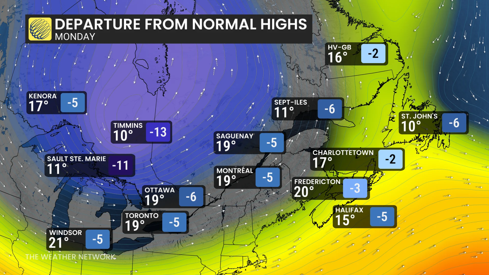
As the associated cold front sweeps cooler air into Ontario and Quebec late Sunday, temperatures will dip below seasonal averages through the start of next week. Unsettled conditions could persist, with a lingering trough potentially keeping the weather pattern active in Ontario during the week ahead.
Stay with The Weather Network for more information and updates on your forecast across Ontario and Quebec.