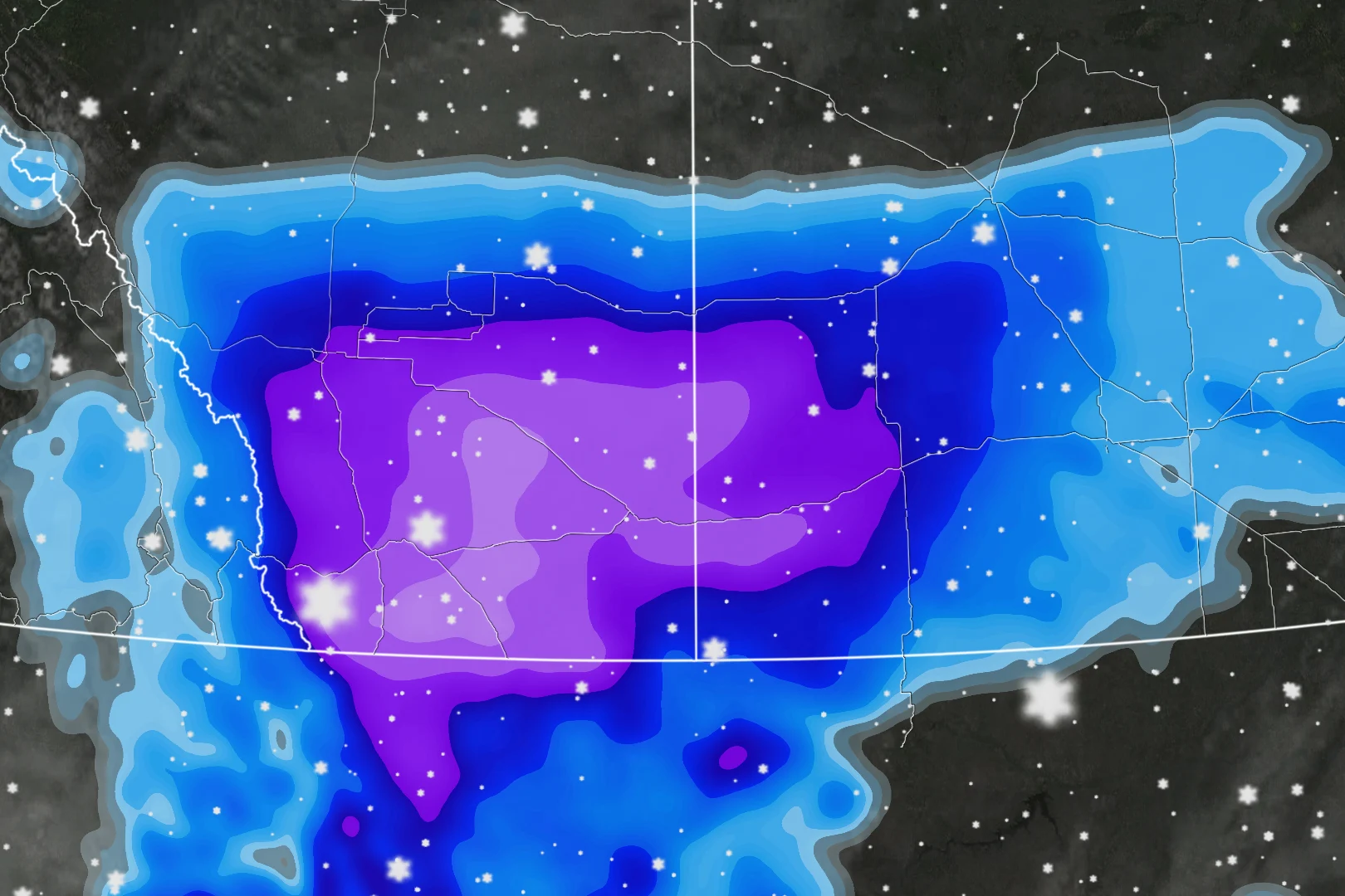
10-30+cm: Southern Alberta, Saskatchewan brace for major snowfall

A potent storm could bring 10-30+cm of snow to parts of southern Alberta and Saskatchewan, likely to make travel hazardous in the hardest-hit regions
This isn't the first snow event of the season for many locales in Alberta and Saskatchewan, and it certainly won't be the last.
Much of southern Alberta, including Calgary, is under a snowfall warning with special weather statements in effect, too. The same alerts extend into southern Saskatchewan. Difficult travel is expected.
SEE ALSO: Exploring Tofino, B.C.: Canada's storm-watching capitol
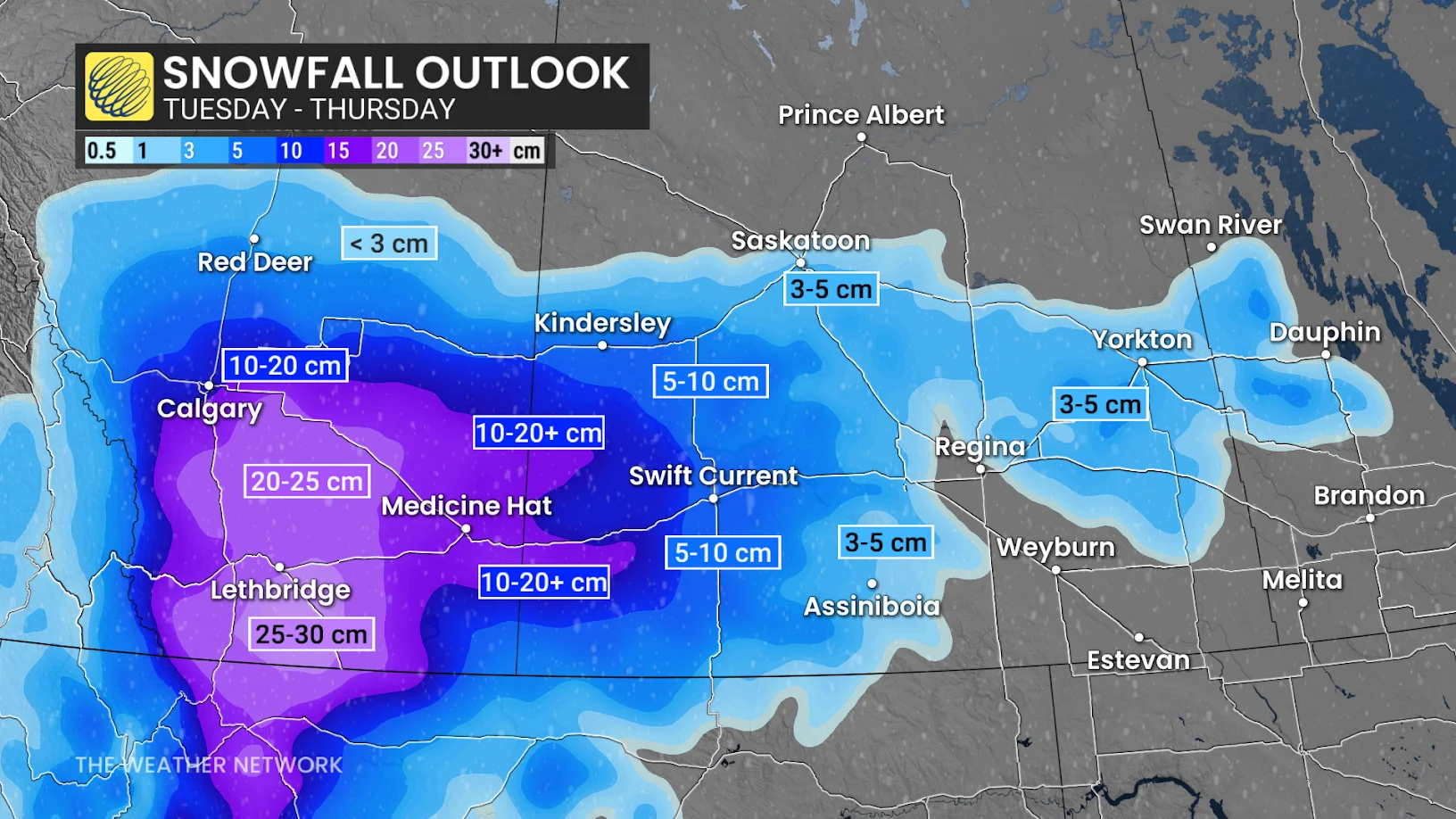
Parts of southern Alberta could see up to 30 cm of snowfall, or locally higher, while parts of Saskatchewan could see more than 20 cm of snow before the event concludes.
"Roads and walkways will likely be difficult to navigate due to accumulating snow. There may be a significant impact on rush hour traffic," Environment and Climate Change Canada [ECCC] states in a snowfall warning. "If driving, turn on your lights, slow down and maintain a safe following distance."
Snowy Wednesday will create difficult travel in Alberta and Saskatchewan
Snowfall is well underway across southern Alberta as snowfall warnings are still in effect. The environment is very saturated and temperatures wll fall below the freezing mark Tuesday overnight.
Snowfall-making will be efficient overnight, and is expected to rapidly accumulate.
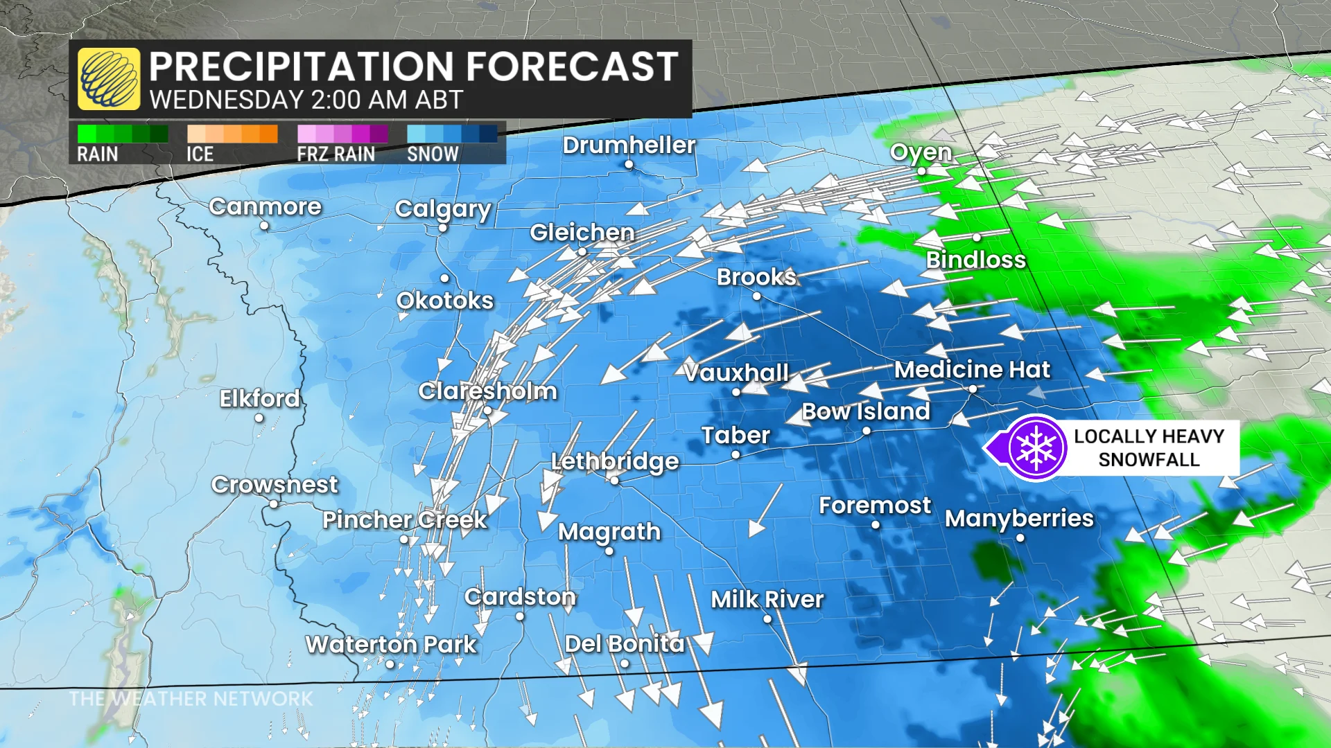
Calgary, Alta., and regions south of it are most at risk for impacts and heavy snow. Totals of 10-15 cm are possible for Calgary airport.
The normal November snowfall accumulations for Calgary airport is 19 cm.
Heaviest snowfall amounts are expected in the southeast. 20-30+cm for Lethbridge, Brooks, Taber, Cardston, Milk River, and surrounding regions. Locally up to 40 cm is possible.
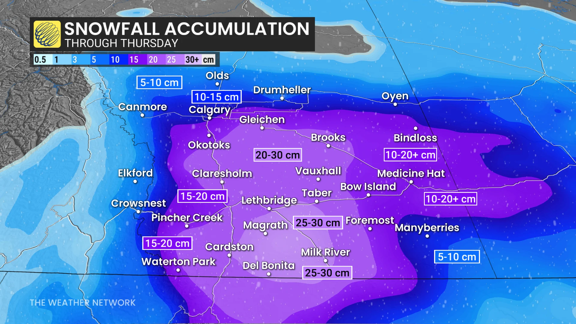
Normal November snowfall for Lethbridge is 16.4 cm, so it may see more than a month's with this event.
By Wednesday morning, very slick roads and significant winter travel delays are expected. Dangerous travel is likely along the QE2 and Highway 3 during the morning commute.
Wind gusts picking up to 40-50+ km/h in the southeast on Wednesday morning will significantly reduce visibility.
Conditions will gradually improve through the day, with flurries lingering into the early evening on Wednesday.
The snowy system will move east into southern Saskatchewan on Wednesday morning.
Regions west of Kindersley are expected to see snow and wind impacts along the Trans-Canada Highway. Wind gusts of 40-60 km/h are expected.
The heaviest snowfall accumulations are predicted in those regions, with 10-20+cm forecast.
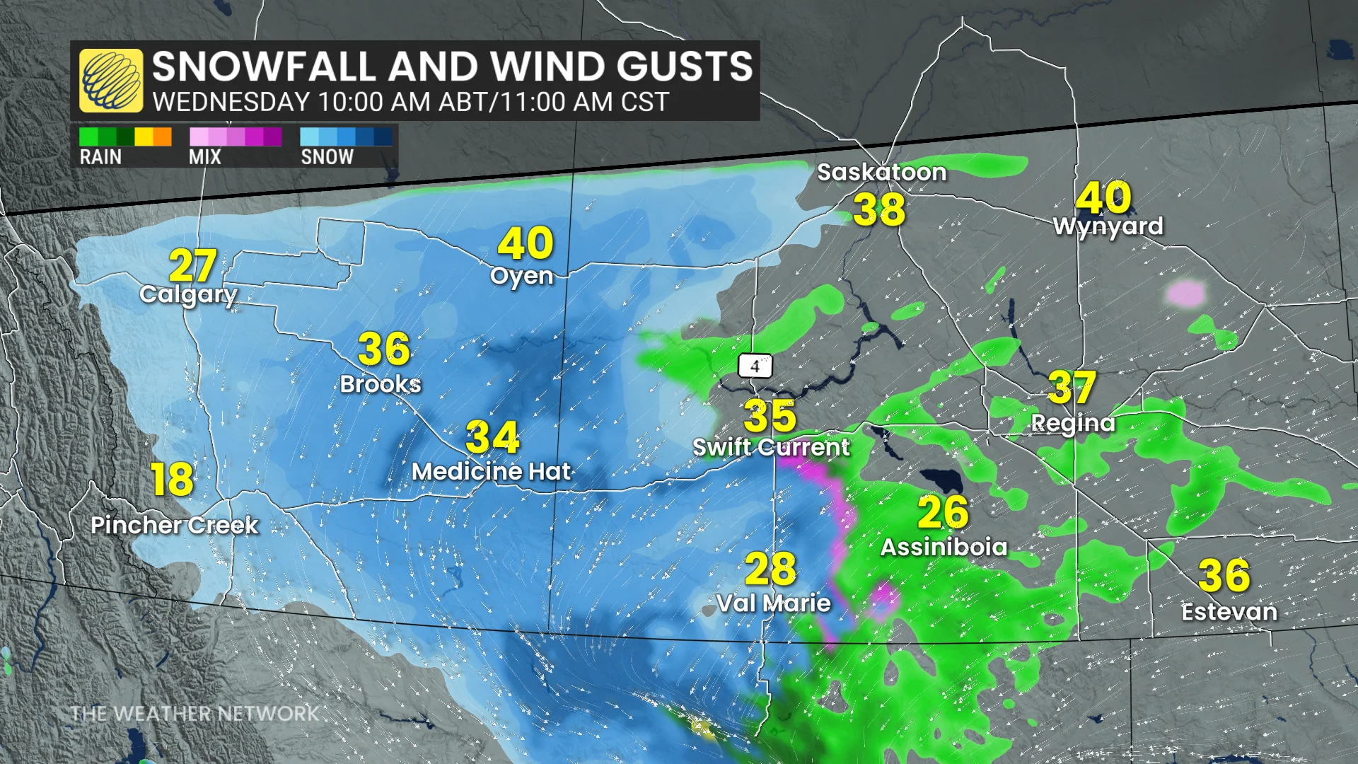
Precipitation will move east through Wednesday afternoon.
Rain changing to heavy snow impacts Regina by early evening on Wednesday. Expect evening commute impacts across southern Saskatchewan.
DON'T MISS: Why cold weather makes your joints hurt
3-5 cm of snow possible in Regina but there is room to increase locally. There is lower confidence, though, with a sharp temperature gradient expected.
Flurries will linger overnight Wednesday into Thursday morning.
Stay with The Weather Network for more information and updates on your weather in Alberta and Saskatchewan.