Watch as thousands of cloud streets billow over the Atlantic

A frigid air mass sweeping off North America led to a tremendous display of cloud streets over the western Atlantic on Sunday
It’s been a frigid couple of weeks for folks across North America as a steady conveyor belt of Arctic air spilled into the lower latitudes.
Temperatures fell as low as -50°C in Alberta with subfreezing temperatures dipping as far south as Florida’s Everglades—cold enough for iguanas to fall out of the trees.
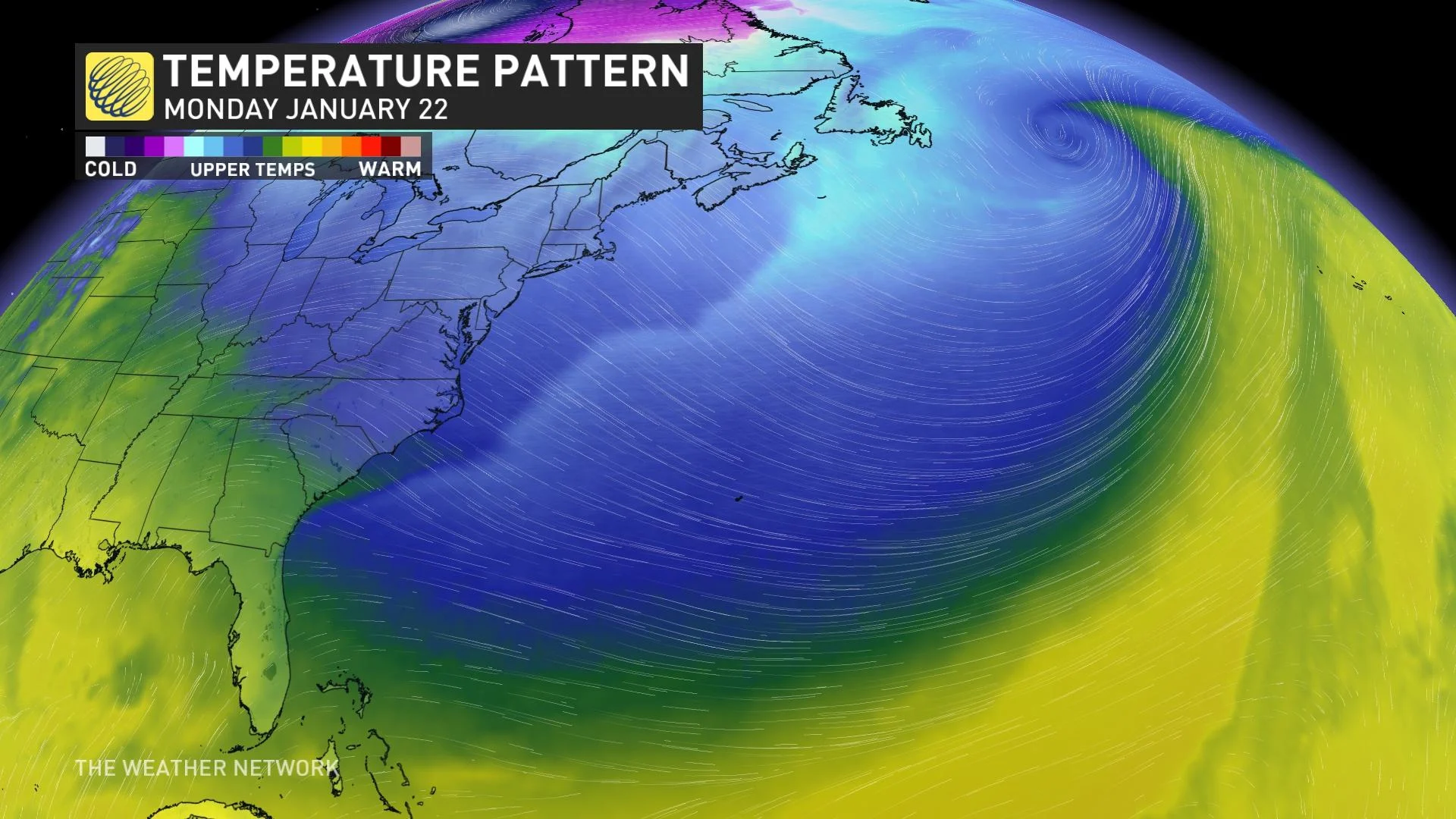
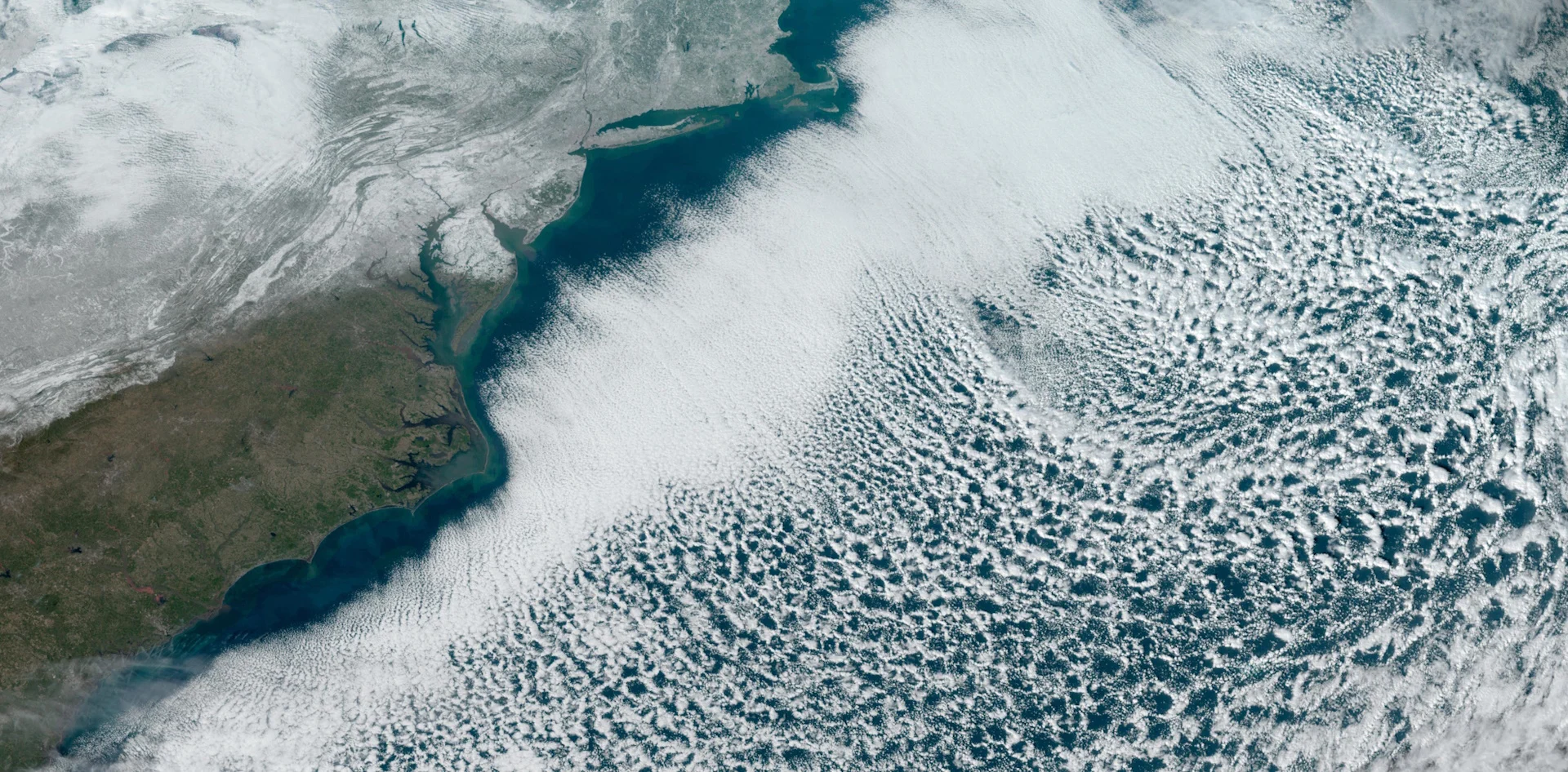
That crisp air didn’t stop at the coast. Frosty winds blowing over the relatively warm Atlantic gave rise to thousands of billowing clouds racing over the open ocean, a fantastic display of beauty amid the winter chill.
DON'T MISS: Heads up! These six special clouds linger in our skies every day
GOES-East has a birds-eye view of the entire Atlantic basin from its steady orbit nearly 36,000 km above the equator.
This satellite has seen just about every Atlantic hurricane, Canadian thunderstorm, and even some of the bigger meteors that have streaked across North America over the past eight years.
It even has a front-row seat to peaceful weather, and Sunday’s placid satellite imagery is a sight for sore eyes.
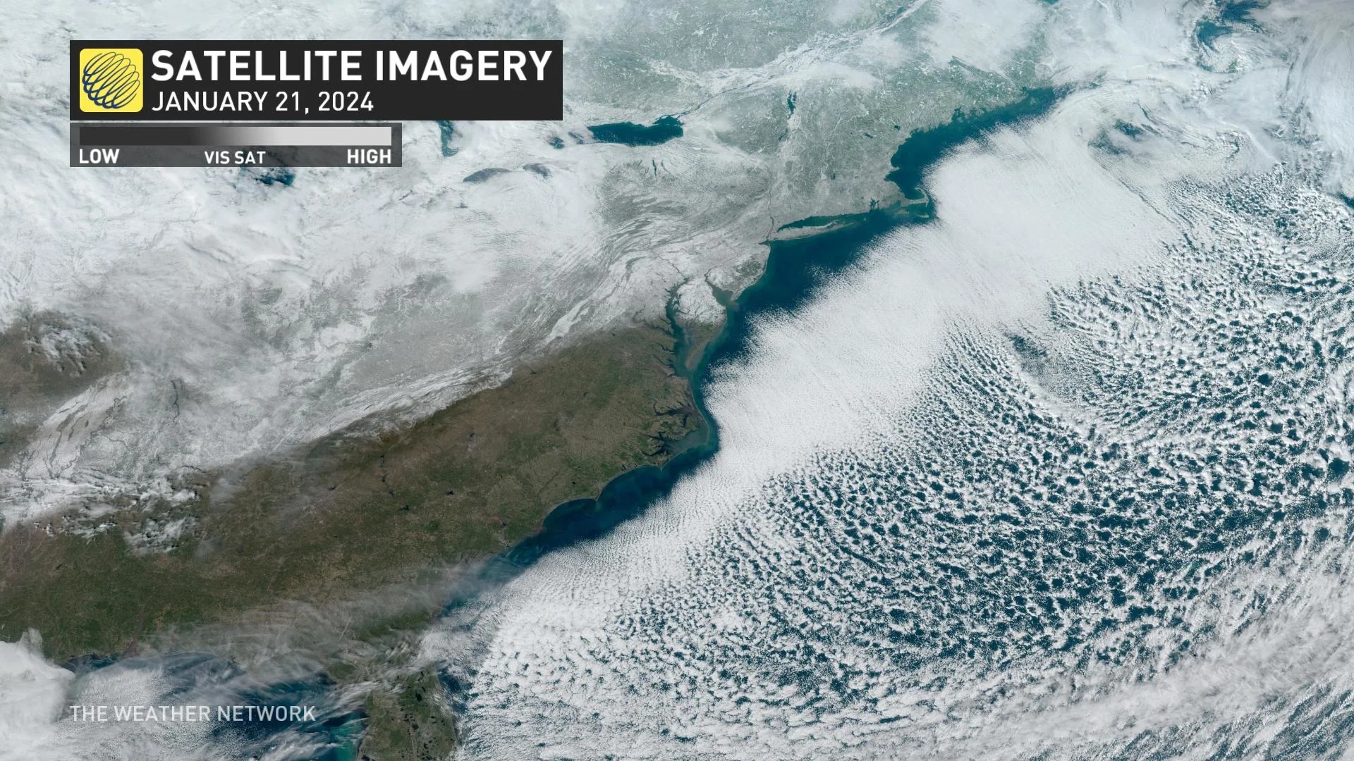
Clear and sunny skies dominated much of the eastern U.S. and Canada on Sunday behind a cold front that slid through a few days ago. We can see the snow that blankets Eastern Canada all the way into the American south, where some cities finally broke their years-long snow drought.
But the most striking effect of the cold air is the fabulous display of clouds wafting over the ocean like steam rising from a fresh bowl of soup. All those thousands of individual bands of clouds streaming downwind are collectively known as cloud streets.
WATCH: Cloud streets fill the skies as frigid air blows over the Atlantic
MUST SEE: How this island churns out dozens of mesmerizing, swirling clouds
Water temperatures over the western Atlantic are hovering around 20-21°C near the Gulf Stream this week, which continues a long-running trend of above-seasonal water temperatures. Much like we see on the Great Lakes during Arctic outbreaks, the sharp contrast between cold air flowing over warm water is a recipe for convection.
Warm ocean waters heat and moisten the cold air touching the sea surface, allowing that moist air to rise through the colder air above and create countless puffy cumulus clouds.
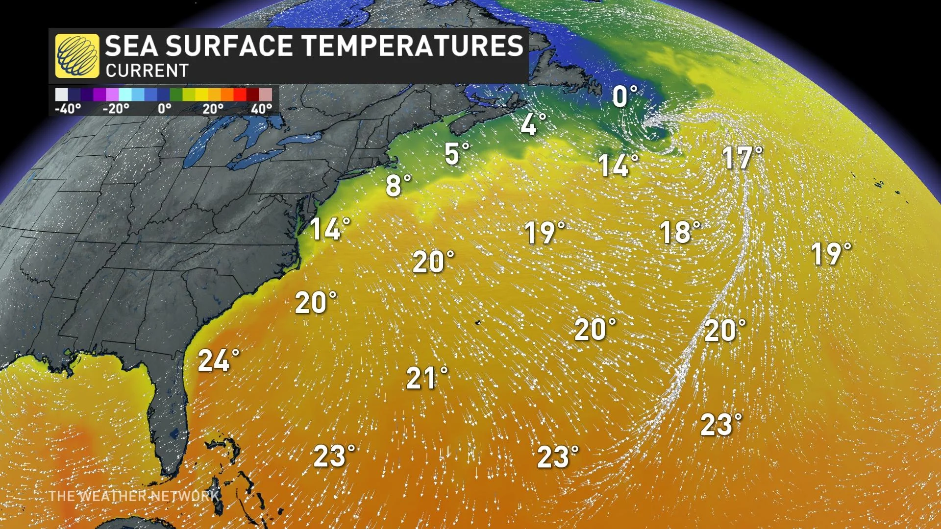
Rising air cools off and begins to sink after creating the cumulus cloud, leading to clear patches around the clouds.
Stiff winds organize these cloud fields into a mass display of neat streets that trace the outline of the wind like a rake through the sands of a Zen garden.
What’s even more noticeable is how this process doesn’t begin immediately. Ocean waters right off the coast are much shallower—and much colder—than they are a few dozen kilometres offshore. The convection required to generate those clouds doesn’t begin until the Arctic winds reach the toasty Gulf Stream far from the coast.
Header image courtesy of NOAA.