United Nations votes to adopt a more representative world map

While the vote isn’t binding, the new standard may appear more frequently going forward
The United Nations last week overwhelmingly voted in favour of a new standard projection for the world map that more fairly represents the size of countries and continents alike.
Developed in 2018, the international body adopted the Equal Earth projection as the new standard for the world map to replace the centuries-old Mercator projection.
While the vote isn’t binding, the new standard may appear more frequently in the future.
DON’T MISS: Are your maps accurate? How these tools can struggle to capture our world
Map projections are serious business. Determining how we draw our three-dimensional world on a flat surface is a make-or-break effort for countless industries and purposes.
All map projections distort our globe to some extent, which means that drawing one location realistically requires sacrificing accuracy in another part of the world to make up the difference.
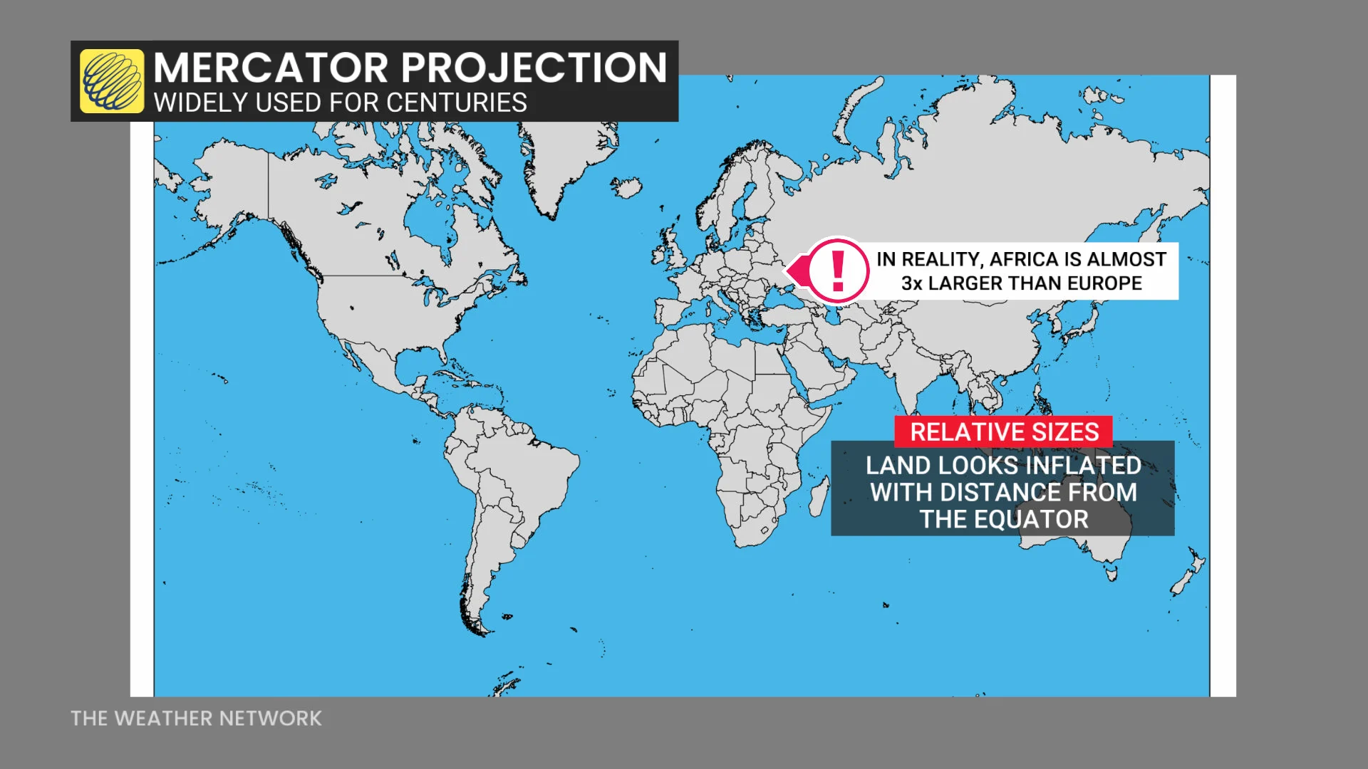
Mercator, the boxy projection popular among navigators for centuries, draws frequent derision because it inflates the size of land areas with distance from the equator.
This has been a major problem for regions that don’t appear as their representative sizes, such as Africa, where concerns exist about perceptions regarding size and importance on the world stage. One would hardly guess that Europe is nearly three times smaller than Africa after looking at a map drawn in the Mercator projection.
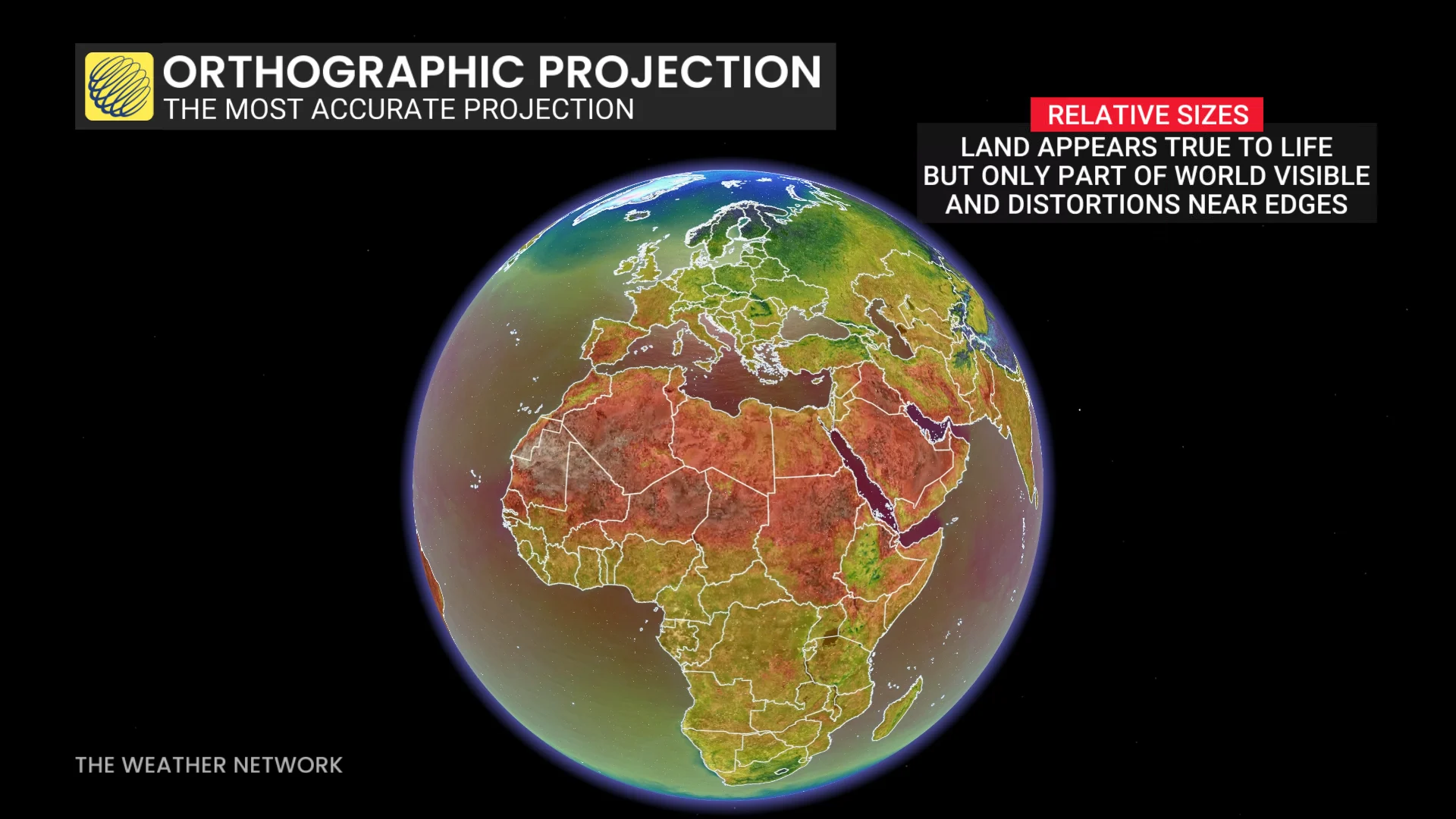
Most weather maps are generated using the orthographic map projection, which emulates the view you’d see of Earth from space. Despite its realism, this view has its limitations. We can only see one side of the Earth at a time, and land appears distorted near the horizon.
What about a happy medium between the two?
Mapmakers have laboured through the years to develop more realistic projections with the fewest sacrifices possible.
RELATED: Where was Canada 320 million years ago? New map lets you explore
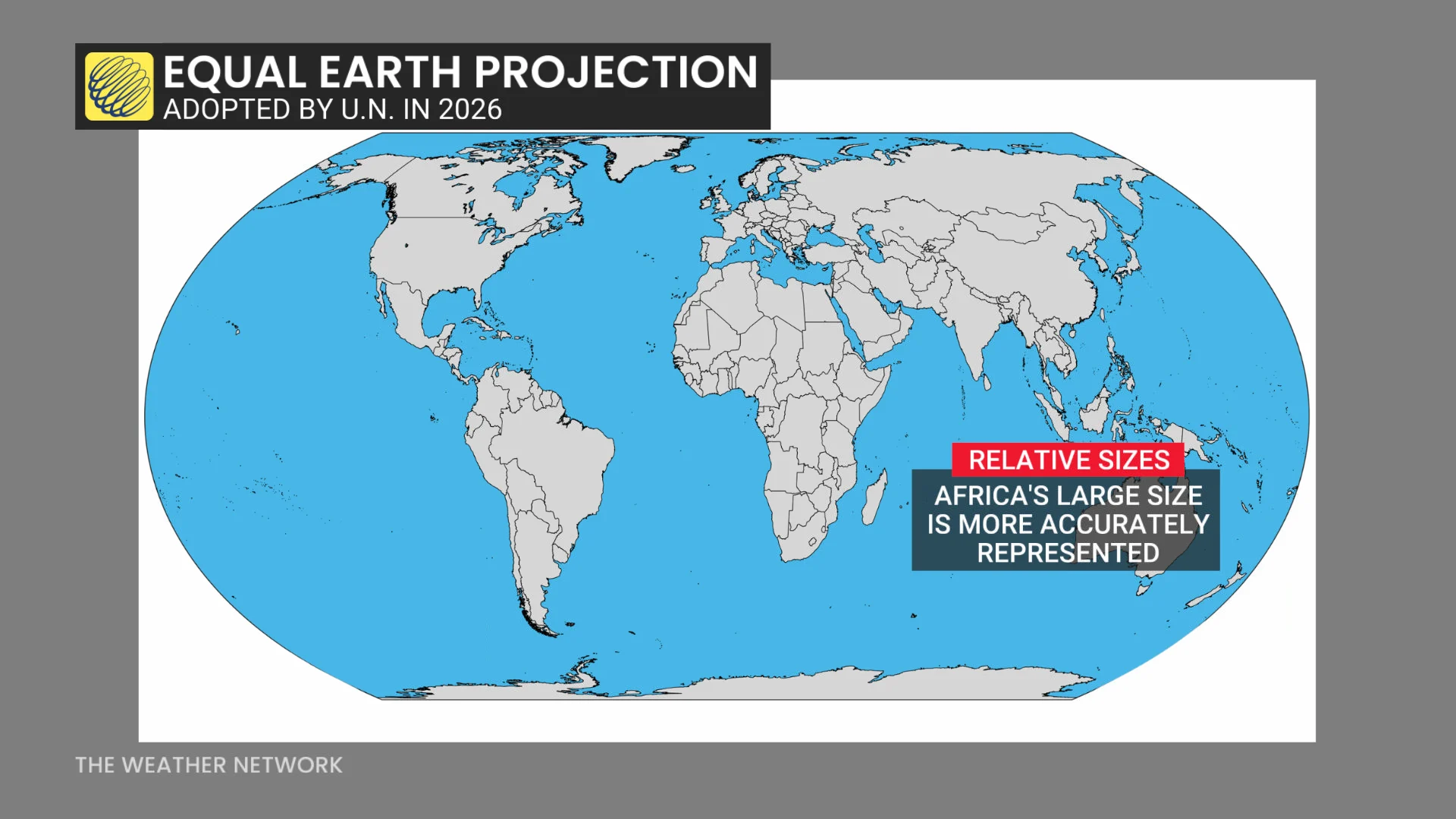
Equal Earth, created in 2018, preserves the relative size of land areas, as well as lines of latitude and longitude, while also creating curved edges rather than a blocky appearance.
Member states in the United Nations voted almost unanimously on Friday to endorse the Equal Earth projection over other more popular but less representative projections like Mercator.
“The resolution says those distortions have contributed to the ‘symbolic minimization’ of Africa and perpetuated an unbalanced view of the world,” the U.N. said in a press release after the vote.
The tiny nation of Togo led the continent’s efforts to pass the resolution and update how we see the blue marble we call home.
Friday’s resolution isn’t binding, nor does it ban the use of other projections such as Mercator.
“Instead,” the U.N. said in its release, the resolution “encourages governments, schools, international organizations and technology companies to use the Equal Earth projection and other so-called equal-area maps when relative size matters, and to teach the limitations of any flat map in representing a spherical planet.”