Earth shows off in first image released by brand-new weather satellite

Europe’s latest weather satellite will keep a watchful eye on conditions across hemispheres
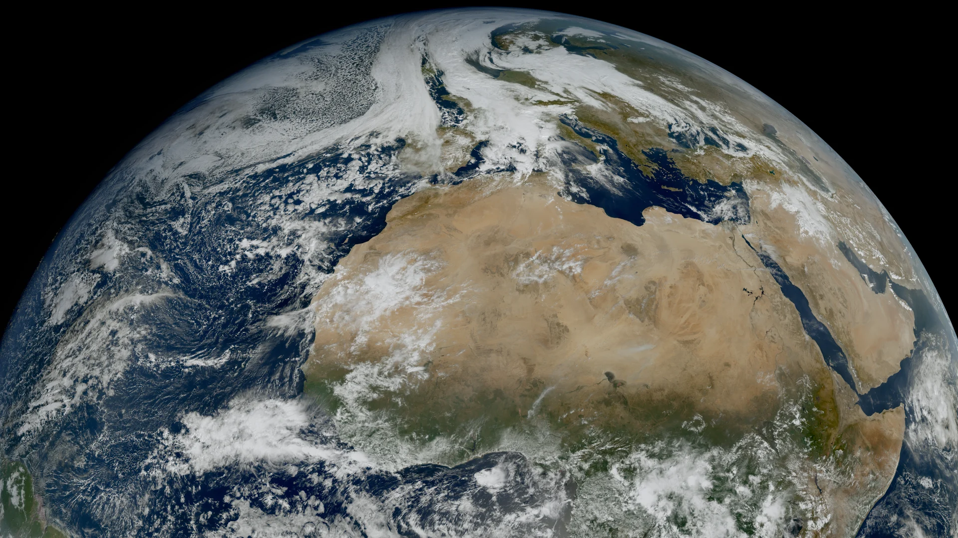
Earth looked simply stunning in the first image released by a brand-new European weather satellite.
Meteosat-14 will soon keep a watchful eye on skies over Europe, Africa, southwest Asia, and the far eastern Atlantic Ocean. The state-of-the-art instruments will help forecasters track critical storms, wildfires, and clouds of dust.
DON'T MISS: GOES marks 50 breathtaking years of watching Canada’s skies
EUMETSAT released the first full-disk image of Earth from the new satellite on Nov. 6, capturing a crystal-clear view of Europe and Africa.
The new satellite launched into orbit this past August from the Guiana Space Centre along the northern shores of South America.
Similar to the pair of GOES satellites that watch over the Americas, the Meteosat family operates in a geostationary orbit more than 36,000 km above Earth’s surface.
Geostationary orbits perfectly match the vehicle’s speed with the rotation of the Earth, keeping the satellite parked over a precise location to provide the same view for its lifespan.
Dubbed MTG-I2 before it officially enters service, the satellite carries numerous advanced instruments to keep track of the skies over the region.
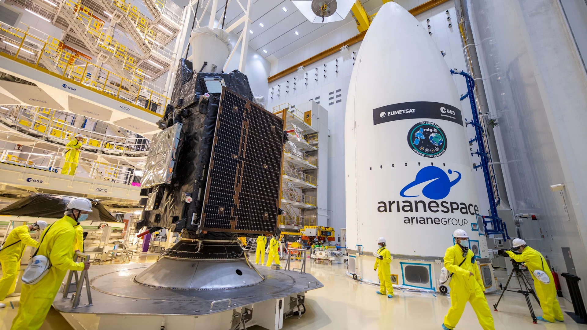
MTG-I2 loaded onto the fairing that will attach it to the rocket. (ESA/EUMETSAT)
A Flexible Combined Imager (FCI) provides the visible, infrared, and water vapour imagery we see in weather presentations on a daily basis. The updated FCI offers four more bands (wavelengths), enabling experts to analyze even more aspects of our atmosphere.
It’s the speed and resolution of the new FCI that’s particularly exciting.
The new generation of satellites will take full-disk imagery every 10 minutes, with rapidly updating imagery of Europe and northern Africa every 2.5 minutes.
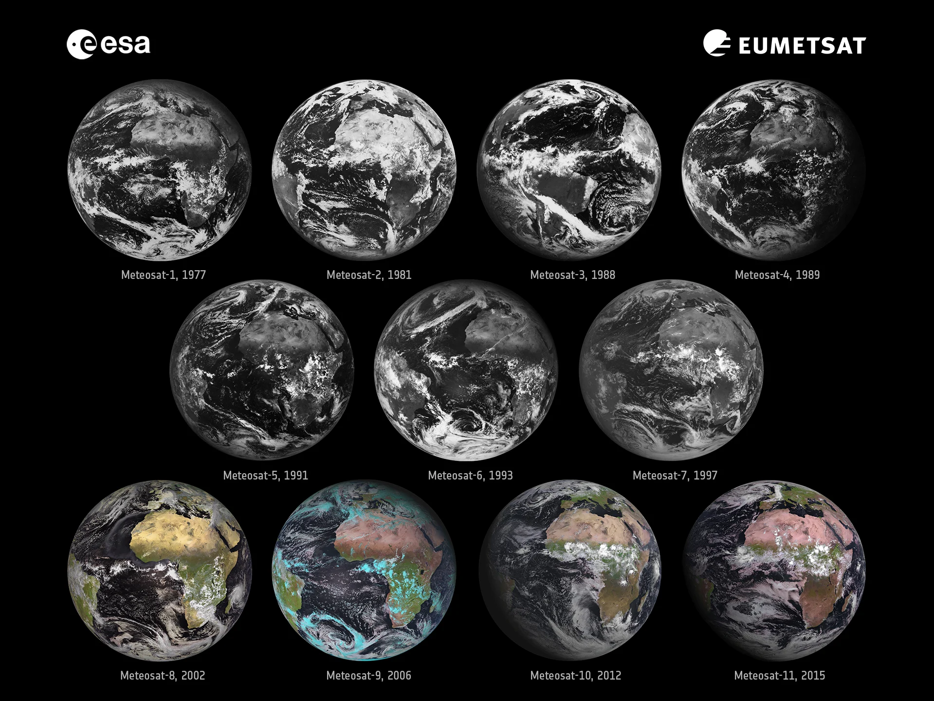
The inaugural images released by each of the first 11 Meteosat vehicles. (ESA/EUMETSAT)
Additionally, a finer resolution of just 1-2 km will provide more granular views of cloud structures, wildfires, and other points of interest.
The Lightning Imager (LI) is similar to the Global Lightning Mapper (GLM) included on the current series of GOES satellites. Four cameras take more than 1,000 images per second to capture lightning strikes across more than 85 per cent of the visible side of Earth.
Lightning detection from space is a major technological advancement.
Meteorologists can track the development of storms far away from weather radar sites. Observing lightning activity in fire danger zones can help the deployment of crews and aid. Increased lightning activity can even signal the imminent strengthening of a tropical cyclone. The instrument is also capable of spotting bright meteors entering the atmosphere.
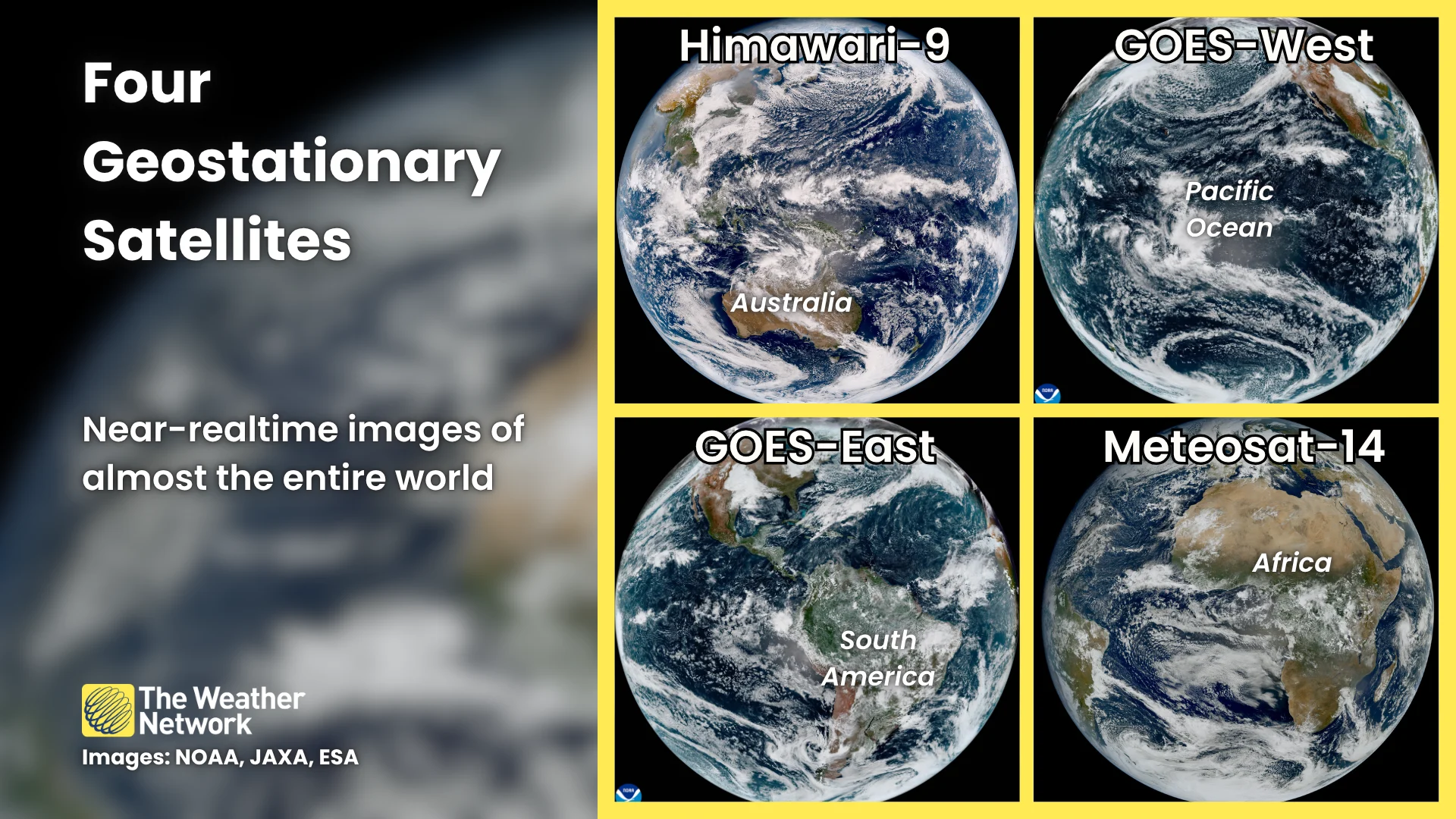
Meteosat-14 will join a constellation of geostationary weather satellites that keep a constant watch over the world's skies. Combined with GOES-East and -West, as well as Japan's Himawari-9, we now have access to near-realtime monitoring of almost the entire world.