
Canada's first severe thunderstorm of the year was followed by snow
A Texas low packed a wallop when it came through southern Ontario Saturday, generating snow, ice, heavy rain, damaging wind gusts and even Canada's first severe thunderstorm warning of the year
Saturday in Ontario was a prime example of what Mother Nature can deliver in a transitional season.
A strong Texas low moved across Lake Huron Saturday afternoon, while a trailing cold front swept across southern Ontario. The storm brought almost everything you can think of in a spring storm: Snow, freezing rain, rain, intense, damaging wind gusts, and even a severe thunderstorm.
SEE ALSO: How vivid thundersnow stole the show in Toronto's big snowstorm
The result saw numerous trees and hydro poles toppled, large waves generated and power cut to thousands at one point.
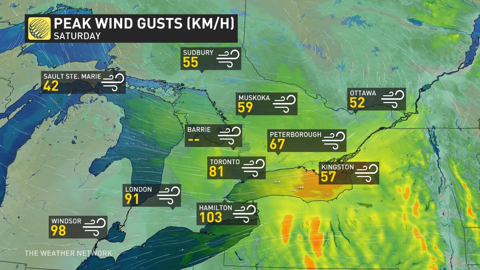
The winds were quite blustery in parts of southern Ontario, with a 103 km/h gust recorded in Hamilton, 98 km/h documented in Windsor and 81 km/h observed in Toronto.
Just before 3:30 p.m. EDT on Saturday, Canada had its first severe thunderstorm warning issued by Environment and Climate Change Canada (ECCC).
The cell developed northeast of Lake St. Clair and then intensified, bringing with it wind gusts exceeding 90 km/h. The bulk of the cell passed northwest of London, Ont., impacting communities such as Strathroy-Caradoc and Lucan.
It's a reminder we're still in the early season of thunderstorm activity as it was snowing by 10 p.m. over the same region.
The thunderstorms were moving in excess of 80 km/h as the upper-level winds were racing, all associated with a powerful Texas low moving through the area.
Below is a selection of visuals from the storm currently circulating on social media.
WATCH: Serious sparks fly as powerful winds rip across through southern Ontario
Thumbnail courtesy of Aric/Twitter/@ARICBRINDLEY1.