
More rain may impact Lee’s cleanup in the Maritimes, effects linger Sunday

The worst of post-tropical storm Lee may be over, but there will be residual effects on Sunday in the Maritimes as some of the rain and winds move into Newfoundland. Cleanup efforts could be hampered by more unsettled conditions early this week
The peak of Lee’s impacts are over, but some of them will linger in Atlantic Canada Sunday as affected communities in the Maritimes begin to take stock of the damage.
Visit The Weather Network's hurricane hub to keep up with the latest on tropical developments in Canada and around the world
Unsettled conditions associated with Lee will hang on in the Maritimes into Sunday before winding down in the afternoon. Some of the rainfall and winds associated with Lee's remnants will make their way into Newfoundland Sunday.
However, the cleanup effort may be hindered by another round of rainfall in the coming days.
RELATED: PHOTOS: Powerful Lee leaves impactful mark on the Maritimes, one injured
WATCH: House shifted off its foundation as Lee hits Peggy's Cove
Sunday
Areas: Atlantic Canada
Timing: Lee eases Sunday afternoon
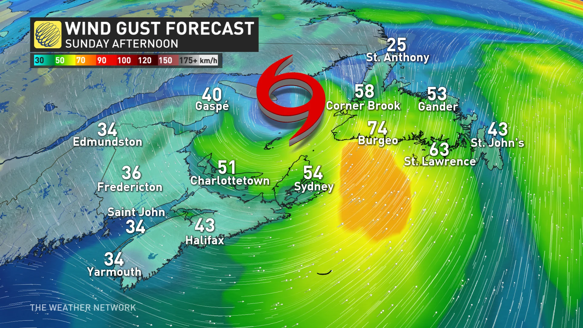
Weather: Post-tropical storm Lee’s rainfall will target the eastern Maritimes through Sunday afternoon, along with gusty winds. Wind gusts of 60-90 km/h possible, especially along the eastern Nova Scotia coast.
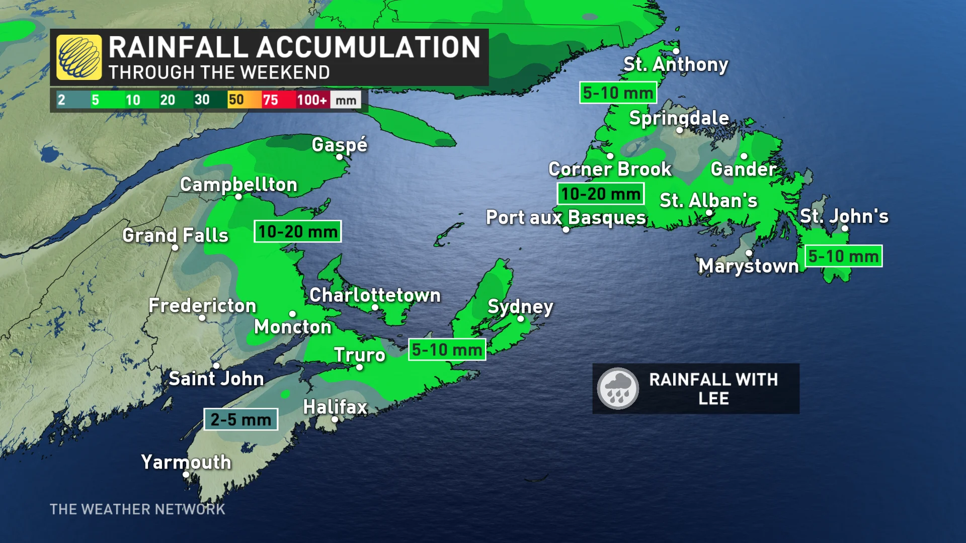
Rainfall will be spotty and light in Nova Scotia, but heavy at times in northeastern New Brunswick and Gaspé Peninsula in Quebec where rainfall warnings hold on, with an additional 10-20 mm expected.
Lee is expected to move into Newfoundland with 10-20 mm of rain for the southwest, and winds near 60 km/h over the island through Sunday.
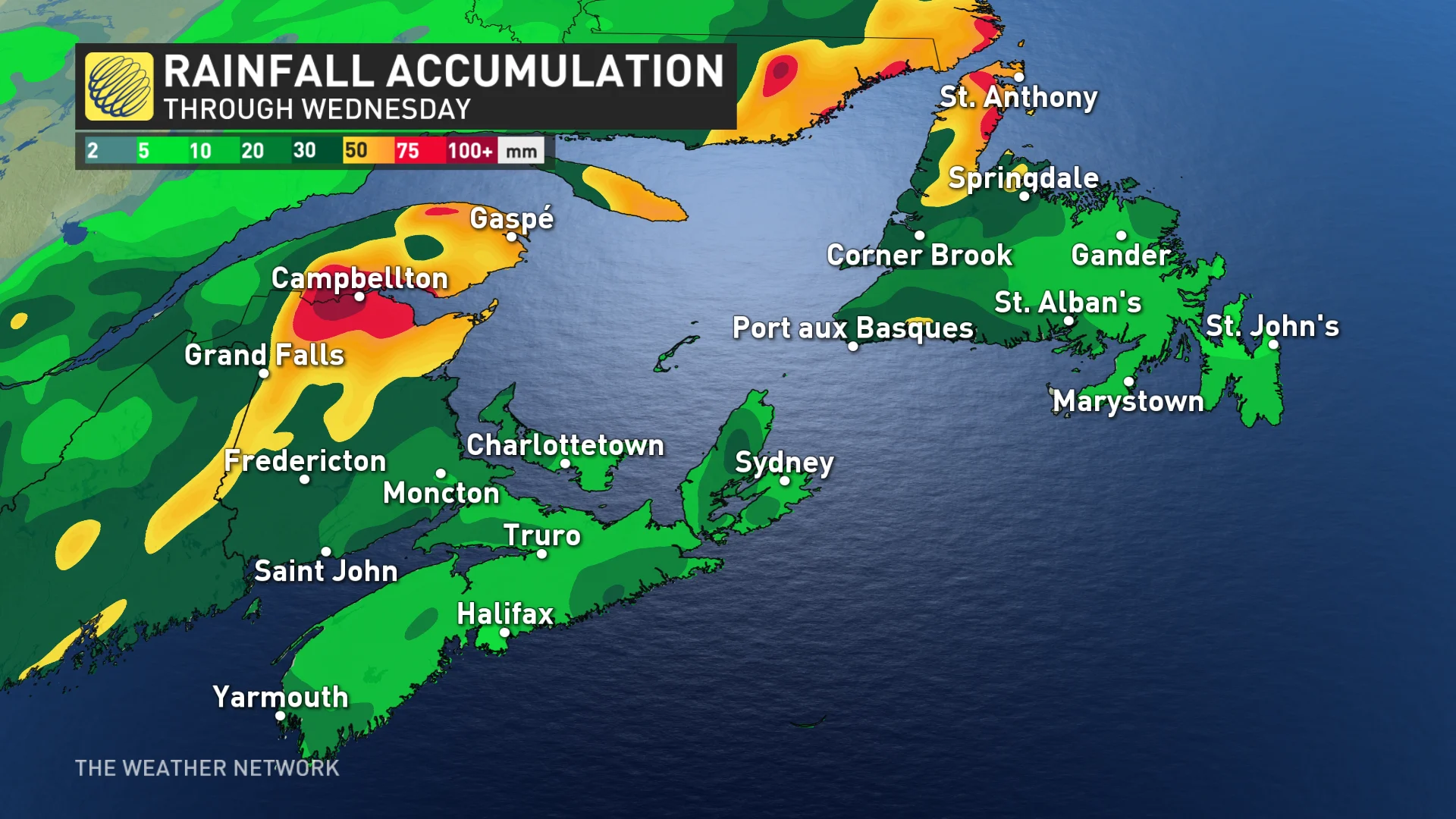
Stormy conditions will ease through Sunday afternoon in the Maritimes from west to east, with a much-needed dry period into Monday. However, another system will likely interrupt with yet another round of heavy rainfall by late Monday into Tuesday.
Confidence: High
Monday-Tuesday
Areas: Maritimes
Timing: Late Monday to Tuesday
Weather: Another rainy system will swiftly follow Lee, targeting eerily similar locations in the Maritimes with more heavy rainfall.
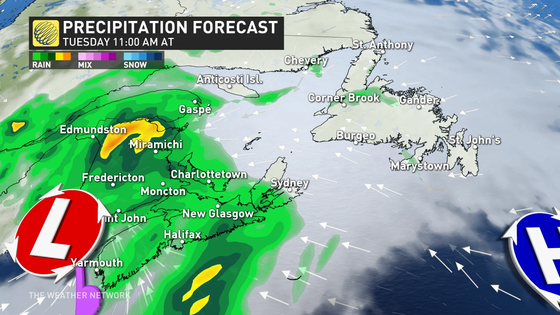
While there is still room for change in the storm track, there is some confidence for high rainfall totals in New Brunswick and the Gaspé Peninsula -- regions that were hit the hardest with Lee’s rains already.
Winds are expected to be near 40-70 km/h during the event, potentially enough to add to the tree and power line damage from Lee, especially with the highly saturated ground.
Confidence: Medium
DON'T MISS: Storm surge, winds cause damage in N.S. South Shore communities
Stay with The Weather Network as we continue to update the forecast for Atlantic Canada.
Header image courtesy of Nova Scotia Power/X.