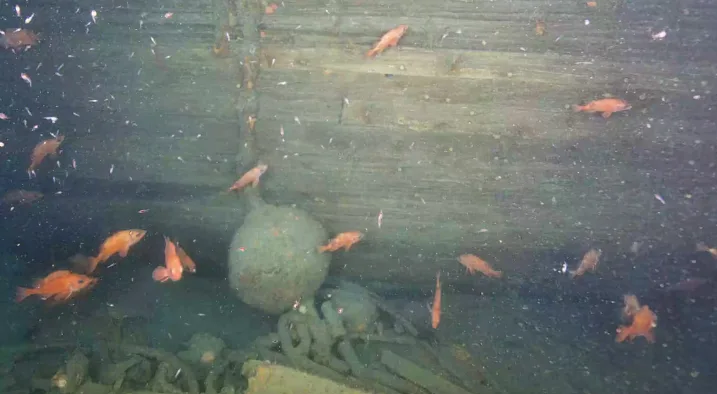
Underwater images reveal 1st look at explorer Ernest Shackleton's Quest

An expedition almost 400 metres below the surface of the Labrador Sea is revealing the first images of Quest, the ship that carried famed Antarctic explorer Sir Ernest Shackleton on his final voyage.
The Royal Canadian Geographical Society (RCGS) sent a remotely operated vehicle (ROV) down to capture images of the ship where it sank off the coast of Labrador in 1962.
CBC News is on board the research ship Atlantis with exclusive access to the expedition as the first images were revealed to show the stern of the exploration ship tangled in fishing lines.
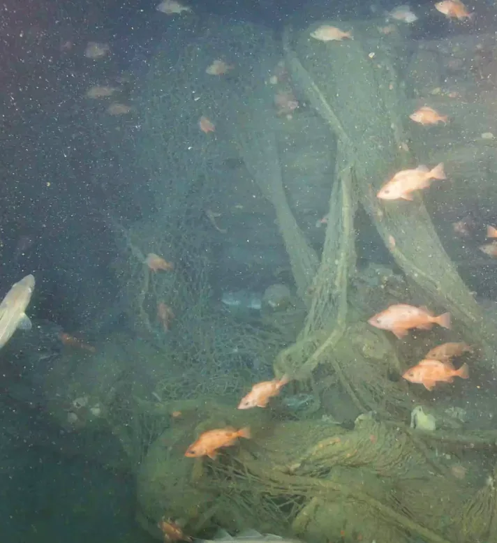
The first images from the expedition show that much of Quest is covered in old fishing gear. The wreck is located in the Hawke Channel, which was closed to fishing in 2002. (Canadian Geographic)
"It doesn't look good," said David Mearns, co-chief scientist for the expedition and a professional shipwreck hunter who's found 29 wrecks.
Mearns worries that the nets have damaged the wreck more than if it had just sat on the floor of the ocean undisturbed. The location of the wreck of Quest was first discovered by the RCGS two years ago using side-scan sonar.
"We didn't get any indication of nets in the original side-scan data, but it's clear here. It is what it is, it's disappointing."
This expedition to get the images is the largest ever by the society, with a price tag in the millions of dollars.
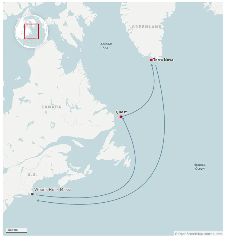
The RCGS partnered with the Massachusetts-based non-profit Woods Hole Oceanographic Institution, using their ship and submersible to explore two shipwrecks in the Labrador Sea.
John Geiger, the CEO of the RCGS and the head of the expedition, was in the submersible Alvin when it made the very first dive on the wreck.
"Suddenly, you see the bow of the ship coming out of the darkness and it emerging," he said. "And you start to think about Shackleton. You think about where that ship has been. It's very moving."
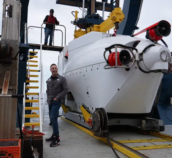
Entrepreneur Mark Pathy joined the head of the Royal Canadian Geographical Society on the first dive down to the wreck of Quest aboard the submersible Alvin on Tuesday. (Peter Cowan/CBC)
The last ship of Ernest Shackleton
Quest was initially purchased by Shackleton to explore Northern Canada, but when the Canadian government wouldn't back the expedition, he instead explored Antarctica.
He died of a heart attack on board the ship in January 1922 near South Georgia, a remote island 1,400 kilometres southeast of the Falkland Islands.
During the Second World War it was used as a minesweeper. After that it was used by a Norwegian company to hunt seals.
It sank in 1962 off the south coast of Labrador after ice crushed the hull. Though all the crew made it off the ship alive, its cargo of thousands of seal pelts was lost.
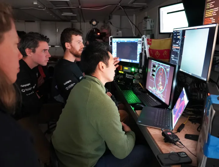
Members of an underwater expedition crew aboard the research ship Atlantis used a remote operated vehicle to capture the first images of the Quest shipwreck some 400 metres below the Labrador Sea on July 7, 2026. (Peter Cowan/CBC)
Wreck confirmed to be Quest
The name and registration number of the ship aren't visible, but research director Antoine Normandin, who did the calculations to find the original location, says it's clearly Quest.
"There's clear distinguishing features that we found Quest," he said, pointing to two distinctive portholes below the bridge that match old photographs of the ship.
"It's always disappointing to know that the wreck has been damaged by trawl fishing, but I'm just very happy to see that some of the more important sections from a historical perspective remain intact."
The wreck sits in the Hawke Channel that has been closed to fishing since 2002.
Part of the mission includes creating a digital twin of the wreck using 3D imaging technology.
Fishing nets are obscuring much of the starboard side of the ship, making it more difficult to get imagery of the ship underneath.
The shipwreck was discovered in 2024 and researchers hope the RCGS expedition will answer questions about what has survived, what has changed and what the wreck — and the 300-metre debris field around it — can reveal.
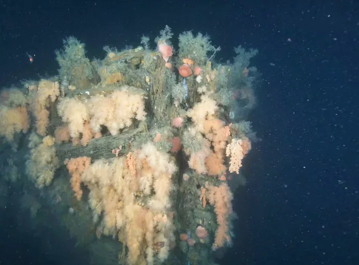
Underwater images taken on Tuesday show the bow of Quest covered in soft coral. (Canadian Geographic)
Expedition heading for 2nd wreck
After several days of diving on Quest, the expedition will head to the southern tip of Greenland to explore another wreck — Terra Nova, a ship that was originally owned by the Bowring Company based out of St. John's.
Robert Falcon Scott used Terra Nova to reach the South Pole during his fatal expedition in 1912.
Planned route to the Quest and Terra Nova shipwrecks
CBC
This article, written by Peter Cowan, was originally published for CBC News.