June nearly broke global heat records despite cooling effect of La Niña

The world just endured one of the hottest months on record.
Even with the cooling influence of La Niña still in full swing, global temperatures soared in June. As a result, concerns are now rising around what record-shattering temperatures we may see when this cool pattern ends, or even worse, if a new El Niño develops.
The major climate monitoring agencies worldwide have completed their tally of June global temperatures. According to NASA, last month tied with June 2020 as the hottest month of June in their records, which date back to 1880. Europe's Copernicus Climate Change Service and the Japan Meteorological Agency ranked it the third warmest. Meanwhile, in NOAA's records, the month ended in sixth place. However, when they only counted stations on land — where the vast majority of humanity lives — the month shot up to second hottest, behind June 2021.
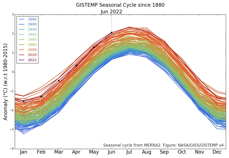
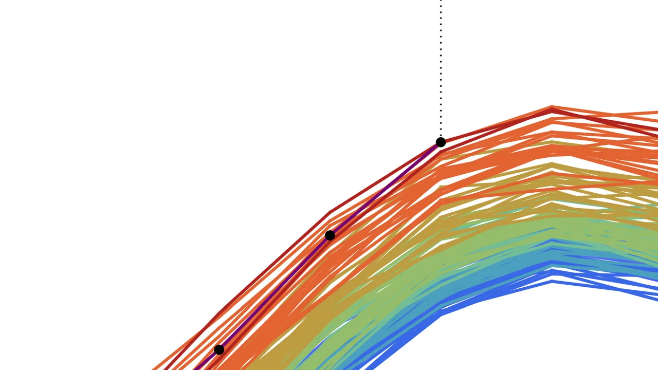
This graph ranks global temperatures against the average monthly temperatures from 1980 to 2015, putting them into perspective for Earth's seasonal cycles. According to NASA's records, June 2022 ranked as tied for the hottest month of June since 1880. (NASA GISS)
LA NINA IS STILL COOLING, FOR NOW
So far this year, global temperatures have been on the cooler side due to a stubborn "double-dip" La Niña that has been in effect since late 2020.
La Niña is the "cool phase" of the El Niño Southern Oscillation (ENSO) — a large-scale climate pattern of wind and ocean temperatures across the Pacific that significantly influences global temperatures. During a La Niña, cold waters well up from deep in the ocean to the west of South America. This causes weather patterns to shift, and as the cold water absorbs heat from the atmosphere, it results in slightly cooler conditions for the globe. During an El Niño (the "warm phase" of ENSO), that upwelling of cold water is cut off, and a significant amount of heat is released from the ocean surface back into the atmosphere.
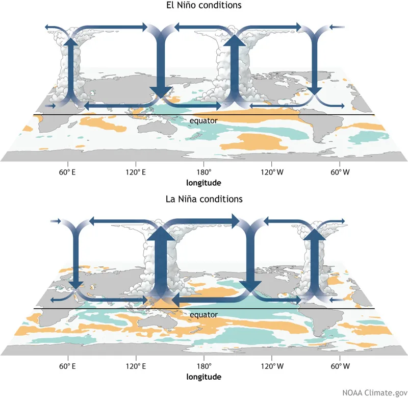
These two illustrations show the wind and water temperature patterns typical of the El Niño (top) and La Niña (bottom) phases of ENSO. (NOAA Climate.gov)
In 2015 and 2016, a record-breaking El Niño pushed each of those successive years into the top spots on the list of hottest years on record. Even now, six years later, 2016 still retains its record status. A more moderate El Niño in 2019 released enough extra heat that the year beat out 2015 for 2nd hottest, and it nearly topped 2016's record. The following year, in 2020, when we were transitioning from El Niño to La Niña, global temperatures came even closer to beating those in 2016.
The last year and a half have been significantly cooler under the influence of La Niña. As a result, 2021 came in as the sixth warmest year, and 2022 is — so far — continuing this trend.
However, the extreme heat events we are seeing so far in 2022, despite the La Niña, will undoubtedly impact the year's final ranking. Also, this La Niña will eventually end, with indications that we will likely transition to "ENSO-neutral" (when neither the hot nor the cold phase dominates) in 2023.
What can we expect when that happens?
Once La Niña's cooling influence is removed, global temperatures will rise, even under the resulting normal conditions. As we saw in 2019 and 2020, the first year after this La Niña could challenge 2016's ranking as the hottest year on record. Given ever-increasing greenhouse gas emissions and some of the extreme heat events we've witnessed recently, it may even edge 2016 out of that top spot.
In all likelihood, the next El Niño — even if it is a moderate one — will result in global temperatures shattering previous records.