Most of Canada sees 'above average' summer wildfire risk, worst in the West

Natural Resources Canada has released its outlook for the 2020 fire season.
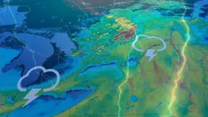
Most of Canada is looking at an above-average season of wildfire risk, rising to well above average for the western half of the country for much of the summer.
That's according to models released by Natural Resources Canada (NRCAN) scientists earlier this month, based on a "40-member ensemble of predicted monthly temperature and precipitation anomalies using two numeric weather prediction models."
DON'T MISS: The Weather Network's official 2020 Summer Forecast coming to all platforms on June 1.
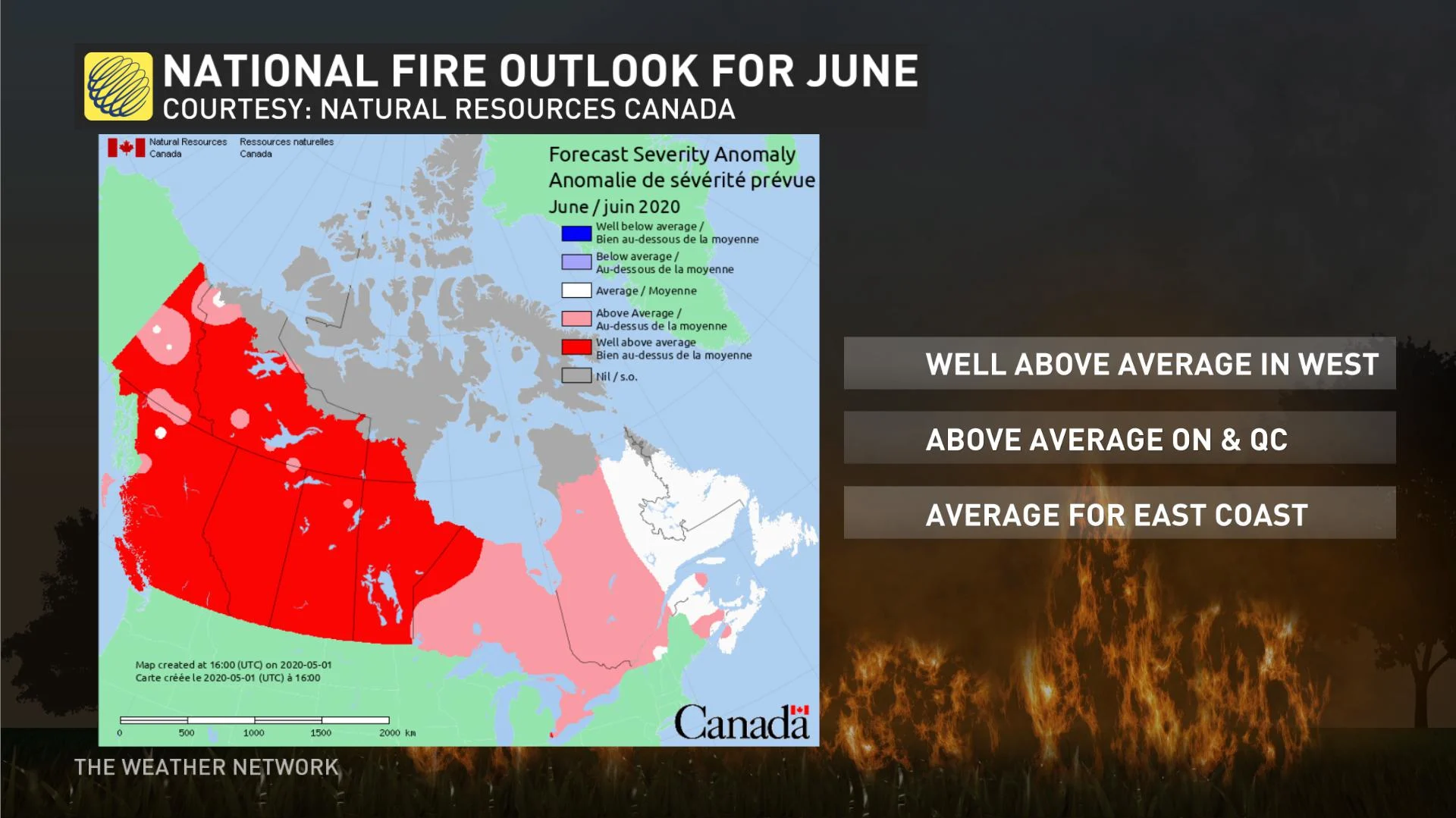
Under the latest forecasts, eastern Quebec and most of Atlantic Canada are the only parts of the country that look to have a near-normal fire danger in June, with most of the rest of Quebec and Ontario looking at above-average risk," and everything from Manitoba through to British Columbia and Yukon sitting at well-above-average.
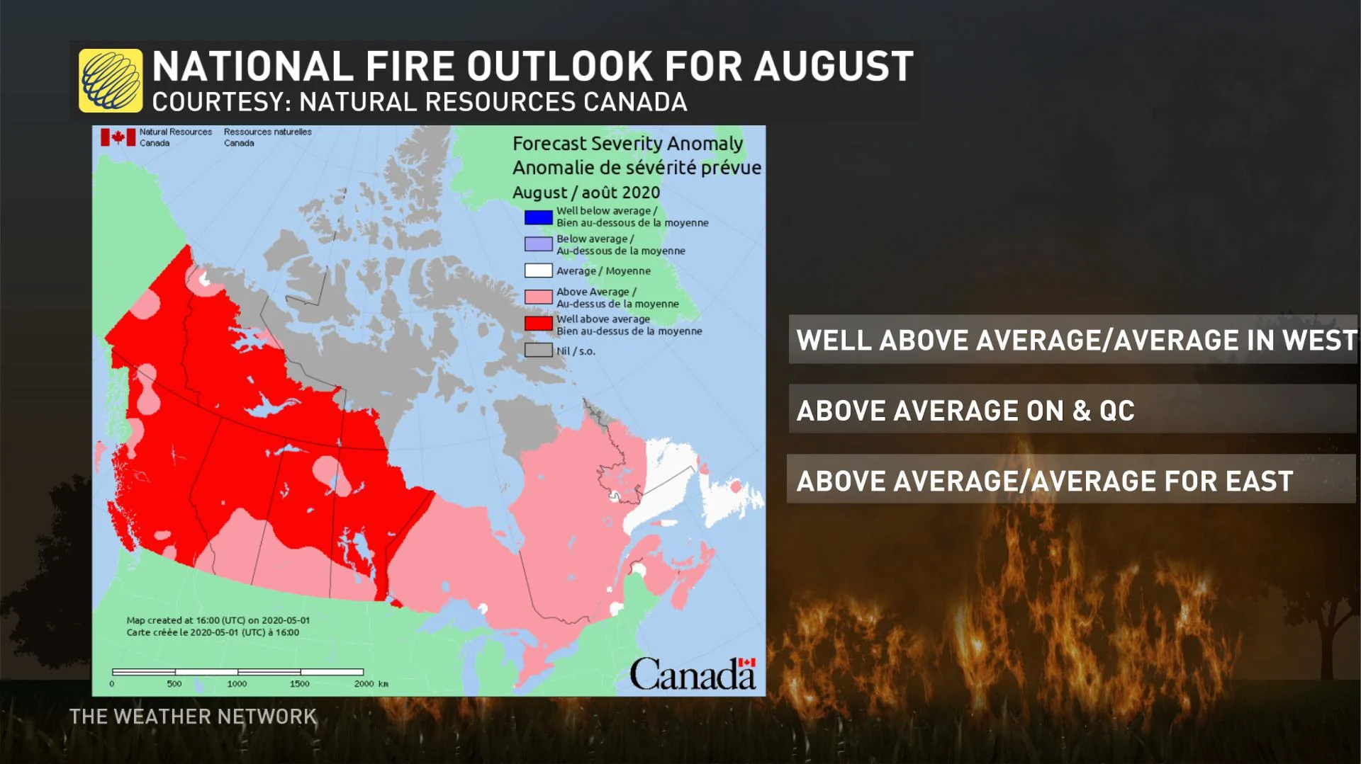
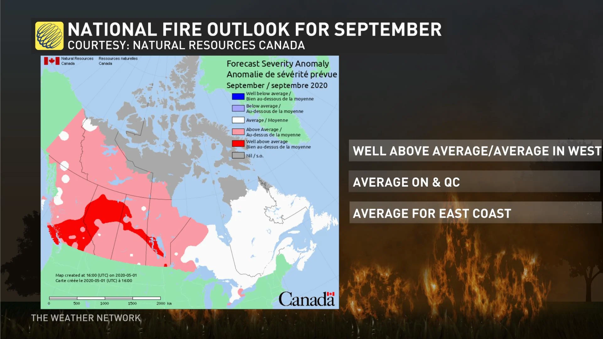
There's some short-lived abatement in July, but it's not until September that Ontario and Quebec return to more normal risk, with most of the west still above average or well-above average that month. See the NRCAN maps below:

NRCAN and other forecasters are quick to stress that the maps do not predict wildfire numbers, nor do they predict wildfire intensity. Rather, they attempt to predict where the risk of wildfires is greatest, and should be viewed "not for their accuracy, but for the general trends they present," NRCAN says.
Still, planners will need to be mindful of that risk, particularly as climate change makes severe weather events more likely in Canada.
As it is, wildfires have become more widespread in Canada in the past decades, with the amount of land burned by them doubling since 1970.
The number of wildfires also doesn't necessarily correlate to the amount of land burned, with about three per cent of all fires responsible for 97 per cent of land burned. In 2018, Alberta's second-worst wildfire year on record, just four of the season's 989 fires were responsible for 85 per cent of the 884,000 hectares burned.
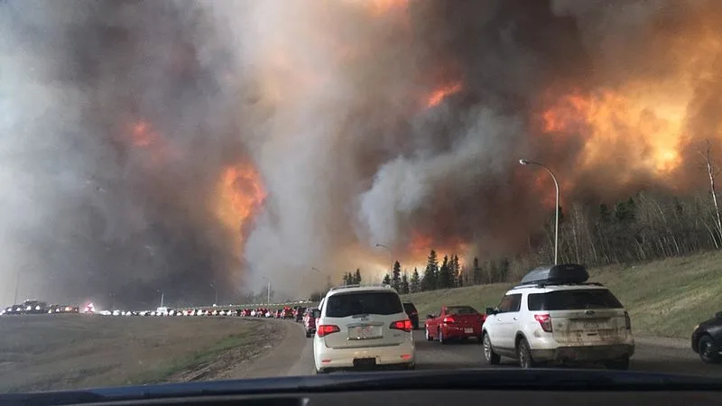
The new estimates from NRCAN come four years after the Fort McMurray wildfire, which destroyed thousands of structures and sent more than 80,000 people fleeing to safety. Two people were killed in a traffic accident during the evacuation.
In B.C., the 2018 season, which saw some 1.3 million hectares burned, was the province's worst, taking a crown that had last been work by 2017's season.