
How will jet streams shape our weather in a warmer future?

The upper-atmospheric feature plays a critical role in Earth's climate.
This has been a summer of unusual weather across the northern hemisphere with many areas experiencing a rollercoaster of heat waves, with July being the warmest month ever measured on the planet.
Europe has seen temperature records shattered, with Paris reaching a historic 42.6°C and many other western European cities climbing into the upper 30-degree mark. Further north, Greenland's ice cap temperature, which rarely climbs above zero degrees at one of its measuring stations located 3,200 metres above sea level, reached a value of 3.6°C.
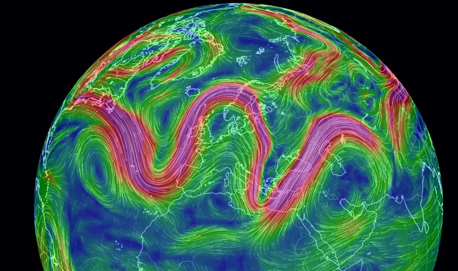
How the jet stream appeared in Europe in July. Image: NOAA
The last time temperatures were high enough to produce melting at the summit was back in 2012, one of the most dramatic years in terms of ice loss in Greenland. The heat wave that affected the ice sheet between July 30 and August 2 produced several record high temperatures in the region, a situation experts say is very likely linked to an anomalous behaviour of the North Atlantic jet stream.
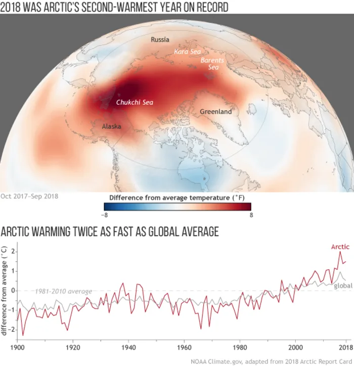
Map of the Arctic showing where average annual air temperatures from October 2017–September 2018 were above (red) and below (blue) the 1981–2010 average, based on NCEP reanalysis data. (The Arctic monitoring year runs from October-September to avoid splitting the winter season). The graph tracks difference from average temperature each year from 1900 through September 2018. The red line indicates Arctic temperatures, and the grey line indicates global temperatures. NOAA Climate.gov graphic
This summer, the fast current of upper-level winds blowing from west to east trapped warm air above Greenland for several days. A similar situation occurred in Europe earlier in the summer, both in June and later in July, and across portions of North America as well.
In a warmer world, there is a consensus among the scientific community that the behaviour of the jet stream, independent of the season, is a key atmospheric ingredient that shapes the weather, (For example, influencing floods, droughts, heat waves, cold spells, crop yields, sea level rise and other) across many countries.
We haven't studied the jet stream long enough to fully understand how climate change may be affecting its usual pattern. One of the most observed jets is the northern hemisphere Polar Jet because it has a major impact on Europe's weather. However, since modern precise satellite data did not become available until the 1980s, we have a short time period of evidence that does not span as far back in time as scientists would like. While temperature measurements started way back in the late 19th century, data for the four jet streams that circle the planet (two in each hemisphere) is fairly recent.
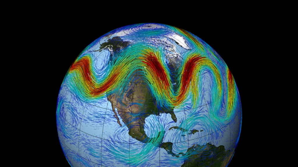
A representation of the jet stream. Source: NOAA
The initial and most-supported theory relating to jet stream variations and climate change is one in which warmer temperatures, especially in the Arctic as compared to the tropics, are making it slow down and become 'wavier.'
This means we can have more intense cold air incursions in the winter, but also more intense and prolonged heat waves during the summer. If the temperature difference between poles and tropics narrows, the jet stream swings more north and south beyond its usual boundaries, and then we can have warm air from tropical or subtropical latitudes driven as far north as Greenland.
Other theories based on Global Circulation Model (GCM) calculations point in the opposite direction. For instance, the U.K. Met Office predicts that climate change will cause the jet stream not only to get stronger, but also to slowly shift closer to the poles. If this were to happen, weather across much of Europe, including the northern countries, would be milder and wetter during the winter months. Summers, however, could be marked by drier, warmer weather conditions.
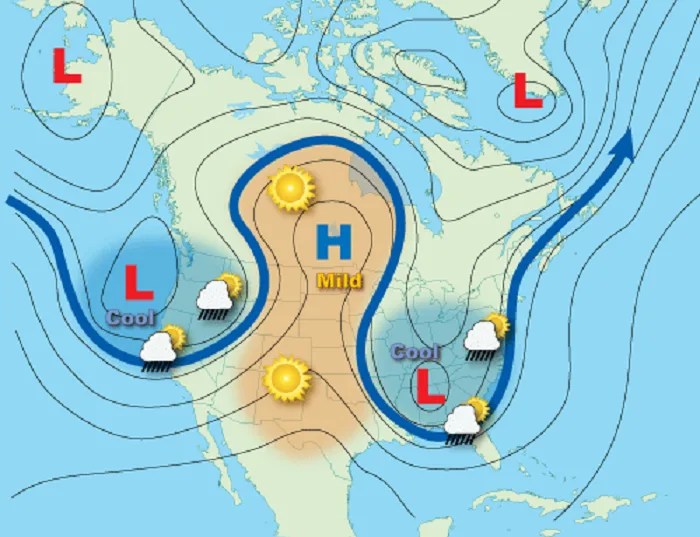
An example of an omega-shaped jet stream. NOAA
The picture can be even more complex, since ocean-atmosphere interactions also need to be considered in this new jet stream scenario. In the northern hemisphere, the jet stream interacts with ocean currents such as the Gulf Stream. Winds affect ocean currents and there is growing evidence that ocean currents also influence atmospheric circulation.
Although scientists are trying to solve this jet stream puzzle, contemporary climate models are not able to simulate over the long term what jet streams' future behaviour will be. We can forecast fairly well what the jet stream will do in the coming days, but doing the same for a future climate scenario is much more complex and requires more data and research.